359:
292:
242:
284:
234:
306:
256:
327:
365:
370:
67:
835:"}},"text\/plain":{"en":{"":"heading"}}},"{\"value\":{\"amount\":\"+22\",\"unit\":\"http:\\\/\\\/www.wikidata.org\\\/entity\\\/Q28390\"},\"type\":\"quantity\"}":{"text\/html":{"en":{"P7787":"22
771:"}},"text\/plain":{"en":{"":"heading"}}},"{\"value\":{\"amount\":\"+22\",\"unit\":\"http:\\\/\\\/www.wikidata.org\\\/entity\\\/Q28390\"},\"type\":\"quantity\"}":{"text\/html":{"en":{"P7787":"22
767:
275:
38:
225:
417:– You must give appropriate credit, provide a link to the license, and indicate if changes were made. You may do so in any reasonable manner, but not in any way that suggests the licensor endorses you or your use.
46:
78:
832:
768:
968:
162:
669:
633:
597:
299:
249:
689:
1116:
334:
979:
This file contains additional information, probably added from the digital camera or scanner used to create or digitize it.
936:
931:
424:
37:
560:
873:
846:
809:
782:
712:
653:
581:
553:
540:
525:
740:
697:
682:
617:
498:
481:
321:
380:
982:
If the file has been modified from its original state, some details may not fully reflect the modified file.
964:
The following pages on the
English Knowledge (XXG) use this file (pages on other projects are not listed):
1164:
423:– If you remix, transform, or build upon the material, you must distribute your contributions under the
341:
on the
Geograph website for the photographer's contact details. The copyright on this image is owned by
377:
1200:
1085:
839:"}},"text\/plain":{"en":{"P7787":"22 degree"}}}}": -->
775:"}},"text\/plain":{"en":{"P7787":"22 degree"}}}}": -->
86:
194:
1313:
1001:
719:
704:
532:
178:
305:
255:
1268:
1182:
1008:
947:
346:
73:
1323:
1278:
1048:
239:
1218:
130:
1028:
289:
991:
151:
141:
1333:
1018:
326:
338:
904:
Click on a date/time to view the file as it appeared at that time.
291:
241:
226:
54° 18′ 19.56″ N, 2° 24′ 49.77″ W
266:
216:
61:
276:
54° 18′ 27.8″ N, 2° 24′ 46″ W
465:
Add a one-line explanation of what this file represents
111:
47:
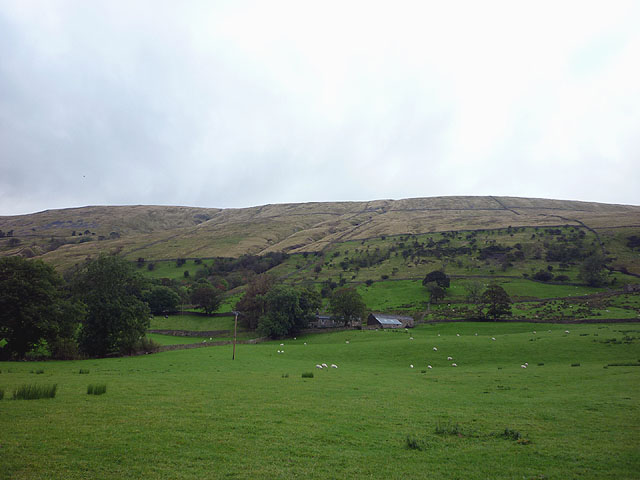
East_Rackenthwaite_in_Garsdale_(geograph_2612573).jpg
169:
Creative
Commons Attribution Share-alike license 2.0
105:
85:
Commons is a freely licensed media file repository.
634:
Creative
Commons Attribution-ShareAlike 2.0 Generic
1205:Flash did not fire, compulsory flash suppression
51:(640 × 480 pixels, file size: 68 KB, MIME type:
434:https://creativecommons.org/licenses/by-sa/2.0
66:
440:Creative Commons Attribution-Share Alike 2.0
358:
8:
969:Grade II* listed buildings in South Lakeland
836:
772:
400:– to copy, distribute and transmit the work
984:
906:
461:
705:https://www.geograph.org.uk/photo/2612573
533:https://www.geograph.org.uk/profile/37389
1331:
1321:
1311:
1303:
1295:
1287:
1276:
1266:
1258:
1250:
1242:
1234:
1226:
1216:
1208:
1198:
1190:
1180:
1172:
1162:
1154:
1133:
1125:
1114:
1106:
1098:
1090:
1080:
1072:
1064:
1056:
1045:
1037:
1026:
1016:
1006:
996:
966:
860:
844:
796:
780:
754:
738:
667:
651:
631:
615:
595:
579:
512:
496:
479:
476:
457:
450:
269:
219:
954:Transferred from geograph.co.uk using
298:View this and other nearby images on:
248:View this and other nearby images on:
986:
7:
345:and is licensed for reuse under the
895:
381:Attribution-Share Alike 2.0 Generic
369:
364:
349:Attribution-ShareAlike 2.0 license.
977:
470:
464:
355:
332:
115:
98:
44:
469:
1039:Date and time of data generation
783:coordinates of the point of view
455:
411:Under the following conditions:
376:This file is licensed under the
368:
363:
357:
325:
304:
290:
282:
254:
240:
232:
65:
21:
452:
116:
41:No higher resolution available.
14:
670:file available on the internet
451:
333:This image was taken from the
209:East Rackenthwaite in Garsdale
190:East Rackenthwaite in Garsdale
121:East Rackenthwaite in Garsdale
26:
1:
1247:A directly photographed image
847:coordinates of depicted place
798:54°18'19.555"N, 2°24'49.766"W
31:
690:Geograph Britain and Ireland
554:object of statement has role
477:Items portrayed in this file
1127:Date and time of digitizing
862:54°18'27.83"N, 2°24'46.08"W
281:
231:
1355:
1289:Focal length in 35 mm film
1231:One-chip color area sensor
1210:Supported Flashpix version
425:same or compatible license
1135:Meaning of each component
1092:File change date and time
896:
207:Karl and Ali /
188:Karl and Ali /
16:
1130:17:53, 18 September 2011
1095:20:36, 21 September 2011
1042:17:53, 18 September 2011
713:geograph.org.uk image ID
454:
391:
72:This is a file from the
1252:Custom image processing
953:
179:required by the license
157:
147:
136:
129:
126:
108:
76:. Information from its
1156:Image compression mode
932:12:48, 15 January 2017
339:this photograph's page
310:54.307730; -2.412800
260:54.305432; -2.413824
79:description page there
1174:Maximum land aperture
1066:Horizontal resolution
1239:Digital still camera
1100:Y and C positioning
1086:Adobe Photoshop 7.0
1074:Vertical resolution
988:Camera manufacturer
406:– to adapt the work
1297:Scene capture type
1273:Auto white balance
541:author name string
1342:
1341:
1013:1/125 sec (0.008)
957:
838:
774:
756:18 September 2011
618:copyright license
463:
354:
353:
337:collection. See
315:
314:
265:
264:
214:
213:
182:
166:
163:Reusing this file
131:18 September 2011
94:
93:
74:Wikimedia Commons
1346:
1108:Exposure Program
985:
944:
884:
883:
878:
820:
819:
814:
722:
717:
707:
702:
698:described at URL
692:
687:
582:copyright status
563:
558:
548:
545:
535:
530:
447:
444:
441:
438:
435:
427:as the original.
389:
378:Creative Commons
372:
371:
367:
366:
361:
360:
347:Creative Commons
335:Geograph project
329:
322:
311:
308:
294:
293:
287:
286:
285:
279:
278:
267:
261:
258:
244:
243:
237:
236:
235:
229:
228:
217:
176:
160:
132:
120:
112:
106:
90:
69:
68:
62:
56:
54:
1354:
1353:
1349:
1348:
1347:
1345:
1344:
1343:
1177:3 APEX (f/2.83)
973:
965:
958:
950:
942:
898:
897:
894:
893:
892:
891:
890:
889:
888:
887:
886:
885:
881:
879:
876:
867:
866:
865:
863:
853:
852:
851:
849:
830:
829:
828:
827:
826:
825:
824:
823:
822:
821:
817:
815:
812:
803:
802:
801:
799:
789:
788:
787:
785:
766:
765:
764:
763:
762:
761:
760:
759:
757:
747:
746:
745:
743:
732:
731:
730:
729:
728:
727:
726:
725:
724:
723:
718:
715:
709:
708:
703:
700:
694:
693:
688:
685:
676:
675:
674:
672:
660:
659:
658:
656:
645:
644:
643:
642:
641:
640:
639:
638:
636:
624:
623:
622:
620:
609:
608:
607:
606:
605:
604:
603:
602:
600:
588:
587:
586:
584:
573:
572:
571:
570:
569:
568:
567:
566:
565:
564:
559:
556:
550:
549:
546:
543:
537:
536:
531:
528:
519:
518:
517:
515:
505:
504:
503:
501:
490:
489:
488:
487:
486:
484:
468:
467:
466:
449:
448:
445:
442:
439:
436:
433:
432:
390:
387:
384:
373:
350:
320:
309:
283:
274:
273:
270:Object location
259:
233:
224:
223:
220:Camera location
215:
204:
197:
185:
142:geograph.org.uk
122:
110:
103:
96:
95:
84:
83:
82:is shown below.
58:
52:
50:
43:
42:
12:
11:
5:
1352:
1350:
1340:
1339:
1336:
1330:
1329:
1326:
1320:
1319:
1316:
1310:
1309:
1306:
1302:
1301:
1298:
1294:
1293:
1290:
1286:
1285:
1282:
1275:
1274:
1271:
1265:
1264:
1261:
1257:
1256:
1255:Normal process
1253:
1249:
1248:
1245:
1241:
1240:
1237:
1233:
1232:
1229:
1228:Sensing method
1225:
1224:
1221:
1215:
1214:
1211:
1207:
1206:
1203:
1197:
1196:
1193:
1189:
1188:
1185:
1179:
1178:
1175:
1171:
1170:
1167:
1161:
1160:
1157:
1153:
1152:
1151:
1150:
1149:does not exist
1147:
1144:
1141:
1136:
1132:
1131:
1128:
1124:
1123:
1120:
1113:
1112:
1111:Normal program
1109:
1105:
1104:
1101:
1097:
1096:
1093:
1089:
1088:
1083:
1079:
1078:
1075:
1071:
1070:
1067:
1063:
1062:
1059:
1055:
1054:
1051:
1044:
1043:
1040:
1036:
1035:
1032:
1025:
1024:
1021:
1015:
1014:
1011:
1005:
1004:
999:
995:
994:
989:
976:
972:
971:
963:
962:
961:
956:
955:
952:
948:
945:
939:
934:
929:
925:
924:
921:
918:
915:
912:
909:
902:
901:
872:
871:
870:
869:
868:
864:
861:
859:
858:
857:
856:
855:
854:
850:
845:
843:
842:
841:
840:
834:
808:
807:
806:
805:
804:
800:
797:
795:
794:
793:
792:
791:
790:
786:
781:
779:
778:
777:
776:
770:
758:
755:
753:
752:
751:
750:
749:
748:
744:
739:
737:
736:
735:
734:
733:
711:
710:
696:
695:
681:
680:
679:
678:
677:
673:
668:
666:
665:
664:
663:
662:
661:
657:
654:source of file
652:
650:
649:
648:
647:
646:
637:
632:
630:
629:
628:
627:
626:
625:
621:
616:
614:
613:
612:
611:
610:
601:
596:
594:
593:
592:
591:
590:
589:
585:
580:
578:
577:
576:
575:
574:
552:
551:
539:
538:
524:
523:
522:
521:
520:
516:
513:
511:
510:
509:
508:
507:
506:
502:
497:
495:
494:
493:
492:
491:
485:
480:
478:
475:
474:
473:
472:
471:
460:
459:
456:
453:
431:
430:
429:
428:
418:
409:
408:
407:
401:
394:You are free:
385:
375:
374:
356:
352:
351:
330:
319:
316:
313:
312:
302:
296:
271:
263:
262:
252:
246:
221:
212:
211:
205:
202:
199:
198:
193:
186:
183:
171:
170:
167:
155:
154:
149:
145:
144:
138:
134:
133:
128:
124:
123:
113:
104:
102:
99:
97:
92:
91:
70:
60:
59:
40:
36:
35:
34:
29:
24:
19:
13:
10:
9:
6:
4:
3:
2:
1351:
1337:
1335:
1332:
1327:
1325:
1322:
1317:
1315:
1312:
1307:
1305:Scene control
1304:
1299:
1296:
1291:
1288:
1283:
1280:
1277:
1272:
1270:
1269:White balance
1267:
1263:Auto exposure
1262:
1260:Exposure mode
1259:
1254:
1251:
1246:
1243:
1238:
1235:
1230:
1227:
1222:
1220:
1217:
1212:
1209:
1204:
1202:
1199:
1194:
1191:
1186:
1184:
1183:Metering mode
1181:
1176:
1173:
1168:
1166:
1165:Exposure bias
1163:
1158:
1155:
1148:
1145:
1142:
1139:
1138:
1137:
1134:
1129:
1126:
1121:
1118:
1115:
1110:
1107:
1102:
1099:
1094:
1091:
1087:
1084:
1082:Software used
1081:
1076:
1073:
1068:
1065:
1060:
1057:
1052:
1050:
1046:
1041:
1038:
1033:
1030:
1027:
1022:
1020:
1017:
1012:
1010:
1009:Exposure time
1007:
1003:
1000:
997:
993:
990:
987:
983:
980:
974:
970:
967:
959:
951:
946:
940:
938:
935:
933:
930:
927:
926:
922:
919:
916:
913:
910:
908:
907:
905:
899:
875:
848:
811:
784:
742:
721:
714:
706:
699:
691:
684:
671:
655:
635:
619:
599:
583:
562:
555:
542:
534:
527:
500:
483:
437:CC BY-SA 2.0
426:
422:
419:
416:
413:
412:
410:
405:
402:
399:
396:
395:
393:
392:
386:Attribution:
382:
379:
362:
348:
344:
340:
336:
331:
328:
324:
323:
317:
307:
303:
301:
300:OpenStreetMap
297:
295:
277:
272:
268:
257:
253:
251:
250:OpenStreetMap
247:
245:
227:
222:
218:
210:
206:
201:
200:
196:
192: /
191:
187:
180:
175:
173:
172:
168:
164:
159:
156:
153:
150:
146:
143:
139:
135:
125:
119:
114:
107:
100:
88:
81:
80:
75:
71:
64:
63:
57:
48:
39:
33:
30:
28:
25:
23:
20:
18:
15:
1279:Digital zoom
1192:Light source
1049:focal length
998:Camera model
981:
978:
903:
900:File history
561:photographer
547:Karl and Ali
420:
414:
403:
397:
388:Karl and Ali
343:Karl and Ali
342:
280:
230:
208:
195:CC BY-SA 2.0
189:
152:Karl and Ali
117:
87:You can help
77:
45:
22:File history
1236:File source
1219:Color space
1058:Orientation
598:copyrighted
421:share alike
415:attribution
174:Attribution
109:Description
1324:Saturation
1244:Scene type
960:File usage
941:640 × 480
917:Dimensions
514:some value
158:Permission
53:image/jpeg
27:File usage
1334:Sharpness
1029:ISO speed
992:Panasonic
914:Thumbnail
911:Date/Time
741:inception
318:Licensing
203:InfoField
184:InfoField
118:English:
1314:Contrast
1300:Standard
1103:Co-sited
1019:F-number
1002:DMC-FS62
975:Metadata
949:Plucas58
683:operator
458:Captions
404:to remix
398:to share
383:license.
32:Metadata
1195:Unknown
1187:Pattern
1119:version
1077:180 dpi
1069:180 dpi
943:(68 KB)
928:current
923:Comment
874:heading
833:heading
810:heading
769:heading
720:2612573
499:creator
482:depicts
462:English
101:Summary
49:
1338:Normal
1328:Normal
1318:Normal
1061:Normal
1053:5.5 mm
1031:rating
882:degree
837:degree
818:degree
773:degree
288:
238:
148:Author
137:Source
1292:33 mm
1281:ratio
1201:Flash
1047:Lens
1023:f/2.8
140:From
1308:None
1223:sRGB
1122:2.21
1117:Exif
920:User
446:true
443:true
127:Date
17:File
880:22
816:22
526:URL
1146:Cr
1143:Cb
1034:80
877::
813::
716::
701::
686::
557::
544::
529::
1284:0
1213:1
1169:0
1159:4
1140:Y
181:)
177:(
165:)
161:(
89:.
55:)
Text is available under the Creative Commons Attribution-ShareAlike License. Additional terms may apply.
.jpg)
.jpg¶ms=054.305432_N_-002.413824_E_globe:Earth_type:camera_heading:22.00_source:geograph&language=en)
.jpg¶ms=054.307730_N_-002.412800_E_globe:Earth_class:object_type:object_source:geograph-osgb36(SD73239031)_region:GB-GBN_heading:22.00&language=en)
