38:
242:
248:
253:
94:
961:
538:
676:
701:
300:– You must give appropriate credit, provide a link to the license, and indicate if changes were made. You may do so in any reasonable manner, but not in any way that suggests the licensor endorses you or your use.
559:, UK. Equirectangular map projection on WGS 84 datum, with N/S stretched 175% Geographic limits: *West: 3.47W *East: 3.05W *North: 56.05N *South: 55.80N |Source=[[w:Ordnance Survey|Ordnan
1010:
658:
826:
653:
906:
60:
56:
52:
48:
42:
105:
73:
891:
231:
648:
886:
449:
413:
202:
307:
638:
397:
469:
433:
380:
340:
643:
623:
263:
881:
598:
306:– If you remix, transform, or build upon the material, you must distribute your contributions under the
537:
532:
64:
37:
260:
821:
569:
The following pages on the
English Knowledge use this file (pages on other projects are not listed):
991:
871:
628:
1001:
851:
185:
608:
113:
986:
846:
603:
711:
696:
686:
573:
971:
811:
182:
876:
861:
618:
588:
786:
633:
613:
578:
548:
206:
100:
981:
916:
896:
841:
219:
976:
593:
583:
836:
171:
731:
139:
556:
946:
931:
951:
936:
145:
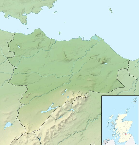
Equirectangular map projection on WGS 84 datum, with N/S stretched 175%
195:
Administrative borders and coastline data from
Boundary-Line product.
801:
505:
Click on a date/time to view the file as it appeared at that time.
926:
771:
271:
Contains
Ordnance Survey data © Crown copyright and database right
741:
776:
88:
766:
746:
736:
721:
761:
796:
781:
756:
726:
791:
751:
364:
Add a one-line explanation of what this file represents
992:
Module:Location map/data/United
Kingdom Edinburgh/doc
852:
Module:Location map/data/United
Kingdom Edinburgh/doc
659:
Module:Location map/data/United
Kingdom Edinburgh/doc
78:(2,005 × 2,088 pixels, file size: 285 KB, MIME type:
892:モジュール:Location map/data/United Kingdom Edinburgh/doc
450:
Creative
Commons Attribution-ShareAlike 3.0 Unported
127:
112:
Commons is a freely licensed media file repository.
198:All other geographic data from Meridian 2 product.
1002:Module:Location map/data/United Kingdom Edinburgh
987:Module:Location map/data/United Kingdom Edinburgh
962:Шаблон:ПозКарта Великобритания Шотландия Эдинбург
847:Module:Location map/data/United Kingdom Edinburgh
654:Module:Location map/data/United Kingdom Edinburgh
887:モジュール:Location map/data/United Kingdom Edinburgh
907:ಟೆಂಪ್ಲೇಟು:Location map United Kingdom Edinburgh
712:Plantilya:Location map United Kingdom Edinburgh
972:Template:Location map United Kingdom Edinburgh
877:Template:Location map United Kingdom Edinburgh
317:https://creativecommons.org/licenses/by-sa/3.0
93:
862:Templat:Location map United Kingdom Edinburgh
323:Creative Commons Attribution-Share Alike 3.0
241:
8:
192:Relief data from Land-Form Panorama product.
787:Vorlage:Positionskarte Schottland Edinburgh
283:– to copy, distribute and transmit the work
507:
360:
669:The following other wikis use this file:
555:{{Information |Description=Relief map of
917:Sjabloon:Positiekaart Edinburgh Council
677:قالب:خريطة مواقع المملكة المتحدة/إدنبرة
571:
483:
467:
447:
431:
411:
395:
378:
375:
356:
349:
982:Module:Location map/data/Edinburgh/doc
897:Template:Infobox Settlement/testcases3
842:Module:Location map/data/Edinburgh/doc
203:File: United Kingdom location map.svg
7:
264:Attribution-Share Alike 3.0 Unported
222:, created using Ordnance Survey data
133:Edinburgh UK relief location map.jpg
496:
252:
247:
977:Module:Location map/data/Edinburgh
837:Module:Location map/data/Edinburgh
649:Module:Location map/data/Edinburgh
369:
363:
238:
125:
71:
702:Шаблон:ПК Великобритания Единбург
368:
812:Modèle:Géolocalisation/Édimbourg
354:
294:Under the following conditions:
259:This file is licensed under the
251:
246:
240:
201:Inset derived from derived from
92:
31:
21:
351:
341:File:Edinburgh UK blank map.svg
14:
998:Usage on simple.wikipedia.org
350:
26:
1:
639:Queensferry Lifeboat Station
376:Items portrayed in this file
968:Usage on sco.wikipedia.org
708:Usage on ceb.wikipedia.org
1027:
958:Usage on ru.wikipedia.org
943:Usage on pl.wikibooks.org
923:Usage on pl.wikipedia.org
913:Usage on nl.wikipedia.org
903:Usage on kn.wikipedia.org
868:Usage on ja.wikipedia.org
858:Usage on id.wikipedia.org
833:Usage on hi.wikipedia.org
818:Usage on he.wikipedia.org
808:Usage on fr.wikipedia.org
718:Usage on de.wikipedia.org
693:Usage on bg.wikipedia.org
683:Usage on ba.wikipedia.org
673:Usage on ar.wikipedia.org
308:same or compatible license
732:Arthur’s Seat (Edinburgh)
497:
16:
947:Moduł:Mapa/dane/Edynburg
932:Moduł:Mapa/dane/Edynburg
827:תבנית:מפת מיקום/אדינבורו
644:User:Adrianmckie/sandbox
624:Edinburgh Central Mosque
353:
274:
99:This is a file from the
802:Castle Rock (Edinburgh)
599:Castle Rock (Edinburgh)
554:
533:12:20, 30 November 2011
336:
226:
215:
177:
170:
167:
130:
103:. Information from its
952:Moduł:Mapa/dane/GB-EDH
937:Moduł:Mapa/dane/GB-EDH
106:description page there
41:Size of this preview:
772:Clubbiedean Reservoir
742:Threipmuir Reservoir
65:2,005 × 2,088 pixels
629:Old Town, Edinburgh
289:– to adapt the work
148:Geographic limits:
47:Other resolutions:
609:Craiglockhart Hill
574:Arthur's Seat
61:983 × 1,024 pixels
1011:more global usage
777:Torduff Reservoir
665:Global file usage
604:Corstorphine Hill
562:
434:copyright license
362:
347:
346:
235:
232:Reusing this file
121:
120:
101:Wikimedia Commons
32:Global file usage
1018:
767:Bonaly Reservoir
747:Harlaw Reservoir
737:Merchiston Tower
722:Duddingston Loch
545:
485:30 November 2010
398:copyright status
330:
327:
324:
321:
318:
310:as the original.
272:
261:Creative Commons
255:
254:
250:
249:
244:
243:
229:
173:
172:30 November 2010
134:
128:
117:
96:
95:
89:
83:
81:
68:
57:737 × 768 pixels
53:461 × 480 pixels
49:230 × 240 pixels
43:576 × 600 pixels
1026:
1025:
1021:
1020:
1019:
1017:
1016:
1015:
762:Caerketton Hill
663:
619:East Cairn Hill
589:Caerketton Hill
570:
563:
551:
543:
499:
498:
495:
494:
493:
492:
491:
490:
489:
488:
486:
476:
475:
474:
472:
461:
460:
459:
458:
457:
456:
455:
454:
452:
440:
439:
438:
436:
425:
424:
423:
422:
421:
420:
419:
418:
416:
404:
403:
402:
400:
389:
388:
387:
386:
385:
383:
367:
366:
365:
348:
332:
331:
328:
325:
322:
319:
316:
315:
273:
270:
267:
256:
183:Ordnance Survey
132:
123:
122:
111:
110:
109:is shown below.
85:
79:
77:
70:
69:
46:
12:
11:
5:
1024:
1022:
1013:of this file.
1007:
1006:
1005:
1004:
996:
995:
994:
989:
984:
979:
974:
966:
965:
964:
956:
955:
954:
949:
941:
940:
939:
934:
929:
921:
920:
919:
911:
910:
909:
901:
900:
899:
894:
889:
884:
879:
874:
866:
865:
864:
856:
855:
854:
849:
844:
839:
831:
830:
829:
824:
816:
815:
814:
806:
805:
804:
799:
797:Liberton Tower
794:
789:
784:
782:Cramond Island
779:
774:
769:
764:
759:
757:Allermuir Hill
754:
749:
744:
739:
734:
729:
724:
716:
715:
714:
706:
705:
704:
699:
691:
690:
689:
681:
680:
679:
667:
666:
662:
661:
656:
651:
646:
641:
636:
634:Pentland Hills
631:
626:
621:
616:
614:Cramond Island
611:
606:
601:
596:
591:
586:
581:
579:Blackford Hill
576:
568:
567:
566:
561:
560:
553:
549:
546:
542:2,005 × 2,088
540:
535:
530:
526:
525:
522:
519:
516:
513:
510:
503:
502:
487:
484:
482:
481:
480:
479:
478:
477:
473:
468:
466:
465:
464:
463:
462:
453:
448:
446:
445:
444:
443:
442:
441:
437:
432:
430:
429:
428:
427:
426:
417:
412:
410:
409:
408:
407:
406:
405:
401:
396:
394:
393:
392:
391:
390:
384:
379:
377:
374:
373:
372:
371:
370:
359:
358:
355:
352:
345:
344:
338:
337:Other versions
334:
333:
314:
313:
312:
311:
301:
292:
291:
290:
284:
277:You are free:
268:
258:
257:
239:
236:
224:
223:
217:
213:
212:
211:
210:
199:
196:
193:
179:
175:
174:
169:
165:
164:
163:
162:
159:
156:
153:
138:Relief map of
135:
126:
124:
119:
118:
97:
87:
86:
40:
36:
35:
34:
29:
24:
19:
13:
10:
9:
6:
4:
3:
2:
1023:
1014:
1012:
1003:
1000:
999:
997:
993:
990:
988:
985:
983:
980:
978:
975:
973:
970:
969:
967:
963:
960:
959:
957:
953:
950:
948:
945:
944:
942:
938:
935:
933:
930:
928:
927:Arthur’s Seat
925:
924:
922:
918:
915:
914:
912:
908:
905:
904:
902:
898:
895:
893:
890:
888:
885:
883:
880:
878:
875:
873:
870:
869:
867:
863:
860:
859:
857:
853:
850:
848:
845:
843:
840:
838:
835:
834:
832:
828:
825:
823:
820:
819:
817:
813:
810:
809:
807:
803:
800:
798:
795:
793:
790:
788:
785:
783:
780:
778:
775:
773:
770:
768:
765:
763:
760:
758:
755:
753:
750:
748:
745:
743:
740:
738:
735:
733:
730:
728:
727:Dunsapie Loch
725:
723:
720:
719:
717:
713:
710:
709:
707:
703:
700:
698:
695:
694:
692:
688:
685:
684:
682:
678:
675:
674:
672:
671:
670:
664:
660:
657:
655:
652:
650:
647:
645:
642:
640:
637:
635:
632:
630:
627:
625:
622:
620:
617:
615:
612:
610:
607:
605:
602:
600:
597:
595:
592:
590:
587:
585:
582:
580:
577:
575:
572:
564:
558:
552:
547:
541:
539:
536:
534:
531:
528:
527:
523:
520:
517:
514:
511:
509:
508:
506:
500:
471:
451:
435:
415:
399:
382:
342:
339:
335:
320:CC BY-SA 3.0
309:
305:
302:
299:
296:
295:
293:
288:
285:
282:
279:
278:
276:
275:
269:Attribution:
265:
262:
245:
237:
233:
228:
225:
221:
218:
214:
208:
204:
200:
197:
194:
191:
190:
189:
187:
184:
180:
176:
166:
161:South: 55.80N
160:
158:North: 56.05N
157:
154:
151:
150:
149:
146:
143:
141:
136:
129:
115:
108:
107:
102:
98:
91:
90:
84:
75:
74:Original file
66:
62:
58:
54:
50:
44:
39:
33:
30:
28:
25:
23:
20:
18:
15:
1008:
792:Lennox Tower
752:Capelaw Hill
668:
504:
501:File history
303:
297:
286:
280:
207:NordNordWest
181:
147:
144:
137:
114:You can help
104:
72:
22:File history
594:Calton Hill
584:Braid Hills
414:copyrighted
343:- Blank map
304:share alike
298:attribution
155:East: 3.05W
152:West: 3.47W
131:Description
822:ארתורס סיט
565:File usage
518:Dimensions
227:Permission
80:image/jpeg
27:File usage
557:Edinburgh
550:Nilfanion
515:Thumbnail
512:Date/Time
470:inception
220:Nilfanion
140:Edinburgh
697:Единбург
687:Эдинбург
544:(285 KB)
357:Captions
287:to remix
281:to share
266:license.
186:OpenData
882:アーサーの玉座
529:current
524:Comment
381:depicts
361:English
76:
872:エディンバラ
216:Author
178:Source
142:, UK.
1009:View
521:User
329:true
326:true
168:Date
17:File
205:by
188:.
63:|
59:|
55:|
51:|
45:.
234:)
230:(
209:.
116:.
82:)
67:.
Text is available under the Creative Commons Attribution-ShareAlike License. Additional terms may apply.
