43:
376:
309:
259:
301:
251:
323:
273:
344:
382:
387:
99:
943:"}},"text\/plain":{"en":{"":"heading"}}},"{\"value\":{\"amount\":\"+247\",\"unit\":\"http:\\\/\\\/www.wikidata.org\\\/entity\\\/Q28390\"},\"type\":\"quantity\"}":{"text\/html":{"en":{"P7787":"247
720:"}},"text\/plain":{"en":{"":"heading"}}},"{\"value\":{\"amount\":\"+247\",\"unit\":\"http:\\\/\\\/www.wikidata.org\\\/entity\\\/Q28390\"},\"type\":\"quantity\"}":{"text\/html":{"en":{"P7787":"247
939:
292:
1204:== {{int:filedesc}} == {{Information |description={{en|1=Elie House Elie House was built by Sir William Anstruther, who bought the estate in or about 1697. It changed owbership several times, being for a period after WW2 in use as a convent. Its latest re
242:
153:
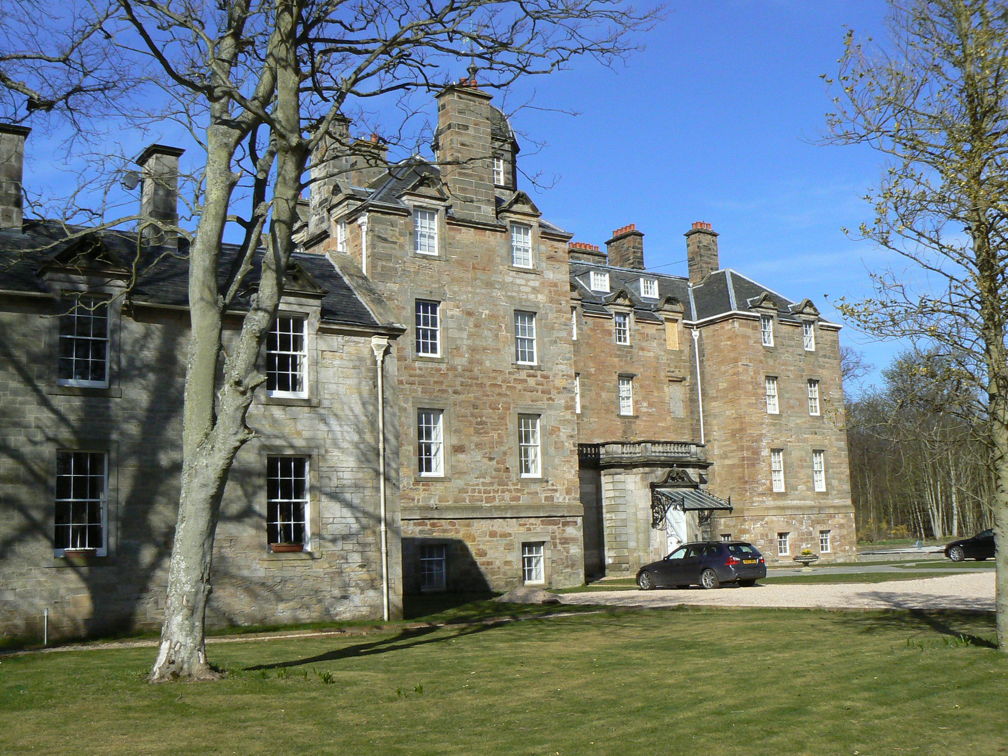
Elie House Elie House was built by Sir
William Anstruther, who bought the estate in or about 1697. It changed owbership several times, being for a period after WW2 in use as a convent. Its latest reincarnation is as a block of residential
434:– You must give appropriate credit, provide a link to the license, and indicate if changes were made. You may do so in any reasonable manner, but not in any way that suggests the licensor endorses you or your use.
940:
717:
65:
61:
57:
53:
47:
110:
78:
1223:
1228:
890:
803:
669:
633:
514:
316:
266:
1238:
926:
823:
1421:
351:
1284:
This file contains additional information, probably added from the digital camera or scanner used to create or digitize it.
441:
596:
1115:
1081:
1044:
1010:
981:
954:
910:
874:
831:
787:
758:
731:
617:
589:
574:
561:
846:
816:
689:
653:
534:
498:
338:
397:
1287:
If the file has been modified from its original state, some details may not fully reflect the modified file.
1186:
1181:
69:
42:
1448:
440:– If you remix, transform, or build upon the material, you must distribute your contributions under the
358:
on the
Geograph website for the photographer's contact details. The copyright on this image is owned by
1197:
394:
947:"}},"text\/plain":{"en":{"P7787":"247 degree"}}}}": -->
724:"}},"text\/plain":{"en":{"P7787":"247 degree"}}}}": -->
1484:
1233:
118:
211:
1565:
1390:
853:
838:
581:
195:
322:
272:
1528:
1466:
1313:
363:
105:
1575:
1538:
1353:
1256:
1494:
163:
1333:
1218:
306:
256:
1296:
174:
184:
1585:
1323:
343:
1306:
355:
1154:
Click on a date/time to view the file as it appeared at that time.
308:
258:
283:
233:
93:
293:
56° 11′ 49″ N, 2° 48′ 53″ W
243:
56° 11′ 49″ N, 2° 48′ 50″ W
1261:
482:
Add a one-line explanation of what this file represents
1271:
83:(2,048 × 1,536 pixels, file size: 1.43 MB, MIME type:
137:
117:
Commons is a freely licensed media file repository.
670:
Creative
Commons Attribution-ShareAlike 2.0 Generic
1489:Flash did not fire, compulsory flash suppression
451:https://creativecommons.org/licenses/by-sa/2.0
98:
457:Creative Commons Attribution-Share Alike 2.0
375:
8:
944:
721:
417:– to copy, distribute and transmit the work
1289:
1156:
478:
143:Elie House - geograph.org.uk - 1804605.jpg
1249:The following other wikis use this file:
854:https://www.geograph.org.uk/photo/1804605
582:https://www.geograph.org.uk/profile/4202
1583:
1573:
1563:
1555:
1547:
1536:
1526:
1518:
1510:
1502:
1492:
1482:
1474:
1464:
1456:
1446:
1438:
1430:
1419:
1411:
1403:
1395:
1385:
1377:
1369:
1361:
1350:
1342:
1331:
1321:
1311:
1301:
1216:
1129:
1113:
1095:
1079:
1058:
1042:
1024:
1008:
968:
952:
924:
908:
888:
872:
801:
785:
745:
729:
703:
687:
667:
651:
631:
615:
548:
532:
512:
496:
493:
474:
467:
286:
236:
1257:Liste der Kategorie-A-Bauwerke in Fife
1224:List of listed buildings in Elie, Fife
315:View this and other nearby images on:
265:View this and other nearby images on:
1291:
1214:The following 5 pages use this file:
7:
362:and is licensed for reuse under the
1145:
398:Attribution-Share Alike 2.0 Generic
386:
381:
366:Attribution-ShareAlike 2.0 license.
1282:
487:
481:
372:
349:
147:
130:
76:
486:
1344:Date and time of data generation
1229:Sir John Anstruther, 1st Baronet
732:coordinates of the point of view
472:
428:Under the following conditions:
393:This file is licensed under the
385:
380:
374:
342:
321:
307:
299:
271:
257:
249:
97:
31:
21:
1239:User:Stinglehammer/Scottish WLM
469:
148:
14:
804:file available on the internet
468:
350:This image was taken from the
26:
1:
955:coordinates of depicted place
36:
824:Geograph Britain and Ireland
590:object of statement has role
494:Items portrayed in this file
298:
248:
1432:Date and time of digitizing
970:56°11'49.16"N, 2°48'52.92"W
747:56°11'49.49"N, 2°48'50.04"W
1607:
1549:Focal length in 35 mm film
1507:One-chip color area sensor
1268:Usage on www.wikidata.org
1253:Usage on de.wikipedia.org
442:same or compatible license
1397:File change date and time
1146:
16:
832:geograph.org.uk image ID
471:
408:
224:James Allan /
205:James Allan /
104:This is a file from the
1512:Custom image processing
1471:Center weighted average
1203:
927:Panasonic Lumix DMC-FZ7
196:required by the license
180:
169:
162:
159:
140:
108:. Information from its
1440:Image compression mode
356:this photograph's page
327:56.196990; -2.814700
277:56.197080; -2.813900
111:description page there
46:Size of this preview:
1458:Maximum land aperture
1371:Horizontal resolution
1435:09:21, 12 April 2010
1400:09:21, 12 April 2010
1347:09:21, 12 April 2010
1182:12:41, 14 March 2011
875:location of creation
70:2,048 × 1,536 pixels
1405:Y and C positioning
1379:Vertical resolution
1318:1/1,000 sec (0.001)
1293:Camera manufacturer
423:– to adapt the work
52:Other resolutions:
1557:Scene capture type
1533:Auto white balance
1234:William Anstruther
562:author name string
515:apartment building
66:1,280 × 960 pixels
62:1,024 × 768 pixels
1594:
1593:
1245:Global file usage
1207:
946:
723:
654:copyright license
480:
371:
370:
354:collection. See
332:
331:
282:
281:
231:
230:
199:
126:
125:
106:Wikimedia Commons
32:Global file usage
1598:
1413:Exposure Program
1290:
1194:
1134:
1063:
992:
991:
986:
856:
851:
847:described at URL
841:
836:
826:
821:
769:
768:
763:
618:copyright status
599:
594:
584:
579:
569:
566:
464:
461:
458:
455:
452:
444:as the original.
406:
395:Creative Commons
389:
388:
384:
383:
378:
377:
364:Creative Commons
352:Geograph project
346:
339:
328:
325:
311:
310:
304:
303:
302:
296:
295:
284:
278:
275:
261:
260:
254:
253:
252:
246:
245:
234:
193:
165:
152:
144:
138:
122:
101:
100:
94:
88:
86:
73:
58:640 × 480 pixels
54:320 × 240 pixels
48:800 × 600 pixels
1606:
1605:
1601:
1600:
1599:
1597:
1596:
1595:
1461:3 APEX (f/2.83)
1278:
1243:
1208:
1200:
1192:
1148:
1147:
1144:
1143:
1142:
1141:
1140:
1139:
1138:
1137:
1135:
1132:
1122:
1121:
1120:
1118:
1107:
1106:
1105:
1104:
1103:
1102:
1101:
1100:
1098:
1088:
1087:
1086:
1084:
1073:
1072:
1071:
1070:
1069:
1068:
1067:
1066:
1064:
1061:
1051:
1050:
1049:
1047:
1036:
1035:
1034:
1033:
1032:
1031:
1030:
1029:
1027:
1017:
1016:
1015:
1013:
1002:
1001:
1000:
999:
998:
997:
996:
995:
994:
993:
989:
987:
984:
975:
974:
973:
971:
961:
960:
959:
957:
938:
937:
936:
935:
934:
933:
932:
931:
929:
917:
916:
915:
913:
902:
901:
900:
899:
898:
897:
896:
895:
893:
881:
880:
879:
877:
866:
865:
864:
863:
862:
861:
860:
859:
858:
857:
852:
849:
843:
842:
837:
834:
828:
827:
822:
819:
810:
809:
808:
806:
794:
793:
792:
790:
779:
778:
777:
776:
775:
774:
773:
772:
771:
770:
766:
764:
761:
752:
751:
750:
748:
738:
737:
736:
734:
715:
714:
713:
712:
711:
710:
709:
708:
706:
696:
695:
694:
692:
681:
680:
679:
678:
677:
676:
675:
674:
672:
660:
659:
658:
656:
645:
644:
643:
642:
641:
640:
639:
638:
636:
624:
623:
622:
620:
609:
608:
607:
606:
605:
604:
603:
602:
601:
600:
595:
592:
586:
585:
580:
577:
571:
570:
567:
564:
555:
554:
553:
551:
541:
540:
539:
537:
526:
525:
524:
523:
522:
521:
520:
519:
517:
505:
504:
503:
501:
485:
484:
483:
466:
465:
462:
459:
456:
453:
450:
449:
407:
404:
401:
390:
367:
337:
326:
300:
291:
290:
287:Object location
276:
250:
241:
240:
237:Camera location
232:
221:
214:
202:
175:geograph.org.uk
155:
142:
135:
128:
127:
116:
115:
114:is shown below.
90:
84:
82:
75:
74:
51:
12:
11:
5:
1604:
1602:
1592:
1591:
1588:
1582:
1581:
1578:
1572:
1571:
1568:
1562:
1561:
1558:
1554:
1553:
1550:
1546:
1545:
1542:
1535:
1534:
1531:
1525:
1524:
1521:
1517:
1516:
1515:Normal process
1513:
1509:
1508:
1505:
1504:Sensing method
1501:
1500:
1497:
1491:
1490:
1487:
1481:
1480:
1477:
1473:
1472:
1469:
1463:
1462:
1459:
1455:
1454:
1451:
1445:
1444:
1441:
1437:
1436:
1433:
1429:
1428:
1425:
1418:
1417:
1416:Normal program
1414:
1410:
1409:
1406:
1402:
1401:
1398:
1394:
1393:
1388:
1384:
1383:
1380:
1376:
1375:
1372:
1368:
1367:
1364:
1360:
1359:
1356:
1349:
1348:
1345:
1341:
1340:
1337:
1330:
1329:
1326:
1320:
1319:
1316:
1310:
1309:
1304:
1300:
1299:
1294:
1281:
1277:
1276:
1275:
1274:
1266:
1265:
1264:
1259:
1247:
1246:
1242:
1241:
1236:
1231:
1226:
1221:
1212:
1211:
1206:
1205:
1202:
1198:
1195:
1191:2,048 × 1,536
1189:
1184:
1179:
1175:
1174:
1171:
1168:
1165:
1162:
1159:
1152:
1151:
1136:
1130:
1128:
1127:
1126:
1125:
1124:
1123:
1119:
1114:
1112:
1111:
1110:
1109:
1108:
1099:
1096:
1094:
1093:
1092:
1091:
1090:
1089:
1085:
1080:
1078:
1077:
1076:
1075:
1074:
1065:
1059:
1057:
1056:
1055:
1054:
1053:
1052:
1048:
1043:
1041:
1040:
1039:
1038:
1037:
1028:
1025:
1023:
1022:
1021:
1020:
1019:
1018:
1014:
1009:
1007:
1006:
1005:
1004:
1003:
980:
979:
978:
977:
976:
972:
969:
967:
966:
965:
964:
963:
962:
958:
953:
951:
950:
949:
948:
942:
930:
925:
923:
922:
921:
920:
919:
918:
914:
909:
907:
906:
905:
904:
903:
894:
889:
887:
886:
885:
884:
883:
882:
878:
873:
871:
870:
869:
868:
867:
845:
844:
830:
829:
815:
814:
813:
812:
811:
807:
802:
800:
799:
798:
797:
796:
795:
791:
788:source of file
786:
784:
783:
782:
781:
780:
757:
756:
755:
754:
753:
749:
746:
744:
743:
742:
741:
740:
739:
735:
730:
728:
727:
726:
725:
719:
707:
704:
702:
701:
700:
699:
698:
697:
693:
688:
686:
685:
684:
683:
682:
673:
668:
666:
665:
664:
663:
662:
661:
657:
652:
650:
649:
648:
647:
646:
637:
632:
630:
629:
628:
627:
626:
625:
621:
616:
614:
613:
612:
611:
610:
588:
587:
573:
572:
560:
559:
558:
557:
556:
552:
549:
547:
546:
545:
544:
543:
542:
538:
533:
531:
530:
529:
528:
527:
518:
513:
511:
510:
509:
508:
507:
506:
502:
497:
495:
492:
491:
490:
489:
488:
477:
476:
473:
470:
448:
447:
446:
445:
435:
426:
425:
424:
418:
411:You are free:
402:
392:
391:
373:
369:
368:
347:
336:
333:
330:
329:
319:
313:
288:
280:
279:
269:
263:
238:
229:
228:
222:
219:
216:
215:
210:
203:
200:
188:
187:
182:
178:
177:
171:
167:
166:
161:
157:
156:
145:
136:
134:
131:
129:
124:
123:
102:
92:
91:
45:
41:
40:
39:
34:
29:
24:
19:
13:
10:
9:
6:
4:
3:
2:
1603:
1589:
1587:
1584:
1579:
1577:
1574:
1569:
1567:
1564:
1559:
1556:
1551:
1548:
1543:
1540:
1537:
1532:
1530:
1529:White balance
1527:
1523:Auto exposure
1522:
1520:Exposure mode
1519:
1514:
1511:
1506:
1503:
1498:
1496:
1493:
1488:
1486:
1483:
1478:
1475:
1470:
1468:
1467:Metering mode
1465:
1460:
1457:
1452:
1450:
1449:Exposure bias
1447:
1442:
1439:
1434:
1431:
1426:
1423:
1420:
1415:
1412:
1407:
1404:
1399:
1396:
1392:
1389:
1387:Software used
1386:
1381:
1378:
1373:
1370:
1365:
1362:
1357:
1355:
1351:
1346:
1343:
1338:
1335:
1332:
1327:
1325:
1322:
1317:
1315:
1314:Exposure time
1312:
1308:
1305:
1302:
1298:
1295:
1292:
1288:
1285:
1279:
1273:
1270:
1269:
1267:
1263:
1260:
1258:
1255:
1254:
1252:
1251:
1250:
1244:
1240:
1237:
1235:
1232:
1230:
1227:
1225:
1222:
1220:
1217:
1215:
1209:
1201:
1196:
1190:
1188:
1185:
1183:
1180:
1177:
1176:
1172:
1169:
1166:
1163:
1160:
1158:
1157:
1155:
1149:
1117:
1083:
1046:
1045:exposure time
1012:
983:
956:
928:
912:
911:captured with
892:
876:
855:
848:
840:
833:
825:
818:
805:
789:
760:
733:
705:12 April 2010
691:
671:
655:
635:
619:
598:
591:
583:
576:
563:
536:
516:
500:
454:CC BY-SA 2.0
443:
439:
436:
433:
430:
429:
427:
422:
419:
416:
413:
412:
410:
409:
403:Attribution:
399:
396:
379:
365:
361:
357:
353:
348:
345:
341:
340:
334:
324:
320:
318:
317:OpenStreetMap
314:
312:
294:
289:
285:
274:
270:
268:
267:OpenStreetMap
264:
262:
244:
239:
235:
227:
223:
218:
217:
213:
209: /
208:
204:
197:
192:
190:
189:
186:
183:
179:
176:
172:
168:
164:12 April 2010
158:
151:
146:
139:
132:
120:
113:
112:
107:
103:
96:
95:
89:
80:
79:Original file
71:
67:
63:
59:
55:
49:
44:
38:
35:
33:
30:
28:
25:
23:
20:
18:
15:
1539:Digital zoom
1476:Light source
1354:focal length
1303:Camera model
1286:
1283:
1248:
1213:
1153:
1150:File history
1116:focal length
597:photographer
437:
431:
420:
414:
359:
297:
247:
225:
212:CC BY-SA 2.0
206:
149:
119:You can help
109:
77:
22:File history
1495:Color space
1363:Orientation
1199:GeographBot
634:copyrighted
568:James Allan
438:share alike
432:attribution
405:James Allan
360:James Allan
191:Attribution
185:James Allan
154:apartments.
141:Description
1576:Saturation
1262:Elie House
1219:Elie House
1210:File usage
1167:Dimensions
1133:millimetre
550:some value
226:Elie House
207:Elie House
85:image/jpeg
27:File usage
1586:Sharpness
1391:Ver.1.0
1334:ISO speed
1297:Panasonic
1272:Q17571329
1193:(1.43 MB)
1164:Thumbnail
1161:Date/Time
1011:ISO speed
690:inception
335:Licensing
220:InfoField
201:InfoField
150:English:
1566:Contrast
1560:Standard
1408:Co-sited
1324:F-number
1280:Metadata
1082:f-number
817:operator
475:Captions
421:to remix
415:to share
400:license.
37:Metadata
1479:Unknown
1424:version
1307:DMC-FZ7
1178:current
1173:Comment
982:heading
941:heading
839:1804605
759:heading
718:heading
535:creator
499:depicts
479:English
133:Summary
81:
1580:Normal
1570:Normal
1382:72 dpi
1374:72 dpi
1366:Normal
1336:rating
1062:second
1060:0.001
990:degree
945:degree
767:degree
722:degree
305:
255:
181:Author
170:Source
1552:36 mm
1541:ratio
1485:Flash
1352:Lens
173:From
1590:Hard
1499:sRGB
1422:Exif
1358:6 mm
1170:User
988:247
891:Elie
765:247
463:true
460:true
160:Date
17:File
1427:2.2
1339:200
1328:f/8
1026:200
575:URL
1131:6
985::
850::
835::
820::
762::
593::
578::
565::
68:|
64:|
60:|
56:|
50:.
1544:0
1453:0
1443:4
1097:8
198:)
194:(
121:.
87:)
72:.
Text is available under the Creative Commons Attribution-ShareAlike License. Additional terms may apply.
_heading:247.00&language=en)
_heading:247.00&language=en)
