281:
214:
206:
228:
249:
287:
292:
67:
681:"}},"text\/plain":{"en":{"":"heading"}}},"{\"value\":{\"amount\":\"+292\",\"unit\":\"http:\\\/\\\/www.wikidata.org\\\/entity\\\/Q28390\"},\"type\":\"quantity\"}":{"text\/html":{"en":{"P7787":"292
677:
783:
339:– You must give appropriate credit, provide a link to the license, and indicate if changes were made. You may do so in any reasonable manner, but not in any way that suggests the licensor endorses you or your use.
197:
830:{{Information |Description={{en|1=== {{int:filedesc}} == {{Information |Description={{en|1=Fordington High Street 1976}} |Source=From |Date=1976 |Author=[http://www.geograph.org.uk/profile/19422 Sa
38:
678:
78:
46:
175:
613:
577:
541:
221:
663:
256:
346:
812:
807:
476:
719:
692:
641:
597:
525:
499:
484:
469:
656:
626:
561:
442:
425:
243:
302:
840:
The following pages on the
English Knowledge (XXG) use this file (pages on other projects are not listed):
345:– If you remix, transform, or build upon the material, you must distribute your contributions under the
263:
on the
Geograph website for the photographer's contact details. The copyright on this image is owned by
299:
685:"}},"text\/plain":{"en":{"P7787":"292 degree"}}}}": -->
844:
782:
777:
86:
37:
491:
648:
633:
227:
823:
793:
268:
73:
211:
164:
154:
248:
143:
260:
750:
Click on a date/time to view the file as it appeared at that time.
213:
198:
50° 42′ 54.15″ N, 2° 25′ 51.98″ W
188:
61:
862:
409:
Add a one-line explanation of what this file represents
182:
Creative
Commons Attribution Share-alike license 2.0
118:
100:
85:
Commons is a freely licensed media file repository.
578:
Creative
Commons Attribution-ShareAlike 2.0 Generic
51:(640 × 509 pixels, file size: 156 KB, MIME type:
356:https://creativecommons.org/licenses/by-sa/2.0
66:
362:Creative Commons Attribution-Share Alike 2.0
280:
8:
682:
322:– to copy, distribute and transmit the work
752:
405:
855:The following other wikis use this file:
492:https://www.geograph.org.uk/profile/19422
634:https://www.geograph.org.uk/photo/907123
842:
706:
690:
611:
595:
575:
559:
539:
523:
456:
440:
423:
420:
401:
394:
191:
220:View this and other nearby images on:
7:
267:and is licensed for reuse under the
741:
303:Attribution-Share Alike 2.0 Generic
291:
286:
271:Attribution-ShareAlike 2.0 license.
414:
408:
277:
254:
128:
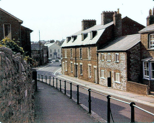
110:
98:
44:
413:
693:coordinates of the point of view
399:
333:Under the following conditions:
298:This file is licensed under the
290:
285:
279:
247:
226:
212:
204:
65:
31:
21:
396:
129:
124:Fordington High Street 1976.jpg
111:
106:Fordington High Street 1976.jpg
47:Fordington_High_Street_1976.jpg
41:No higher resolution available.
14:
614:file available on the internet
395:
255:This image was taken from the
26:
1:
708:50°42'54.148"N, 2°25'51.982"W
664:Geograph Britain and Ireland
470:object of statement has role
421:Items portrayed in this file
203:
134:Fordington High Street 1976
881:
859:Usage on sv.wikipedia.org
347:same or compatible license
742:
16:
642:geograph.org.uk image ID
398:
313:
72:This is a file from the
829:
799:
778:15:14, 12 December 2016
384:
376:
170:
160:
149:
142:
139:
121:
103:
76:. Information from its
261:this photograph's page
232:50.715041; -2.431106
79:description page there
328:– to adapt the work
845:Fordington, Dorset
800:Remove colour cast
500:author name string
851:Global file usage
833:
808:02:29, 1 May 2010
684:
562:copyright license
407:
392:
391:
276:
275:
259:collection. See
237:
236:
186:
185:
179:
176:Reusing this file
94:
93:
74:Wikimedia Commons
32:Global file usage
872:
820:
790:
730:
729:
724:
666:
661:
651:
646:
636:
631:
627:described at URL
526:copyright status
507:
504:
494:
489:
479:
474:
369:
366:
363:
360:
357:
349:as the original.
311:
300:Creative Commons
294:
293:
289:
288:
283:
282:
269:Creative Commons
257:Geograph project
251:
244:
233:
230:
216:
215:
209:
208:
207:
201:
200:
189:
173:
145:
133:
125:
119:
115:
107:
101:
90:
69:
68:
62:
56:
54:
880:
879:
875:
874:
873:
871:
870:
869:
849:
841:
834:
826:
818:
796:
788:
744:
743:
740:
739:
738:
737:
736:
735:
734:
733:
732:
731:
727:
725:
722:
713:
712:
711:
709:
699:
698:
697:
695:
676:
675:
674:
673:
672:
671:
670:
669:
668:
667:
662:
659:
653:
652:
647:
644:
638:
637:
632:
629:
620:
619:
618:
616:
604:
603:
602:
600:
589:
588:
587:
586:
585:
584:
583:
582:
580:
568:
567:
566:
564:
553:
552:
551:
550:
549:
548:
547:
546:
544:
532:
531:
530:
528:
517:
516:
515:
514:
513:
512:
511:
510:
509:
508:
505:
502:
496:
495:
490:
487:
481:
480:
475:
472:
463:
462:
461:
459:
449:
448:
447:
445:
434:
433:
432:
431:
430:
428:
412:
411:
410:
393:
372:
371:
370:
367:
364:
361:
358:
355:
354:
312:
309:
306:
295:
272:
242:
231:
205:
196:
195:
192:Camera location
187:
155:geograph.org.uk
135:
123:
105:
96:
95:
84:
83:
82:is shown below.
58:
52:
50:
43:
42:
12:
11:
5:
878:
876:
868:
867:
866:
865:
853:
852:
848:
847:
839:
838:
837:
832:
831:
828:
824:
821:
815:
810:
805:
802:
801:
798:
794:
791:
785:
780:
775:
771:
770:
767:
764:
761:
758:
755:
748:
747:
718:
717:
716:
715:
714:
710:
707:
705:
704:
703:
702:
701:
700:
696:
691:
689:
688:
687:
686:
680:
655:
654:
640:
639:
625:
624:
623:
622:
621:
617:
612:
610:
609:
608:
607:
606:
605:
601:
598:source of file
596:
594:
593:
592:
591:
590:
581:
576:
574:
573:
572:
571:
570:
569:
565:
560:
558:
557:
556:
555:
554:
545:
540:
538:
537:
536:
535:
534:
533:
529:
524:
522:
521:
520:
519:
518:
498:
497:
483:
482:
468:
467:
466:
465:
464:
460:
457:
455:
454:
453:
452:
451:
450:
446:
441:
439:
438:
437:
436:
435:
429:
424:
422:
419:
418:
417:
416:
415:
404:
403:
400:
397:
390:
389:
386:
382:
381:
378:
374:
373:
353:
352:
351:
350:
340:
331:
330:
329:
323:
316:You are free:
307:
297:
296:
278:
274:
273:
252:
241:
238:
235:
234:
224:
218:
193:
184:
183:
180:
168:
167:
162:
158:
157:
151:
147:
146:
141:
137:
136:
126:
117:
116:== Summary ==
108:
99:
97:
92:
91:
70:
60:
59:
40:
36:
35:
34:
29:
24:
19:
13:
10:
9:
6:
4:
3:
2:
877:
864:
861:
860:
858:
857:
856:
850:
846:
843:
835:
827:
822:
816:
814:
811:
809:
806:
804:
803:
797:
792:
786:
784:
781:
779:
776:
773:
772:
768:
765:
762:
759:
756:
754:
753:
751:
745:
721:
694:
665:
658:
650:
643:
635:
628:
615:
599:
579:
563:
543:
527:
501:
493:
486:
478:
471:
444:
427:
387:
383:
379:
375:
359:CC BY-SA 2.0
348:
344:
341:
338:
335:
334:
332:
327:
324:
321:
318:
317:
315:
314:
308:Attribution:
304:
301:
284:
270:
266:
262:
258:
253:
250:
246:
245:
239:
229:
225:
223:
222:OpenStreetMap
219:
217:
199:
194:
190:
181:
177:
172:
169:
166:
163:
159:
156:
152:
148:
138:
132:
127:
120:
114:
109:
102:
88:
81:
80:
75:
71:
64:
63:
57:
48:
39:
33:
30:
28:
25:
23:
20:
18:
15:
854:
749:
746:File history
477:photographer
342:
336:
325:
319:
264:
202:
130:
112:
87:You can help
77:
45:
22:File history
542:copyrighted
506:Sarah Smith
388:Sarah Smith
343:share alike
337:attribution
310:Sarah Smith
265:Sarah Smith
165:Sarah Smith
122:Description
104:Description
863:Fordington
836:File usage
817:640 × 509
787:640 × 509
763:Dimensions
458:some value
171:Permission
53:image/jpeg
27:File usage
760:Thumbnail
757:Date/Time
240:Licensing
131:English:
113:English:
825:Brichcja
819:(134 KB)
795:Smalljim
789:(156 KB)
657:operator
402:Captions
380:Georgaph
326:to remix
320:to share
305:license.
774:current
769:Comment
720:heading
679:heading
443:creator
426:depicts
406:English
49:
728:degree
683:degree
649:907123
385:Author
377:Source
210:
161:Author
150:Source
153:From
766:User
726:292
368:true
365:true
144:1976
140:Date
17:File
485:URL
723::
660::
645::
630::
503::
488::
473::
178:)
174:(
89:.
55:)
Text is available under the Creative Commons Attribution-ShareAlike License. Additional terms may apply.
