191:
330:
263:
172:
277:
298:
336:
341:
77:
33:
610:
388:– You must give appropriate credit, provide a link to the license, and indicate if changes were made. You may do so in any reasonable manner, but not in any way that suggests the licensor endorses you or your use.
641:
254:
182:
43:
37:
88:
56:
521:
485:
270:
305:
395:
541:
469:
505:
452:
292:
351:
190:
131:
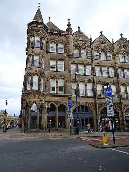
Photograph of the former
Ramsden Estate Buildings, Westgate, Huddersfield, Kirklees, West Yorkshire, England
394:– If you remix, transform, or build upon the material, you must distribute your contributions under the
312:
on the
Geograph website for the photographer's contact details. The copyright on this image is owned by
609:
604:
348:
47:
32:
620:
96:
223:
627:
Uploaded a work by JThomas from https://www.geograph.org.uk/photo/6133903 with UploadWizard
207:
276:
317:
83:
260:
148:
297:
171:
309:
577:
Click on a date/time to view the file as it appeared at that time.
262:
255:
53° 38′ 49.85″ N, 1° 47′ 02.47″ W
642:
Listed buildings in
Huddersfield (Newsome Ward - central area)
534:
245:
166:
71:
436:
Add a one-line explanation of what this file represents
115:
95:
Commons is a freely licensed media file repository.
522:
Creative
Commons Attribution-ShareAlike 2.0 Generic
61:(600 × 800 pixels, file size: 110 KB, MIME type:
405:https://creativecommons.org/licenses/by-sa/2.0
76:
411:Creative Commons Attribution-Share Alike 2.0
329:
8:
371:– to copy, distribute and transmit the work
183:Former Ramsden Estate Buildings cropped.jpg
579:
432:
149:https://www.geograph.org.uk/photo/6133903
639:
555:
539:
519:
503:
483:
467:
450:
447:
428:
421:
248:
269:View this and other nearby images on:
7:
316:and is licensed for reuse under the
238:Businesses on Westgate, Huddersfield
219:Businesses on Westgate, Huddersfield
637:The following page uses this file:
568:
352:Attribution-Share Alike 2.0 Generic
340:
335:
320:Attribution-ShareAlike 2.0 license.
121:Former Ramsden Estate Buildings.jpg
441:
435:
326:
303:
125:
108:
54:
440:
542:coordinates of the point of view
426:
382:Under the following conditions:
347:This file is licensed under the
339:
334:
328:
296:
275:
261:
189:
170:
75:
21:
423:
126:
14:
422:
304:This image was taken from the
26:
1:
140:Taken on 8 November 2018
448:Items portrayed in this file
658:
557:53°38'49.85"N, 1°47'2.47"W
396:same or compatible license
569:
16:
425:
362:
82:This is a file from the
626:
208:required by the license
169:
162:
154:
144:
139:
136:
118:
86:. Information from its
605:10:33, 21 October 2020
310:this photograph's page
281:53.647180; -1.784020
89:description page there
36:Size of this preview:
236:JThomas /
217:JThomas /
377:– to adapt the work
42:Other resolutions:
630:
506:copyright license
434:
325:
324:
308:collection. See
286:
285:
243:
242:
211:
198:
197:
177:This file has an
104:
103:
84:Wikimedia Commons
649:
617:
470:copyright status
418:
415:
412:
409:
406:
398:as the original.
360:
349:Creative Commons
343:
342:
338:
337:
332:
331:
318:Creative Commons
306:Geograph project
300:
293:
282:
279:
265:
264:
258:
257:
246:
205:
193:
174:
167:
130:
122:
116:
100:
79:
78:
72:
66:
64:
51:
48:600 × 800 pixels
44:180 × 240 pixels
38:450 × 600 pixels
657:
656:
652:
651:
650:
648:
647:
646:
631:
623:
615:
571:
570:
567:
566:
565:
564:
563:
562:
561:
560:
558:
548:
547:
546:
544:
533:
532:
531:
530:
529:
528:
527:
526:
524:
512:
511:
510:
508:
497:
496:
495:
494:
493:
492:
491:
490:
488:
476:
475:
474:
472:
461:
460:
459:
458:
457:
455:
439:
438:
437:
420:
419:
416:
413:
410:
407:
404:
403:
361:
358:
355:
344:
321:
291:
280:
253:
252:
249:Camera location
244:
233:
226:
214:
194:
179:extracted image
132:
120:
113:
106:
105:
94:
93:
92:is shown below.
68:
62:
60:
53:
52:
41:
12:
11:
5:
655:
653:
645:
644:
635:
634:
629:
628:
625:
622:Peter I. Vardy
621:
618:
612:
607:
602:
598:
597:
594:
591:
588:
585:
582:
575:
574:
559:
556:
554:
553:
552:
551:
550:
549:
545:
540:
538:
537:
536:
535:
525:
520:
518:
517:
516:
515:
514:
513:
509:
504:
502:
501:
500:
499:
498:
489:
484:
482:
481:
480:
479:
478:
477:
473:
468:
466:
465:
464:
463:
462:
456:
451:
449:
446:
445:
444:
443:
442:
431:
430:
427:
424:
402:
401:
400:
399:
389:
380:
379:
378:
372:
365:You are free:
356:
346:
345:
327:
323:
322:
301:
290:
287:
284:
283:
273:
267:
250:
241:
240:
234:
231:
228:
227:
222:
215:
212:
200:
199:
196:
195:
188:
186:
175:
164:
163:Other versions
160:
159:
156:
152:
151:
146:
142:
141:
138:
134:
133:
123:
114:
112:
109:
107:
102:
101:
80:
70:
69:
35:
31:
30:
29:
24:
19:
13:
10:
9:
6:
4:
3:
2:
654:
643:
640:
638:
632:
624:
619:
613:
611:
608:
606:
603:
600:
599:
595:
592:
589:
586:
583:
581:
580:
578:
572:
543:
523:
507:
487:
471:
454:
408:CC BY-SA 2.0
397:
393:
390:
387:
384:
383:
381:
376:
373:
370:
367:
366:
364:
363:
357:Attribution:
353:
350:
333:
319:
315:
311:
307:
302:
299:
295:
294:
288:
278:
274:
272:
271:OpenStreetMap
268:
266:
256:
251:
247:
239:
235:
230:
229:
225:
221: /
220:
216:
209:
204:
202:
201:
192:
187:
184:
180:
176:
173:
168:
165:
161:
157:
153:
150:
147:
143:
135:
129:
124:
117:
110:
98:
91:
90:
85:
81:
74:
73:
67:
58:
57:Original file
49:
45:
39:
34:
28:
25:
23:
20:
18:
15:
636:
576:
573:File history
391:
385:
374:
368:
313:
237:
224:CC BY-SA 2.0
218:
178:
127:
97:You can help
87:
55:
22:File history
486:copyrighted
392:share alike
386:attribution
203:Attribution
119:Description
633:File usage
614:600 × 800
590:Dimensions
63:image/jpeg
27:File usage
587:Thumbnail
584:Date/Time
289:Licensing
232:InfoField
213:InfoField
128:English:
616:(110 KB)
429:Captions
375:to remix
369:to share
354:license.
601:current
596:Comment
453:depicts
433:English
359:JThomas
314:JThomas
158:JThomas
111:Summary
59:
259:
155:Author
145:Source
593:User
417:true
414:true
137:Date
17:File
181::
46:|
40:.
210:)
206:(
185:.
99:.
65:)
50:.
Text is available under the Creative Commons Attribution-ShareAlike License. Additional terms may apply.


