301:
231:
223:
245:
269:
307:
312:
72:
713:"}},"text\/plain":{"en":{"":"heading"}}},"{\"value\":{\"amount\":\"+180\",\"unit\":\"http:\\\/\\\/www.wikidata.org\\\/entity\\\/Q28390\"},\"type\":\"quantity\"}":{"text\/html":{"en":{"P7787":"180
709:
214:
359:– You must give appropriate credit, provide a link to the license, and indicate if changes were made. You may do so in any reasonable manner, but not in any way that suggests the licensor endorses you or your use.
43:
832:== {{int:filedesc}} == {{Information |description={{en|1=Fortismere. Entrance to the north wing of Fortismere School on Creighton Avenue.}} |date=2006-09-14 |source=From |author=[http://www.geograp
710:
83:
51:
645:
575:
539:
238:
665:
276:
877:
This file contains additional information, probably added from the digital camera or scanner used to create or digitize it.
366:
502:
751:
724:
673:
629:
523:
495:
482:
467:
688:
658:
595:
559:
440:
423:
263:
322:
880:
If the file has been modified from its original state, some details may not fully reflect the modified file.
814:
809:
42:
365:– If you remix, transform, or build upon the material, you must distribute your contributions under the
283:
on the
Geograph website for the photographer's contact details. The copyright on this image is owned by
825:
319:
717:"}},"text\/plain":{"en":{"P7787":"180 degree"}}}}": -->
91:
183:
846:
695:
680:
474:
167:
244:
288:
78:
126:
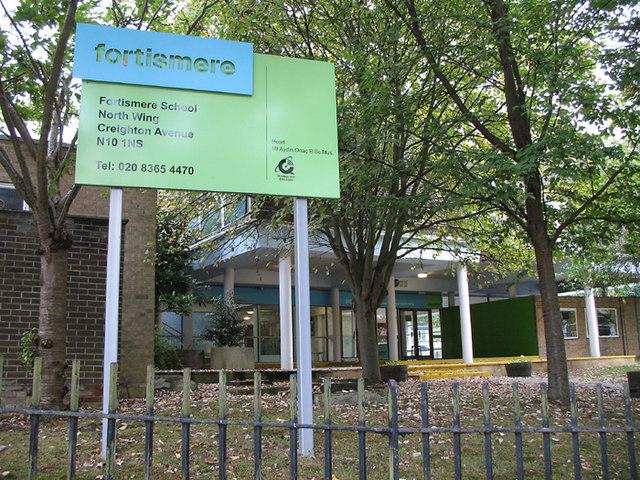
Fortismere. Entrance to the north wing of
Fortismere School on Creighton Avenue.
135:
228:
156:
146:
268:
280:
782:
Click on a date/time to view the file as it appeared at that time.
230:
205:
66:
215:
51° 35′ 41″ N, 0° 09′ 14″ W
407:
Add a one-line explanation of what this file represents
864:
110:
90:
Commons is a freely licensed media file repository.
576:
Creative
Commons Attribution-ShareAlike 2.0 Generic
56:(640 × 480 pixels, file size: 167 KB, MIME type:
376:https://creativecommons.org/licenses/by-sa/2.0
71:
382:Creative Commons Attribution-Share Alike 2.0
300:
8:
714:
342:– to copy, distribute and transmit the work
882:
784:
403:
857:The following other wikis use this file:
116:Fortismere - geograph.org.uk - 240906.jpg
52:Fortismere_-_geograph.org.uk_-_240906.jpg
696:https://www.geograph.org.uk/photo/240906
475:https://www.geograph.org.uk/profile/4942
884:
844:
738:
722:
643:
627:
609:
593:
573:
557:
537:
521:
454:
438:
421:
418:
399:
392:
208:
237:View this and other nearby images on:
7:
287:and is licensed for reuse under the
842:The following page uses this file:
773:
323:Attribution-Share Alike 2.0 Generic
311:
306:
291:Attribution-ShareAlike 2.0 license.
875:
412:
406:
297:
274:
120:
103:
49:
411:
397:
353:Under the following conditions:
318:This file is licensed under the
310:
305:
299:
267:
243:
229:
221:
70:
31:
21:
394:
121:
46:No higher resolution available.
14:
646:file available on the internet
393:
275:This image was taken from the
26:
1:
725:coordinates of depicted place
36:
666:Geograph Britain and Ireland
496:object of statement has role
419:Items portrayed in this file
220:
196:Martin Addison /
177:Martin Addison /
906:
861:Usage on www.wikidata.org
367:same or compatible license
774:
16:
740:51°35'41.3"N, 0°9'14.4"W
674:geograph.org.uk image ID
396:
333:
77:This is a file from the
831:
168:required by the license
152:
141:
134:
131:
113:
81:. Information from its
810:15:25, 1 February 2010
281:this photograph's page
249:51.594800; -0.154000
84:description page there
348:– to adapt the work
483:author name string
893:
892:
853:Global file usage
847:Fortismere School
835:
716:
611:14 September 2006
560:copyright license
405:
296:
295:
279:collection. See
254:
253:
203:
202:
171:
136:14 September 2006
99:
98:
79:Wikimedia Commons
32:Global file usage
897:
883:
822:
762:
761:
756:
698:
693:
689:described at URL
683:
678:
668:
663:
524:copyright status
505:
500:
490:
487:
477:
472:
389:
386:
383:
380:
377:
369:as the original.
331:
320:Creative Commons
314:
313:
309:
308:
303:
302:
289:Creative Commons
277:Geograph project
271:
264:
250:
247:
233:
232:
226:
225:
224:
218:
217:
206:
165:
137:
125:
117:
111:
95:
74:
73:
67:
61:
59:
905:
904:
900:
899:
898:
896:
895:
894:
871:
851:
836:
828:
820:
776:
775:
772:
771:
770:
769:
768:
767:
766:
765:
764:
763:
759:
757:
754:
745:
744:
743:
741:
731:
730:
729:
727:
708:
707:
706:
705:
704:
703:
702:
701:
700:
699:
694:
691:
685:
684:
679:
676:
670:
669:
664:
661:
652:
651:
650:
648:
636:
635:
634:
632:
621:
620:
619:
618:
617:
616:
615:
614:
612:
602:
601:
600:
598:
587:
586:
585:
584:
583:
582:
581:
580:
578:
566:
565:
564:
562:
551:
550:
549:
548:
547:
546:
545:
544:
542:
530:
529:
528:
526:
515:
514:
513:
512:
511:
510:
509:
508:
507:
506:
501:
498:
492:
491:
488:
485:
479:
478:
473:
470:
461:
460:
459:
457:
447:
446:
445:
443:
432:
431:
430:
429:
428:
426:
410:
409:
408:
391:
390:
387:
384:
381:
378:
375:
374:
332:
329:
326:
315:
292:
262:
248:
222:
213:
212:
209:Object location
204:
193:
186:
174:
147:geograph.org.uk
127:
115:
108:
101:
100:
89:
88:
87:is shown below.
63:
57:
55:
48:
47:
12:
11:
5:
903:
901:
891:
890:
887:
874:
870:
869:
868:
867:
855:
854:
850:
849:
840:
839:
834:
833:
830:
826:
823:
817:
812:
807:
803:
802:
799:
796:
793:
790:
787:
780:
779:
750:
749:
748:
747:
746:
742:
739:
737:
736:
735:
734:
733:
732:
728:
723:
721:
720:
719:
718:
712:
687:
686:
672:
671:
657:
656:
655:
654:
653:
649:
644:
642:
641:
640:
639:
638:
637:
633:
630:source of file
628:
626:
625:
624:
623:
622:
613:
610:
608:
607:
606:
605:
604:
603:
599:
594:
592:
591:
590:
589:
588:
579:
574:
572:
571:
570:
569:
568:
567:
563:
558:
556:
555:
554:
553:
552:
543:
538:
536:
535:
534:
533:
532:
531:
527:
522:
520:
519:
518:
517:
516:
494:
493:
489:Martin Addison
481:
480:
466:
465:
464:
463:
462:
458:
455:
453:
452:
451:
450:
449:
448:
444:
439:
437:
436:
435:
434:
433:
427:
422:
420:
417:
416:
415:
414:
413:
402:
401:
398:
395:
373:
372:
371:
370:
360:
351:
350:
349:
343:
336:You are free:
330:Martin Addison
327:
317:
316:
298:
294:
293:
285:Martin Addison
272:
261:
258:
252:
251:
241:
235:
210:
201:
200:
194:
191:
188:
187:
182:
175:
172:
160:
159:
157:Martin Addison
154:
150:
149:
143:
139:
138:
133:
129:
128:
118:
109:
107:
104:
102:
97:
96:
75:
65:
64:
45:
41:
40:
39:
34:
29:
24:
19:
13:
10:
9:
6:
4:
3:
2:
902:
888:
885:
881:
878:
872:
866:
863:
862:
860:
859:
858:
852:
848:
845:
843:
837:
829:
824:
818:
816:
813:
811:
808:
805:
804:
800:
797:
794:
791:
788:
786:
785:
783:
777:
753:
726:
697:
690:
682:
675:
667:
660:
647:
631:
597:
577:
561:
541:
525:
504:
497:
484:
476:
469:
442:
425:
379:CC BY-SA 2.0
368:
364:
361:
358:
355:
354:
352:
347:
344:
341:
338:
337:
335:
334:
328:Attribution:
324:
321:
304:
290:
286:
282:
278:
273:
270:
266:
265:
259:
257:
256:
246:
242:
240:
239:OpenStreetMap
236:
234:
216:
211:
207:
199:
195:
190:
189:
185:
181: /
180:
176:
169:
164:
162:
161:
158:
155:
151:
148:
144:
140:
130:
124:
119:
112:
105:
93:
86:
85:
80:
76:
69:
68:
62:
53:
44:
38:
35:
33:
30:
28:
25:
23:
20:
18:
15:
879:
876:
856:
841:
781:
778:File history
503:photographer
362:
356:
345:
339:
284:
255:
219:
197:
184:CC BY-SA 2.0
178:
122:
92:You can help
82:
50:
22:File history
827:GeographBot
540:copyrighted
363:share alike
357:attribution
163:Attribution
114:Description
886:_error
838:File usage
819:640 × 480
795:Dimensions
456:some value
198:Fortismere
179:Fortismere
58:image/jpeg
27:File usage
792:Thumbnail
789:Date/Time
596:inception
260:Licensing
192:InfoField
173:InfoField
123:English:
873:Metadata
865:Q5472675
821:(167 KB)
659:operator
400:Captions
346:to remix
340:to share
325:license.
37:Metadata
806:current
801:Comment
752:heading
711:heading
441:creator
424:depicts
404:English
106:Summary
54:
760:degree
715:degree
681:240906
227:
153:Author
142:Source
145:From
798:User
758:180
388:true
385:true
132:Date
17:File
468:URL
755::
692::
677::
662::
499::
486::
471::
889:0
170:)
166:(
94:.
60:)
Text is available under the Creative Commons Attribution-ShareAlike License. Additional terms may apply.
_heading:180.00&language=en)
