358:
291:
241:
283:
233:
305:
255:
326:
364:
369:
38:
82:
834:"}},"text\/plain":{"en":{"":"heading"}}},"{\"value\":{\"amount\":\"+202\",\"unit\":\"http:\\\/\\\/www.wikidata.org\\\/entity\\\/Q28390\"},\"type\":\"quantity\"}":{"text\/html":{"en":{"P7787":"202
683:"}},"text\/plain":{"en":{"":"heading"}}},"{\"value\":{\"amount\":\"+202\",\"unit\":\"http:\\\/\\\/www.wikidata.org\\\/entity\\\/Q28390\"},\"type\":\"quantity\"}":{"text\/html":{"en":{"P7787":"202
830:
274:
224:
416:– You must give appropriate credit, provide a link to the license, and indicate if changes were made. You may do so in any reasonable manner, but not in any way that suggests the licensor endorses you or your use.
987:== {{int:filedesc}} == {{Information |description={{en|1=Falling Foss A delightful area for walking including this wonderful waterfall.}} |date=2008-10-12 |source=From |author=[http://www.geograph
831:
680:
48:
42:
93:
61:
766:
632:
596:
298:
248:
786:
333:
1012:
This file contains additional information, probably added from the digital camera or scanner used to create or digitize it.
423:
531:
901:
872:
845:
794:
750:
721:
694:
580:
552:
539:
524:
809:
779:
652:
616:
497:
480:
320:
969:
964:
379:
52:
37:
1015:
If the file has been modified from its original state, some details may not fully reflect the modified file.
422:– If you remix, transform, or build upon the material, you must distribute your contributions under the
340:
on the
Geograph website for the photographer's contact details. The copyright on this image is owned by
980:
376:
838:"}},"text\/plain":{"en":{"P7787":"202 degree"}}}}": -->
687:"}},"text\/plain":{"en":{"P7787":"202 degree"}}}}": -->
101:
193:
816:
801:
559:
177:
304:
254:
345:
88:
1001:
288:
145:
238:
136:
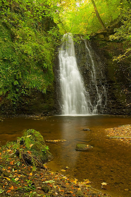
Falling Foss A delightful area for walking including this wonderful waterfall.
166:
156:
325:
337:
937:
Click on a date/time to view the file as it appeared at that time.
290:
240:
265:
215:
76:
275:
54° 25′ 08″ N, 0° 37′ 59″ W
225:
54° 25′ 10″ N, 0° 37′ 57″ W
464:
Add a one-line explanation of what this file represents
120:
100:
Commons is a freely licensed media file repository.
633:
Creative
Commons Attribution-ShareAlike 2.0 Generic
66:(427 × 640 pixels, file size: 144 KB, MIME type:
433:https://creativecommons.org/licenses/by-sa/2.0
81:
439:Creative Commons Attribution-Share Alike 2.0
357:
8:
126:Falling Foss - geograph.org.uk - 1546285.jpg
835:
684:
399:– to copy, distribute and transmit the work
1017:
939:
460:
817:https://www.geograph.org.uk/photo/1546285
560:https://www.geograph.org.uk/profile/41228
1019:
999:
915:
899:
859:
843:
764:
748:
708:
692:
666:
650:
630:
614:
594:
578:
511:
495:
478:
475:
456:
449:
268:
218:
297:View this and other nearby images on:
247:View this and other nearby images on:
7:
344:and is licensed for reuse under the
997:The following page uses this file:
928:
380:Attribution-Share Alike 2.0 Generic
368:
363:
348:Attribution-ShareAlike 2.0 license.
1010:
469:
463:
354:
331:
130:
113:
59:
468:
695:coordinates of the point of view
454:
410:Under the following conditions:
375:This file is licensed under the
367:
362:
356:
324:
303:
289:
281:
253:
239:
231:
80:
21:
451:
131:
14:
767:file available on the internet
450:
332:This image was taken from the
26:
1:
846:coordinates of depicted place
31:
861:54°25'8.090"N, 0°37'58.584"W
787:Geograph Britain and Ireland
525:object of statement has role
476:Items portrayed in this file
280:
230:
206:Richard Spencer /
187:Richard Spencer /
1041:
710:54°25'9.91"N, 0°37'57.36"W
424:same or compatible license
929:
16:
795:geograph.org.uk image ID
453:
390:
87:This is a file from the
986:
178:required by the license
162:
151:
144:
141:
123:
91:. Information from its
338:this photograph's page
309:54.418914; -0.632940
259:54.419420; -0.632600
94:description page there
41:Size of this preview:
965:09:39, 3 March 2011
405:– to adapt the work
47:Other resolutions:
540:author name string
1028:
1027:
990:
837:
686:
617:copyright license
462:
353:
352:
336:collection. See
314:
313:
264:
263:
213:
212:
181:
109:
108:
89:Wikimedia Commons
1032:
1018:
977:
883:
882:
877:
819:
814:
810:described at URL
804:
799:
789:
784:
732:
731:
726:
581:copyright status
562:
557:
547:
544:
534:
529:
446:
443:
440:
437:
434:
426:as the original.
388:
377:Creative Commons
371:
370:
366:
365:
360:
359:
346:Creative Commons
334:Geograph project
328:
321:
310:
307:
293:
292:
286:
285:
284:
278:
277:
266:
260:
257:
243:
242:
236:
235:
234:
228:
227:
216:
175:
147:
135:
127:
121:
105:
84:
83:
77:
71:
69:
56:
53:427 × 640 pixels
49:160 × 240 pixels
43:400 × 600 pixels
1040:
1039:
1035:
1034:
1033:
1031:
1030:
1029:
1006:
991:
983:
975:
931:
930:
927:
926:
925:
924:
923:
922:
921:
920:
918:
908:
907:
906:
904:
893:
892:
891:
890:
889:
888:
887:
886:
885:
884:
880:
878:
875:
866:
865:
864:
862:
852:
851:
850:
848:
829:
828:
827:
826:
825:
824:
823:
822:
821:
820:
815:
812:
806:
805:
800:
797:
791:
790:
785:
782:
773:
772:
771:
769:
757:
756:
755:
753:
742:
741:
740:
739:
738:
737:
736:
735:
734:
733:
729:
727:
724:
715:
714:
713:
711:
701:
700:
699:
697:
678:
677:
676:
675:
674:
673:
672:
671:
669:
668:12 October 2008
659:
658:
657:
655:
644:
643:
642:
641:
640:
639:
638:
637:
635:
623:
622:
621:
619:
608:
607:
606:
605:
604:
603:
602:
601:
599:
587:
586:
585:
583:
572:
571:
570:
569:
568:
567:
566:
565:
564:
563:
558:
555:
549:
548:
546:Richard Spencer
545:
542:
536:
535:
530:
527:
518:
517:
516:
514:
504:
503:
502:
500:
489:
488:
487:
486:
485:
483:
467:
466:
465:
448:
447:
444:
441:
438:
435:
432:
431:
389:
387:Richard Spencer
386:
383:
372:
349:
342:Richard Spencer
319:
308:
282:
273:
272:
269:Object location
258:
232:
223:
222:
219:Camera location
214:
203:
196:
184:
167:Richard Spencer
157:geograph.org.uk
146:12 October 2008
137:
125:
118:
111:
110:
99:
98:
97:is shown below.
73:
67:
65:
58:
57:
46:
12:
11:
5:
1038:
1036:
1026:
1025:
1022:
1009:
1005:
1004:
995:
994:
989:
988:
985:
981:
978:
972:
967:
962:
958:
957:
954:
951:
948:
945:
942:
935:
934:
919:
916:
914:
913:
912:
911:
910:
909:
905:
900:
898:
897:
896:
895:
894:
871:
870:
869:
868:
867:
863:
860:
858:
857:
856:
855:
854:
853:
849:
844:
842:
841:
840:
839:
833:
808:
807:
793:
792:
778:
777:
776:
775:
774:
770:
765:
763:
762:
761:
760:
759:
758:
754:
751:source of file
749:
747:
746:
745:
744:
743:
720:
719:
718:
717:
716:
712:
709:
707:
706:
705:
704:
703:
702:
698:
693:
691:
690:
689:
688:
682:
670:
667:
665:
664:
663:
662:
661:
660:
656:
651:
649:
648:
647:
646:
645:
636:
631:
629:
628:
627:
626:
625:
624:
620:
615:
613:
612:
611:
610:
609:
600:
595:
593:
592:
591:
590:
589:
588:
584:
579:
577:
576:
575:
574:
573:
551:
550:
538:
537:
523:
522:
521:
520:
519:
515:
512:
510:
509:
508:
507:
506:
505:
501:
496:
494:
493:
492:
491:
490:
484:
479:
477:
474:
473:
472:
471:
470:
459:
458:
455:
452:
430:
429:
428:
427:
417:
408:
407:
406:
400:
393:You are free:
384:
374:
373:
355:
351:
350:
329:
318:
315:
312:
311:
301:
295:
270:
262:
261:
251:
245:
220:
211:
210:
204:
201:
198:
197:
192:
185:
182:
170:
169:
164:
160:
159:
153:
149:
148:
143:
139:
138:
128:
119:
117:
114:
112:
107:
106:
85:
75:
74:
40:
36:
35:
34:
29:
24:
19:
13:
10:
9:
6:
4:
3:
2:
1037:
1023:
1020:
1016:
1013:
1007:
1003:
1000:
998:
992:
984:
979:
973:
971:
968:
966:
963:
960:
959:
955:
952:
949:
946:
943:
941:
940:
938:
932:
903:
874:
847:
818:
811:
803:
796:
788:
781:
768:
752:
723:
696:
654:
634:
618:
598:
582:
561:
554:
541:
533:
526:
499:
482:
436:CC BY-SA 2.0
425:
421:
418:
415:
412:
411:
409:
404:
401:
398:
395:
394:
392:
391:
385:Attribution:
381:
378:
361:
347:
343:
339:
335:
330:
327:
323:
322:
316:
306:
302:
300:
299:OpenStreetMap
296:
294:
276:
271:
267:
256:
252:
250:
249:OpenStreetMap
246:
244:
226:
221:
217:
209:
205:
200:
199:
195:
191: /
190:
186:
179:
174:
172:
171:
168:
165:
161:
158:
154:
150:
140:
134:
129:
122:
115:
103:
96:
95:
90:
86:
79:
78:
72:
63:
62:Original file
54:
50:
44:
39:
33:
30:
28:
25:
23:
20:
18:
15:
1014:
1011:
1002:Falling Foss
996:
936:
933:File history
532:photographer
419:
413:
402:
396:
341:
279:
229:
208:Falling Foss
207:
194:CC BY-SA 2.0
189:Falling Foss
188:
132:
102:You can help
92:
60:
22:File history
982:GeographBot
597:copyrighted
420:share alike
414:attribution
173:Attribution
124:Description
1021:_error
993:File usage
974:427 × 640
950:Dimensions
917:image/jpeg
902:media type
513:some value
68:image/jpeg
27:File usage
947:Thumbnail
944:Date/Time
653:inception
317:Licensing
202:InfoField
183:InfoField
133:English:
1008:Metadata
976:(144 KB)
780:operator
457:Captions
403:to remix
397:to share
382:license.
32:Metadata
961:current
956:Comment
873:heading
832:heading
802:1546285
722:heading
681:heading
498:creator
481:depicts
461:English
116:Summary
64:
881:degree
836:degree
730:degree
685:degree
287:
237:
163:Author
152:Source
155:From
953:User
879:202
728:202
445:true
442:true
142:Date
17:File
553:URL
876::
813::
798::
783::
725::
556::
543::
528::
51:|
45:.
1024:0
180:)
176:(
104:.
70:)
55:.
Text is available under the Creative Commons Attribution-ShareAlike License. Additional terms may apply.
_heading:202.00&language=en)
_heading:202.00&language=en)
