199:
313:
327:
167:
205:
210:
67:
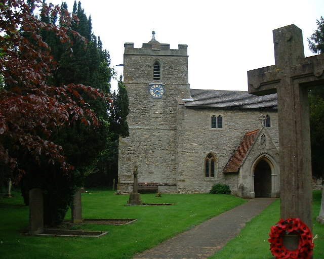
701:{{Information |Description=St Michael & All Angels Church, Finmere, Oxfordshire |Source=http://www.geograph.org.uk/photo/71123 |Date=Tuesday, 11 May, 2004 |Author=Ian Baker |Permission={{geograph|71123|Ian Baker}} |other_versions= }} [[Category:Geograph
684:
304:
257:– You must give appropriate credit, provide a link to the license, and indicate if changes were made. You may do so in any reasonable manner, but not in any way that suggests the licensor endorses you or your use.
715:
38:
154:
456:
420:
384:
320:
853:
174:
726:
This file contains additional information, probably added from the digital camera or scanner used to create or digitize it.
264:
822:
612:
578:
544:
510:
404:
476:
440:
368:
161:
78:
46:
220:
729:
If the file has been modified from its original state, some details may not fully reflect the modified file.
927:
263:– If you remix, transform, or build upon the material, you must distribute your contributions under the
181:
on the
Geograph website for the photographer's contact details. The copyright on this image is owned by
217:
955:
748:
86:
326:
945:
901:
186:
73:
683:
678:
116:
Church of
England parish church of St Michael & All Angels, Finmere, Oxfordshire
37:
785:
973:
125:
765:
694:
310:
135:
755:
738:
385:
Finmere War
Memorial in Churchyard of Church of St Michael and All Angels
166:
178:
651:
Click on a date/time to view the file as it appeared at that time.
312:
295:
61:
503:
716:
List of church restorations and alterations by G. E. Street
305:
51° 59′ 35″ N, 1° 04′ 23″ W
352:
Add a one-line explanation of what this file represents
100:
85:
Commons is a freely licensed media file repository.
457:
Creative
Commons Attribution-ShareAlike 2.0 Generic
51:(640 × 512 pixels, file size: 103 KB, MIME type:
274:https://creativecommons.org/licenses/by-sa/2.0
66:
280:Creative Commons Attribution-Share Alike 2.0
198:
8:
240:– to copy, distribute and transmit the work
731:
653:
348:
1021:
1013:
1005:
997:
989:
981:
971:
963:
953:
943:
935:
925:
917:
909:
899:
891:
870:
862:
851:
843:
835:
827:
817:
809:
801:
793:
782:
774:
763:
753:
743:
713:
626:
610:
592:
576:
558:
542:
524:
508:
490:
474:
454:
438:
418:
402:
382:
366:
363:
344:
337:
298:
136:https://www.geograph.org.uk/photo/71123
319:View this and other nearby images on:
733:
7:
185:and is licensed for reuse under the
711:The following page uses this file:
642:
221:Attribution-Share Alike 2.0 Generic
209:
204:
189:Attribution-ShareAlike 2.0 license.
823:Digital Camera MX-1700ZOOM Ver1.00
724:
357:
351:
195:
172:
110:
98:
44:
356:
776:Date and time of data generation
342:
325:
311:
251:Under the following conditions:
216:This file is licensed under the
208:
203:
197:
165:
65:
21:
339:
111:
41:No higher resolution available.
14:
338:
173:This image was taken from the
26:
1:
1026:A directly photographed image
511:coordinates of depicted place
31:
364:Items portrayed in this file
999:Focal plane resolution unit
864:Date and time of digitizing
1043:
1010:One-chip color area sensor
965:Supported Flashpix version
265:same or compatible license
872:Meaning of each component
829:File change date and time
643:
16:
991:Focal plane Y resolution
983:Focal plane X resolution
526:51°59'35.2"N, 1°4'22.8"W
341:
231:
72:This is a file from the
700:
149:
141:
131:
124:
121:
103:
76:. Information from its
893:Image compression mode
331:51.993100; -1.073000
179:this photograph's page
79:description page there
937:Maximum land aperture
803:Horizontal resolution
1018:Digital still camera
837:Y and C positioning
811:Vertical resolution
735:Camera manufacturer
246:– to adapt the work
960:Flash did not fire
867:08:26, 11 May 2004
832:08:26, 11 May 2004
779:08:26, 11 May 2004
679:20:40, 13 May 2008
106:Finmere church.jpg
47:Finmere_church.jpg
1030:
1029:
940:3.3 APEX (f/3.14)
704:
441:copyright license
350:
336:
335:
293:
292:
194:
193:
177:collection. See
158:
155:Reusing this file
94:
93:
74:Wikimedia Commons
1034:
845:Exposure Program
732:
691:
631:
405:copyright status
332:
329:
315:
314:
308:
307:
296:
287:
284:
281:
278:
275:
267:as the original.
229:
218:Creative Commons
212:
211:
207:
206:
201:
200:
187:Creative Commons
175:Geograph project
169:
162:
152:
127:
115:
107:
101:
90:
69:
68:
62:
56:
54:
1042:
1041:
1037:
1036:
1035:
1033:
1032:
1031:
919:APEX brightness
720:
705:
697:
689:
645:
644:
641:
640:
639:
638:
637:
636:
635:
634:
632:
629:
619:
618:
617:
615:
604:
603:
602:
601:
600:
599:
598:
597:
595:
585:
584:
583:
581:
570:
569:
568:
567:
566:
565:
564:
563:
561:
551:
550:
549:
547:
536:
535:
534:
533:
532:
531:
530:
529:
527:
517:
516:
515:
513:
502:
501:
500:
499:
498:
497:
496:
495:
493:
483:
482:
481:
479:
468:
467:
466:
465:
464:
463:
462:
461:
459:
447:
446:
445:
443:
432:
431:
430:
429:
428:
427:
426:
425:
423:
411:
410:
409:
407:
396:
395:
394:
393:
392:
391:
390:
389:
387:
375:
374:
373:
371:
355:
354:
353:
330:
303:
302:
299:Object location
294:
289:
288:
285:
282:
279:
276:
273:
272:
230:
227:
224:
213:
190:
117:
105:
96:
95:
84:
83:
82:is shown below.
58:
52:
50:
43:
42:
12:
11:
5:
1040:
1038:
1028:
1027:
1024:
1020:
1019:
1016:
1012:
1011:
1008:
1007:Sensing method
1004:
1003:
1000:
996:
995:
992:
988:
987:
984:
980:
979:
976:
970:
969:
966:
962:
961:
958:
952:
951:
948:
942:
941:
938:
934:
933:
930:
924:
923:
920:
916:
915:
912:
908:
907:
904:
898:
897:
894:
890:
889:
888:
887:
886:does not exist
884:
881:
878:
873:
869:
868:
865:
861:
860:
857:
850:
849:
848:Normal program
846:
842:
841:
838:
834:
833:
830:
826:
825:
820:
816:
815:
812:
808:
807:
804:
800:
799:
796:
792:
791:
788:
781:
780:
777:
773:
772:
769:
762:
761:
758:
752:
751:
746:
742:
741:
736:
723:
719:
718:
709:
708:
703:
702:
699:
695:
692:
686:
681:
676:
672:
671:
668:
665:
662:
659:
656:
649:
648:
633:
627:
625:
624:
623:
622:
621:
620:
616:
611:
609:
608:
607:
606:
605:
596:
593:
591:
590:
589:
588:
587:
586:
582:
577:
575:
574:
573:
572:
571:
562:
559:
557:
556:
555:
554:
553:
552:
548:
543:
541:
540:
539:
538:
537:
528:
525:
523:
522:
521:
520:
519:
518:
514:
509:
507:
506:
505:
504:
494:
491:
489:
488:
487:
486:
485:
484:
480:
475:
473:
472:
471:
470:
469:
460:
455:
453:
452:
451:
450:
449:
448:
444:
439:
437:
436:
435:
434:
433:
424:
419:
417:
416:
415:
414:
413:
412:
408:
403:
401:
400:
399:
398:
397:
388:
383:
381:
380:
379:
378:
377:
376:
372:
367:
365:
362:
361:
360:
359:
358:
347:
346:
343:
340:
334:
333:
323:
317:
300:
291:
290:
271:
270:
269:
268:
258:
249:
248:
247:
241:
234:You are free:
225:
215:
214:
196:
192:
191:
170:
159:
147:
146:
143:
139:
138:
133:
129:
128:
123:
119:
118:
108:
99:
97:
92:
91:
70:
60:
59:
40:
36:
35:
34:
29:
24:
19:
13:
10:
9:
6:
4:
3:
2:
1039:
1025:
1022:
1017:
1014:
1009:
1006:
1001:
998:
993:
990:
985:
982:
977:
975:
972:
967:
964:
959:
957:
954:
949:
947:
946:Metering mode
944:
939:
936:
931:
929:
928:Exposure bias
926:
921:
918:
913:
911:APEX aperture
910:
905:
903:
902:Shutter speed
900:
895:
892:
885:
882:
879:
876:
875:
874:
871:
866:
863:
858:
855:
852:
847:
844:
839:
836:
831:
828:
824:
821:
819:Software used
818:
813:
810:
805:
802:
797:
794:
789:
787:
783:
778:
775:
770:
767:
764:
759:
757:
754:
750:
747:
744:
740:
737:
734:
730:
727:
721:
717:
714:
712:
706:
698:
693:
687:
685:
682:
680:
677:
674:
673:
669:
666:
663:
660:
657:
655:
654:
652:
646:
614:
580:
546:
512:
478:
458:
442:
422:
406:
386:
370:
328:
324:
322:
321:OpenStreetMap
318:
316:
306:
301:
297:
277:CC BY-SA 2.0
266:
262:
259:
256:
253:
252:
250:
245:
242:
239:
236:
235:
233:
232:
226:Attribution:
222:
219:
202:
188:
184:
180:
176:
171:
168:
164:
163:
160:
156:
151:
148:
144:
140:
137:
134:
130:
120:
114:
109:
102:
88:
81:
80:
75:
71:
64:
63:
57:
48:
39:
33:
30:
28:
25:
23:
20:
18:
15:
786:focal length
745:Camera model
728:
725:
710:
650:
647:File history
613:focal length
260:
254:
243:
237:
182:
112:
87:You can help
77:
45:
22:File history
1015:File source
974:Color space
795:Orientation
749:MX-1700ZOOM
492:11 May 2004
421:copyrighted
261:share alike
255:attribution
126:11 May 2004
104:Description
1023:Scene type
707:File usage
688:640 × 512
664:Dimensions
630:millimetre
150:Permission
53:image/jpeg
27:File usage
766:ISO speed
661:Thumbnail
658:Date/Time
545:ISO speed
477:inception
228:Ian Baker
183:Ian Baker
145:Ian Baker
113:English:
840:Co-sited
756:F-number
739:FUJIFILM
722:Metadata
690:(103 KB)
579:f-number
345:Captions
244:to remix
238:to share
223:license.
32:Metadata
950:Pattern
856:version
675:current
670:Comment
369:depicts
349:English
49:
814:72 dpi
806:72 dpi
798:Normal
790:6.6 mm
768:rating
309:
142:Author
132:Source
994:2,174
986:2,174
956:Flash
784:Lens
760:f/3.3
696:Polly
978:sRGB
854:Exif
667:User
628:6.6
286:true
283:true
122:Date
17:File
922:6.6
914:3.4
906:8.6
859:2.1
771:125
594:3.3
560:125
883:Cr
880:Cb
1002:3
968:1
932:0
896:2
877:Y
157:)
153:(
89:.
55:)
Text is available under the Creative Commons Attribution-ShareAlike License. Additional terms may apply.

_region:GB-ENG_&language=en)