343:
276:
226:
268:
218:
290:
240:
311:
349:
354:
67:
855:"}},"text\/plain":{"en":{"":"heading"}}},"{\"value\":{\"amount\":\"+180\",\"unit\":\"http:\\\/\\\/www.wikidata.org\\\/entity\\\/Q28390\"},\"type\":\"quantity\"}":{"text\/html":{"en":{"P7787":"180
755:"}},"text\/plain":{"en":{"":"heading"}}},"{\"value\":{\"amount\":\"+180\",\"unit\":\"http:\\\/\\\/www.wikidata.org\\\/entity\\\/Q28390\"},\"type\":\"quantity\"}":{"text\/html":{"en":{"P7787":"180
751:
259:
974:== {{int:filedesc}} == {{Information |description={{en|1=Frithsden Beeches Part of the Ashridge Estate, Frithsden Beeches is an area of very old pollarded trees, managed as a conservation project.}} |date=2006-10-26 |source=From [http://www.geograph.org.u
209:
38:
401:– You must give appropriate credit, provide a link to the license, and indicate if changes were made. You may do so in any reasonable manner, but not in any way that suggests the licensor endorses you or your use.
78:
46:
852:
752:
121:
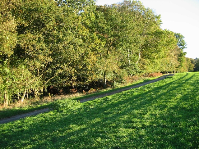
Frithsden
Beeches Part of the Ashridge Estate, Frithsden Beeches is an area of very old pollarded trees, managed as a conservation project.
687:
617:
581:
283:
233:
838:
707:
1107:
318:
999:
This file contains additional information, probably added from the digital camera or scanner used to create or digitize it.
408:
516:
893:
866:
822:
793:
766:
715:
671:
565:
537:
524:
509:
730:
700:
637:
601:
482:
465:
956:
951:
305:
37:
364:
1002:
If the file has been modified from its original state, some details may not fully reflect the modified file.
1021:
1152:
407:– If you remix, transform, or build upon the material, you must distribute your contributions under the
325:
on the
Geograph website for the photographer's contact details. The copyright on this image is owned by
967:
361:
859:"}},"text\/plain":{"en":{"P7787":"180 degree"}}}}": -->
759:"}},"text\/plain":{"en":{"P7787":"180 degree"}}}}": -->
1180:
86:
178:
737:
722:
544:
162:
1011:
289:
239:
1248:
1170:
1134:
1028:
330:
73:
1258:
1057:
1190:
130:
988:
273:
223:
151:
141:
1038:
310:
322:
924:
Click on a date/time to view the file as it appeared at that time.
275:
225:
250:
200:
61:
260:
51° 47′ 08″ N, 0° 33′ 14″ W
210:
51° 47′ 15″ N, 0° 33′ 14″ W
449:
Add a one-line explanation of what this file represents
105:
85:
Commons is a freely licensed media file repository.
618:
Creative
Commons Attribution-ShareAlike 2.0 Generic
51:(640 × 480 pixels, file size: 343 KB, MIME type:
111:Frithsden Beeches - geograph.org.uk - 268169.jpg
47:Frithsden_Beeches_-_geograph.org.uk_-_268169.jpg
418:https://creativecommons.org/licenses/by-sa/2.0
66:
424:Creative Commons Attribution-Share Alike 2.0
342:
8:
856:
756:
384:– to copy, distribute and transmit the work
1004:
926:
445:
738:https://www.geograph.org.uk/photo/268169
545:https://www.geograph.org.uk/profile/3863
1267:
1256:
1246:
1238:
1230:
1222:
1214:
1206:
1198:
1188:
1178:
1168:
1160:
1150:
1142:
1132:
1124:
1116:
1105:
1097:
1089:
1081:
1073:
1065:
1054:
1046:
1036:
1026:
1016:
986:
880:
864:
836:
820:
780:
764:
685:
669:
651:
635:
615:
599:
579:
563:
496:
480:
463:
460:
441:
434:
253:
203:
282:View this and other nearby images on:
232:View this and other nearby images on:
1006:
7:
329:and is licensed for reuse under the
984:The following page uses this file:
915:
365:Attribution-Share Alike 2.0 Generic
353:
348:
333:Attribution-ShareAlike 2.0 license.
997:
454:
448:
339:
316:
115:
98:
44:
453:
1048:Date and time of data generation
767:coordinates of the point of view
439:
395:Under the following conditions:
360:This file is licensed under the
352:
347:
341:
309:
288:
274:
266:
238:
224:
216:
65:
21:
436:
116:
41:No higher resolution available.
14:
688:file available on the internet
435:
317:This image was taken from the
26:
1:
1185:Flash did not fire, auto mode
867:coordinates of depicted place
31:
708:Geograph Britain and Ireland
510:object of statement has role
461:Items portrayed in this file
265:
215:
1216:Focal plane resolution unit
1118:Date and time of digitizing
1289:
1227:One-chip color area sensor
409:same or compatible license
1091:File change date and time
916:
782:51°47'14.6"N, 0°33'14.4"W
16:
1208:Focal plane Y resolution
1200:Focal plane X resolution
882:51°47'8.2"N, 0°33'14.4"W
716:geograph.org.uk image ID
438:
375:
72:This is a file from the
1232:Custom image processing
973:
952:15:39, 12 December 2010
191:John Allan /
172:John Allan /
163:required by the license
147:
136:
129:
126:
108:
76:. Information from its
1126:Image compression mode
1121:16:41, 26 October 2006
1094:16:41, 26 October 2006
1051:16:41, 26 October 2006
1022:Canon DIGITAL IXUS 400
839:Canon Digital IXUS 400
323:this photograph's page
294:51.785600; -0.554000
244:51.787400; -0.554000
79:description page there
1162:Maximum land aperture
1075:Horizontal resolution
1165:2.96875 APEX (f/2.8)
1099:Y and C positioning
1083:Vertical resolution
1033:1/160 sec (0.00625)
1008:Camera manufacturer
390:– to adapt the work
1269:Scene capture type
1253:Auto white balance
525:author name string
1276:
1275:
977:
858:
758:
602:copyright license
447:
338:
337:
321:collection. See
299:
298:
249:
248:
198:
197:
193:Frithsden Beeches
174:Frithsden Beeches
166:
94:
93:
74:Wikimedia Commons
1280:
1211:8,114.2857142857
1203:8,114.2857142857
1005:
964:
904:
903:
898:
804:
803:
798:
740:
735:
731:described at URL
725:
720:
710:
705:
566:copyright status
547:
542:
532:
529:
519:
514:
431:
428:
425:
422:
419:
411:as the original.
373:
362:Creative Commons
356:
355:
351:
350:
345:
344:
331:Creative Commons
319:Geograph project
313:
306:
295:
292:
278:
277:
271:
270:
269:
263:
262:
251:
245:
242:
228:
227:
221:
220:
219:
213:
212:
201:
160:
132:
120:
112:
106:
90:
69:
68:
62:
56:
54:
1288:
1287:
1283:
1282:
1281:
1279:
1278:
1277:
993:
978:
970:
962:
918:
917:
914:
913:
912:
911:
910:
909:
908:
907:
906:
905:
901:
899:
896:
887:
886:
885:
883:
873:
872:
871:
869:
850:
849:
848:
847:
846:
845:
844:
843:
841:
829:
828:
827:
825:
814:
813:
812:
811:
810:
809:
808:
807:
806:
805:
801:
799:
796:
787:
786:
785:
783:
773:
772:
771:
769:
750:
749:
748:
747:
746:
745:
744:
743:
742:
741:
736:
733:
727:
726:
721:
718:
712:
711:
706:
703:
694:
693:
692:
690:
678:
677:
676:
674:
663:
662:
661:
660:
659:
658:
657:
656:
654:
653:26 October 2006
644:
643:
642:
640:
629:
628:
627:
626:
625:
624:
623:
622:
620:
608:
607:
606:
604:
593:
592:
591:
590:
589:
588:
587:
586:
584:
572:
571:
570:
568:
557:
556:
555:
554:
553:
552:
551:
550:
549:
548:
543:
540:
534:
533:
530:
527:
521:
520:
515:
512:
503:
502:
501:
499:
489:
488:
487:
485:
474:
473:
472:
471:
470:
468:
452:
451:
450:
433:
432:
429:
426:
423:
420:
417:
416:
374:
371:
368:
357:
334:
304:
293:
267:
258:
257:
254:Object location
243:
217:
208:
207:
204:Camera location
199:
188:
181:
169:
142:geograph.org.uk
131:26 October 2006
122:
110:
103:
96:
95:
84:
83:
82:is shown below.
58:
52:
50:
43:
42:
12:
11:
5:
1286:
1284:
1274:
1273:
1270:
1266:
1265:
1262:
1255:
1254:
1251:
1245:
1244:
1241:
1237:
1236:
1235:Normal process
1233:
1229:
1228:
1225:
1224:Sensing method
1221:
1220:
1217:
1213:
1212:
1209:
1205:
1204:
1201:
1197:
1196:
1193:
1187:
1186:
1183:
1177:
1176:
1173:
1167:
1166:
1163:
1159:
1158:
1155:
1149:
1148:
1145:
1141:
1140:
1137:
1131:
1130:
1127:
1123:
1122:
1119:
1115:
1114:
1111:
1104:
1103:
1100:
1096:
1095:
1092:
1088:
1087:
1084:
1080:
1079:
1076:
1072:
1071:
1068:
1064:
1063:
1060:
1053:
1052:
1049:
1045:
1044:
1041:
1035:
1034:
1031:
1025:
1024:
1019:
1015:
1014:
1009:
996:
992:
991:
982:
981:
976:
975:
972:
968:
965:
959:
954:
949:
945:
944:
941:
938:
935:
932:
929:
922:
921:
892:
891:
890:
889:
888:
884:
881:
879:
878:
877:
876:
875:
874:
870:
865:
863:
862:
861:
860:
854:
842:
837:
835:
834:
833:
832:
831:
830:
826:
821:
819:
818:
817:
816:
815:
792:
791:
790:
789:
788:
784:
781:
779:
778:
777:
776:
775:
774:
770:
765:
763:
762:
761:
760:
754:
729:
728:
714:
713:
699:
698:
697:
696:
695:
691:
686:
684:
683:
682:
681:
680:
679:
675:
672:source of file
670:
668:
667:
666:
665:
664:
655:
652:
650:
649:
648:
647:
646:
645:
641:
636:
634:
633:
632:
631:
630:
621:
616:
614:
613:
612:
611:
610:
609:
605:
600:
598:
597:
596:
595:
594:
585:
580:
578:
577:
576:
575:
574:
573:
569:
564:
562:
561:
560:
559:
558:
536:
535:
523:
522:
508:
507:
506:
505:
504:
500:
497:
495:
494:
493:
492:
491:
490:
486:
481:
479:
478:
477:
476:
475:
469:
464:
462:
459:
458:
457:
456:
455:
444:
443:
440:
437:
415:
414:
413:
412:
402:
393:
392:
391:
385:
378:You are free:
369:
359:
358:
340:
336:
335:
314:
303:
300:
297:
296:
286:
280:
255:
247:
246:
236:
230:
205:
196:
195:
189:
186:
183:
182:
177:
170:
167:
155:
154:
149:
145:
144:
138:
134:
133:
128:
124:
123:
113:
104:
102:
99:
97:
92:
91:
70:
60:
59:
40:
36:
35:
34:
29:
24:
19:
13:
10:
9:
6:
4:
3:
2:
1285:
1271:
1268:
1263:
1260:
1257:
1252:
1250:
1249:White balance
1247:
1243:Auto exposure
1242:
1240:Exposure mode
1239:
1234:
1231:
1226:
1223:
1218:
1215:
1210:
1207:
1202:
1199:
1194:
1192:
1189:
1184:
1182:
1179:
1174:
1172:
1171:Metering mode
1169:
1164:
1161:
1156:
1154:
1153:Exposure bias
1151:
1146:
1144:APEX aperture
1143:
1138:
1136:
1135:Shutter speed
1133:
1128:
1125:
1120:
1117:
1112:
1109:
1106:
1101:
1098:
1093:
1090:
1085:
1082:
1077:
1074:
1069:
1066:
1061:
1059:
1055:
1050:
1047:
1042:
1040:
1037:
1032:
1030:
1029:Exposure time
1027:
1023:
1020:
1017:
1013:
1010:
1007:
1003:
1000:
994:
990:
987:
985:
979:
971:
966:
960:
958:
955:
953:
950:
947:
946:
942:
939:
936:
933:
930:
928:
927:
925:
919:
895:
868:
840:
824:
823:captured with
795:
768:
739:
732:
724:
717:
709:
702:
689:
673:
639:
619:
603:
583:
567:
546:
539:
526:
518:
511:
484:
467:
421:CC BY-SA 2.0
410:
406:
403:
400:
397:
396:
394:
389:
386:
383:
380:
379:
377:
376:
370:Attribution:
366:
363:
346:
332:
328:
324:
320:
315:
312:
308:
307:
301:
291:
287:
285:
284:OpenStreetMap
281:
279:
261:
256:
252:
241:
237:
235:
234:OpenStreetMap
231:
229:
211:
206:
202:
194:
190:
185:
184:
180:
176: /
175:
171:
164:
159:
157:
156:
153:
150:
146:
143:
139:
135:
125:
119:
114:
107:
100:
88:
81:
80:
75:
71:
64:
63:
57:
48:
39:
33:
30:
28:
25:
23:
20:
18:
15:
1259:Digital zoom
1058:focal length
1018:Camera model
1001:
998:
983:
923:
920:File history
517:photographer
404:
398:
387:
381:
326:
264:
214:
192:
179:CC BY-SA 2.0
173:
117:
87:You can help
77:
45:
22:File history
1191:Color space
1067:Orientation
969:GeographBot
582:copyrighted
405:share alike
399:attribution
158:Attribution
109:Description
1062:7.40625 mm
980:File usage
961:640 × 480
937:Dimensions
531:John Allan
498:some value
372:John Allan
327:John Allan
152:John Allan
53:image/jpeg
27:File usage
989:Frithsden
934:Thumbnail
931:Date/Time
638:inception
302:Licensing
187:InfoField
168:InfoField
118:English:
1272:Standard
1102:Centered
1039:F-number
995:Metadata
963:(343 KB)
701:operator
442:Captions
388:to remix
382:to share
367:license.
32:Metadata
1175:Pattern
1147:2.96875
1110:version
1086:180 dpi
1078:180 dpi
948:current
943:Comment
894:heading
853:heading
794:heading
753:heading
483:creator
466:depicts
446:English
101:Summary
49:
1219:inches
1139:7.3125
1070:Normal
902:degree
857:degree
802:degree
757:degree
723:268169
272:
222:
148:Author
137:Source
1261:ratio
1181:Flash
1056:Lens
1043:f/2.8
1012:Canon
140:From
1195:sRGB
1108:Exif
940:User
900:180
800:180
430:true
427:true
127:Date
17:File
1113:2.2
538:URL
897::
797::
734::
719::
704::
541::
528::
513::
1264:1
1157:0
1129:5
165:)
161:(
89:.
55:)
Text is available under the Creative Commons Attribution-ShareAlike License. Additional terms may apply.
_heading:180.00&language=en)
_heading:180.00&language=en)
