348:
281:
231:
273:
223:
295:
245:
316:
354:
359:
72:
824:"}},"text\/plain":{"en":{"":"heading"}}},"{\"value\":{\"amount\":\"+90\",\"unit\":\"http:\\\/\\\/www.wikidata.org\\\/entity\\\/Q28390\"},\"type\":\"quantity\"}":{"text\/html":{"en":{"P7787":"90
760:"}},"text\/plain":{"en":{"":"heading"}}},"{\"value\":{\"amount\":\"+90\",\"unit\":\"http:\\\/\\\/www.wikidata.org\\\/entity\\\/Q28390\"},\"type\":\"quantity\"}":{"text\/html":{"en":{"P7787":"90
820:
264:
214:
43:
406:– You must give appropriate credit, provide a link to the license, and indicate if changes were made. You may do so in any reasonable manner, but not in any way that suggests the licensor endorses you or your use.
1162:
821:
757:
83:
51:
1143:== {{int:filedesc}} == {{Information |description={{en|1=Knock Castle}} |date=2007-11-10 |source=From |author= |permission= |other_versions= }} {{L
1070:
658:
622:
586:
288:
238:
693:
323:
1208:
This file contains additional information, probably added from the digital camera or scanner used to create or digitize it.
413:
549:
1036:
1002:
965:
928:
891:
862:
835:
798:
771:
671:
642:
570:
542:
527:
514:
1063:
729:
701:
686:
606:
487:
470:
310:
369:
1125:
1120:
42:
1211:
If the file has been modified from its original state, some details may not fully reflect the modified file.
412:– If you remix, transform, or build upon the material, you must distribute your contributions under the
330:
on the
Geograph website for the photographer's contact details. The copyright on this image is owned by
1136:
366:
1153:
The following pages on the
English Knowledge use this file (pages on other projects are not listed):
1157:
828:"}},"text\/plain":{"en":{"P7787":"90 degree"}}}}": -->
764:"}},"text\/plain":{"en":{"P7787":"90 degree"}}}}": -->
91:
183:
1180:
708:
678:
534:
167:
294:
244:
335:
78:
135:
278:
228:
156:
146:
1185:
315:
327:
1093:
Click on a date/time to view the file as it appeared at that time.
280:
230:
255:
205:
66:
265:
55° 49′ 32″ N, 4° 53′ 11″ W
215:
55° 49′ 31″ N, 4° 53′ 21″ W
454:
Add a one-line explanation of what this file represents
1195:
1163:
List of
Category A listed buildings in North Ayrshire
110:
90:
Commons is a freely licensed media file repository.
623:
Creative
Commons Attribution-ShareAlike 2.0 Generic
1181:Liste der Kategorie-A-Bauwerke in North Ayrshire
56:(640 × 480 pixels, file size: 68 KB, MIME type:
423:https://creativecommons.org/licenses/by-sa/2.0
71:
429:Creative Commons Attribution-Share Alike 2.0
347:
8:
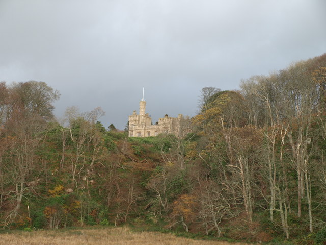
825:
761:
389:– to copy, distribute and transmit the work
116:Knock Castle - geograph.org.uk - 608859.jpg
52:Knock_Castle_-_geograph.org.uk_-_608859.jpg
1213:
1095:
450:
1173:The following other wikis use this file:
1052:d8ab4fa254eb36e5bcaae133983c54e765b610bb
709:https://www.geograph.org.uk/photo/608859
535:https://www.geograph.org.uk/profile/7544
1215:
1155:
1050:
1034:
1016:
1000:
979:
963:
942:
926:
905:
889:
849:
833:
785:
769:
743:
727:
656:
640:
620:
604:
584:
568:
501:
485:
468:
465:
446:
439:
258:
208:
287:View this and other nearby images on:
237:View this and other nearby images on:
7:
334:and is licensed for reuse under the
1084:
370:Attribution-Share Alike 2.0 Generic
358:
353:
338:Attribution-ShareAlike 2.0 license.
1206:
459:
453:
344:
321:
120:
103:
49:
458:
772:coordinates of the point of view
444:
400:Under the following conditions:
365:This file is licensed under the
357:
352:
346:
314:
293:
279:
271:
243:
229:
221:
70:
31:
21:
441:
121:
46:No higher resolution available.
14:
659:file available on the internet
440:
322:This image was taken from the
26:
1:
1186:Knock Castle (North Ayrshire)
836:coordinates of depicted place
36:
694:Geograph Britain and Ireland
543:object of statement has role
466:Items portrayed in this file
851:55°49'31.66"N, 4°53'11.40"W
787:55°49'30.79"N, 4°53'20.76"W
270:
220:
1237:
1192:Usage on www.wikidata.org
1177:Usage on de.wikipedia.org
414:same or compatible license
1085:
16:
672:geograph.org.uk image ID
443:
380:
77:This is a file from the
1142:
168:required by the license
152:
141:
134:
131:
113:
81:. Information from its
1121:23:32, 6 February 2011
328:this photograph's page
299:55.825460; -4.886500
249:55.825220; -4.889100
84:description page there
196:wfmillar /
177:wfmillar /
1064:determination method
1158:Knock Castle, Largs
395:– to adapt the work
515:author name string
1224:
1223:
1169:Global file usage
1146:
827:
763:
607:copyright license
452:
343:
342:
326:collection. See
304:
303:
254:
253:
203:
202:
171:
99:
98:
79:Wikimedia Commons
32:Global file usage
1228:
1214:
1133:
1073:
1068:
984:
947:
910:
873:
872:
867:
809:
808:
803:
745:10 November 2007
711:
706:
702:described at URL
696:
691:
681:
676:
571:copyright status
552:
547:
537:
532:
522:
519:
436:
433:
430:
427:
424:
416:as the original.
378:
367:Creative Commons
361:
360:
356:
355:
350:
349:
336:Creative Commons
324:Geograph project
318:
311:
300:
297:
283:
282:
276:
275:
274:
268:
267:
256:
250:
247:
233:
232:
226:
225:
224:
218:
217:
206:
165:
137:
136:10 November 2007
125:
117:
111:
95:
74:
73:
67:
61:
59:
1236:
1235:
1231:
1230:
1229:
1227:
1226:
1225:
1202:
1167:
1154:
1147:
1139:
1131:
1087:
1086:
1083:
1082:
1081:
1080:
1079:
1078:
1077:
1076:
1075:
1074:
1069:
1066:
1057:
1056:
1055:
1053:
1043:
1042:
1041:
1039:
1028:
1027:
1026:
1025:
1024:
1023:
1022:
1021:
1019:
1009:
1008:
1007:
1005:
994:
993:
992:
991:
990:
989:
988:
987:
985:
982:
972:
971:
970:
968:
957:
956:
955:
954:
953:
952:
951:
950:
948:
945:
935:
934:
933:
931:
920:
919:
918:
917:
916:
915:
914:
913:
911:
908:
898:
897:
896:
894:
883:
882:
881:
880:
879:
878:
877:
876:
875:
874:
870:
868:
865:
856:
855:
854:
852:
842:
841:
840:
838:
819:
818:
817:
816:
815:
814:
813:
812:
811:
810:
806:
804:
801:
792:
791:
790:
788:
778:
777:
776:
774:
755:
754:
753:
752:
751:
750:
749:
748:
746:
736:
735:
734:
732:
721:
720:
719:
718:
717:
716:
715:
714:
713:
712:
707:
704:
698:
697:
692:
689:
683:
682:
677:
674:
665:
664:
663:
661:
649:
648:
647:
645:
634:
633:
632:
631:
630:
629:
628:
627:
625:
613:
612:
611:
609:
598:
597:
596:
595:
594:
593:
592:
591:
589:
577:
576:
575:
573:
562:
561:
560:
559:
558:
557:
556:
555:
554:
553:
548:
545:
539:
538:
533:
530:
524:
523:
520:
517:
508:
507:
506:
504:
494:
493:
492:
490:
479:
478:
477:
476:
475:
473:
457:
456:
455:
438:
437:
434:
431:
428:
425:
422:
421:
379:
376:
373:
362:
339:
309:
298:
272:
263:
262:
259:Object location
248:
222:
213:
212:
209:Camera location
204:
193:
186:
174:
147:geograph.org.uk
127:
115:
108:
101:
100:
89:
88:
87:is shown below.
63:
57:
55:
48:
47:
12:
11:
5:
1234:
1232:
1222:
1221:
1218:
1205:
1201:
1200:
1199:
1198:
1190:
1189:
1188:
1183:
1171:
1170:
1166:
1165:
1160:
1152:
1151:
1150:
1145:
1144:
1141:
1137:
1134:
1128:
1123:
1118:
1114:
1113:
1110:
1107:
1104:
1101:
1098:
1091:
1090:
1062:
1061:
1060:
1059:
1058:
1054:
1051:
1049:
1048:
1047:
1046:
1045:
1044:
1040:
1035:
1033:
1032:
1031:
1030:
1029:
1020:
1017:
1015:
1014:
1013:
1012:
1011:
1010:
1006:
1001:
999:
998:
997:
996:
995:
986:
980:
978:
977:
976:
975:
974:
973:
969:
964:
962:
961:
960:
959:
958:
949:
943:
941:
940:
939:
938:
937:
936:
932:
927:
925:
924:
923:
922:
921:
912:
906:
904:
903:
902:
901:
900:
899:
895:
890:
888:
887:
886:
885:
884:
861:
860:
859:
858:
857:
853:
850:
848:
847:
846:
845:
844:
843:
839:
834:
832:
831:
830:
829:
823:
797:
796:
795:
794:
793:
789:
786:
784:
783:
782:
781:
780:
779:
775:
770:
768:
767:
766:
765:
759:
747:
744:
742:
741:
740:
739:
738:
737:
733:
728:
726:
725:
724:
723:
722:
700:
699:
685:
684:
670:
669:
668:
667:
666:
662:
657:
655:
654:
653:
652:
651:
650:
646:
643:source of file
641:
639:
638:
637:
636:
635:
626:
621:
619:
618:
617:
616:
615:
614:
610:
605:
603:
602:
601:
600:
599:
590:
585:
583:
582:
581:
580:
579:
578:
574:
569:
567:
566:
565:
564:
563:
541:
540:
526:
525:
513:
512:
511:
510:
509:
505:
502:
500:
499:
498:
497:
496:
495:
491:
486:
484:
483:
482:
481:
480:
474:
469:
467:
464:
463:
462:
461:
460:
449:
448:
445:
442:
420:
419:
418:
417:
407:
398:
397:
396:
390:
383:You are free:
374:
364:
363:
345:
341:
340:
319:
308:
305:
302:
301:
291:
285:
260:
252:
251:
241:
235:
210:
201:
200:
194:
191:
188:
187:
182:
175:
172:
160:
159:
154:
150:
149:
143:
139:
138:
133:
129:
128:
118:
109:
107:
104:
102:
97:
96:
75:
65:
64:
45:
41:
40:
39:
34:
29:
24:
19:
13:
10:
9:
6:
4:
3:
2:
1233:
1219:
1216:
1212:
1209:
1203:
1197:
1194:
1193:
1191:
1187:
1184:
1182:
1179:
1178:
1176:
1175:
1174:
1168:
1164:
1161:
1159:
1156:
1148:
1140:
1135:
1129:
1127:
1124:
1122:
1119:
1116:
1115:
1111:
1108:
1105:
1102:
1099:
1097:
1096:
1094:
1088:
1072:
1065:
1038:
1004:
967:
930:
893:
864:
837:
800:
773:
731:
710:
703:
695:
688:
680:
673:
660:
644:
624:
608:
588:
572:
551:
544:
536:
529:
516:
489:
472:
426:CC BY-SA 2.0
415:
411:
408:
405:
402:
401:
399:
394:
391:
388:
385:
384:
382:
381:
375:Attribution:
371:
368:
351:
337:
333:
329:
325:
320:
317:
313:
312:
306:
296:
292:
290:
289:OpenStreetMap
286:
284:
266:
261:
257:
246:
242:
240:
239:OpenStreetMap
236:
234:
216:
211:
207:
199:
195:
190:
189:
185:
181: /
180:
176:
169:
164:
162:
161:
158:
155:
151:
148:
144:
140:
130:
124:
119:
112:
105:
93:
86:
85:
80:
76:
69:
68:
62:
53:
44:
38:
35:
33:
30:
28:
25:
23:
20:
18:
15:
1210:
1207:
1172:
1092:
1089:File history
550:photographer
409:
403:
392:
386:
331:
269:
219:
198:Knock Castle
197:
184:CC BY-SA 2.0
179:Knock Castle
178:
126:Knock Castle
122:
92:You can help
82:
50:
22:File history
1138:GeographBot
587:copyrighted
410:share alike
404:attribution
163:Attribution
114:Description
1217:_error
1149:File usage
1130:640 × 480
1106:Dimensions
1018:image/jpeg
1003:media type
503:some value
58:image/jpeg
27:File usage
1103:Thumbnail
1100:Date/Time
892:data size
730:inception
307:Licensing
192:InfoField
173:InfoField
123:English:
1204:Metadata
1196:Q6422763
1037:checksum
687:operator
521:wfmillar
447:Captions
393:to remix
387:to share
377:wfmillar
372:license.
332:wfmillar
157:wfmillar
37:Metadata
1132:(68 KB)
1117:current
1112:Comment
907:70,122
863:heading
822:heading
799:heading
758:heading
488:creator
471:depicts
451:English
106:Summary
54:
929:height
871:degree
826:degree
807:degree
762:degree
679:608859
277:
227:
153:Author
142:Source
1071:SHA-1
983:pixel
966:width
946:pixel
145:From
1109:User
981:640
944:480
909:byte
435:true
432:true
132:Date
17:File
869:90
805:90
528:URL
1067::
866::
802::
705::
690::
675::
546::
531::
518::
1220:0
170:)
166:(
94:.
60:)
Text is available under the Creative Commons Attribution-ShareAlike License. Additional terms may apply.
_heading:90.00&language=en)
_heading:90.00&language=en)
