262:
227:
376:
241:
268:
43:
91:
273:
685:
891:
881:
325:– You must give appropriate credit, provide a link to the license, and indicate if changes were made. You may do so in any reasonable manner, but not in any way that suggests the licensor endorses you or your use.
218:
916:
951:
946:
866:
57:
53:
47:
102:
70:
871:
746:
393:
391:; with no Invariant Sections, no Front-Cover Texts, and no Back-Cover Texts. A copy of the license is included in the section entitled
383:
796:
562:
545:
509:
234:
1138:
1004:
This file contains additional information, probably added from the digital camera or scanner used to create or digitize it.
398:
332:
286:
616:
493:
388:
582:
529:
476:
911:
846:
282:
141:
1007:
If the file has been modified from its original state, some details may not fully reflect the modified file.
684:
679:
61:
42:
703:
1175:
331:– If you remix, transform, or build upon the material, you must distribute your contributions under the
695:
279:
196:
1211:
110:
786:
160:
Blick nach Süden auf den
Vermilion River im Kootenay Nationalpark; von der Fußgängerbrücke bei
145:
1107:
1024:
370:
436:
381:
Permission is granted to copy, distribute and/or modify this document under the terms of the
346:
707:
728:
981:
971:
375:
240:
1193:
1157:
1041:
97:
831:
224:
1221:
1034:
714:.}} |Source=Transferred from |Date={{Date|2005|06|15}} (original upload date) |
1061:
816:
961:
1051:
149:
936:
756:
926:
856:
826:
766:
711:
901:
806:
652:
Click on a date/time to view the file as it appeared at that time.
609:
219:
51° 10′ 13.06″ N, 116° 09′ 04.36″ W
200:
226:
847:
Liste de points de géolocalisation en rapport avec le
Columbia
702:{{Information |Description={{en|The Ottertail River, found in
345:
This licensing tag was added to this file as part of the GFDL
256:
209:
85:
776:
460:
Add a one-line explanation of what this file represents
428:
991:
841:
563:
Creative
Commons Attribution-ShareAlike 3.0 Unported
546:
387:, Version 1.2 or any later version published by the
124:
109:
Commons is a freely licensed media file repository.
75:(1,024 × 768 pixels, file size: 114 KB, MIME type:
787:Vermilion River (suba sa Kanada, British Columbia)
431:. All following user names refer to en.wikipedia.
352:http://creativecommons.org/licenses/by-sa/3.0/
183:
90:
261:
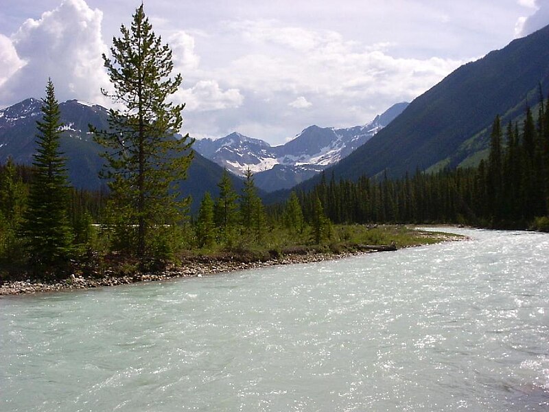
8:
1046:403,225/268,435,456 sec (0.0015021301805973)
358:Creative Commons Attribution-Share Alike 3.0
308:– to copy, distribute and transmit the work
1009:
654:
456:
739:The following other wikis use this file:
130:Kootenay National Park Kootenay River.JPG
1237:
1229:
1219:
1209:
1201:
1191:
1183:
1173:
1165:
1155:
1147:
1136:
1128:
1120:
1112:
1102:
1094:
1086:
1078:
1070:
1059:
1049:
1039:
1029:
1011:
726:
630:
614:
596:
580:
560:
543:
527:
507:
491:
474:
471:
452:
445:
212:
233:View this and other nearby images on:
1019:
7:
403:http://www.gnu.org/copyleft/fdl.html
283:Attribution-Share Alike 3.0 Unported
724:The following page uses this file:
643:
272:
267:
173:15 June 2005 (original upload date)
1002:
465:
459:
427:The original description page was
426:
154:
134:
122:
68:
464:
441:The ], found in ], ], ]. {{GFDL}}
1072:Date and time of data generation
817:Vermilion River (Kootenay River)
617:coordinates of the point of view
450:
374:
319:Under the following conditions:
278:This file is licensed under the
271:
266:
260:
239:
225:
89:
31:
21:
882:Ұзындығы бойынша өзендер тізімі
447:
135:
14:
952:Портал:Канада/Слика март 2015.
933:Usage on simple.wikipedia.org
872:Մասնակից:Manushak13/Ավազարկղ-1
446:
409:GNU Free Documentation License
394:GNU Free Documentation License
384:GNU Free Documentation License
155:
26:
1:
1216:Flash did not fire, auto mode
832:Río Vermilion (río Kootenay )
632:51°10'13.062"N, 116°9'4.356"W
36:
472:Items portrayed in this file
164:; Foster Peak im Hintergrund
1149:Date and time of digitizing
917:Кутеней (национальный парк)
783:Usage on ceb.wikipedia.org
763:Usage on ban.wikipedia.org
1259:
1242:One-chip color area sensor
988:Usage on www.wikidata.org
978:Usage on vi.wikipedia.org
968:Usage on uk.wikipedia.org
958:Usage on tr.wikipedia.org
943:Usage on sr.wikipedia.org
923:Usage on sh.wikipedia.org
908:Usage on ru.wikipedia.org
898:Usage on nl.wikipedia.org
888:Usage on ml.wikipedia.org
878:Usage on kk.wikipedia.org
863:Usage on hy.wikipedia.org
853:Usage on hr.wikipedia.org
838:Usage on fr.wikipedia.org
823:Usage on es.wikipedia.org
813:Usage on de.wikipedia.org
803:Usage on da.wikipedia.org
793:Usage on cv.wikipedia.org
773:Usage on ca.wikipedia.org
753:Usage on az.wikipedia.org
743:Usage on ar.wikipedia.org
333:same or compatible license
195:The original uploader was
140:Vermilion River, found in
1114:File change date and time
704:en:Kootenay National Park
644:
439:1024×768× (116300 bytes)
291:
259:
16:
927:Nacionalni park Kootenay
857:Nacionalni park Kootenay
827:Parque nacional Kootenay
449:
389:Free Software Foundation
96:This is a file from the
947:Кутни (национални парк)
902:Nationaal park Kootenay
767:Taman Nasional Kootenay
701:
191:
177:
172:
169:
127:
100:. Information from its
982:Vườn quốc gia Kootenay
937:Kootenay National Park
892:കൂട്ടനായി ദേശീയോദ്യാനം
807:Kootenay National Park
245:51.170295; -116.151210
142:Kootenay National Park
103:description page there
46:Size of this preview:
1185:Maximum land aperture
1088:Horizontal resolution
867:Կուտենեյ ազգային պարկ
962:Kootenay Millî Parkı
757:Kootenay Milli Parkı
747:متنزه كوتيناي الوطني
680:09:08, 28 April 2009
285:license. Subject to
1152:2004:06:29:17:17:30
1122:Y and C positioning
1117:17:38, 15 June 2005
1096:Vertical resolution
1075:2004:06:29:17:17:30
1021:Camera manufacturer
708:en:British Columbia
423:Original upload log
314:– to adapt the work
52:Other resolutions:
62:1,024 × 768 pixels
1246:
1245:
1188:3.07 APEX (f/2.9)
1025:Minolta Co., Ltd.
797:Кутеней (юханшыв)
735:Global file usage
717:
530:copyright license
458:
435:2005-06-15 22:40
420:
419:
369:
368:
250:
249:
207:
206:
201:English Knowledge
181:Transferred from
118:
117:
98:Wikimedia Commons
32:Global file usage
1250:
1130:Exposure Program
1010:
692:
494:copyright status
416:
413:
410:
407:
404:
378:
371:
365:
362:
359:
356:
353:
350:
347:licensing update
335:as the original.
280:Creative Commons
275:
274:
270:
269:
264:
263:
257:
246:
243:
229:
228:
222:
221:
210:
186:
159:
146:British Columbia
139:
131:
125:
114:
93:
92:
86:
80:
78:
65:
58:640 × 480 pixels
54:320 × 240 pixels
48:800 × 600 pixels
1258:
1257:
1253:
1252:
1251:
1249:
1248:
1247:
998:
733:
729:User:Yetiwriter
718:
698:
690:
646:
645:
642:
641:
640:
639:
638:
637:
636:
635:
633:
623:
622:
621:
619:
608:
607:
606:
605:
604:
603:
602:
601:
599:
589:
588:
587:
585:
574:
573:
572:
571:
570:
569:
568:
567:
565:
554:
553:
552:
551:
550:
548:
536:
535:
534:
532:
521:
520:
519:
518:
517:
516:
515:
514:
512:
500:
499:
498:
496:
485:
484:
483:
482:
481:
479:
463:
462:
461:
432:
425:
414:
411:
408:
405:
402:
363:
360:
357:
354:
351:
344:
255:
244:
217:
216:
213:Camera location
208:
182:
165:
153:
129:
120:
119:
108:
107:
106:is shown below.
82:
76:
74:
67:
66:
51:
12:
11:
5:
1256:
1254:
1244:
1243:
1240:
1239:Sensing method
1236:
1235:
1232:
1231:Exposure index
1228:
1227:
1224:
1218:
1217:
1214:
1208:
1207:
1204:
1200:
1199:
1196:
1190:
1189:
1186:
1182:
1181:
1178:
1172:
1171:
1168:
1164:
1163:
1160:
1154:
1153:
1150:
1146:
1145:
1142:
1135:
1134:
1133:Normal program
1131:
1127:
1126:
1123:
1119:
1118:
1115:
1111:
1110:
1105:
1101:
1100:
1097:
1093:
1092:
1089:
1085:
1084:
1081:
1077:
1076:
1073:
1069:
1068:
1065:
1058:
1057:
1054:
1048:
1047:
1044:
1038:
1037:
1032:
1028:
1027:
1022:
1018:
1017:
1014:
1001:
997:
996:
995:
994:
986:
985:
984:
976:
975:
974:
966:
965:
964:
956:
955:
954:
949:
941:
940:
939:
931:
930:
929:
921:
920:
919:
914:
912:Кутеней (река)
906:
905:
904:
896:
895:
894:
886:
885:
884:
876:
875:
874:
869:
861:
860:
859:
851:
850:
849:
844:
836:
835:
834:
829:
821:
820:
819:
811:
810:
809:
801:
800:
799:
791:
790:
789:
781:
780:
779:
771:
770:
769:
761:
760:
759:
751:
750:
749:
737:
736:
732:
731:
722:
721:
716:
715:
700:
696:
693:
687:
682:
677:
673:
672:
669:
666:
663:
660:
657:
650:
649:
634:
631:
629:
628:
627:
626:
625:
624:
620:
615:
613:
612:
611:
610:
600:
597:
595:
594:
593:
592:
591:
590:
586:
581:
579:
578:
577:
576:
575:
566:
561:
559:
558:
557:
556:
555:
549:
544:
542:
541:
540:
539:
538:
537:
533:
528:
526:
525:
524:
523:
522:
513:
508:
506:
505:
504:
503:
502:
501:
497:
492:
490:
489:
488:
487:
486:
480:
475:
473:
470:
469:
468:
467:
466:
455:
454:
451:
448:
444:
443:
424:
421:
418:
417:
379:
367:
366:
341:
340:
339:
338:
337:
336:
326:
317:
316:
315:
309:
302:You are free:
297:
296:
293:
292:
290:
276:
254:
251:
248:
247:
237:
231:
214:
205:
204:
193:
189:
188:
179:
175:
174:
171:
167:
166:
132:
123:
121:
116:
115:
94:
84:
83:
45:
41:
40:
39:
34:
29:
24:
19:
13:
10:
9:
6:
4:
3:
2:
1255:
1241:
1238:
1233:
1230:
1225:
1223:
1220:
1215:
1213:
1210:
1205:
1202:
1197:
1195:
1194:Metering mode
1192:
1187:
1184:
1179:
1177:
1176:Exposure bias
1174:
1169:
1167:APEX aperture
1166:
1161:
1159:
1158:Shutter speed
1156:
1151:
1148:
1143:
1140:
1137:
1132:
1129:
1124:
1121:
1116:
1113:
1109:
1106:
1104:Software used
1103:
1098:
1095:
1090:
1087:
1082:
1079:
1074:
1071:
1066:
1063:
1060:
1055:
1053:
1050:
1045:
1043:
1042:Exposure time
1040:
1036:
1033:
1030:
1026:
1023:
1020:
1015:
1012:
1008:
1005:
999:
993:
990:
989:
987:
983:
980:
979:
977:
973:
970:
969:
967:
963:
960:
959:
957:
953:
950:
948:
945:
944:
942:
938:
935:
934:
932:
928:
925:
924:
922:
918:
915:
913:
910:
909:
907:
903:
900:
899:
897:
893:
890:
889:
887:
883:
880:
879:
877:
873:
870:
868:
865:
864:
862:
858:
855:
854:
852:
848:
845:
843:
840:
839:
837:
833:
830:
828:
825:
824:
822:
818:
815:
814:
812:
808:
805:
804:
802:
798:
795:
794:
792:
788:
785:
784:
782:
778:
775:
774:
772:
768:
765:
764:
762:
758:
755:
754:
752:
748:
745:
744:
742:
741:
740:
734:
730:
727:
725:
719:
713:
709:
705:
699:
694:
688:
686:
683:
681:
678:
675:
674:
670:
667:
664:
661:
658:
656:
655:
653:
647:
618:
584:
564:
547:
531:
511:
495:
478:
442:
438:
434:
433:
430:
422:
400:
397:. Subject to
396:
395:
390:
386:
385:
380:
377:
373:
372:
348:
343:
342:
334:
330:
327:
324:
321:
320:
318:
313:
310:
307:
304:
303:
301:
300:
299:
298:
295:
294:
288:
284:
281:
277:
265:
258:
252:
242:
238:
236:
235:OpenStreetMap
232:
230:
220:
215:
211:
202:
198:
194:
190:
185:
180:
176:
168:
163:
158:
151:
147:
143:
138:
133:
126:
112:
105:
104:
99:
95:
88:
87:
81:
72:
71:Original file
63:
59:
55:
49:
44:
38:
35:
33:
30:
28:
25:
23:
20:
18:
15:
1203:Light source
1031:Camera model
1006:
1003:
777:Riu Kootenay
738:
723:
689:1,024 × 768
651:
648:File history
598:15 June 2005
440:
392:
382:
355:CC BY-SA 3.0
328:
322:
311:
305:
184:en.wikipedia
161:
156:
136:
111:You can help
101:
69:
22:File history
1222:Color space
1080:Orientation
1035:DiMAGE E223
1016:Minolta DSC
1013:Image title
510:copyrighted
399:disclaimers
329:share alike
323:attribution
287:disclaimers
187:to Commons.
128:Description
720:File usage
697:Urdangaray
665:Dimensions
437:Yetiwriter
197:Yetiwriter
162:Paint Pots
77:image/jpeg
27:File usage
1062:ISO speed
712:en:Canada
662:Thumbnail
659:Date/Time
583:inception
253:Licensing
157:Deutsch:
137:English:
1125:Co-sited
1108:Ver.1.00
1052:F-number
1000:Metadata
992:Q7921608
842:Kootenay
691:(114 KB)
453:Captions
312:to remix
306:to share
37:Metadata
1206:Unknown
1198:Pattern
1141:version
972:Кутеней
676:current
671:Comment
477:depicts
457:English
73:
1099:72 dpi
1091:72 dpi
1083:Normal
1064:rating
223:
192:Author
178:Source
150:Canada
1212:Flash
1162:9.375
1056:f/6.9
1226:sRGB
1170:5.57
1139:Exif
668:User
429:here
415:true
412:true
406:GFDL
364:true
361:true
170:Date
17:File
1144:2.2
1067:100
199:at
710:,
706:,
289:.
148:,
144:,
60:|
56:|
50:.
1234:1
1180:0
401:.
349:.
203:.
152:.
113:.
79:)
64:.
Text is available under the Creative Commons Attribution-ShareAlike License. Additional terms may apply.

