313:
227:
219:
268:
241:
319:
91:
593:"}},"text\/plain":{"en":{"":"heading"}}},"{\"value\":{\"amount\":\"+180\",\"unit\":\"http:\\\/\\\/www.wikidata.org\\\/entity\\\/Q28390\"},\"type\":\"quantity\"}":{"text\/html":{"en":{"P7787":"180
589:
695:
360:– You must give appropriate credit, provide a link to the license, and indicate if changes were made. You may do so in any reasonable manner, but not in any way that suggests the licensor endorses you or your use.
210:
590:
285:
283:; with no Invariant Sections, no Front-Cover Texts, and no Back-Cover Texts. A copy of the license is included in the section entitled
275:
57:
53:
47:
102:
542:
506:
489:
453:
234:
742:
70:
939:
788:
This file contains additional information, probably added from the digital camera or scanner used to create or digitize it.
631:
604:
526:
437:
280:
562:
473:
420:
908:
717:
156:
791:
If the file has been modified from its original state, some details may not fully reflect the modified file.
1005:
329:
326:
597:"}},"text\/plain":{"en":{"P7787":"180 degree"}}}}": -->
1041:
110:
765:
725:
705:
262:
760:
273:
Permission is granted to copy, distribute and/or modify this document under the terms of the
694:
689:
61:
42:
808:
721:
240:
160:
1023:
987:
831:
259:
I, the copyright holder of this work, hereby publish it under the following licenses:
97:
871:
224:
1059:
172:
851:
146:
841:
713:
193:
662:
Click on a date/time to view the file as it appeared at that time.
226:
211:
37° 13′ 46.23″ N, 129° 02′ 29.3″ E
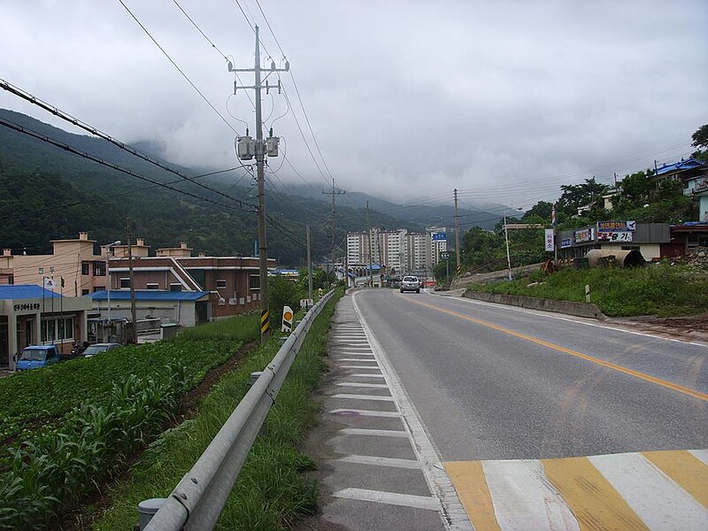
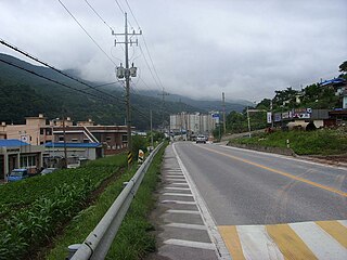
712:{{Information |Description={{en|1=National Road #38 at Dogye,
201:
85:
404:
Add a one-line explanation of what this file represents
775:
490:
279:, Version 1.2 or any later version published by the
129:
109:
Commons is a freely licensed media file repository.
75:(1,024 × 768 pixels, file size: 122 KB, MIME type:
1046:Flash did not fire, compulsory flash suppression
90:
312:
8:
594:
367:https://creativecommons.org/licenses/by/3.0
343:– to copy, distribute and transmit the work
793:
664:
400:
385:You may select the license of your choice.
753:The following other wikis use this file:
728:|Date=2007/06/24 1307HRS KST |Permission=
507:Creative Commons Attribution 3.0 Unported
1107:
1099:
1091:
1083:
1075:
1067:
1057:
1049:
1039:
1031:
1021:
1013:
1003:
995:
985:
977:
956:
948:
937:
929:
921:
913:
903:
895:
887:
879:
868:
860:
849:
839:
829:
821:
813:
800:<Digimax i6 PMP, Samsung #11 PMP>
795:
740:
618:
602:
576:
560:
540:
524:
504:
487:
471:
451:
435:
418:
415:
396:
389:
204:
233:View this and other nearby images on:
803:
7:
291:http://www.gnu.org/copyleft/fdl.html
738:The following page uses this file:
653:
318:
786:
409:
403:
384:
334:
309:
258:
150:
139:
122:
68:
408:
373:Creative Commons Attribution 3.0
862:Date and time of data generation
724:도계읍}} |Source=self-made |Author=
605:coordinates of the point of view
394:
354:Under the following conditions:
325:This file is licensed under the
317:
311:
267:
266:
239:
225:
217:
89:
31:
21:
743:National Route 38 (South Korea)
391:
140:
14:
620:37°13'46.229"N, 129°2'29.299"E
390:
297:GNU Free Documentation License
286:GNU Free Documentation License
276:GNU Free Documentation License
151:
26:
1:
1104:A directly photographed image
543:original creation by uploader
36:
416:Items portrayed in this file
216:
145:National Road #38 at Dogye,
950:Date and time of digitizing
1129:
1088:One-chip color area sensor
1051:Supported Flashpix version
909:Adobe Photoshop CS Windows
772:Usage on www.wikidata.org
757:Usage on ko.wikipedia.org
135:Korea National Road 38.jpg
958:Meaning of each component
915:File change date and time
654:
183:
16:
690:04:14, 28 September 2008
393:
330:Attribution 3.0 Unported
281:Free Software Foundation
96:This is a file from the
711:
189:
179:
171:
168:
132:
100:. Information from its
979:Image compression mode
245:37.229508; 129.041472
103:description page there
46:Size of this preview:
1015:Maximum land aperture
889:Horizontal resolution
1096:Digital still camera
1018:3.625 APEX (f/3.51)
953:13:07, 24 June 2007
923:Y and C positioning
918:23:20, 24 June 2007
897:Vertical resolution
865:13:07, 24 June 2007
805:Camera manufacturer
349:– to adapt the work
52:Other resolutions:
1069:Related audio file
62:1,024 × 768 pixels
1116:
1115:
836:1/125 sec (0.008)
749:Global file usage
731:
596:
474:copyright license
402:
308:
307:
250:
249:
199:
198:
118:
117:
98:Wikimedia Commons
32:Global file usage
1120:
931:Exposure Program
823:Copyright holder
794:
702:
642:
641:
636:
438:copyright status
380:
377:
374:
371:
368:
327:Creative Commons
321:
320:
315:
314:
304:
301:
298:
295:
292:
270:
269:
263:
246:
243:
229:
228:
222:
221:
220:
214:
213:
202:
185:
174:
155:
144:
136:
130:
114:
93:
92:
86:
80:
78:
65:
58:640 × 480 pixels
54:320 × 240 pixels
48:800 × 600 pixels
1128:
1127:
1123:
1122:
1121:
1119:
1118:
1117:
982:3.8279864518767
826:COPYRIGHT, 2006
809:Samsung Techwin
782:
747:
732:
708:
700:
656:
655:
652:
651:
650:
649:
648:
647:
646:
645:
644:
643:
639:
637:
634:
625:
624:
623:
621:
611:
610:
609:
607:
588:
587:
586:
585:
584:
583:
582:
581:
579:
569:
568:
567:
565:
554:
553:
552:
551:
550:
549:
548:
547:
545:
533:
532:
531:
529:
518:
517:
516:
515:
514:
513:
512:
511:
509:
498:
497:
496:
495:
494:
492:
480:
479:
478:
476:
465:
464:
463:
462:
461:
460:
459:
458:
456:
444:
443:
442:
440:
429:
428:
427:
426:
425:
423:
407:
406:
405:
388:
387:
386:
382:
381:
378:
375:
372:
369:
366:
365:
333:
322:
302:
299:
296:
293:
290:
261:
260:
255:
244:
218:
209:
208:
205:Camera location
200:
164:
149:
134:
127:
120:
119:
108:
107:
106:is shown below.
82:
76:
74:
67:
66:
51:
12:
11:
5:
1126:
1124:
1114:
1113:
1110:
1106:
1105:
1102:
1098:
1097:
1094:
1090:
1089:
1086:
1085:Sensing method
1082:
1081:
1078:
1077:Exposure index
1074:
1073:
1070:
1066:
1065:
1062:
1056:
1055:
1052:
1048:
1047:
1044:
1038:
1037:
1034:
1030:
1029:
1026:
1020:
1019:
1016:
1012:
1011:
1008:
1002:
1001:
998:
994:
993:
990:
984:
983:
980:
976:
975:
974:
973:
972:does not exist
970:
967:
964:
959:
955:
954:
951:
947:
946:
943:
936:
935:
934:Normal program
932:
928:
927:
924:
920:
919:
916:
912:
911:
906:
902:
901:
898:
894:
893:
890:
886:
885:
882:
878:
877:
874:
867:
866:
863:
859:
858:
855:
848:
847:
844:
838:
837:
834:
828:
827:
824:
820:
819:
816:
812:
811:
806:
802:
801:
798:
785:
781:
780:
779:
778:
770:
769:
768:
763:
751:
750:
746:
745:
736:
735:
730:
729:
710:
706:
703:
697:
692:
687:
683:
682:
679:
676:
673:
670:
667:
660:
659:
630:
629:
628:
627:
626:
622:
619:
617:
616:
615:
614:
613:
612:
608:
603:
601:
600:
599:
598:
592:
580:
577:
575:
574:
573:
572:
571:
570:
566:
561:
559:
558:
557:
556:
555:
546:
541:
539:
538:
537:
536:
535:
534:
530:
527:source of file
525:
523:
522:
521:
520:
519:
510:
505:
503:
502:
501:
500:
499:
493:
488:
486:
485:
484:
483:
482:
481:
477:
472:
470:
469:
468:
467:
466:
457:
452:
450:
449:
448:
447:
446:
445:
441:
436:
434:
433:
432:
431:
430:
424:
419:
417:
414:
413:
412:
411:
410:
399:
398:
395:
392:
383:
364:
363:
362:
361:
352:
351:
350:
344:
337:You are free:
324:
323:
310:
306:
305:
271:
257:
256:
254:
251:
248:
247:
237:
231:
206:
197:
196:
191:
187:
186:
181:
177:
176:
170:
166:
165:
137:
128:
126:
123:
121:
116:
115:
94:
84:
83:
45:
41:
40:
39:
34:
29:
24:
19:
13:
10:
9:
6:
4:
3:
2:
1125:
1111:
1108:
1103:
1100:
1095:
1092:
1087:
1084:
1079:
1076:
1071:
1068:
1063:
1061:
1058:
1053:
1050:
1045:
1043:
1040:
1035:
1032:
1027:
1025:
1024:Metering mode
1022:
1017:
1014:
1009:
1007:
1006:Exposure bias
1004:
999:
997:APEX aperture
996:
991:
989:
988:Shutter speed
986:
981:
978:
971:
968:
965:
962:
961:
960:
957:
952:
949:
944:
941:
938:
933:
930:
925:
922:
917:
914:
910:
907:
905:Software used
904:
899:
896:
891:
888:
883:
880:
875:
873:
869:
864:
861:
856:
853:
850:
845:
843:
840:
835:
833:
832:Exposure time
830:
825:
822:
817:
814:
810:
807:
804:
799:
796:
792:
789:
783:
777:
774:
773:
771:
767:
764:
762:
759:
758:
756:
755:
754:
748:
744:
741:
739:
733:
727:
723:
719:
715:
709:
704:
698:
696:
693:
691:
688:
685:
684:
680:
677:
674:
671:
668:
666:
665:
663:
657:
633:
606:
564:
544:
528:
508:
491:
475:
455:
439:
422:
359:
356:
355:
353:
348:
345:
342:
339:
338:
336:
335:
331:
328:
316:
288:
287:
282:
278:
277:
272:
265:
264:
252:
242:
238:
236:
235:OpenStreetMap
232:
230:
212:
207:
203:
195:
192:
188:
182:
178:
167:
162:
158:
154:
148:
143:
138:
131:
124:
112:
105:
104:
99:
95:
88:
87:
81:
72:
71:Original file
63:
59:
55:
49:
44:
38:
35:
33:
30:
28:
25:
23:
20:
18:
15:
1072:RelatedSound
1033:Light source
872:focal length
815:Camera model
790:
787:
752:
737:
699:1,024 × 768
661:
658:File history
578:24 June 2007
357:
346:
340:
284:
274:
215:
173:24 June 2007
152:
141:
111:You can help
101:
69:
22:File history
1109:IIM version
1093:File source
1060:Color space
881:Orientation
797:Image title
454:copyrighted
358:attribution
175:1307HRS KST
133:Description
1101:Scene type
766:사용자:G43/사진
734:File usage
716:}} {{ko|1=
675:Dimensions
370:CC BY 3.0
77:image/jpeg
27:File usage
852:ISO speed
776:Q16099539
672:Thumbnail
669:Date/Time
563:inception
253:Licensing
142:English:
926:Co-sited
842:F-number
784:Metadata
761:국도 제38호선
726:User:G43
714:Samcheok
701:(122 KB)
397:Captions
347:to remix
341:to share
332:license.
194:User:G43
184:Own work
147:Samcheok
37:Metadata
1036:Unknown
1028:Pattern
992:6.96875
942:version
686:current
681:Comment
632:heading
591:heading
421:depicts
401:English
125:Summary
73:
1000:5.3125
900:96 dpi
892:96 dpi
884:Normal
876:6.6 mm
854:rating
718:38번 국도
640:degree
595:degree
223:
190:Author
180:Source
157:38번 국도
1042:Flash
870:Lens
846:f/6.3
153:한국어:
1064:sRGB
940:Exif
678:User
638:180
379:true
376:true
303:true
300:true
294:GFDL
169:Date
17:File
945:2.2
707:G43
163:도계읍
969:Cr
966:Cb
857:50
722:삼척
720:,
635::
161:삼척
159:,
60:|
56:|
50:.
1112:2
1080:1
1054:1
1010:0
963:Y
818:]
289:.
113:.
79:)
64:.
Text is available under the Creative Commons Attribution-ShareAlike License. Additional terms may apply.
