313:
173:
249:
179:
87:
43:
576:
312:
546:
593:{{Information |Description=The raw satellite imagery shown in these images was obtain from NASA and/or the US Geological Survey. Post-processing and production by http://www.terraprints.com |Source=http://www.terraprints.com |Date=20061025 |Author=http://
220:– You must give appropriate credit, provide a link to the license, and indicate if changes were made. You may do so in any reasonable manner, but not in any way that suggests the licensor endorses you or your use.
660:
253:
271:
The
Wikimedia Foundation has received an e-mail confirming that the copyright holder has approved publication under the terms mentioned on this page. This correspondence has been
612:
680:
287:
457:
296:
53:
47:
130:
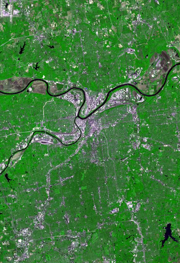
The raw satellite imagery shown in these images was obtain from NASA and/or the US Geological Survey. Post-processing and production by
700:
265:
98:
66:
421:
385:
753:
This file contains additional information, probably added from the digital camera or scanner used to create or digitize it.
607:
575:
570:
441:
369:
303:
477:
405:
352:
730:
282:
278:
269:, you do not need to request permission as long as you follow any licensing requirements mentioned on this page.
756:
If the file has been modified from its original state, some details may not fully reflect the modified file.
189:
586:
186:
304:
https://ticket.wikimedia.org/otrs/index.pl?Action=AgentTicketZoom&TicketNumber=2006110810005047
106:
545:
540:
57:
42:
260:
720:
93:
670:
650:
556:
141:
690:
630:
295:
If you have questions about the archived correspondence, please use the
640:
513:
Click on a date/time to view the file as it appeared at that time.
243:
81:
161:
151:
131:
285:. The correspondence is available to trusted volunteers as
263:
and may be used by anyone for any purpose. If you wish to
710:
731:
Knowledge:Önskelistor från
Wikidata/Efter folkmängd/USA
336:
Add a one-line explanation of what this file represents
740:
120:
105:
Commons is a freely licensed media file repository.
613:User:Rrostie/sandbox/Kansas CIty Metropolitan Area
71:(582 × 848 pixels, file size: 106 KB, MIME type:
86:
172:
8:
227:https://creativecommons.org/licenses/by/2.5
203:– to copy, distribute and transmit the work
758:
515:
332:
623:The following other wikis use this file:
422:Creative Commons Attribution 2.5 Generic
760:
605:
491:
475:
455:
439:
419:
403:
383:
367:
350:
347:
328:
321:
309:Find other files from the same ticket:
603:The following 2 pages use this file:
248:
7:
279:Volunteer Response Team (VRT) member
504:
273:
178:
751:
671:Zone métropolitaine de Kansas City
341:
335:
194:
169:
118:
64:
691:Area metropolitana di Kansas City
651:Área metropolitana de Kansas City
340:
233:Creative Commons Attribution 2.5
326:
311:
247:
214:Under the following conditions:
185:This file is licensed under the
177:
171:
85:
31:
21:
721:Metropolitná oblasť Kansas City
323:
14:
631:Ardal fetropolitan Kansas City
322:
26:
1:
608:Kansas City metropolitan area
126:Kansas City satellite map.jpg
36:
442:Wikimedia VRTS ticket number
348:Items portrayed in this file
661:منطقه کلانشهری کانزاسسیتی
782:
737:Usage on www.wikidata.org
727:Usage on sv.wikipedia.org
717:Usage on sk.wikipedia.org
707:Usage on pl.wikipedia.org
697:Usage on ja.wikipedia.org
687:Usage on it.wikipedia.org
677:Usage on he.wikipedia.org
667:Usage on fr.wikipedia.org
657:Usage on fa.wikipedia.org
647:Usage on es.wikipedia.org
641:Metropolregion Kansas City
637:Usage on de.wikipedia.org
627:Usage on cy.wikipedia.org
162:http://www.terraprints.com
152:http://www.terraprints.com
132:http://www.terraprints.com
505:
16:
325:
288:ticket #2006110810005047
246:
92:This is a file from the
681:המטרופולין של קנזס סיטי
592:
562:
190:Attribution 2.5 Generic
157:
147:
140:
137:
123:
96:. Information from its
571:18:35, 25 October 2006
99:description page there
46:Size of this preview:
541:17:25, 27 April 2008
209:– to adapt the work
52:Other resolutions:
283:permission archive
281:and stored in our
769:
768:
619:Global file usage
596:
406:copyright license
334:
320:
319:
310:
306:
300:
167:
166:
114:
113:
94:Wikimedia Commons
32:Global file usage
773:
759:
583:
553:
458:2006110810005047
370:copyright status
315:
308:
301:
294:
275:
266:use this content
255:
251:
250:
244:
240:
237:
234:
231:
228:
187:Creative Commons
181:
180:
175:
174:
143:
127:
121:
110:
89:
88:
82:
76:
74:
61:
58:582 × 848 pixels
54:165 × 240 pixels
48:411 × 599 pixels
781:
780:
776:
775:
774:
772:
771:
770:
747:
617:
597:
589:
581:
559:
551:
507:
506:
503:
502:
501:
500:
499:
498:
497:
496:
494:
493:25 October 2006
484:
483:
482:
480:
469:
468:
467:
466:
465:
464:
463:
462:
460:
448:
447:
446:
444:
433:
432:
431:
430:
429:
428:
427:
426:
424:
412:
411:
410:
408:
397:
396:
395:
394:
393:
392:
391:
390:
388:
376:
375:
374:
372:
361:
360:
359:
358:
357:
355:
339:
338:
337:
297:VRT noticeboard
242:
241:
238:
235:
232:
229:
226:
225:
193:
182:
168:
142:25 October 2006
125:
116:
115:
104:
103:
102:is shown below.
78:
72:
70:
63:
62:
51:
12:
11:
5:
779:
777:
767:
766:
763:
750:
746:
745:
744:
743:
735:
734:
733:
725:
724:
723:
715:
714:
713:
705:
704:
703:
695:
694:
693:
685:
684:
683:
675:
674:
673:
665:
664:
663:
655:
654:
653:
645:
644:
643:
635:
634:
633:
621:
620:
616:
615:
610:
601:
600:
595:
594:
591:
587:
584:
578:
573:
568:
565:
564:
563:border cropped
561:
557:
554:
548:
543:
538:
534:
533:
530:
527:
524:
521:
518:
511:
510:
495:
492:
490:
489:
488:
487:
486:
485:
481:
476:
474:
473:
472:
471:
470:
461:
456:
454:
453:
452:
451:
450:
449:
445:
440:
438:
437:
436:
435:
434:
425:
420:
418:
417:
416:
415:
414:
413:
409:
404:
402:
401:
400:
399:
398:
389:
384:
382:
381:
380:
379:
378:
377:
373:
368:
366:
365:
364:
363:
362:
356:
351:
349:
346:
345:
344:
343:
342:
331:
330:
327:
324:
318:
317:
257:
224:
223:
222:
221:
212:
211:
210:
204:
197:You are free:
184:
183:
170:
165:
164:
159:
155:
154:
149:
145:
144:
139:
135:
134:
128:
119:
117:
112:
111:
90:
80:
79:
45:
41:
40:
39:
34:
29:
24:
19:
13:
10:
9:
6:
4:
3:
2:
778:
764:
761:
757:
754:
748:
742:
739:
738:
736:
732:
729:
728:
726:
722:
719:
718:
716:
712:
709:
708:
706:
702:
699:
698:
696:
692:
689:
688:
686:
682:
679:
678:
676:
672:
669:
668:
666:
662:
659:
658:
656:
652:
649:
648:
646:
642:
639:
638:
636:
632:
629:
628:
626:
625:
624:
618:
614:
611:
609:
606:
604:
598:
590:
585:
579:
577:
574:
572:
569:
567:
566:
560:
555:
549:
547:
544:
542:
539:
536:
535:
531:
528:
525:
522:
519:
517:
516:
514:
508:
479:
459:
443:
423:
407:
387:
371:
354:
316:
314:
307:
305:
302:Ticket link:
298:
292:
290:
289:
284:
280:
276:
268:
267:
262:
259:This work is
258:
256:
245:
219:
216:
215:
213:
208:
205:
202:
199:
198:
196:
195:
191:
188:
176:
163:
160:
156:
153:
150:
146:
136:
133:
129:
122:
108:
101:
100:
95:
91:
84:
83:
77:
68:
67:Original file
59:
55:
49:
44:
38:
35:
33:
30:
28:
25:
23:
20:
18:
15:
755:
752:
622:
602:
580:669 × 1,000
512:
509:File history
293:
286:
272:
270:
264:
252:
217:
206:
200:
107:You can help
97:
65:
22:File history
711:Kansas City
588:Terraprints
386:copyrighted
218:attribution
124:Description
762:_error
701:カンザスシティ都市圏
599:File usage
550:582 × 848
526:Dimensions
230:CC BY 2.5
73:image/jpeg
27:File usage
523:Thumbnail
520:Date/Time
478:inception
749:Metadata
741:Q2307187
582:(118 KB)
552:(106 KB)
329:Captions
274:reviewed
207:to remix
201:to share
192:license.
37:Metadata
558:Finavon
537:current
532:Comment
353:depicts
333:English
69:
254:
158:Author
148:Source
277:by a
529:User
261:free
239:true
236:true
138:Date
17:File
291:.
56:|
50:.
765:0
299:.
109:.
75:)
60:.
Text is available under the Creative Commons Attribution-ShareAlike License. Additional terms may apply.