208:
299:
214:
219:
43:
91:
554:
260:– You must give appropriate credit, provide a link to the license, and indicate if changes were made. You may do so in any reasonable manner, but not in any way that suggests the licensor endorses you or your use.
352:
Sie müssen das Bild unter gleichen
Bedingungen weitergeben. Wenn sie das Bild abändern oder Arbeiten auf diesem Bild aufbauen, müssen Sie das Ergebnis aus dieser Arbeit ebenfalls unter diese Lizenz stellen.
318:
The ODbL does not require any particular license for maps produced from ODbL data. Prior to 1 August 2020, map tiles produced by the OpenStreetMap
Foundation were licensed under the
571:== {{int:filedesc}} == {{Information |Description = {{de|1=Umgebungskarte des Kordigast}} |Source={{own}}, using a map rendered by which uses
197:
170:
499:
463:
427:
625:
This file contains additional information, probably added from the digital camera or scanner used to create or digitize it.
267:
483:
411:
447:
394:
57:
53:
47:
102:
70:
229:
637:
628:
If the file has been modified from its original state, some details may not fully reflect the modified file.
349:
Im Falle einer
Verbreitung müssen Sie anderen die Lizenzbedingungen, unter die dieses Bild fällt, mitteilen.
266:– If you remix, transform, or build upon the material, you must distribute your contributions under the
226:
355:
Jede dieser
Bedingungen kann nach schriftlicher Einwilligung des Rechtsinhabers aufgehoben werden.
110:
293:
612:
572:
553:
548:
97:
61:
42:
319:
311:
564:
185:
181:
166:
589:
298:
521:
Click on a date/time to view the file as it appeared at that time.
322:. Maps produced by other people may be subject to other licences.
307:
85:
342:
Sie dürfen das Bild zu den folgenden
Bedingungen nutzen:
378:
Add a one-line explanation of what this file represents
607:
129:
109:
Commons is a freely licensed media file repository.
464:
Creative
Commons Attribution-ShareAlike 2.0 Generic
75:(982 × 941 pixels, file size: 313 KB, MIME type:
277:https://creativecommons.org/licenses/by-sa/2.0
90:
331:http://opendatacommons.org/licenses/odbl/1.0/
283:Creative Commons Attribution-Share Alike 2.0
207:
8:
243:– to copy, distribute and transmit the work
630:
523:
374:
600:The following other wikis use this file:
671:xmp.did:D1260C9DA741E3119C029440228B0959
613:Knowledge:Kartenwerkstatt/Archiv/2013-10
575:and [[:en:Shuttle Radar Topography Mi...
666:
658:
650:
642:
632:
587:
497:
481:
461:
445:
425:
409:
392:
389:
370:
363:
346:Sie müssen den Namen des Autors nennen.
165:, using a map rendered by which uses
7:
310:, which is made available under the
306:This work contains information from
585:The following page uses this file:
512:
230:Attribution-Share Alike 2.0 Generic
218:
213:
623:
383:
377:
204:
139:
122:
68:
382:
368:
297:
254:Under the following conditions:
225:This file is licensed under the
217:
212:
206:
89:
31:
21:
652:Date metadata was last modified
365:
14:
668:Unique ID of original document
364:
140:
26:
1:
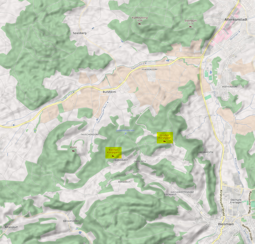
500:original creation by uploader
36:
390:Items portrayed in this file
312:Open Database License (ODbL)
296:
145:Umgebungskarte des Kordigast
644:Date and time of digitizing
688:
604:Usage on de.wikipedia.org
268:same or compatible license
660:File change date and time
513:
162:
16:
367:
234:
96:This is a file from the
638:Adobe Illustrator CS5.1
570:
192:
177:
158:
153:
150:
132:
100:. Information from its
663:21:11, 30 October 2013
655:23:11, 30 October 2013
647:23:11, 30 October 2013
549:21:49, 30 October 2013
103:description page there
46:Size of this preview:
325:Open Database License
182:Maximilian Dörrbecker
320:CC-BY-SA-2.0 license
249:– to adapt the work
135:Karte Kordigast.jpg
52:Other resolutions:
675:
674:
596:Global file usage
578:
448:copyright license
376:
361:
360:
340:
339:
323:
201:
198:Reusing this file
118:
117:
98:Wikimedia Commons
32:Global file usage
679:
631:
561:
412:copyright status
335:
332:
329:
326:
317:
301:
294:
290:
287:
284:
281:
278:
270:as the original.
227:Creative Commons
221:
220:
216:
215:
210:
209:
195:
164:
154:see file history
144:
136:
130:
114:
93:
92:
86:
80:
78:
65:
62:982 × 941 pixels
58:501 × 480 pixels
54:250 × 240 pixels
48:626 × 600 pixels
687:
686:
682:
681:
680:
678:
677:
676:
619:
594:
579:
567:
559:
515:
514:
511:
510:
509:
508:
507:
506:
505:
504:
502:
490:
489:
488:
486:
475:
474:
473:
472:
471:
470:
469:
468:
466:
454:
453:
452:
450:
439:
438:
437:
436:
435:
434:
433:
432:
430:
418:
417:
416:
414:
403:
402:
401:
400:
399:
397:
381:
380:
379:
362:
333:
330:
327:
324:
292:
291:
288:
285:
282:
279:
276:
275:
233:
222:
146:
134:
127:
120:
119:
108:
107:
106:is shown below.
82:
76:
74:
67:
66:
51:
12:
11:
5:
685:
683:
673:
672:
669:
665:
664:
661:
657:
656:
653:
649:
648:
645:
641:
640:
635:
622:
618:
617:
616:
615:
610:
598:
597:
593:
592:
583:
582:
577:
576:
569:
565:
562:
556:
551:
546:
542:
541:
538:
535:
532:
529:
526:
519:
518:
503:
498:
496:
495:
494:
493:
492:
491:
487:
484:source of file
482:
480:
479:
478:
477:
476:
467:
462:
460:
459:
458:
457:
456:
455:
451:
446:
444:
443:
442:
441:
440:
431:
426:
424:
423:
422:
421:
420:
419:
415:
410:
408:
407:
406:
405:
404:
398:
393:
391:
388:
387:
386:
385:
384:
373:
372:
369:
366:
359:
358:
357:
356:
353:
350:
347:
338:
337:
304:
302:
274:
273:
272:
271:
261:
252:
251:
250:
244:
237:You are free:
224:
223:
205:
202:
190:
189:
179:
175:
174:
160:
156:
155:
152:
148:
147:
137:
128:
126:
123:
121:
116:
115:
94:
84:
83:
45:
41:
40:
39:
34:
29:
24:
19:
13:
10:
9:
6:
4:
3:
2:
684:
670:
667:
662:
659:
654:
651:
646:
643:
639:
636:
634:Software used
633:
629:
626:
620:
614:
611:
609:
606:
605:
603:
602:
601:
595:
591:
588:
586:
580:
574:
573:OpenStreetMap
568:
563:
557:
555:
552:
550:
547:
544:
543:
539:
536:
533:
530:
527:
525:
524:
522:
516:
501:
485:
465:
449:
429:
413:
396:
354:
351:
348:
345:
344:
343:
336:
321:
315:
313:
309:
308:OpenStreetMap
305:
303:
300:
295:
280:CC BY-SA 2.0
269:
265:
262:
259:
256:
255:
253:
248:
245:
242:
239:
238:
236:
235:
231:
228:
211:
203:
199:
194:
191:
187:
183:
180:
176:
172:
168:
167:OpenStreetMap
161:
157:
149:
143:
138:
131:
124:
112:
105:
104:
99:
95:
88:
87:
81:
72:
71:Original file
63:
59:
55:
49:
44:
38:
35:
33:
30:
28:
25:
23:
20:
18:
15:
627:
624:
599:
584:
520:
517:File history
341:
316:
263:
257:
246:
240:
141:
111:You can help
101:
69:
22:File history
428:copyrighted
264:share alike
258:attribution
133:Description
581:File usage
558:982 × 941
534:Dimensions
193:Permission
77:image/jpeg
27:File usage
608:Kordigast
590:Kordigast
531:Thumbnail
528:Date/Time
142:Deutsch:
621:Metadata
560:(313 KB)
371:Captions
247:to remix
241:to share
232:license.
163:Own work
37:Metadata
545:current
540:Comment
395:depicts
375:English
125:Summary
73:
566:Chumwa
186:Chumwa
178:Author
159:Source
537:User
334:true
328:ODbL
289:true
286:true
173:data
171:SRTM
169:and
151:Date
17:File
314:.
60:|
56:|
50:.
200:)
196:(
188:)
184:(
113:.
79:)
64:.
Text is available under the Creative Commons Attribution-ShareAlike License. Additional terms may apply.