43:
341:
274:
266:
288:
309:
347:
352:
99:
753:"}},"text\/plain":{"en":{"":"heading"}}},"{\"value\":{\"amount\":\"+315\",\"unit\":\"http:\\\/\\\/www.wikidata.org\\\/entity\\\/Q28390\"},\"type\":\"quantity\"}":{"text\/html":{"en":{"P7787":"315
749:
891:
257:
399:– You must give appropriate credit, provide a link to the license, and indicate if changes were made. You may do so in any reasonable manner, but not in any way that suggests the licensor endorses you or your use.
65:
61:
57:
53:
47:
110:
750:
78:
920:
915:
194:
651:
615:
579:
281:
836:
671:
1120:
316:
983:
This file contains additional information, probably added from the digital camera or scanner used to create or digitize it.
406:
514:
820:
791:
764:
679:
635:
563:
535:
522:
507:
722:
694:
664:
599:
480:
463:
303:
890:
885:
69:
42:
901:
362:
986:
If the file has been modified from its original state, some details may not fully reflect the modified file.
948:
The following pages on the
English Knowledge (XXG) use this file (pages on other projects are not listed):
1194:
405:– If you remix, transform, or build upon the material, you must distribute your contributions under the
323:
on the
Geograph website for the photographer's contact details. The copyright on this image is owned by
359:
757:"}},"text\/plain":{"en":{"P7787":"315 degree"}}}}": -->
1230:
1113:
118:
226:
1325:
952:
931:
701:
686:
542:
210:
287:
1280:
1212:
1020:
328:
105:
1335:
1290:
1052:
271:
1139:
162:
1040:
995:
183:
173:
1345:
1030:
1005:
308:
320:
858:
Click on a date/time to view the file as it appeared at that time.
1189:
Landscape mode (for landscape photos with the background in focus)
273:
258:
51° 23′ 44.24″ N, 2° 25′ 00.92″ W
970:
248:
93:
447:
Add a one-line explanation of what this file represents
83:(2,728 × 1,718 pixels, file size: 438 KB, MIME type:
201:
Creative
Commons Attribution Share-alike license 2.0
137:
117:
Commons is a freely licensed media file repository.
616:
Creative
Commons Attribution-ShareAlike 2.0 Generic
1235:Flash did not fire, compulsory flash suppression
416:https://creativecommons.org/licenses/by-sa/2.0
143:Kelston toll booth-4139972-geograph.org.uk.jpg
98:
422:Creative Commons Attribution-Share Alike 2.0
340:
8:
754:
382:– to copy, distribute and transmit the work
988:
860:
443:
963:The following other wikis use this file:
702:https://www.geograph.org.uk/photo/4139972
543:https://www.geograph.org.uk/profile/19290
908:Higher-resolution version from Geograph.
1343:
1333:
1323:
1315:
1307:
1299:
1288:
1278:
1270:
1262:
1254:
1246:
1238:
1228:
1220:
1210:
1202:
1192:
1184:
1176:
1168:
1147:
1137:
1129:
1118:
1108:
1100:
1092:
1084:
1076:
1068:
1060:
1049:
1038:
1028:
1018:
1010:
1000:
950:
834:
818:
778:
762:
736:
720:
649:
633:
613:
597:
577:
561:
494:
478:
461:
458:
439:
432:
251:
280:View this and other nearby images on:
990:
7:
327:and is licensed for reuse under the
938:User created page with UploadWizard
849:
363:Attribution-Share Alike 2.0 Generic
351:
346:
331:Attribution-ShareAlike 2.0 license.
981:
452:
446:
337:
314:
147:
130:
76:
451:
1012:Date and time of data generation
765:coordinates of the point of view
437:
393:Under the following conditions:
358:This file is licensed under the
350:
345:
339:
307:
286:
272:
264:
97:
31:
21:
434:
148:
14:
652:file available on the internet
433:
315:This image was taken from the
26:
1:
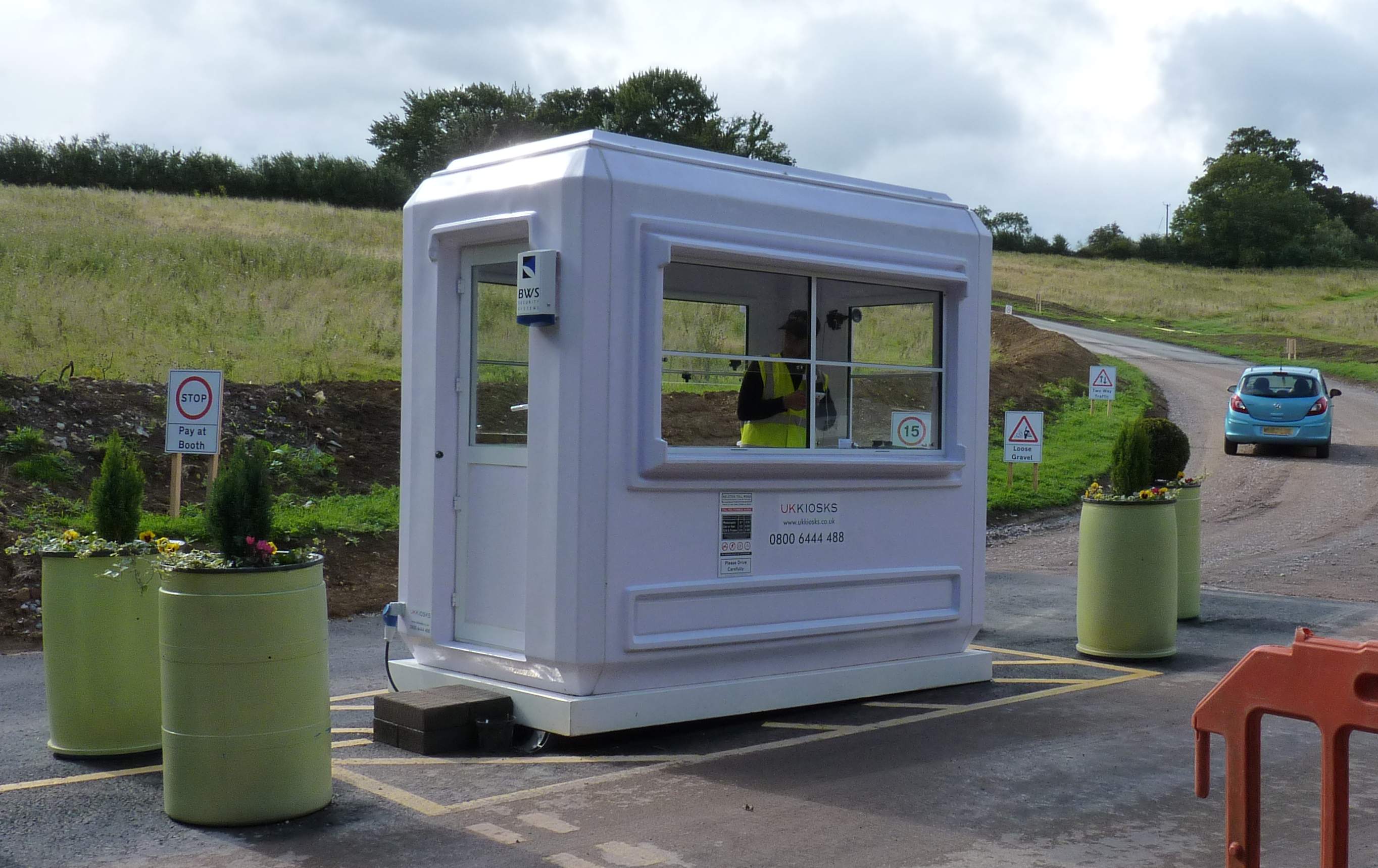
1259:A directly photographed image
36:
780:51°23'44.243"N, 2°25'0.923"W
672:Geograph Britain and Ireland
508:object of statement has role
459:Items portrayed in this file
263:
1178:Date and time of digitizing
1367:
1301:Focal length in 35 mm film
1243:One-chip color area sensor
1131:Supported Flashpix version
967:Usage on de.wikipedia.org
407:same or compatible license
1149:Meaning of each component
1102:File change date and time
850:
239:Rick Crowley /
220:Rick Crowley /
16:
886:21:15, 18 September 2017
837:Panasonic Lumix DMC-FZ38
680:geograph.org.uk image ID
436:
373:
104:This is a file from the
1264:Custom image processing
937:
907:
211:required by the license
189:
179:
168:
161:
158:
140:
108:. Information from its
1170:Image compression mode
916:08:38, 8 November 2014
321:this photograph's page
292:51.395623; -2.416923
111:description page there
46:Size of this preview:
1204:Maximum land aperture
1181:16:06, 26 August 2014
1105:16:06, 26 August 2014
1078:Horizontal resolution
1015:16:06, 26 August 2014
1251:Digital still camera
70:2,728 × 1,718 pixels
1114:PaintShop Pro 15.00
1086:Vertical resolution
992:Camera manufacturer
903:Geograph Update Bot
388:– to adapt the work
52:Other resolutions:
1309:Scene capture type
1285:Auto white balance
523:author name string
66:1,280 × 806 pixels
62:1,024 × 645 pixels
1354:
1353:
1025:1/250 sec (0.004)
971:Kelston toll road
959:Global file usage
953:Kelston toll road
941:
756:
600:copyright license
445:
336:
335:
319:collection. See
297:
296:
246:
245:
241:Kelston Toll Road
222:Kelston Toll Road
214:
198:
195:Reusing this file
153:Kelston Toll Road
126:
125:
106:Wikimedia Commons
32:Global file usage
1358:
1186:Exposure Program
989:
928:
898:
802:
801:
796:
704:
699:
695:described at URL
689:
684:
674:
669:
564:copyright status
545:
540:
530:
527:
517:
512:
429:
426:
423:
420:
417:
409:as the original.
371:
360:Creative Commons
354:
353:
349:
348:
343:
342:
329:Creative Commons
317:Geograph project
311:
304:
293:
290:
276:
275:
269:
268:
267:
261:
260:
249:
208:
192:
164:
152:
144:
138:
122:
101:
100:
94:
88:
86:
73:
58:640 × 403 pixels
54:320 × 202 pixels
48:800 × 504 pixels
1366:
1365:
1361:
1360:
1359:
1357:
1356:
1355:
1207:3 APEX (f/2.83)
977:
957:
949:
942:
934:
926:
904:
896:
852:
851:
848:
847:
846:
845:
844:
843:
842:
841:
839:
827:
826:
825:
823:
812:
811:
810:
809:
808:
807:
806:
805:
804:
803:
799:
797:
794:
785:
784:
783:
781:
771:
770:
769:
767:
748:
747:
746:
745:
744:
743:
742:
741:
739:
729:
728:
727:
725:
714:
713:
712:
711:
710:
709:
708:
707:
706:
705:
700:
697:
691:
690:
685:
682:
676:
675:
670:
667:
658:
657:
656:
654:
642:
641:
640:
638:
627:
626:
625:
624:
623:
622:
621:
620:
618:
606:
605:
604:
602:
591:
590:
589:
588:
587:
586:
585:
584:
582:
570:
569:
568:
566:
555:
554:
553:
552:
551:
550:
549:
548:
547:
546:
541:
538:
532:
531:
528:
525:
519:
518:
513:
510:
501:
500:
499:
497:
487:
486:
485:
483:
472:
471:
470:
469:
468:
466:
450:
449:
448:
431:
430:
427:
424:
421:
418:
415:
414:
372:
369:
366:
355:
332:
302:
291:
265:
256:
255:
252:Camera location
247:
236:
229:
217:
174:geograph.org.uk
154:
142:
135:
128:
127:
116:
115:
114:is shown below.
90:
84:
82:
75:
74:
51:
12:
11:
5:
1364:
1362:
1352:
1351:
1348:
1342:
1341:
1338:
1332:
1331:
1328:
1322:
1321:
1318:
1314:
1313:
1310:
1306:
1305:
1302:
1298:
1297:
1294:
1287:
1286:
1283:
1277:
1276:
1273:
1269:
1268:
1267:Normal process
1265:
1261:
1260:
1257:
1253:
1252:
1249:
1245:
1244:
1241:
1240:Sensing method
1237:
1236:
1233:
1227:
1226:
1223:
1219:
1218:
1215:
1209:
1208:
1205:
1201:
1200:
1197:
1191:
1190:
1187:
1183:
1182:
1179:
1175:
1174:
1171:
1167:
1166:
1165:
1164:
1163:does not exist
1161:
1158:
1155:
1150:
1146:
1145:
1142:
1136:
1135:
1132:
1128:
1127:
1124:
1117:
1116:
1111:
1107:
1106:
1103:
1099:
1098:
1095:
1091:
1090:
1087:
1083:
1082:
1079:
1075:
1074:
1071:
1067:
1066:
1063:
1059:
1058:
1055:
1048:
1047:
1044:
1037:
1036:
1033:
1027:
1026:
1023:
1017:
1016:
1013:
1009:
1008:
1003:
999:
998:
993:
980:
976:
975:
974:
973:
961:
960:
956:
955:
947:
946:
945:
940:
939:
936:
932:
929:
923:
918:
913:
910:
909:
906:
902:
899:
895:2,728 × 1,718
893:
888:
883:
879:
878:
875:
872:
869:
866:
863:
856:
855:
840:
835:
833:
832:
831:
830:
829:
828:
824:
819:
817:
816:
815:
814:
813:
790:
789:
788:
787:
786:
782:
779:
777:
776:
775:
774:
773:
772:
768:
763:
761:
760:
759:
758:
752:
740:
738:26 August 2014
737:
735:
734:
733:
732:
731:
730:
726:
721:
719:
718:
717:
716:
715:
693:
692:
678:
677:
663:
662:
661:
660:
659:
655:
650:
648:
647:
646:
645:
644:
643:
639:
636:source of file
634:
632:
631:
630:
629:
628:
619:
614:
612:
611:
610:
609:
608:
607:
603:
598:
596:
595:
594:
593:
592:
583:
578:
576:
575:
574:
573:
572:
571:
567:
562:
560:
559:
558:
557:
556:
534:
533:
521:
520:
506:
505:
504:
503:
502:
498:
495:
493:
492:
491:
490:
489:
488:
484:
479:
477:
476:
475:
474:
473:
467:
462:
460:
457:
456:
455:
454:
453:
442:
441:
438:
435:
413:
412:
411:
410:
400:
391:
390:
389:
383:
376:You are free:
367:
357:
356:
338:
334:
333:
312:
301:
298:
295:
294:
284:
278:
253:
244:
243:
237:
234:
231:
230:
225:
218:
215:
203:
202:
199:
187:
186:
181:
177:
176:
170:
166:
165:
163:26 August 2014
160:
156:
155:
145:
136:
134:
131:
129:
124:
123:
102:
92:
91:
45:
41:
40:
39:
34:
29:
24:
19:
13:
10:
9:
6:
4:
3:
2:
1363:
1349:
1347:
1344:
1339:
1337:
1334:
1329:
1327:
1324:
1319:
1317:Scene control
1316:
1311:
1308:
1303:
1300:
1295:
1292:
1289:
1284:
1282:
1281:White balance
1279:
1275:Auto exposure
1274:
1272:Exposure mode
1271:
1266:
1263:
1258:
1255:
1250:
1247:
1242:
1239:
1234:
1232:
1229:
1224:
1221:
1216:
1214:
1213:Metering mode
1211:
1206:
1203:
1198:
1196:
1195:Exposure bias
1193:
1188:
1185:
1180:
1177:
1172:
1169:
1162:
1159:
1156:
1153:
1152:
1151:
1148:
1143:
1141:
1138:
1133:
1130:
1125:
1122:
1119:
1115:
1112:
1110:Software used
1109:
1104:
1101:
1096:
1093:
1088:
1085:
1080:
1077:
1072:
1069:
1064:
1061:
1056:
1054:
1050:
1045:
1042:
1039:
1034:
1032:
1029:
1024:
1022:
1021:Exposure time
1019:
1014:
1011:
1007:
1004:
1001:
997:
994:
991:
987:
984:
978:
972:
969:
968:
966:
965:
964:
958:
954:
951:
943:
935:
930:
924:
922:
919:
917:
914:
912:
911:
905:
900:
894:
892:
889:
887:
884:
881:
880:
876:
873:
870:
867:
864:
862:
861:
859:
853:
838:
822:
821:captured with
793:
766:
724:
703:
696:
688:
681:
673:
666:
653:
637:
617:
601:
581:
565:
544:
537:
524:
516:
509:
482:
465:
419:CC BY-SA 2.0
408:
404:
401:
398:
395:
394:
392:
387:
384:
381:
378:
377:
375:
374:
368:Attribution:
364:
361:
344:
330:
326:
322:
318:
313:
310:
306:
305:
299:
289:
285:
283:
282:OpenStreetMap
279:
277:
259:
254:
250:
242:
238:
233:
232:
228:
224: /
223:
219:
212:
207:
205:
204:
200:
196:
191:
188:
185:
182:
178:
175:
171:
167:
157:
151:
146:
139:
132:
120:
113:
112:
107:
103:
96:
95:
89:
80:
79:Original file
71:
67:
63:
59:
55:
49:
44:
38:
35:
33:
30:
28:
25:
23:
20:
18:
15:
1291:Digital zoom
1222:Light source
1053:focal length
1002:Camera model
985:
982:
962:
933:Bob1960evens
857:
854:File history
529:Rick Crowley
515:photographer
402:
396:
385:
379:
370:Rick Crowley
325:Rick Crowley
324:
262:
240:
227:CC BY-SA 2.0
221:
184:Rick Crowley
149:
119:You can help
109:
77:
22:File history
1320:Low gain up
1248:File source
1140:Color space
1094:Orientation
580:copyrighted
403:share alike
397:attribution
206:Attribution
141:Description
1336:Saturation
1256:Scene type
944:File usage
925:640 × 403
871:Dimensions
496:some value
190:Permission
85:image/jpeg
27:File usage
1346:Sharpness
1041:ISO speed
996:Panasonic
868:Thumbnail
865:Date/Time
723:inception
300:Licensing
235:InfoField
216:InfoField
150:English:
1326:Contrast
1312:Standard
1073:1,718 px
1065:2,728 px
1031:F-number
1006:DMC-FZ38
979:Metadata
897:(438 KB)
665:operator
440:Captions
386:to remix
380:to share
365:license.
37:Metadata
1225:Unknown
1217:Pattern
1123:version
1089:180 dpi
1081:180 dpi
927:(57 KB)
882:current
877:Comment
792:heading
751:heading
687:4139972
481:creator
464:depicts
444:English
133:Summary
81:
1350:Normal
1340:Normal
1330:Normal
1097:Normal
1070:Height
1057:4.8 mm
1043:rating
800:degree
755:degree
270:
180:Author
169:Source
1304:28 mm
1293:ratio
1231:Flash
1062:Width
1051:Lens
172:From
1144:sRGB
1126:2.21
1121:Exif
874:User
798:315
428:true
425:true
159:Date
17:File
1046:125
1035:f/5
536:URL
1160:Cr
1157:Cb
795::
698::
683::
668::
539::
526::
511::
68:|
64:|
60:|
56:|
50:.
1296:0
1199:0
1173:4
1154:Y
1134:1
213:)
209:(
197:)
193:(
121:.
87:)
72:.
Text is available under the Creative Commons Attribution-ShareAlike License. Additional terms may apply.
