283:
216:
208:
230:
251:
289:
38:
294:
82:
661:"}},"text\/plain":{"en":{"":"heading"}}},"{\"value\":{\"amount\":\"+45\",\"unit\":\"http:\\\/\\\/www.wikidata.org\\\/entity\\\/Q28390\"},\"type\":\"quantity\"}":{"text\/html":{"en":{"P7787":"45
827:
657:
199:
341:– You must give appropriate credit, provide a link to the license, and indicate if changes were made. You may do so in any reasonable manner, but not in any way that suggests the licensor endorses you or your use.
844:{{Information |Description={{en|1=== {{int:filedesc}} == {{Information |Description={{en|1=King Alfred's Tower}} |Source=From |Date=1984-03 |Author=[http://www.geograph.org.uk/profile/14530 Trevor
48:
42:
61:
93:
658:
826:
821:
177:
593:
557:
521:
223:
643:
258:
348:
456:
699:
672:
621:
577:
505:
479:
464:
449:
728:
636:
606:
541:
422:
405:
796:
791:
52:
37:
245:
304:
347:– If you remix, transform, or build upon the material, you must distribute your contributions under the
265:
on the
Geograph website for the photographer's contact details. The copyright on this image is owned by
301:
665:"}},"text\/plain":{"en":{"P7787":"45 degree"}}}}": -->
863:
837:
101:
858:
471:
921:
628:
613:
229:
807:
270:
88:
213:
956:
166:
145:
156:
896:
250:
814:
Rm blue cast, enhance contrast, straighten and apply slight sharpening.
262:
764:
Click on a date/time to view the file as it appeared at that time.
911:
886:
946:
931:
215:
200:
51° 06′ 51.67″ N, 2° 21′ 50.24″ W
906:
190:
76:
976:
936:
881:
966:
389:
Add a one-line explanation of what this file represents
184:
Creative
Commons Attribution Share-alike license 2.0
120:
100:
Commons is a freely licensed media file repository.
558:
Creative
Commons Attribution-ShareAlike 2.0 Generic
66:(631 × 610 pixels, file size: 141 KB, MIME type:
358:https://creativecommons.org/licenses/by-sa/2.0
81:
364:Creative Commons Attribution-Share Alike 2.0
282:
8:
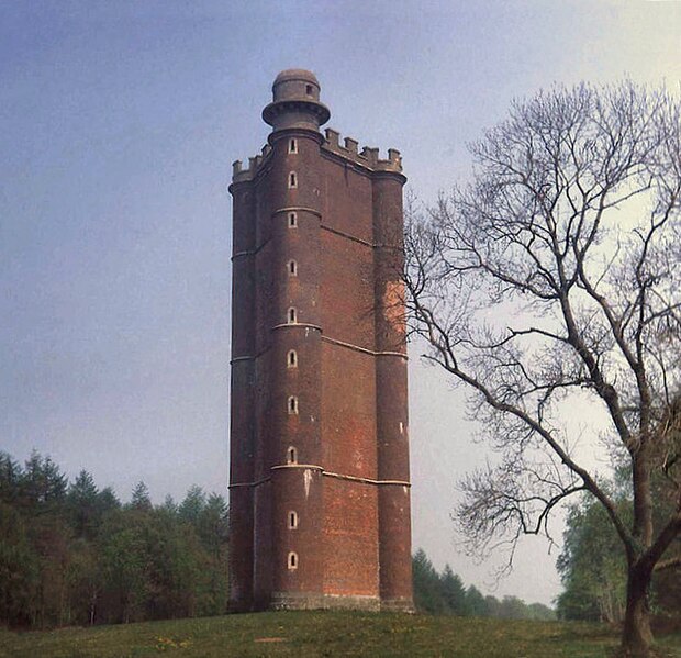
126:King Alfred's Tower, Stourhead, Somerset.jpg
662:
324:– to copy, distribute and transmit the work
766:
385:
874:The following other wikis use this file:
472:https://www.geograph.org.uk/profile/14530
614:https://www.geograph.org.uk/photo/886206
856:
742:
726:
686:
670:
591:
575:
555:
539:
519:
503:
436:
420:
403:
400:
381:
374:
193:
222:View this and other nearby images on:
854:The following 2 pages use this file:
7:
269:and is licensed for reuse under the
755:
305:Attribution-Share Alike 2.0 Generic
293:
288:
273:Attribution-ShareAlike 2.0 license.
394:
388:
279:
256:
130:
113:
59:
393:
673:coordinates of the point of view
379:
335:Under the following conditions:
300:This file is licensed under the
292:
287:
281:
249:
228:
214:
206:
80:
31:
21:
376:
131:
14:
594:file available on the internet
375:
257:This image was taken from the
26:
1:
897:The Ballad of the White Horse
688:51°6'51.674"N, 2°21'50.238"W
644:Geograph Britain and Ireland
450:object of statement has role
401:Items portrayed in this file
205:
995:
973:Usage on vi.wikipedia.org
963:Usage on sl.wikipedia.org
953:Usage on ro.wikipedia.org
943:Usage on pt.wikipedia.org
928:Usage on no.wikipedia.org
918:Usage on ko.wikipedia.org
903:Usage on it.wikipedia.org
893:Usage on en.wikiquote.org
878:Usage on ca.wikipedia.org
349:same or compatible license
756:
16:
622:geograph.org.uk image ID
378:
315:
87:This is a file from the
887:Batalla d'Ethandun
843:
813:
172:
162:
151:
144:
141:
123:
91:. Information from its
957:Bătălia de la Edington
263:this photograph's page
234:51.114354; -2.363955
94:description page there
41:Size of this preview:
912:Battaglia di Ethandun
947:Batalha de Ethandun
932:Slaget ved Ethandun
330:– to adapt the work
136:King Alfred's Tower
47:Other resolutions:
864:Battle of Edington
822:13:23, 3 June 2010
792:21:38, 5 July 2012
480:author name string
907:Alfredo il Grande
870:Global file usage
847:
664:
542:copyright license
387:
278:
277:
261:collection. See
239:
238:
188:
187:
181:
178:Reusing this file
109:
108:
89:Wikimedia Commons
32:Global file usage
986:
977:Alfred the Great
937:Alfred den store
859:Alfred the Great
834:
804:
710:
709:
704:
646:
641:
631:
626:
616:
611:
607:described at URL
506:copyright status
487:
484:
474:
469:
459:
454:
371:
368:
365:
362:
359:
351:as the original.
313:
302:Creative Commons
296:
295:
291:
290:
285:
284:
271:Creative Commons
259:Geograph project
253:
246:
235:
232:
218:
217:
211:
210:
209:
203:
202:
191:
175:
147:
135:
127:
121:
105:
84:
83:
77:
71:
69:
56:
53:631 × 610 pixels
49:248 × 240 pixels
43:620 × 599 pixels
994:
993:
989:
988:
987:
985:
984:
983:
868:
848:
840:
832:
810:
802:
758:
757:
754:
753:
752:
751:
750:
749:
748:
747:
745:
735:
734:
733:
731:
720:
719:
718:
717:
716:
715:
714:
713:
712:
711:
707:
705:
702:
693:
692:
691:
689:
679:
678:
677:
675:
656:
655:
654:
653:
652:
651:
650:
649:
648:
647:
642:
639:
633:
632:
627:
624:
618:
617:
612:
609:
600:
599:
598:
596:
584:
583:
582:
580:
569:
568:
567:
566:
565:
564:
563:
562:
560:
548:
547:
546:
544:
533:
532:
531:
530:
529:
528:
527:
526:
524:
512:
511:
510:
508:
497:
496:
495:
494:
493:
492:
491:
490:
489:
488:
485:
482:
476:
475:
470:
467:
461:
460:
455:
452:
443:
442:
441:
439:
429:
428:
427:
425:
414:
413:
412:
411:
410:
408:
392:
391:
390:
373:
372:
369:
366:
363:
360:
357:
356:
314:
311:
308:
297:
274:
244:
233:
207:
198:
197:
194:Camera location
189:
157:geograph.org.uk
137:
125:
118:
111:
110:
99:
98:
97:is shown below.
73:
67:
65:
58:
57:
46:
12:
11:
5:
992:
990:
982:
981:
980:
979:
971:
970:
969:
961:
960:
959:
951:
950:
949:
941:
940:
939:
934:
926:
925:
924:
916:
915:
914:
909:
901:
900:
899:
891:
890:
889:
884:
882:Alfred el Gran
872:
871:
867:
866:
861:
852:
851:
846:
845:
842:
838:
835:
829:
824:
819:
816:
815:
812:
808:
805:
799:
794:
789:
785:
784:
781:
778:
775:
772:
769:
762:
761:
746:
743:
741:
740:
739:
738:
737:
736:
732:
727:
725:
724:
723:
722:
721:
698:
697:
696:
695:
694:
690:
687:
685:
684:
683:
682:
681:
680:
676:
671:
669:
668:
667:
666:
660:
635:
634:
620:
619:
605:
604:
603:
602:
601:
597:
592:
590:
589:
588:
587:
586:
585:
581:
578:source of file
576:
574:
573:
572:
571:
570:
561:
556:
554:
553:
552:
551:
550:
549:
545:
540:
538:
537:
536:
535:
534:
525:
520:
518:
517:
516:
515:
514:
513:
509:
504:
502:
501:
500:
499:
498:
486:Trevor Rickard
478:
477:
463:
462:
448:
447:
446:
445:
444:
440:
437:
435:
434:
433:
432:
431:
430:
426:
421:
419:
418:
417:
416:
415:
409:
404:
402:
399:
398:
397:
396:
395:
384:
383:
380:
377:
355:
354:
353:
352:
342:
333:
332:
331:
325:
318:You are free:
312:Trevor Rickard
309:
299:
298:
280:
276:
275:
267:Trevor Rickard
254:
243:
240:
237:
236:
226:
220:
195:
186:
185:
182:
170:
169:
167:Trevor Rickard
164:
160:
159:
153:
149:
148:
143:
139:
138:
128:
119:
117:
114:
112:
107:
106:
85:
75:
74:
40:
36:
35:
34:
29:
24:
19:
13:
10:
9:
6:
4:
3:
2:
991:
978:
975:
974:
972:
968:
967:Alfred Veliki
965:
964:
962:
958:
955:
954:
952:
948:
945:
944:
942:
938:
935:
933:
930:
929:
927:
923:
920:
919:
917:
913:
910:
908:
905:
904:
902:
898:
895:
894:
892:
888:
885:
883:
880:
879:
877:
876:
875:
869:
865:
862:
860:
857:
855:
849:
841:
839:Wilfridselsey
836:
830:
828:
825:
823:
820:
818:
817:
811:
806:
800:
798:
795:
793:
790:
787:
786:
782:
779:
776:
773:
770:
768:
767:
765:
759:
730:
701:
674:
645:
638:
630:
623:
615:
608:
595:
579:
559:
543:
523:
507:
481:
473:
466:
458:
451:
424:
407:
361:CC BY-SA 2.0
350:
346:
343:
340:
337:
336:
334:
329:
326:
323:
320:
319:
317:
316:
310:Attribution:
306:
303:
286:
272:
268:
264:
260:
255:
252:
248:
247:
241:
231:
227:
225:
224:OpenStreetMap
221:
219:
201:
196:
192:
183:
179:
174:
171:
168:
165:
161:
158:
154:
150:
140:
134:
129:
122:
115:
103:
96:
95:
90:
86:
79:
78:
72:
63:
62:Original file
54:
50:
44:
39:
33:
30:
28:
25:
23:
20:
18:
15:
873:
853:
763:
760:File history
457:photographer
344:
338:
327:
321:
266:
204:
132:
102:You can help
92:
60:
22:File history
522:copyrighted
345:share alike
339:attribution
124:Description
850:File usage
831:640 × 606
801:631 × 610
777:Dimensions
744:March 1984
438:some value
173:Permission
146:March 1984
68:image/jpeg
27:File usage
774:Thumbnail
771:Date/Time
729:inception
242:Licensing
133:English:
809:Smalljim
803:(141 KB)
637:operator
382:Captions
328:to remix
322:to share
307:license.
833:(94 KB)
788:current
783:Comment
700:heading
659:heading
423:creator
406:depicts
386:English
116:Summary
64:
922:에딩턴 전투
708:degree
663:degree
629:886206
212:
163:Author
152:Source
155:From
780:User
370:true
367:true
142:Date
17:File
706:45
465:URL
703::
640::
625::
610::
483::
468::
453::
51:|
45:.
180:)
176:(
104:.
70:)
55:.
Text is available under the Creative Commons Attribution-ShareAlike License. Additional terms may apply.

