332:
265:
223:
279:
237:
300:
338:
343:
72:
850:
256:
214:
43:
390:– You must give appropriate credit, provide a link to the license, and indicate if changes were made. You may do so in any reasonable manner, but not in any way that suggests the licensor endorses you or your use.
83:
51:
867:== {{int:filedesc}} == {{Information |description={{en|1=HANKERTON, Wiltshire. The church of Holy Cross}} |date=2002-10 |source=From |author= |
881:
642:
606:
570:
272:
230:
662:
307:
927:
This file contains additional information, probably added from the digital camera or scanner used to create or digitize it.
397:
533:
781:
713:
670:
626:
554:
526:
513:
498:
849:
844:
747:
685:
655:
590:
471:
454:
42:
294:
353:
930:
If the file has been modified from its original state, some details may not fully reflect the modified file.
396:– If you remix, transform, or build upon the material, you must distribute your contributions under the
314:
on the
Geograph website for the photographer's contact details. The copyright on this image is owned by
860:
350:
877:
The following pages on the
English Knowledge use this file (pages on other projects are not listed):
91:
183:
505:
167:
692:
677:
278:
236:
319:
78:
886:
262:
135:
220:
156:
146:
299:
311:
817:
Click on a date/time to view the file as it appeared at that time.
264:
222:
247:
205:
66:
774:
706:
904:
257:
51° 36′ 56″ N, 2° 02′ 28″ W
215:
51° 36′ 56″ N, 2° 02′ 24″ W
438:
Add a one-line explanation of what this file represents
914:
110:
90:
Commons is a freely licensed media file repository.
607:
Creative
Commons Attribution-ShareAlike 2.0 Generic
116:HANKERTON, Wiltshire - geograph.org.uk - 65239.jpg
52:HANKERTON,_Wiltshire_-_geograph.org.uk_-_65239.jpg
56:(640 × 480 pixels, file size: 68 KB, MIME type:
407:https://creativecommons.org/licenses/by-sa/2.0
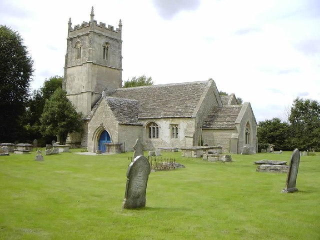
126:HANKERTON, Wiltshire. The church of Holy Cross
71:
413:Creative Commons Attribution-Share Alike 2.0
331:
8:
373:– to copy, distribute and transmit the work
932:
819:
434:
897:The following other wikis use this file:
506:https://www.geograph.org.uk/profile/2694
934:
879:
795:
779:
761:
745:
727:
711:
693:https://www.geograph.org.uk/photo/65239
640:
624:
604:
588:
568:
552:
485:
469:
452:
449:
430:
423:
250:
208:
271:View this and other nearby images on:
229:View this and other nearby images on:
882:George Ingram, 8th Viscount of Irvine
7:
318:and is licensed for reuse under the
808:
354:Attribution-Share Alike 2.0 Generic
342:
337:
322:Attribution-ShareAlike 2.0 license.
925:
443:
437:
328:
305:
120:
103:
49:
442:
714:coordinates of the point of view
428:
384:Under the following conditions:
349:This file is licensed under the
341:
336:
330:
298:
277:
263:
235:
221:
70:
31:
21:
425:
121:
46:No higher resolution available.
14:
643:file available on the internet
424:
306:This image was taken from the
26:
1:
782:coordinates of depicted place
36:
663:Geograph Britain and Ireland
527:object of statement has role
450:Items portrayed in this file
956:
911:Usage on www.wikidata.org
901:Usage on fr.wikipedia.org
398:same or compatible license
196:ChurchCrawler /
177:ChurchCrawler /
809:
16:
797:51°36'56.2"N, 2°2'27.6"W
729:51°36'56.2"N, 2°2'24.0"W
671:geograph.org.uk image ID
427:
364:
77:This is a file from the
866:
168:required by the license
152:
141:
134:
131:
113:
81:. Information from its
845:15:51, 30 January 2010
312:this photograph's page
283:51.615600; -2.041000
241:51.615600; -2.040000
84:description page there
198:HANKERTON, Wiltshire
179:HANKERTON, Wiltshire
379:– to adapt the work
514:author name string
943:
942:
893:Global file usage
870:
591:copyright license
436:
327:
326:
310:collection. See
288:
287:
246:
245:
203:
202:
171:
99:
98:
79:Wikimedia Commons
32:Global file usage
947:
933:
857:
695:
690:
686:described at URL
680:
675:
665:
660:
555:copyright status
536:
531:
521:
518:
508:
503:
420:
417:
414:
411:
408:
400:as the original.
362:
351:Creative Commons
345:
344:
340:
339:
334:
333:
320:Creative Commons
308:Geograph project
302:
295:
284:
281:
267:
266:
260:
259:
248:
242:
239:
225:
224:
218:
217:
206:
165:
137:
125:
117:
111:
95:
74:
73:
67:
61:
59:
955:
954:
950:
949:
948:
946:
945:
944:
921:
891:
878:
871:
863:
855:
811:
810:
807:
806:
805:
804:
803:
802:
801:
800:
798:
788:
787:
786:
784:
773:
772:
771:
770:
769:
768:
767:
766:
764:
754:
753:
752:
750:
739:
738:
737:
736:
735:
734:
733:
732:
730:
720:
719:
718:
716:
705:
704:
703:
702:
701:
700:
699:
698:
697:
696:
691:
688:
682:
681:
676:
673:
667:
666:
661:
658:
649:
648:
647:
645:
633:
632:
631:
629:
618:
617:
616:
615:
614:
613:
612:
611:
609:
597:
596:
595:
593:
582:
581:
580:
579:
578:
577:
576:
575:
573:
561:
560:
559:
557:
546:
545:
544:
543:
542:
541:
540:
539:
538:
537:
532:
529:
523:
522:
519:
516:
510:
509:
504:
501:
492:
491:
490:
488:
478:
477:
476:
474:
463:
462:
461:
460:
459:
457:
441:
440:
439:
422:
421:
418:
415:
412:
409:
406:
405:
363:
360:
357:
346:
323:
293:
282:
255:
254:
251:Object location
240:
213:
212:
209:Camera location
204:
193:
186:
174:
147:geograph.org.uk
127:
115:
108:
101:
100:
89:
88:
87:is shown below.
63:
57:
55:
48:
47:
12:
11:
5:
953:
951:
941:
940:
937:
924:
920:
919:
918:
917:
909:
908:
907:
895:
894:
890:
889:
884:
876:
875:
874:
869:
868:
865:
861:
858:
852:
847:
842:
838:
837:
834:
831:
828:
825:
822:
815:
814:
799:
796:
794:
793:
792:
791:
790:
789:
785:
780:
778:
777:
776:
775:
765:
762:
760:
759:
758:
757:
756:
755:
751:
746:
744:
743:
742:
741:
740:
731:
728:
726:
725:
724:
723:
722:
721:
717:
712:
710:
709:
708:
707:
684:
683:
669:
668:
654:
653:
652:
651:
650:
646:
641:
639:
638:
637:
636:
635:
634:
630:
627:source of file
625:
623:
622:
621:
620:
619:
610:
605:
603:
602:
601:
600:
599:
598:
594:
589:
587:
586:
585:
584:
583:
574:
569:
567:
566:
565:
564:
563:
562:
558:
553:
551:
550:
549:
548:
547:
525:
524:
512:
511:
497:
496:
495:
494:
493:
489:
486:
484:
483:
482:
481:
480:
479:
475:
470:
468:
467:
466:
465:
464:
458:
453:
451:
448:
447:
446:
445:
444:
433:
432:
429:
426:
404:
403:
402:
401:
391:
382:
381:
380:
374:
367:You are free:
358:
348:
347:
329:
325:
324:
303:
292:
289:
286:
285:
275:
269:
252:
244:
243:
233:
227:
210:
201:
200:
194:
191:
188:
187:
182:
175:
172:
160:
159:
154:
150:
149:
143:
139:
138:
133:
129:
128:
118:
109:
107:
104:
102:
97:
96:
75:
65:
64:
45:
41:
40:
39:
34:
29:
24:
19:
13:
10:
9:
6:
4:
3:
2:
952:
938:
935:
931:
928:
922:
916:
913:
912:
910:
906:
905:George Ingram
903:
902:
900:
899:
898:
892:
888:
885:
883:
880:
872:
864:
859:
853:
851:
848:
846:
843:
840:
839:
835:
832:
829:
826:
823:
821:
820:
818:
812:
783:
749:
715:
694:
687:
679:
672:
664:
657:
644:
628:
608:
592:
572:
556:
535:
528:
520:ChurchCrawler
515:
507:
500:
473:
456:
410:CC BY-SA 2.0
399:
395:
392:
389:
386:
385:
383:
378:
375:
372:
369:
368:
366:
365:
361:ChurchCrawler
359:Attribution:
355:
352:
335:
321:
317:
316:ChurchCrawler
313:
309:
304:
301:
297:
296:
290:
280:
276:
274:
273:OpenStreetMap
270:
268:
258:
253:
249:
238:
234:
232:
231:OpenStreetMap
228:
226:
216:
211:
207:
199:
195:
190:
189:
185:
181: /
180:
176:
169:
164:
162:
161:
158:
157:ChurchCrawler
155:
151:
148:
144:
140:
130:
124:
119:
112:
105:
93:
86:
85:
80:
76:
69:
68:
62:
53:
44:
38:
35:
33:
30:
28:
25:
23:
20:
18:
15:
929:
926:
896:
816:
813:File history
763:October 2002
534:photographer
393:
387:
376:
370:
315:
197:
184:CC BY-SA 2.0
178:
136:October 2002
122:
92:You can help
82:
50:
22:File history
862:GeographBot
571:copyrighted
394:share alike
388:attribution
163:Attribution
114:Description
936:_error
873:File usage
854:640 × 480
830:Dimensions
487:some value
58:image/jpeg
27:File usage
915:Q17534161
887:Hankerton
827:Thumbnail
824:Date/Time
748:inception
291:Licensing
192:InfoField
173:InfoField
123:English:
923:Metadata
656:operator
431:Captions
377:to remix
371:to share
356:license.
37:Metadata
856:(68 KB)
841:current
836:Comment
472:creator
455:depicts
435:English
106:Summary
54:
261:
219:
153:Author
142:Source
678:65239
145:From
833:User
419:true
416:true
132:Date
17:File
499:URL
689::
674::
659::
530::
517::
502::
939:0
170:)
166:(
94:.
60:)
Text is available under the Creative Commons Attribution-ShareAlike License. Additional terms may apply.
_&language=en)
_&language=en)
