286:
219:
385:
233:
254:
292:
297:
67:
920:
210:
121:
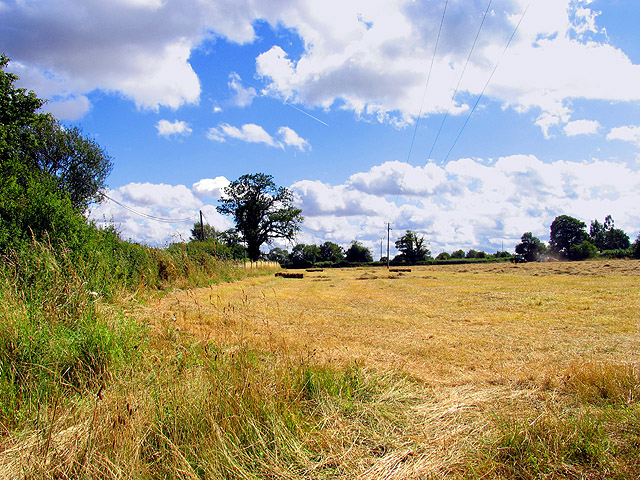
Haymaking near
Greenham. This field was in the process of being mown for hay. This square contains some of the village of Bishops Green and is mostly farmland. This field is in the western half of the square, near the intersection of the minor road and Hyde
937:== {{int:filedesc}} == {{Information |description={{en|1=Haymaking near Greenham. This field was in the process of being mown for hay. This square contains some of the village of Bishops Green and is mostly farmland. This field is in the western half of t
38:
344:– You must give appropriate credit, provide a link to the license, and indicate if changes were made. You may do so in any reasonable manner, but not in any way that suggests the licensor endorses you or your use.
78:
46:
393:
410:
951:
712:
676:
640:
226:
747:
261:
972:
This file contains additional information, probably added from the digital camera or scanner used to create or digitize it.
351:
961:
575:
851:
817:
725:
696:
624:
596:
583:
568:
919:
914:
486:
37:
783:
755:
740:
660:
541:
524:
433:
425:
248:
307:
975:
If the file has been modified from its original state, some details may not fully reflect the modified file.
406:
947:
The following pages on the
English Knowledge (XXG) use this file (pages on other projects are not listed):
350:– If you remix, transform, or build upon the material, you must distribute your contributions under the
268:
on the
Geograph website for the photographer's contact details. The copyright on this image is owned by
930:
304:
414:
86:
179:
399:
Remove redundant categories and try to put this image in the most specific category/categories
956:
163:
762:
732:
477:
603:
481:
473:
469:
465:
461:
457:
453:
449:
445:
441:
232:
273:
73:
216:
131:
142:
253:
152:
265:
887:
Click on a date/time to view the file as it appeared at that time.
810:
218:
211:
51° 21′ 39.54″ N, 1° 16′ 55.4″ W
201:
61:
508:
Add a one-line explanation of what this file represents
413:
combined with a database. You can also have a look at
405:
The location categories are based on information from
111:
Haymaking near
Greenham - geograph.org.uk - 29269.jpg
47:
Haymaking_near_Greenham_-_geograph.org.uk_-_29269.jpg
105:
85:
Commons is a freely licensed media file repository.
677:
Creative
Commons Attribution-ShareAlike 2.0 Generic
51:(640 × 480 pixels, file size: 197 KB, MIME type:
390:The categories of this image should be checked.
361:https://creativecommons.org/licenses/by-sa/2.0
66:
367:Creative Commons Attribution-Share Alike 2.0
285:
8:
327:– to copy, distribute and transmit the work
977:
889:
504:
485:
979:
949:
865:
849:
831:
815:
797:
781:
763:https://www.geograph.org.uk/photo/29269
710:
694:
674:
658:
638:
622:
555:
539:
522:
519:
500:
493:
432:This image was uploaded as part of the
204:
604:https://www.geograph.org.uk/profile/40
225:View this and other nearby images on:
420:The topic category from Geograph was
7:
272:and is licensed for reuse under the
878:
308:Attribution-Share Alike 2.0 Generic
296:
291:
276:Attribution-ShareAlike 2.0 license.
970:
513:
507:
282:
259:
115:
98:
44:
952:Agriculture in the United Kingdom
512:
498:
383:
338:Under the following conditions:
303:This file is licensed under the
295:
290:
284:
252:
231:
217:
65:
21:
495:
116:
41:No higher resolution available.
14:
713:file available on the internet
494:
260:This image was taken from the
26:
1:
962:United Kingdom enterprise law
833:51°21'39.542"N, 1°16'55.416"W
818:coordinates of depicted place
31:
748:Geograph Britain and Ireland
569:object of statement has role
520:Items portrayed in this file
1001:
352:same or compatible license
879:
16:
726:geograph.org.uk image ID
497:
415:this tool from mysociety
381:
380:
318:
72:This is a file from the
936:
411:this OpenStreetMap tool
194:Haymaking near Greenham
192:Pam Brophy /
175:Haymaking near Greenham
173:Pam Brophy /
164:required by the license
148:
137:
130:
127:
108:
76:. Information from its
915:03:11, 30 January 2010
266:this photograph's page
237:51.360984; -1.282060
79:description page there
434:Geograph batch upload
424:(find similar images
402:Remove this template
478:português do Brasil
333:– to adapt the work
584:author name string
407:this geonames tool
988:
987:
940:
661:copyright license
506:
489:
436:
281:
280:
264:collection. See
242:
241:
199:
198:
167:
94:
93:
74:Wikimedia Commons
992:
978:
957:English land law
927:
765:
760:
756:described at URL
750:
745:
735:
730:
625:copyright status
606:
601:
591:
588:
578:
573:
490:
431:
388:
387:
386:
374:
371:
368:
365:
362:
354:as the original.
316:
305:Creative Commons
299:
298:
294:
293:
288:
287:
274:Creative Commons
262:Geograph project
256:
249:
238:
235:
221:
220:
214:
213:
202:
161:
133:
120:
112:
106:
90:
69:
68:
62:
56:
54:
1000:
999:
995:
994:
993:
991:
990:
989:
966:
948:
941:
933:
925:
881:
880:
877:
876:
875:
874:
873:
872:
871:
870:
868:
858:
857:
856:
854:
843:
842:
841:
840:
839:
838:
837:
836:
834:
824:
823:
822:
820:
809:
808:
807:
806:
805:
804:
803:
802:
800:
790:
789:
788:
786:
775:
774:
773:
772:
771:
770:
769:
768:
767:
766:
761:
758:
752:
751:
746:
743:
737:
736:
731:
728:
719:
718:
717:
715:
703:
702:
701:
699:
688:
687:
686:
685:
684:
683:
682:
681:
679:
667:
666:
665:
663:
652:
651:
650:
649:
648:
647:
646:
645:
643:
631:
630:
629:
627:
616:
615:
614:
613:
612:
611:
610:
609:
608:
607:
602:
599:
593:
592:
589:
586:
580:
579:
574:
571:
562:
561:
560:
558:
548:
547:
546:
544:
533:
532:
531:
530:
529:
527:
511:
510:
509:
492:
440:
437:
394:Check them now!
384:
382:
376:
375:
372:
369:
366:
363:
360:
359:
317:
314:
311:
300:
277:
247:
236:
209:
208:
205:Object location
200:
189:
182:
170:
143:geograph.org.uk
123:
110:
103:
96:
95:
84:
83:
82:is shown below.
58:
52:
50:
43:
42:
12:
11:
5:
998:
996:
986:
985:
982:
969:
965:
964:
959:
954:
946:
945:
944:
939:
938:
935:
931:
928:
922:
917:
912:
908:
907:
904:
901:
898:
895:
892:
885:
884:
869:
866:
864:
863:
862:
861:
860:
859:
855:
850:
848:
847:
846:
845:
844:
835:
832:
830:
829:
828:
827:
826:
825:
821:
816:
814:
813:
812:
811:
801:
798:
796:
795:
794:
793:
792:
791:
787:
782:
780:
779:
778:
777:
776:
754:
753:
739:
738:
724:
723:
722:
721:
720:
716:
711:
709:
708:
707:
706:
705:
704:
700:
697:source of file
695:
693:
692:
691:
690:
689:
680:
675:
673:
672:
671:
670:
669:
668:
664:
659:
657:
656:
655:
654:
653:
644:
639:
637:
636:
635:
634:
633:
632:
628:
623:
621:
620:
619:
618:
617:
595:
594:
582:
581:
567:
566:
565:
564:
563:
559:
556:
554:
553:
552:
551:
550:
549:
545:
540:
538:
537:
536:
535:
534:
528:
523:
521:
518:
517:
516:
515:
514:
503:
502:
499:
496:
430:
429:
418:
403:
400:
358:
357:
356:
355:
345:
336:
335:
334:
328:
321:You are free:
312:
302:
301:
283:
279:
278:
257:
246:
243:
240:
239:
229:
223:
206:
197:
196:
190:
187:
184:
183:
178:
171:
168:
156:
155:
150:
146:
145:
139:
135:
134:
129:
125:
124:
113:
104:
102:
99:
97:
92:
91:
70:
60:
59:
40:
36:
35:
34:
29:
24:
19:
13:
10:
9:
6:
4:
3:
2:
997:
983:
980:
976:
973:
967:
963:
960:
958:
955:
953:
950:
942:
934:
929:
923:
921:
918:
916:
913:
910:
909:
905:
902:
899:
896:
893:
891:
890:
888:
882:
853:
819:
785:
764:
757:
749:
742:
734:
727:
714:
698:
678:
662:
642:
626:
605:
598:
585:
577:
570:
543:
526:
491:
488:
483:
479:
475:
471:
467:
463:
459:
455:
451:
447:
443:
438:
435:
427:
423:
419:
416:
412:
408:
404:
401:
398:
397:
396:
395:
391:
379:
378:
364:CC BY-SA 2.0
353:
349:
346:
343:
340:
339:
337:
332:
329:
326:
323:
322:
320:
319:
313:Attribution:
309:
306:
289:
275:
271:
267:
263:
258:
255:
251:
250:
244:
234:
230:
228:
227:OpenStreetMap
224:
222:
212:
207:
203:
195:
191:
186:
185:
181:
177: /
176:
172:
165:
160:
158:
157:
154:
151:
147:
144:
140:
136:
126:
119:
114:
107:
100:
88:
81:
80:
75:
71:
64:
63:
57:
48:
39:
33:
30:
28:
25:
23:
20:
18:
15:
974:
971:
886:
883:File history
799:20 July 2005
576:photographer
439:
421:
392:
389:
377:
347:
341:
330:
324:
269:
193:
180:CC BY-SA 2.0
174:
132:20 July 2005
117:
87:You can help
77:
45:
22:File history
932:GeographBot
641:copyrighted
426:at Geograph
348:share alike
342:attribution
159:Attribution
109:Description
981:_error
943:File usage
924:640 × 480
900:Dimensions
867:image/jpeg
852:media type
590:Pam Brophy
557:some value
466:македонски
315:Pam Brophy
270:Pam Brophy
153:Pam Brophy
53:image/jpeg
27:File usage
897:Thumbnail
894:Date/Time
784:inception
474:português
245:Licensing
188:InfoField
169:InfoField
118:English:
968:Metadata
926:(197 KB)
741:operator
501:Captions
484: |
480: |
476: |
472: |
468: |
464: |
460: |
456: |
452: |
450:français
448: |
444: |
422:Farmland
331:to remix
325:to share
310:license.
32:Metadata
911:current
906:Comment
542:creator
525:depicts
505:English
442:English
101:Summary
49:
482:Türkçe
470:മലയാളം
462:magyar
454:galego
215:
149:Author
138:Source
733:29269
458:עברית
446:suomi
141:From
122:Lane.
903:User
409:and
373:true
370:true
128:Date
17:File
597:URL
487:+/−
759::
744::
729::
600::
587::
572::
984:0
428:)
417:.
166:)
162:(
89:.
55:)
Text is available under the Creative Commons Attribution-ShareAlike License. Additional terms may apply.
_&language=en)
