376:
309:
267:
323:
281:
344:
382:
110:
134:
387:
72:
964:
300:
258:
434:– You must give appropriate credit, provide a link to the license, and indicate if changes were made. You may do so in any reasonable manner, but not in any way that suggests the licensor endorses you or your use.
43:
1005:
1010:
83:
1020:
51:
981:== {{int:filedesc}} == {{Information |description={{en|1=Hanger Wood. View south-west.}} |date=2006-01-15 |source=From |author= |permission= |other_ve
1015:
126:
1392:
686:
650:
614:
316:
274:
841:
721:
1208:
995:
351:
1071:
This file contains additional information, probably added from the digital camera or scanner used to create or digitize it.
441:
564:
895:
861:
825:
757:
729:
670:
598:
572:
557:
542:
791:
714:
699:
634:
515:
498:
338:
397:
1074:
If the file has been modified from its original state, some details may not fully reflect the modified file.
963:
958:
42:
1235:
440:– If you remix, transform, or build upon the material, you must distribute your contributions under the
358:
on the
Geograph website for the photographer's contact details. The copyright on this image is owned by
121:
974:
394:
109:
991:
The following pages on the
English Knowledge use this file (pages on other projects are not listed):
1271:
133:
91:
227:
1177:
1344:
736:
706:
549:
211:
322:
280:
1386:
1307:
1253:
1100:
363:
78:
1354:
1317:
1140:
1281:
1048:
1000:
264:
179:
1120:
306:
116:
200:
190:
1364:
1110:
343:
355:
931:
Click on a date/time to view the file as it appeared at that time.
1093:
1083:
750:
308:
266:
291:
259:
52° 07′ 57.64″ N, 0° 32′ 40.6″ W
249:
104:
66:
854:
1006:
List of Sites of
Special Scientific Interest in Bedfordshire
132:
301:
52° 07′ 57″ N, 0° 32′ 46″ W
1038:
482:
Add a one-line explanation of what this file represents
1058:
154:
90:
Commons is a freely licensed media file repository.
651:
Creative
Commons Attribution-ShareAlike 2.0 Generic
1011:User:Skinsmoke/Sandbox/Civil parishes/Bedfordshire
56:(640 × 480 pixels, file size: 164 KB, MIME type:
451:https://creativecommons.org/licenses/by-sa/2.0
71:
1021:Template:Did you know nominations/Hanger Wood
457:Creative Commons Attribution-Share Alike 2.0
375:
8:
417:– to copy, distribute and transmit the work
1076:
933:
478:
160:Hanger Wood - geograph.org.uk - 106678.jpg
52:Hanger_Wood_-_geograph.org.uk_-_106678.jpg
1031:The following other wikis use this file:
707:https://www.geograph.org.uk/photo/106678
550:https://www.geograph.org.uk/profile/1039
1372:
1362:
1352:
1342:
1334:
1326:
1315:
1305:
1297:
1289:
1279:
1269:
1261:
1251:
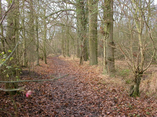
1243:
1233:
1225:
1217:
1206:
1198:
1190:
1182:
1172:
1164:
1156:
1148:
1137:
1129:
1118:
1108:
1098:
1088:
1016:Knowledge:Recent additions/2014/January
993:
909:
893:
875:
859:
839:
823:
805:
789:
771:
755:
684:
668:
648:
632:
612:
596:
529:
513:
496:
493:
474:
467:
294:
252:
1049:Bedfordshire'daki civil parishler
315:View this and other nearby images on:
273:View this and other nearby images on:
1078:
7:
362:and is licensed for reuse under the
922:
398:Attribution-Share Alike 2.0 Generic
386:
381:
366:Attribution-ShareAlike 2.0 license.
115:This image appeared on Knowledge's
1069:
487:
481:
372:
349:
164:
147:
103:
49:
486:
1131:Date and time of data generation
758:coordinates of the point of view
472:
428:Under the following conditions:
393:This file is licensed under the
385:
380:
374:
342:
321:
307:
279:
265:
108:
70:
31:
21:
469:
165:
125:column on 18 January 2014 (see
46:No higher resolution available.
14:
1105:10/833 sec (0.012004801920768)
996:Civil parishes in Bedfordshire
687:file available on the internet
468:
350:This image was taken from the
26:
1:
1393:Knowledge Did you know images
1276:Flash did not fire, auto mode
862:coordinates of depicted place
170:Hanger Wood. View south-west.
36:
773:52°7'57.644"N, 0°32'40.632"W
722:Geograph Britain and Ireland
558:object of statement has role
494:Items portrayed in this file
1219:Date and time of digitizing
1409:
1328:Focal length in 35 mm film
1055:Usage on www.wikidata.org
1045:Usage on tr.wikipedia.org
1035:Usage on fr.wikipedia.org
442:same or compatible license
1184:File change date and time
923:
16:
877:52°7'57.4"N, 0°32'45.6"W
730:geograph.org.uk image ID
471:
408:
77:This is a file from the
1291:Custom image processing
980:
212:required by the license
196:
185:
178:
175:
157:
81:. Information from its
1374:Subject distance range
1227:Image compression mode
1222:11:58, 15 January 2006
1187:11:58, 15 January 2006
1134:11:58, 15 January 2006
959:23:29, 30 January 2010
356:this photograph's page
327:52.132600; -0.546000
285:52.132679; -0.544620
138:
84:description page there
1245:Maximum land aperture
1158:Horizontal resolution
136:
1192:Y and C positioning
1166:Vertical resolution
1080:Camera manufacturer
423:– to adapt the work
1336:Scene capture type
1312:Auto white balance
842:Nikon Coolpix 4500
573:author name string
240:Kokai /
221:Kokai /
139:
1381:
1380:
1248:2.8 APEX (f/2.64)
1027:Global file usage
984:
635:copyright license
480:
371:
370:
354:collection. See
332:
331:
290:
289:
247:
246:
215:
143:
142:
99:
98:
79:Wikimedia Commons
32:Global file usage
1400:
1200:Exposure Program
1077:
971:
739:
734:
724:
719:
709:
704:
700:described at URL
599:copyright status
580:
577:
567:
562:
552:
547:
464:
461:
458:
455:
452:
444:as the original.
406:
395:Creative Commons
389:
388:
384:
383:
378:
377:
364:Creative Commons
352:Geograph project
346:
339:
328:
325:
311:
310:
304:
303:
292:
286:
283:
269:
268:
262:
261:
250:
209:
181:
169:
161:
155:
112:
105:
95:
74:
73:
67:
61:
59:
1408:
1407:
1403:
1402:
1401:
1399:
1398:
1397:
1383:
1382:
1065:
1025:
992:
985:
977:
969:
925:
924:
921:
920:
919:
918:
917:
916:
915:
914:
912:
902:
901:
900:
898:
887:
886:
885:
884:
883:
882:
881:
880:
878:
868:
867:
866:
864:
853:
852:
851:
850:
849:
848:
847:
846:
844:
832:
831:
830:
828:
817:
816:
815:
814:
813:
812:
811:
810:
808:
807:15 January 2006
798:
797:
796:
794:
783:
782:
781:
780:
779:
778:
777:
776:
774:
764:
763:
762:
760:
749:
748:
747:
746:
745:
744:
743:
742:
741:
740:
735:
732:
726:
725:
720:
717:
711:
710:
705:
702:
693:
692:
691:
689:
677:
676:
675:
673:
662:
661:
660:
659:
658:
657:
656:
655:
653:
641:
640:
639:
637:
626:
625:
624:
623:
622:
621:
620:
619:
617:
605:
604:
603:
601:
590:
589:
588:
587:
586:
585:
584:
583:
582:
581:
578:
575:
569:
568:
563:
560:
554:
553:
548:
545:
536:
535:
534:
532:
522:
521:
520:
518:
507:
506:
505:
504:
503:
501:
485:
484:
483:
466:
465:
462:
459:
456:
453:
450:
449:
407:
404:
401:
390:
367:
337:
326:
299:
298:
295:Object location
284:
257:
256:
253:Camera location
248:
237:
230:
218:
191:geograph.org.uk
180:15 January 2006
171:
159:
152:
145:
144:
101:
100:
89:
88:
87:is shown below.
63:
57:
55:
48:
47:
12:
11:
5:
1406:
1404:
1396:
1395:
1385:
1384:
1379:
1378:
1375:
1371:
1370:
1367:
1361:
1360:
1357:
1351:
1350:
1347:
1341:
1340:
1337:
1333:
1332:
1329:
1325:
1324:
1321:
1314:
1313:
1310:
1304:
1303:
1300:
1296:
1295:
1294:Normal process
1292:
1288:
1287:
1284:
1278:
1277:
1274:
1268:
1267:
1264:
1260:
1259:
1256:
1250:
1249:
1246:
1242:
1241:
1238:
1232:
1231:
1228:
1224:
1223:
1220:
1216:
1215:
1212:
1205:
1204:
1203:Normal program
1201:
1197:
1196:
1193:
1189:
1188:
1185:
1181:
1180:
1175:
1171:
1170:
1167:
1163:
1162:
1159:
1155:
1154:
1151:
1147:
1146:
1143:
1136:
1135:
1132:
1128:
1127:
1124:
1117:
1116:
1113:
1107:
1106:
1103:
1097:
1096:
1091:
1087:
1086:
1081:
1068:
1064:
1063:
1062:
1061:
1053:
1052:
1051:
1043:
1042:
1041:
1029:
1028:
1024:
1023:
1018:
1013:
1008:
1003:
998:
990:
989:
988:
983:
982:
979:
975:
972:
966:
961:
956:
952:
951:
948:
945:
942:
939:
936:
929:
928:
913:
910:
908:
907:
906:
905:
904:
903:
899:
894:
892:
891:
890:
889:
888:
879:
876:
874:
873:
872:
871:
870:
869:
865:
860:
858:
857:
856:
855:
845:
840:
838:
837:
836:
835:
834:
833:
829:
824:
822:
821:
820:
819:
818:
809:
806:
804:
803:
802:
801:
800:
799:
795:
790:
788:
787:
786:
785:
784:
775:
772:
770:
769:
768:
767:
766:
765:
761:
756:
754:
753:
752:
751:
728:
727:
713:
712:
698:
697:
696:
695:
694:
690:
685:
683:
682:
681:
680:
679:
678:
674:
671:source of file
669:
667:
666:
665:
664:
663:
654:
649:
647:
646:
645:
644:
643:
642:
638:
633:
631:
630:
629:
628:
627:
618:
613:
611:
610:
609:
608:
607:
606:
602:
597:
595:
594:
593:
592:
591:
571:
570:
556:
555:
541:
540:
539:
538:
537:
533:
530:
528:
527:
526:
525:
524:
523:
519:
514:
512:
511:
510:
509:
508:
502:
497:
495:
492:
491:
490:
489:
488:
477:
476:
473:
470:
448:
447:
446:
445:
435:
426:
425:
424:
418:
411:You are free:
402:
392:
391:
373:
369:
368:
347:
336:
333:
330:
329:
319:
313:
296:
288:
287:
277:
271:
254:
245:
244:
238:
235:
232:
231:
226:
219:
216:
204:
203:
198:
194:
193:
187:
183:
182:
177:
173:
172:
162:
153:
151:
148:
146:
141:
140:
130:
113:
102:
97:
96:
75:
65:
64:
45:
41:
40:
39:
34:
29:
24:
19:
13:
10:
9:
6:
4:
3:
2:
1405:
1394:
1391:
1390:
1388:
1376:
1373:
1368:
1366:
1363:
1358:
1356:
1353:
1348:
1346:
1343:
1338:
1335:
1330:
1327:
1322:
1319:
1316:
1311:
1309:
1308:White balance
1306:
1302:Auto exposure
1301:
1299:Exposure mode
1298:
1293:
1290:
1285:
1283:
1280:
1275:
1273:
1270:
1265:
1262:
1257:
1255:
1254:Metering mode
1252:
1247:
1244:
1239:
1237:
1236:Exposure bias
1234:
1229:
1226:
1221:
1218:
1213:
1210:
1207:
1202:
1199:
1194:
1191:
1186:
1183:
1179:
1176:
1174:Software used
1173:
1168:
1165:
1160:
1157:
1152:
1149:
1144:
1142:
1138:
1133:
1130:
1125:
1122:
1119:
1114:
1112:
1109:
1104:
1102:
1101:Exposure time
1099:
1095:
1092:
1089:
1085:
1082:
1079:
1075:
1072:
1066:
1060:
1057:
1056:
1054:
1050:
1047:
1046:
1044:
1040:
1037:
1036:
1034:
1033:
1032:
1026:
1022:
1019:
1017:
1014:
1012:
1009:
1007:
1004:
1002:
999:
997:
994:
986:
978:
973:
967:
965:
962:
960:
957:
954:
953:
949:
946:
943:
940:
937:
935:
934:
932:
926:
897:
863:
843:
827:
826:captured with
793:
759:
738:
731:
723:
716:
708:
701:
688:
672:
652:
636:
616:
600:
574:
566:
559:
551:
544:
517:
500:
454:CC BY-SA 2.0
443:
439:
436:
433:
430:
429:
427:
422:
419:
416:
413:
412:
410:
409:
403:Attribution:
399:
396:
379:
365:
361:
357:
353:
348:
345:
341:
340:
334:
324:
320:
318:
317:OpenStreetMap
314:
312:
302:
297:
293:
282:
278:
276:
275:OpenStreetMap
272:
270:
260:
255:
251:
243:
239:
234:
233:
229:
225: /
224:
220:
213:
208:
206:
205:
202:
199:
195:
192:
188:
184:
174:
168:
163:
156:
149:
135:
131:
128:
124:
123:
122:Did you know?
118:
114:
111:
107:
106:
93:
86:
85:
80:
76:
69:
68:
62:
53:
44:
38:
35:
33:
30:
28:
25:
23:
20:
18:
15:
1318:Digital zoom
1263:Light source
1141:focal length
1090:Camera model
1073:
1070:
1030:
930:
927:File history
565:photographer
437:
431:
420:
414:
359:
241:
228:CC BY-SA 2.0
222:
166:
120:
92:You can help
82:
50:
22:File history
1282:Color space
1150:Orientation
1039:Hanger Wood
1001:Hanger Wood
976:GeographBot
615:copyrighted
438:share alike
432:attribution
242:Hanger Wood
223:Hanger Wood
207:Attribution
158:Description
1355:Saturation
987:File usage
968:640 × 480
944:Dimensions
911:image/jpeg
896:media type
531:some value
58:image/jpeg
27:File usage
1365:Sharpness
1178:E4500v1.1
1121:ISO speed
1059:Q15631280
941:Thumbnail
938:Date/Time
792:inception
335:Licensing
236:InfoField
217:InfoField
167:English:
137:Knowledge
117:Main Page
1387:Category
1345:Contrast
1339:Standard
1195:Co-sited
1111:F-number
1067:Metadata
970:(164 KB)
715:operator
475:Captions
421:to remix
415:to share
400:license.
127:archives
37:Metadata
1377:Unknown
1266:Unknown
1258:Pattern
1211:version
1169:300 dpi
1161:300 dpi
1145:7.85 mm
955:current
950:Comment
516:creator
499:depicts
479:English
150:Summary
119:in the
54:
1369:Normal
1359:Normal
1349:Normal
1153:Normal
1123:rating
737:106678
305:
263:
197:Author
186:Source
1331:38 mm
1320:ratio
1272:Flash
1139:Lens
1115:f/3.7
1094:E4500
1084:NIKON
579:Kokai
405:Kokai
360:Kokai
201:Kokai
189:From
1286:sRGB
1209:Exif
947:User
463:true
460:true
176:Date
17:File
1214:2.2
1126:100
543:URL
1389::
733::
718::
703::
576::
561::
546::
129:).
1323:0
1240:0
1230:4
214:)
210:(
94:.
60:)
Text is available under the Creative Commons Attribution-ShareAlike License. Additional terms may apply.
_&language=en)
_&language=en)
