240:
201:
215:
43:
246:
251:
99:
768:
738:
292:– You must give appropriate credit, provide a link to the license, and indicate if changes were made. You may do so in any reasonable manner, but not in any way that suggests the licensor endorses you or your use.
192:
785:{{Information |Description=Two Lint 41-trains from Lokalbanen meets on Helsinge Station on Gribskovbanen, Denmark. |Source={{own}} |Date=2011-05-28 |Author=
579:
509:
473:
208:
615:
1006:
869:
This file contains additional information, probably added from the digital camera or scanner used to create or digitize it.
299:
669:
635:
599:
563:
457:
429:
414:
401:
65:
61:
57:
53:
47:
529:
493:
421:
374:
357:
110:
78:
803:
767:
762:
261:
872:
If the file has been modified from its original state, some details may not fully reflect the modified file.
799:
The following pages on the
English Knowledge (XXG) use this file (pages on other projects are not listed):
1033:
298:– If you remix, transform, or build upon the material, you must distribute your contributions under the
836:
258:
1069:
436:
786:
778:
748:
118:
1139:
975:
175:
214:
147:
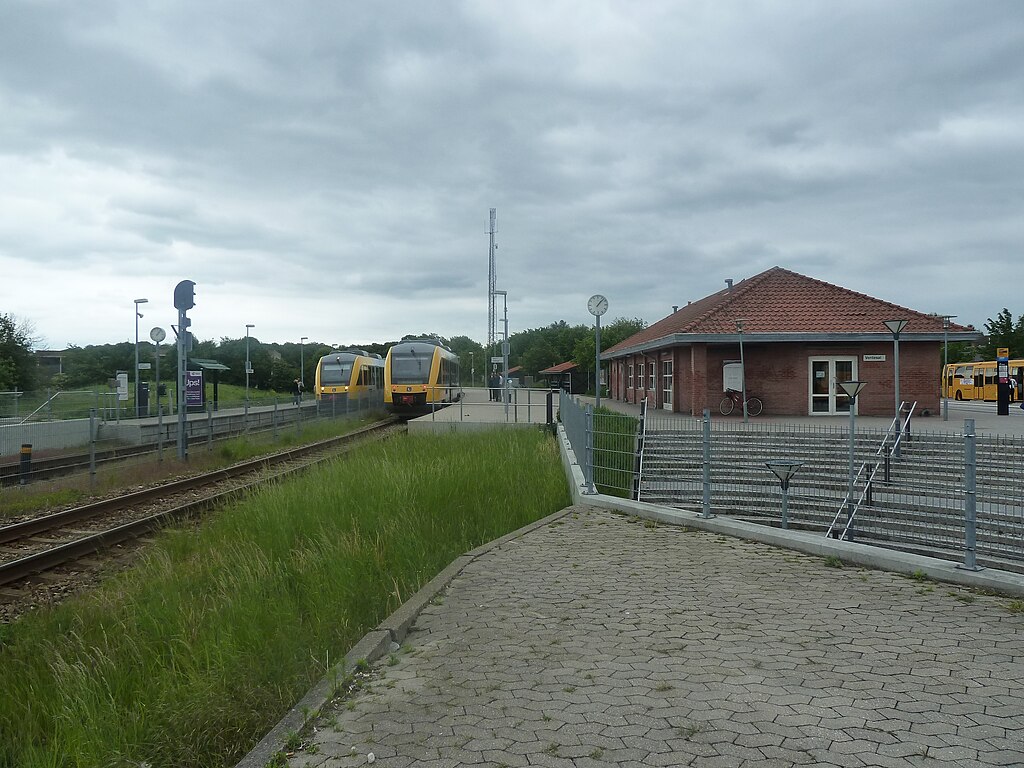
Two Lint 41-trains from
Lokalbanen meets on Helsinge Station on Gribskovbanen, Denmark.
826:
737:
732:
69:
42:
1113:
1051:
898:
105:
233:
I, the copyright holder of this work, hereby publish it under the following license:
1149:
938:
198:
1079:
155:
918:
881:
1159:
908:
891:
846:
705:
Click on a date/time to view the file as it appeared at that time.
1001:
Landscape mode (for landscape photos with the background in focus)
628:
200:
193:
56° 01′ 24.11″ N, 12° 12′ 15.29″ E
183:
93:
821:
789:|Permission= |other_versions= }} [[Category:Train stations
341:
Add a one-line explanation of what this file represents
856:
83:(2,560 × 1,920 pixels, file size: 2.81 MB, MIME type:
510:
Creative
Commons Attribution-ShareAlike 3.0 Unported
137:
117:
Commons is a freely licensed media file repository.
437:https://commons.wikimedia.org/user:Dannebrog_Spy
309:https://creativecommons.org/licenses/by-sa/3.0
98:
315:Creative Commons Attribution-Share Alike 3.0
239:
8:
275:– to copy, distribute and transmit the work
874:
707:
337:
827:Bruger:Steenth/Autoliste/Danske stationer
814:The following other wikis use this file:
1223:
1215:
1207:
1199:
1191:
1183:
1175:
1167:
1157:
1147:
1137:
1129:
1121:
1111:
1103:
1095:
1087:
1077:
1067:
1059:
1049:
1041:
1031:
1023:
1015:
1004:
996:
988:
980:
970:
962:
954:
946:
935:
927:
916:
906:
896:
886:
801:
683:
667:
649:
633:
613:
597:
577:
561:
543:
527:
507:
491:
471:
455:
388:
372:
355:
352:
333:
326:
186:
207:View this and other nearby images on:
876:
7:
262:Attribution-Share Alike 3.0 Unported
696:
250:
245:
867:
346:
340:
236:
232:
130:
76:
345:
929:Date and time of data generation
636:coordinates of the point of view
331:
286:Under the following conditions:
257:This file is licensed under the
249:
244:
238:
213:
199:
97:
31:
21:
1185:Satellites used for measurement
837:Dánia vasútállomásainak listája
328:
14:
327:
26:
1:
1074:Flash did not fire, auto mode
651:56°1'24.110"N, 12°12'15.289"E
580:original creation by uploader
36:
353:Items portrayed in this file
1017:Date and time of digitizing
1245:
1123:Focal length in 35 mm film
1092:One-chip color area sensor
853:Usage on www.wikidata.org
847:Helsinge (stacja kolejowa)
843:Usage on pl.wikipedia.org
833:Usage on hu.wikipedia.org
818:Usage on da.wikipedia.org
300:same or compatible license
1217:Geodetic survey data used
1204:2-dimensional measurement
982:File change date and time
697:
165:
16:
804:Helsinge railway station
733:14:09, 18 September 2011
616:Panasonic Lumix DMC-TZ10
330:
266:
104:This is a file from the
1196:Measurement in progress
1169:North or south latitude
1097:Custom image processing
784:
754:
171:
161:
154:
151:
140:
108:. Information from its
1177:East or west longitude
1025:Image compression mode
219:56.023364; 12.204247
111:description page there
46:Size of this preview:
1209:Measurement precision
1043:Maximum land aperture
956:Horizontal resolution
763:19:13, 5 August 2011
143:Helsinge Station.jpg
70:2,560 × 1,920 pixels
990:Y and C positioning
964:Vertical resolution
878:Camera manufacturer
281:– to adapt the work
52:Other resolutions:
1131:Scene capture type
1118:Auto white balance
1046:3.44 APEX (f/3.29)
1020:13:05, 28 May 2011
985:13:05, 28 May 2011
932:13:05, 28 May 2011
755:Original solution.
415:Wikimedia username
402:author name string
66:1,280 × 960 pixels
62:1,024 × 768 pixels
1232:
1231:
903:1/250 sec (0.004)
810:Global file usage
792:
494:copyright license
339:
224:
223:
181:
180:
126:
125:
106:Wikimedia Commons
32:Global file usage
1236:
1201:Measurement mode
998:Exposure Program
875:
822:Helsinge Station
775:
745:
458:copyright status
439:
434:
424:
419:
409:
406:
322:
319:
316:
313:
310:
302:as the original.
259:Creative Commons
253:
252:
248:
247:
242:
241:
220:
217:
203:
202:
196:
195:
184:
167:
157:
144:
138:
122:
101:
100:
94:
88:
86:
73:
58:640 × 480 pixels
54:320 × 240 pixels
48:800 × 600 pixels
1244:
1243:
1239:
1238:
1237:
1235:
1234:
1233:
1193:Receiver status
863:
808:
800:
793:
781:
773:
751:
743:
699:
698:
695:
694:
693:
692:
691:
690:
689:
688:
686:
676:
675:
674:
672:
661:
660:
659:
658:
657:
656:
655:
654:
652:
642:
641:
640:
638:
627:
626:
625:
624:
623:
622:
621:
620:
618:
606:
605:
604:
602:
591:
590:
589:
588:
587:
586:
585:
584:
582:
570:
569:
568:
566:
555:
554:
553:
552:
551:
550:
549:
548:
546:
536:
535:
534:
532:
521:
520:
519:
518:
517:
516:
515:
514:
512:
500:
499:
498:
496:
485:
484:
483:
482:
481:
480:
479:
478:
476:
464:
463:
462:
460:
449:
448:
447:
446:
445:
444:
443:
442:
441:
440:
435:
432:
426:
425:
420:
417:
411:
410:
407:
404:
395:
394:
393:
391:
381:
380:
379:
377:
366:
365:
364:
363:
362:
360:
344:
343:
342:
325:
324:
323:
320:
317:
314:
311:
308:
307:
265:
254:
235:
234:
229:
218:
191:
190:
187:Camera location
182:
142:
135:
128:
127:
116:
115:
114:is shown below.
90:
84:
82:
75:
74:
51:
12:
11:
5:
1242:
1240:
1230:
1229:
1226:
1222:
1221:
1218:
1214:
1213:
1210:
1206:
1205:
1202:
1198:
1197:
1194:
1190:
1189:
1186:
1182:
1181:
1180:East longitude
1178:
1174:
1173:
1172:North latitude
1170:
1166:
1165:
1162:
1156:
1155:
1152:
1146:
1145:
1142:
1136:
1135:
1132:
1128:
1127:
1124:
1120:
1119:
1116:
1110:
1109:
1106:
1102:
1101:
1100:Normal process
1098:
1094:
1093:
1090:
1089:Sensing method
1086:
1085:
1082:
1076:
1075:
1072:
1066:
1065:
1062:
1058:
1057:
1054:
1048:
1047:
1044:
1040:
1039:
1036:
1030:
1029:
1026:
1022:
1021:
1018:
1014:
1013:
1010:
1003:
1002:
999:
995:
994:
991:
987:
986:
983:
979:
978:
973:
969:
968:
965:
961:
960:
957:
953:
952:
949:
945:
944:
941:
934:
933:
930:
926:
925:
922:
915:
914:
911:
905:
904:
901:
895:
894:
889:
885:
884:
879:
866:
862:
861:
860:
859:
851:
850:
849:
841:
840:
839:
831:
830:
829:
824:
812:
811:
807:
806:
798:
797:
796:
791:
790:
787:Leif Jørgensen
783:
779:
776:
770:
765:
760:
757:
756:
753:
749:
746:
742:2,560 × 1,920
740:
735:
730:
726:
725:
722:
719:
716:
713:
710:
703:
702:
687:
684:
682:
681:
680:
679:
678:
677:
673:
668:
666:
665:
664:
663:
662:
653:
650:
648:
647:
646:
645:
644:
643:
639:
634:
632:
631:
630:
629:
619:
614:
612:
611:
610:
609:
608:
607:
603:
598:
596:
595:
594:
593:
592:
583:
578:
576:
575:
574:
573:
572:
571:
567:
564:source of file
562:
560:
559:
558:
557:
556:
547:
544:
542:
541:
540:
539:
538:
537:
533:
528:
526:
525:
524:
523:
522:
513:
508:
506:
505:
504:
503:
502:
501:
497:
492:
490:
489:
488:
487:
486:
477:
472:
470:
469:
468:
467:
466:
465:
461:
456:
454:
453:
452:
451:
450:
428:
427:
413:
412:
408:Leif Jørgensen
400:
399:
398:
397:
396:
392:
389:
387:
386:
385:
384:
383:
382:
378:
373:
371:
370:
369:
368:
367:
361:
356:
354:
351:
350:
349:
348:
347:
336:
335:
332:
329:
306:
305:
304:
303:
293:
284:
283:
282:
276:
269:You are free:
256:
255:
237:
231:
230:
228:
225:
222:
221:
211:
205:
188:
179:
178:
176:Leif Jørgensen
173:
169:
168:
163:
159:
158:
153:
149:
148:
145:
136:
134:
131:
129:
124:
123:
102:
92:
91:
45:
41:
40:
39:
34:
29:
24:
19:
13:
10:
9:
6:
4:
3:
2:
1241:
1227:
1224:
1219:
1216:
1211:
1208:
1203:
1200:
1195:
1192:
1187:
1184:
1179:
1176:
1171:
1168:
1163:
1161:
1158:
1153:
1151:
1148:
1143:
1141:
1138:
1133:
1130:
1125:
1122:
1117:
1115:
1114:White balance
1112:
1108:Auto exposure
1107:
1105:Exposure mode
1104:
1099:
1096:
1091:
1088:
1083:
1081:
1078:
1073:
1071:
1068:
1063:
1060:
1055:
1053:
1052:Metering mode
1050:
1045:
1042:
1037:
1035:
1034:Exposure bias
1032:
1027:
1024:
1019:
1016:
1011:
1008:
1005:
1000:
997:
992:
989:
984:
981:
977:
974:
972:Software used
971:
966:
963:
958:
955:
950:
947:
942:
940:
936:
931:
928:
923:
920:
917:
912:
910:
907:
902:
900:
899:Exposure time
897:
893:
890:
887:
883:
880:
877:
873:
870:
864:
858:
855:
854:
852:
848:
845:
844:
842:
838:
835:
834:
832:
828:
825:
823:
820:
819:
817:
816:
815:
809:
805:
802:
794:
788:
782:
780:Dannebrog Spy
777:
771:
769:
766:
764:
761:
759:
758:
752:
750:Dannebrog Spy
747:
741:
739:
736:
734:
731:
728:
727:
723:
720:
717:
714:
711:
709:
708:
706:
700:
671:
637:
617:
601:
600:captured with
581:
565:
531:
511:
495:
475:
459:
438:
431:
423:
422:Dannebrog Spy
416:
403:
376:
359:
312:CC BY-SA 3.0
301:
297:
294:
291:
288:
287:
285:
280:
277:
274:
271:
270:
268:
267:
263:
260:
243:
226:
216:
212:
210:
209:OpenStreetMap
206:
204:
194:
189:
185:
177:
174:
170:
164:
160:
150:
146:
139:
132:
120:
113:
112:
107:
103:
96:
95:
89:
80:
79:Original file
71:
67:
63:
59:
55:
49:
44:
38:
35:
33:
30:
28:
25:
23:
20:
18:
15:
1061:Light source
939:focal length
888:Camera model
871:
868:
813:
772:1,280 × 960
704:
701:File history
295:
289:
278:
272:
119:You can help
109:
77:
22:File history
1228:28 May 2011
1080:Color space
948:Orientation
545:28 May 2011
474:copyrighted
296:share alike
290:attribution
156:28 May 2011
141:Description
1212:Poor (2.8)
1150:Saturation
795:File usage
718:Dimensions
685:image/jpeg
670:media type
390:some value
85:image/jpeg
27:File usage
1220:WGS-84
1160:Sharpness
976:Ver.1.0
919:ISO speed
882:Panasonic
857:Q12316163
744:(2.81 MB)
715:Thumbnail
712:Date/Time
530:inception
227:Licensing
1225:GPS date
1140:Contrast
1134:Standard
993:Co-sited
909:F-number
892:DMC-TZ10
865:Metadata
774:(431 KB)
334:Captions
279:to remix
273:to share
264:license.
166:Own work
37:Metadata
1064:Unknown
1056:Pattern
1009:version
967:180 dpi
959:180 dpi
729:current
724:Comment
375:creator
358:depicts
338:English
133:Summary
81:
1164:Normal
1154:Normal
1144:Normal
951:Normal
943:4.1 mm
921:rating
197:
172:Author
162:Source
1126:25 mm
1070:Flash
937:Lens
1084:sRGB
1012:2.21
1007:Exif
721:User
321:true
318:true
152:Date
17:File
924:125
913:f/4
430:URL
433::
418::
405::
68:|
64:|
60:|
56:|
50:.
1188:3
1038:0
1028:4
121:.
87:)
72:.
Text is available under the Creative Commons Attribution-ShareAlike License. Additional terms may apply.
