332:
265:
223:
279:
237:
300:
338:
343:
72:
886:
256:
214:
43:
390:– You must give appropriate credit, provide a link to the license, and indicate if changes were made. You may do so in any reasonable manner, but not in any way that suggests the licensor endorses you or your use.
903:== {{int:filedesc}} == {{Information |description={{en|1=Henblas, Llaneilian. Picture taken from rear of Henblas Farmhouse looking North to Coastline}} |date=2004-12-25 |source=From |author=[http://
83:
51:
676:
606:
570:
272:
230:
797:
696:
1205:
307:
1068:
This file contains additional information, probably added from the digital camera or scanner used to create or digitize it.
397:
533:
817:
781:
747:
704:
660:
554:
526:
513:
498:
719:
689:
626:
590:
471:
454:
885:
880:
42:
935:
294:
353:
1071:
If the file has been modified from its original state, some details may not fully reflect the modified file.
1020:
1232:
396:– If you remix, transform, or build upon the material, you must distribute your contributions under the
314:
on the
Geograph website for the photographer's contact details. The copyright on this image is owned by
896:
350:
1268:
91:
183:
1174:
1341:
126:
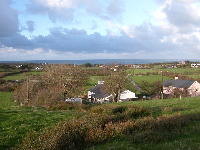
Henblas, Llaneilian. Picture taken from rear of
Henblas Farmhouse looking North to Coastline
505:
167:
726:
711:
278:
236:
1304:
1250:
1097:
319:
78:
1351:
1314:
1137:
960:
1278:
980:
135:
1117:
917:
262:
220:
156:
146:
1361:
1107:
299:
311:
853:
Click on a date/time to view the file as it appeared at that time.
1090:
1080:
264:
222:
1055:
247:
205:
66:
810:
740:
257:
53° 24′ 36″ N, 4° 18′ 43″ W
215:
53° 24′ 17″ N, 4° 18′ 25″ W
945:
1035:
1025:
1021:
Utente:BohemianRhapsody/Lista delle comunità del Galles
1010:
1000:
990:
970:
955:
438:
Add a one-line explanation of what this file represents
1045:
985:
110:
90:
Commons is a freely licensed media file repository.
607:
Creative
Commons Attribution-ShareAlike 2.0 Generic
116:Henblas, Llaneilian - geograph.org.uk - 79332.jpg
56:(640 × 480 pixels, file size: 121 KB, MIME type:
52:Henblas,_Llaneilian_-_geograph.org.uk_-_79332.jpg
407:https://creativecommons.org/licenses/by-sa/2.0
71:
413:Creative Commons Attribution-Share Alike 2.0
331:
8:
373:– to copy, distribute and transmit the work
1073:
855:
434:
928:The following other wikis use this file:
506:https://www.geograph.org.uk/profile/3523
1369:
1359:
1349:
1339:
1331:
1323:
1312:
1302:
1294:
1286:
1276:
1266:
1258:
1248:
1240:
1230:
1222:
1214:
1203:
1195:
1187:
1179:
1169:
1161:
1153:
1145:
1134:
1126:
1115:
1105:
1095:
1085:
915:
831:
815:
795:
779:
761:
745:
727:https://www.geograph.org.uk/photo/79332
674:
658:
640:
624:
604:
588:
568:
552:
485:
469:
452:
449:
430:
423:
250:
208:
961:Defnyddiwr:Prosiect Wici Mon/Cymunedau
271:View this and other nearby images on:
229:View this and other nearby images on:
1075:
7:
318:and is licensed for reuse under the
913:The following page uses this file:
844:
354:Attribution-Share Alike 2.0 Generic
342:
337:
322:Attribution-ShareAlike 2.0 license.
1066:
1052:Usage on zh-min-nan.wikipedia.org
443:
437:
328:
305:
120:
103:
49:
1102:10/1,757 sec (0.0056915196357427)
442:
1128:Date and time of data generation
748:coordinates of the point of view
428:
384:Under the following conditions:
349:This file is licensed under the
341:
336:
330:
298:
277:
263:
235:
221:
70:
31:
21:
425:
121:
46:No higher resolution available.
14:
677:file available on the internet
424:
306:This image was taken from the
26:
1:
1273:Flash did not fire, auto mode
981:Utilisateur:Ælfgar/Brouillon7
818:coordinates of depicted place
36:
697:Geograph Britain and Ireland
527:object of statement has role
450:Items portrayed in this file
1216:Date and time of digitizing
942:Usage on ceb.wikipedia.org
1391:
1325:Focal length in 35 mm film
1042:Usage on www.wikidata.org
1032:Usage on kw.wikipedia.org
1017:Usage on it.wikipedia.org
1007:Usage on gd.wikipedia.org
997:Usage on ga.wikipedia.org
977:Usage on fr.wikipedia.org
967:Usage on eu.wikipedia.org
952:Usage on cy.wikipedia.org
932:Usage on ar.wikipedia.org
398:same or compatible license
1181:File change date and time
845:
833:53°24'36.4"N, 4°18'43.2"W
763:53°24'17.3"N, 4°18'25.2"W
16:
705:geograph.org.uk image ID
427:
364:
196:Peter Finch /
177:Peter Finch /
77:This is a file from the
1288:Custom image processing
1219:14:54, 25 December 2004
1184:14:54, 25 December 2004
1131:14:54, 25 December 2004
902:
168:required by the license
152:
141:
134:
131:
113:
81:. Information from its
1371:Subject distance range
1224:Image compression mode
881:16:11, 30 January 2010
312:this photograph's page
283:53.410100; -4.312000
241:53.404800; -4.307000
84:description page there
1242:Maximum land aperture
1155:Horizontal resolution
1189:Y and C positioning
1163:Vertical resolution
1077:Camera manufacturer
379:– to adapt the work
198:Henblas, Llaneilian
179:Henblas, Llaneilian
1333:Scene capture type
1309:Auto white balance
798:Nikon Coolpix 2500
514:author name string
1378:
1377:
1245:2.9 APEX (f/2.73)
924:Global file usage
906:
591:copyright license
436:
327:
326:
310:collection. See
288:
287:
246:
245:
203:
202:
171:
99:
98:
79:Wikimedia Commons
32:Global file usage
1382:
1197:Exposure Program
1074:
893:
729:
724:
720:described at URL
714:
709:
699:
694:
642:25 December 2004
555:copyright status
536:
531:
521:
518:
508:
503:
420:
417:
414:
411:
408:
400:as the original.
362:
351:Creative Commons
345:
344:
340:
339:
334:
333:
320:Creative Commons
308:Geograph project
302:
295:
284:
281:
267:
266:
260:
259:
248:
242:
239:
225:
224:
218:
217:
206:
165:
137:
136:25 December 2004
125:
117:
111:
95:
74:
73:
67:
61:
59:
1390:
1389:
1385:
1384:
1383:
1381:
1380:
1379:
1062:
922:
907:
899:
891:
847:
846:
843:
842:
841:
840:
839:
838:
837:
836:
834:
824:
823:
822:
820:
809:
808:
807:
806:
805:
804:
803:
802:
800:
788:
787:
786:
784:
773:
772:
771:
770:
769:
768:
767:
766:
764:
754:
753:
752:
750:
739:
738:
737:
736:
735:
734:
733:
732:
731:
730:
725:
722:
716:
715:
710:
707:
701:
700:
695:
692:
683:
682:
681:
679:
667:
666:
665:
663:
652:
651:
650:
649:
648:
647:
646:
645:
643:
633:
632:
631:
629:
618:
617:
616:
615:
614:
613:
612:
611:
609:
597:
596:
595:
593:
582:
581:
580:
579:
578:
577:
576:
575:
573:
561:
560:
559:
557:
546:
545:
544:
543:
542:
541:
540:
539:
538:
537:
532:
529:
523:
522:
519:
516:
510:
509:
504:
501:
492:
491:
490:
488:
478:
477:
476:
474:
463:
462:
461:
460:
459:
457:
441:
440:
439:
422:
421:
418:
415:
412:
409:
406:
405:
363:
360:
357:
346:
323:
293:
282:
255:
254:
251:Object location
240:
213:
212:
209:Camera location
204:
193:
186:
174:
147:geograph.org.uk
127:
115:
108:
101:
100:
89:
88:
87:is shown below.
63:
57:
55:
48:
47:
12:
11:
5:
1388:
1386:
1376:
1375:
1372:
1368:
1367:
1364:
1358:
1357:
1354:
1348:
1347:
1344:
1338:
1337:
1334:
1330:
1329:
1326:
1322:
1321:
1318:
1311:
1310:
1307:
1301:
1300:
1297:
1293:
1292:
1291:Normal process
1289:
1285:
1284:
1281:
1275:
1274:
1271:
1265:
1264:
1261:
1257:
1256:
1253:
1247:
1246:
1243:
1239:
1238:
1235:
1229:
1228:
1225:
1221:
1220:
1217:
1213:
1212:
1209:
1202:
1201:
1200:Normal program
1198:
1194:
1193:
1190:
1186:
1185:
1182:
1178:
1177:
1172:
1168:
1167:
1164:
1160:
1159:
1156:
1152:
1151:
1148:
1144:
1143:
1140:
1133:
1132:
1129:
1125:
1124:
1121:
1114:
1113:
1110:
1104:
1103:
1100:
1094:
1093:
1088:
1084:
1083:
1078:
1065:
1061:
1060:
1059:
1058:
1050:
1049:
1048:
1040:
1039:
1038:
1030:
1029:
1028:
1023:
1015:
1014:
1013:
1005:
1004:
1003:
995:
994:
993:
988:
983:
975:
974:
973:
965:
964:
963:
958:
950:
949:
948:
940:
939:
938:
936:للنيلين (ويلز)
926:
925:
921:
920:
911:
910:
905:
904:
901:
897:
894:
888:
883:
878:
874:
873:
870:
867:
864:
861:
858:
851:
850:
835:
832:
830:
829:
828:
827:
826:
825:
821:
816:
814:
813:
812:
811:
801:
796:
794:
793:
792:
791:
790:
789:
785:
780:
778:
777:
776:
775:
774:
765:
762:
760:
759:
758:
757:
756:
755:
751:
746:
744:
743:
742:
741:
718:
717:
703:
702:
688:
687:
686:
685:
684:
680:
675:
673:
672:
671:
670:
669:
668:
664:
661:source of file
659:
657:
656:
655:
654:
653:
644:
641:
639:
638:
637:
636:
635:
634:
630:
625:
623:
622:
621:
620:
619:
610:
605:
603:
602:
601:
600:
599:
598:
594:
589:
587:
586:
585:
584:
583:
574:
569:
567:
566:
565:
564:
563:
562:
558:
553:
551:
550:
549:
548:
547:
525:
524:
512:
511:
497:
496:
495:
494:
493:
489:
486:
484:
483:
482:
481:
480:
479:
475:
470:
468:
467:
466:
465:
464:
458:
453:
451:
448:
447:
446:
445:
444:
433:
432:
429:
426:
404:
403:
402:
401:
391:
382:
381:
380:
374:
367:You are free:
358:
348:
347:
329:
325:
324:
303:
292:
289:
286:
285:
275:
269:
252:
244:
243:
233:
227:
210:
201:
200:
194:
191:
188:
187:
182:
175:
172:
160:
159:
154:
150:
149:
143:
139:
138:
133:
129:
128:
118:
109:
107:
104:
102:
97:
96:
75:
65:
64:
45:
41:
40:
39:
34:
29:
24:
19:
13:
10:
9:
6:
4:
3:
2:
1387:
1373:
1370:
1365:
1363:
1360:
1355:
1353:
1350:
1345:
1343:
1340:
1335:
1332:
1327:
1324:
1319:
1316:
1313:
1308:
1306:
1305:White balance
1303:
1299:Auto exposure
1298:
1296:Exposure mode
1295:
1290:
1287:
1282:
1280:
1277:
1272:
1270:
1267:
1262:
1259:
1254:
1252:
1251:Metering mode
1249:
1244:
1241:
1236:
1234:
1233:Exposure bias
1231:
1226:
1223:
1218:
1215:
1210:
1207:
1204:
1199:
1196:
1191:
1188:
1183:
1180:
1176:
1173:
1171:Software used
1170:
1165:
1162:
1157:
1154:
1149:
1146:
1141:
1139:
1135:
1130:
1127:
1122:
1119:
1116:
1111:
1109:
1106:
1101:
1099:
1098:Exposure time
1096:
1092:
1089:
1086:
1082:
1079:
1076:
1072:
1069:
1063:
1057:
1054:
1053:
1051:
1047:
1044:
1043:
1041:
1037:
1034:
1033:
1031:
1027:
1024:
1022:
1019:
1018:
1016:
1012:
1009:
1008:
1006:
1002:
999:
998:
996:
992:
989:
987:
984:
982:
979:
978:
976:
972:
969:
968:
966:
962:
959:
957:
954:
953:
951:
947:
944:
943:
941:
937:
934:
933:
931:
930:
929:
923:
919:
916:
914:
908:
900:
895:
889:
887:
884:
882:
879:
876:
875:
871:
868:
865:
862:
859:
857:
856:
854:
848:
819:
799:
783:
782:captured with
749:
728:
721:
713:
706:
698:
691:
678:
662:
628:
608:
592:
572:
556:
535:
528:
515:
507:
500:
473:
456:
410:CC BY-SA 2.0
399:
395:
392:
389:
386:
385:
383:
378:
375:
372:
369:
368:
366:
365:
359:Attribution:
355:
352:
335:
321:
317:
313:
309:
304:
301:
297:
296:
290:
280:
276:
274:
273:OpenStreetMap
270:
268:
258:
253:
249:
238:
234:
232:
231:OpenStreetMap
228:
226:
216:
211:
207:
199:
195:
190:
189:
185:
181: /
180:
176:
169:
164:
162:
161:
158:
155:
151:
148:
144:
140:
130:
124:
119:
112:
105:
93:
86:
85:
80:
76:
69:
68:
62:
53:
44:
38:
35:
33:
30:
28:
25:
23:
20:
18:
15:
1315:Digital zoom
1260:Light source
1138:focal length
1087:Camera model
1070:
1067:
927:
912:
852:
849:File history
534:photographer
393:
387:
376:
370:
315:
197:
184:CC BY-SA 2.0
178:
122:
92:You can help
82:
50:
22:File history
1279:Color space
1147:Orientation
898:GeographBot
571:copyrighted
520:Peter Finch
394:share alike
388:attribution
361:Peter Finch
316:Peter Finch
163:Attribution
157:Peter Finch
114:Description
1352:Saturation
1056:Llaneilian
1036:Llaneilian
1026:Llaneilian
1011:Llaneilian
1001:Llaneilian
991:Llaneilian
971:Llaneilian
956:Llaneilian
946:Llaneilian
918:Llaneilian
909:File usage
890:640 × 480
866:Dimensions
487:some value
58:image/jpeg
27:File usage
1362:Sharpness
1175:E2500v1.1
1118:ISO speed
863:Thumbnail
860:Date/Time
627:inception
291:Licensing
192:InfoField
173:InfoField
123:English:
1342:Contrast
1336:Standard
1192:Centered
1108:F-number
1064:Metadata
1046:Q6661279
986:Rhosybol
892:(121 KB)
690:operator
431:Captions
377:to remix
371:to share
356:license.
37:Metadata
1374:Unknown
1263:Unknown
1255:Pattern
1208:version
1166:300 dpi
1158:300 dpi
877:current
872:Comment
472:creator
455:depicts
435:English
106:Summary
54:
1366:Normal
1356:Normal
1346:Normal
1150:Normal
1142:5.6 mm
1120:rating
261:
219:
153:Author
142:Source
1328:37 mm
1317:ratio
1269:Flash
1136:Lens
1112:f/4.5
1091:E2500
1081:NIKON
712:79332
145:From
1283:sRGB
1206:Exif
869:User
419:true
416:true
132:Date
17:File
1211:2.2
1123:100
499:URL
723::
708::
693::
530::
517::
502::
1320:0
1237:0
1227:4
170:)
166:(
94:.
60:)
Text is available under the Creative Commons Attribution-ShareAlike License. Additional terms may apply.
_&language=en)
_&language=en)
