38:
253:
259:
264:
94:
549:
1133:
311:– You must give appropriate credit, provide a link to the license, and indicate if changes were made. You may do so in any reasonable manner, but not in any way that suggests the licensor endorses you or your use.
1090:
581:
570:, UK with the following information shown: *Administrative borders *Coastline, lakes and rivers *Roads and railways *Urban areas Equirectangular map projection on WGS 84 datum, with N/S s
1392:
64:
68:
60:
56:
52:
48:
42:
351:
105:
77:
242:
460:
424:
928:
823:
668:
1378:
318:
1123:
408:
480:
444:
391:
993:
948:
1058:
1033:
1028:
1353:
1108:
968:
213:
274:
580:
More than 100 pages use this file. The following list shows the first 100 pages that use this file only. A
1043:
973:
798:
733:
708:
648:
1053:
908:
688:
633:
317:– If you remix, transform, or build upon the material, you must distribute your contributions under the
1023:
998:
271:
778:
548:
543:
37:
199:
1168:
1143:
783:
743:
113:
1358:
653:
963:
863:
808:
1153:
893:
843:
196:
1368:
953:
868:
838:
828:
1373:
1363:
1048:
1038:
1018:
923:
918:
873:
763:
678:
559:
139:
1078:
1003:
903:
643:
567:
100:
1008:
983:
938:
813:
788:
613:
230:
978:
958:
943:
933:
898:
878:
738:
217:
185:
1073:
848:
818:
713:
703:
638:
598:
588:
1063:
988:
913:
888:
833:
728:
693:
628:
608:
1383:
1083:
1068:
773:
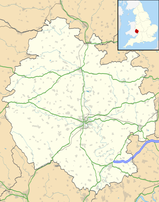
768:
748:
683:
673:
658:
618:
593:
159:
Equirectangular map projection on WGS 84 datum, with N/S stretched 160%
1338:
1013:
883:
803:
793:
753:
723:
698:
663:
603:
1298:
1268:
858:
853:
758:
623:
206:
Administrative borders and coastline data from
Boundary-Line product.
1333:
1318:
1118:
516:
Click on a date/time to view the file as it appeared at that time.
718:
282:
Contains
Ordnance Survey data © Crown copyright and database right
1288:
1223:
88:
1213:
82:(SVG file, nominally 999 × 1,266 pixels, file size: 1.55 MB)
1243:
1178:
1208:
1238:
1263:
1218:
1343:
1293:
1258:
1253:
1193:
1183:
375:
Add a one-line explanation of what this file represents
1323:
1308:
1248:
1198:
1188:
1203:
1173:
1163:
1303:
1283:
1278:
1273:
1233:
1228:
461:
Creative
Commons Attribution-ShareAlike 3.0 Unported
127:
112:
Commons is a freely licensed media file repository.
1328:
1313:
1144:
Plantilya:Location map United
Kingdom Herefordshire
209:All other geographic data from Meridian 2 product.
1169:Plantilla:Mapa de localización de Herefordshire
1154:Nodyn:Location map United Kingdom Herefordshire
1124:Şablon:Yer xəritəsi Böyük Britaniya Herefordşir
1354:الگو:Location map United Kingdom Herefordshire
1109:قالب:Location map United Kingdom Herefordshire
352:File:Herefordshire UK district map (blank).svg
328:https://creativecommons.org/licenses/by-sa/3.0
93:
334:Creative Commons Attribution-Share Alike 3.0
252:
8:
294:– to copy, distribute and transmit the work
142:, UK with the following information shown:
41:Size of this PNG preview of this SVG file:
518:
371:
1101:The following other wikis use this file:
586:
494:
478:
458:
442:
422:
406:
389:
386:
367:
360:
7:
1134:Шаблон:ПК Великобритания Херефордшър
275:Attribution-Share Alike 3.0 Unported
233:, created using Ordnance Survey data
507:
263:
258:
566:{{Information |Description=Map of
380:
374:
249:
125:
75:
379:
133:Herefordshire UK location map.svg
365:
305:Under the following conditions:
270:This file is licensed under the
262:
257:
251:
92:
31:
21:
929:Ridge Hill transmitting station
824:List of places in Herefordshire
669:Brockhampton (near Ross-on-Wye)
362:
14:
361:
26:
1:
387:Items portrayed in this file
1140:Usage on ceb.wikipedia.org
149:Coastline, lakes and rivers
1409:
1350:Usage on fa.wikipedia.org
1339:Wellington (Herefordshire)
1160:Usage on es.wikipedia.org
1150:Usage on cy.wikipedia.org
1130:Usage on bg.wikipedia.org
1115:Usage on az.wikipedia.org
1105:Usage on ar.wikipedia.org
994:Walford, Letton and Newton
949:Stoke Prior, Herefordshire
319:same or compatible license
1299:Kingstone (Herefordshire)
1269:Westfield (Herefordshire)
1059:Withington, Herefordshire
1034:Whitchurch, Herefordshire
1029:Whitbourne, Herefordshire
508:
16:
969:Thornbury, Herefordshire
544:18:55, 26 September 2010
364:
285:
214:England location map.svg
99:This is a file from the
565:
347:
237:
226:
191:
184:
181:
130:
103:. Information from its
1334:Marden (Herefordshire)
1319:Wilton (Herefordshire)
1044:Wigmore, Herefordshire
974:Trumpet, Herefordshire
799:Kington, Herefordshire
734:Eastnor, Herefordshire
709:Cradley, Herefordshire
649:Birley with Upper Hill
146:Administrative borders
106:description page there
1054:Wilton, Herefordshire
909:Pixley, Herefordshire
689:Callow, Herefordshire
634:Bacton, Herefordshire
1289:Weston under Penyard
1024:Weston under Penyard
999:Walford, Ross-on-Wye
65:1,616 × 2,048 pixels
779:Holmer and Shelwick
654:Bishop's Frome
300:– to adapt the work
212:Inset derived from
162:Geographic limits:
47:Other resolutions:
1224:Sutton St Nicholas
784:Hope under Dinmore
744:Eye, Herefordshire
152:Roads and railways
69:999 × 1,266 pixels
61:808 × 1,024 pixels
1393:more global usage
1244:King's Thorn
1097:Global file usage
964:Tedstone Delamere
864:Monnington on Wye
809:Leinthall Starkes
573:
496:26 September 2010
445:copyright license
373:
358:
357:
246:
243:Reusing this file
186:26 September 2010
121:
120:
101:Wikimedia Commons
32:Global file usage
1400:
894:Pembridge Castle
844:Lower Bullingham
556:
409:copyright status
341:
338:
335:
332:
329:
321:as the original.
283:
272:Creative Commons
266:
265:
261:
260:
255:
254:
240:
187:
134:
128:
117:
96:
95:
89:
83:
72:
57:606 × 768 pixels
53:379 × 480 pixels
49:189 × 240 pixels
43:473 × 599 pixels
1408:
1407:
1403:
1402:
1401:
1399:
1398:
1397:
1379:هوپ آندر دینمور
1214:Moreton on Lugg
1095:
954:Stretton Sugwas
869:Moreton on Lugg
839:Longtown Castle
829:Little Hereford
574:
562:
554:
510:
509:
506:
505:
504:
503:
502:
501:
500:
499:
497:
487:
486:
485:
483:
472:
471:
470:
469:
468:
467:
466:
465:
463:
451:
450:
449:
447:
436:
435:
434:
433:
432:
431:
430:
429:
427:
415:
414:
413:
411:
400:
399:
398:
397:
396:
394:
378:
377:
376:
359:
343:
342:
339:
336:
333:
330:
327:
326:
284:
281:
278:
267:
197:Ordnance Survey
132:
123:
122:
111:
110:
109:is shown below.
85:
81:
74:
73:
46:
12:
11:
5:
1406:
1404:
1395:of this file.
1389:
1388:
1387:
1386:
1381:
1376:
1371:
1366:
1361:
1356:
1348:
1347:
1346:
1341:
1336:
1331:
1326:
1321:
1316:
1311:
1306:
1301:
1296:
1291:
1286:
1281:
1276:
1271:
1266:
1261:
1256:
1251:
1246:
1241:
1236:
1231:
1226:
1221:
1216:
1211:
1206:
1201:
1196:
1191:
1186:
1181:
1179:Gorsley Common
1176:
1171:
1166:
1158:
1157:
1156:
1148:
1147:
1146:
1138:
1137:
1136:
1128:
1127:
1126:
1121:
1113:
1112:
1111:
1099:
1098:
1093:to this file.
1087:
1086:
1081:
1076:
1071:
1066:
1061:
1056:
1051:
1049:Wigmore Castle
1046:
1041:
1039:Whitney-on-Wye
1036:
1031:
1026:
1021:
1019:Weston Beggard
1016:
1011:
1006:
1001:
996:
991:
986:
981:
976:
971:
966:
961:
956:
951:
946:
941:
936:
931:
926:
924:RAF Credenhill
921:
919:Preston on Wye
916:
911:
906:
901:
896:
891:
886:
881:
876:
874:Much Dewchurch
871:
866:
861:
856:
851:
846:
841:
836:
831:
826:
821:
816:
811:
806:
801:
796:
791:
786:
781:
776:
771:
766:
764:Hampton Bishop
761:
756:
751:
746:
741:
736:
731:
726:
721:
716:
711:
706:
701:
696:
691:
686:
681:
679:Bromyard Downs
676:
671:
666:
661:
656:
651:
646:
641:
636:
631:
626:
621:
616:
611:
606:
601:
596:
591:
584:is available.
578:
577:
572:
571:
564:
560:
557:
551:
546:
541:
537:
536:
533:
530:
527:
524:
521:
514:
513:
498:
495:
493:
492:
491:
490:
489:
488:
484:
479:
477:
476:
475:
474:
473:
464:
459:
457:
456:
455:
454:
453:
452:
448:
443:
441:
440:
439:
438:
437:
428:
423:
421:
420:
419:
418:
417:
416:
412:
407:
405:
404:
403:
402:
401:
395:
390:
388:
385:
384:
383:
382:
381:
370:
369:
366:
363:
356:
355:
349:
348:Other versions
345:
344:
325:
324:
323:
322:
312:
303:
302:
301:
295:
288:You are free:
279:
269:
268:
250:
247:
235:
234:
228:
224:
223:
222:
221:
210:
207:
193:
189:
188:
183:
179:
178:
177:
176:
173:
170:
167:
157:
156:
153:
150:
147:
135:
126:
124:
119:
118:
97:
87:
86:
40:
36:
35:
34:
29:
24:
19:
13:
10:
9:
6:
4:
3:
2:
1405:
1396:
1394:
1385:
1382:
1380:
1377:
1375:
1372:
1370:
1367:
1365:
1362:
1360:
1357:
1355:
1352:
1351:
1349:
1345:
1342:
1340:
1337:
1335:
1332:
1330:
1327:
1325:
1322:
1320:
1317:
1315:
1312:
1310:
1307:
1305:
1302:
1300:
1297:
1295:
1292:
1290:
1287:
1285:
1282:
1280:
1277:
1275:
1272:
1270:
1267:
1265:
1262:
1260:
1257:
1255:
1252:
1250:
1247:
1245:
1242:
1240:
1237:
1235:
1232:
1230:
1227:
1225:
1222:
1220:
1217:
1215:
1212:
1210:
1209:Bodenham Moor
1207:
1205:
1202:
1200:
1197:
1195:
1192:
1190:
1187:
1185:
1182:
1180:
1177:
1175:
1172:
1170:
1167:
1165:
1162:
1161:
1159:
1155:
1152:
1151:
1149:
1145:
1142:
1141:
1139:
1135:
1132:
1131:
1129:
1125:
1122:
1120:
1117:
1116:
1114:
1110:
1107:
1106:
1104:
1103:
1102:
1096:
1094:
1092:
1085:
1082:
1080:
1079:Wormelow Tump
1077:
1075:
1072:
1070:
1067:
1065:
1062:
1060:
1057:
1055:
1052:
1050:
1047:
1045:
1042:
1040:
1037:
1035:
1032:
1030:
1027:
1025:
1022:
1020:
1017:
1015:
1012:
1010:
1007:
1005:
1004:Welsh Bicknor
1002:
1000:
997:
995:
992:
990:
987:
985:
982:
980:
977:
975:
972:
970:
967:
965:
962:
960:
957:
955:
952:
950:
947:
945:
942:
940:
937:
935:
932:
930:
927:
925:
922:
920:
917:
915:
912:
910:
907:
905:
904:Pipe and Lyde
902:
900:
897:
895:
892:
890:
887:
885:
882:
880:
877:
875:
872:
870:
867:
865:
862:
860:
857:
855:
852:
850:
847:
845:
842:
840:
837:
835:
832:
830:
827:
825:
822:
820:
817:
815:
812:
810:
807:
805:
802:
800:
797:
795:
792:
790:
787:
785:
782:
780:
777:
775:
772:
770:
767:
765:
762:
760:
757:
755:
752:
750:
747:
745:
742:
740:
737:
735:
732:
730:
727:
725:
722:
720:
717:
715:
712:
710:
707:
705:
702:
700:
697:
695:
692:
690:
687:
685:
682:
680:
677:
675:
672:
670:
667:
665:
662:
660:
657:
655:
652:
650:
647:
645:
644:Belmont Rural
642:
640:
637:
635:
632:
630:
627:
625:
622:
620:
617:
615:
612:
610:
607:
605:
602:
600:
597:
595:
592:
590:
587:
585:
583:
575:
569:
568:Herefordshire
563:
558:
552:
550:
547:
545:
542:
539:
538:
534:
531:
528:
525:
522:
520:
519:
517:
511:
482:
462:
446:
426:
410:
393:
353:
350:
346:
331:CC BY-SA 3.0
320:
316:
313:
310:
307:
306:
304:
299:
296:
293:
290:
289:
287:
286:
280:Attribution:
276:
273:
256:
248:
244:
239:
236:
232:
229:
225:
219:
215:
211:
208:
205:
204:
203:
201:
198:
194:
190:
180:
175:South: 51.80N
174:
172:North: 52.45N
171:
168:
165:
164:
163:
160:
154:
151:
148:
145:
144:
143:
141:
140:Herefordshire
136:
129:
115:
108:
107:
102:
98:
91:
90:
84:
79:
78:Original file
70:
66:
62:
58:
54:
50:
44:
39:
33:
30:
28:
25:
23:
20:
18:
15:
1390:
1239:Leintwardine
1119:Qudriç qəsri
1100:
1088:
1009:Welsh Newton
984:Upton Bishop
939:Sapey Common
814:Leintwardine
789:Kerne Bridge
614:Aston Ingham
579:
553:999 × 1,266
515:
512:File history
314:
308:
297:
291:
195:
161:
158:
137:
114:You can help
104:
76:
22:File history
1359:گودریچ (دژ)
1264:Ross-on-Wye
1219:Peterchurch
979:Ullingswick
959:Symonds Yat
944:Stoke Edith
934:Ross-on-Wye
899:Peterchurch
879:Much Marcle
739:Edvin Loach
425:copyrighted
354:- Blank map
315:share alike
309:attribution
169:East: 2.33W
166:West: 3.15W
155:Urban areas
131:Description
1344:Withington
1294:Tarrington
1259:Lugwardine
1254:Leominster
1194:Credenhill
1184:Holme Lacy
1091:more links
1074:Wormbridge
849:Lugwardine
819:Leominster
714:Credenhill
704:Combe Moor
639:Ballingham
599:Allensmore
589:Abbey Dore
576:File usage
529:Dimensions
238:Permission
27:File usage
1324:Lyonshall
1309:Eardisley
1249:Crow Hill
1199:Clehonger
1189:Kingsland
1064:Wolferlow
989:Vowchurch
914:Pontrilas
889:Pembridge
834:Llanwarne
729:Eardisley
694:Clehonger
629:Aymestrey
609:Ashperton
582:full list
561:Nilfanion
555:(1.55 MB)
526:Thumbnail
523:Date/Time
481:inception
231:Nilfanion
1204:Bromyard
1174:Fownhope
1164:Hereford
1084:Yarkhill
1069:Woolhope
774:Hereford
769:Hentland
749:Fownhope
684:Burghill
674:Bromyard
659:Bodenham
619:Avenbury
594:Adforton
368:Captions
298:to remix
292:to share
277:license.
218:Spischot
200:OpenData
1374:برمیارد
1369:کولوال
1364:دورستون
1304:Kington
1284:Shobdon
1279:Wigmore
1274:Weobley
1234:Ledbury
1229:Orleton
1014:Weobley
884:Orleton
804:Ledbury
794:Kilpeck
754:Ganarew
724:Dinedor
699:Colwall
664:Bosbury
604:Almeley
540:current
535:Comment
392:depicts
372:English
138:Map of
80:
1329:Madley
1314:Luston
859:Moccas
854:Madley
759:Garway
624:Aylton
227:Author
192:Source
1391:View
1384:کیلپک
1089:View
719:Cusop
532:User
340:true
337:true
182:Date
17:File
216:by
202:.
67:|
63:|
59:|
55:|
51:|
45:.
245:)
241:(
220:.
116:.
71:.
Text is available under the Creative Commons Attribution-ShareAlike License. Additional terms may apply.

.svg)