43:
382:
234:
343:
476:
357:
388:
240:
393:
245:
208:
103:
981:
951:
508:
334:
434:– You must give appropriate credit, provide a link to the license, and indicate if changes were made. You may do so in any reasonable manner, but not in any way that suggests the licensor endorses you or your use.
286:– You must give appropriate credit, provide a link to the license, and indicate if changes were made. You may do so in any reasonable manner, but not in any way that suggests the licensor endorses you or your use.
69:
65:
61:
57:
53:
47:
82:
114:
980:
975:
197:
862:
737:
701:
665:
350:
792:
1172:
950:
945:
73:
42:
1043:
This file contains additional information, probably added from the digital camera or scanner used to create or digitize it.
441:
293:
882:
846:
776:
721:
649:
621:
608:
593:
1149:
812:
750:
685:
566:
549:
628:
492:
403:
255:
1046:
If the file has been modified from its original state, some details may not fully reflect the modified file.
1008:
The following pages on the
English Knowledge (XXG) use this file (pages on other projects are not listed):
1209:
440:– If you remix, transform, or build upon the material, you must distribute your contributions under the
292:– If you remix, transform, or build upon the material, you must distribute your contributions under the
157:
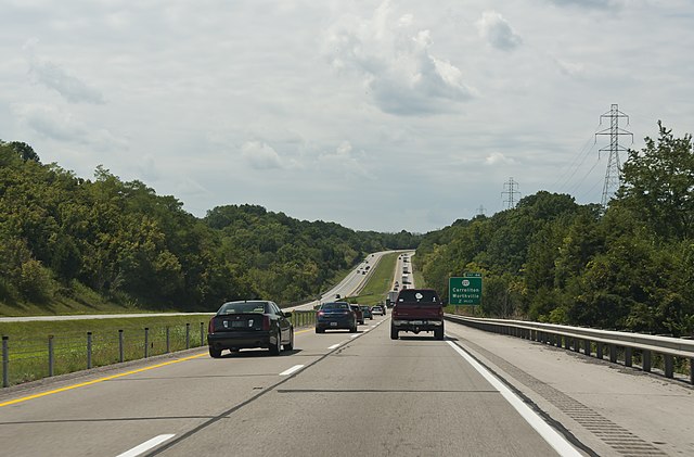
I-71 (Southbound) through the hills of
Kentucky, between Cincinnati and Louisville around mile marker 46
400:
252:
1253:
600:
991:
961:
502:
122:
483:
1382:
1055:
211:
This file is copyrighted and has been released under a license which is incompatible with
186:
166:
356:
1337:
1235:
1191:
1072:
1012:
109:
375:
I, the copyright holder of this work, hereby publish it under the following license:
227:
I, the copyright holder of this work, hereby publish it under the following license:
1392:
1347:
1112:
1287:
340:
1092:
1065:
1402:
1082:
212:
918:
Click on a date/time to view the file as it appeared at that time.
875:
342:
207:
335:
38° 39′ 19.8″ N, 85° 04′ 33.8″ W
325:
97:
702:
Creative
Commons Attribution-ShareAlike 4.0 International
1030:
533:
Add a one-line explanation of what this file represents
147:
I-71 (Southbound) between
Cincinnati and Louisville.jpg
87:(4,205 × 2,765 pixels, file size: 4.5 MB, MIME type:
141:
121:
Commons is a freely licensed media file repository.
601:https://commons.wikimedia.org/user:Sixflashphoto
505:(Southbound) in the hills of northern Kentucky
451:https://creativecommons.org/licenses/by-sa/4.0
303:https://creativecommons.org/licenses/by-sa/4.0
102:
457:Creative Commons Attribution-Share Alike 4.0
381:
309:Creative Commons Attribution-Share Alike 4.0
233:
8:
417:– to copy, distribute and transmit the work
269:– to copy, distribute and transmit the work
1048:
920:
529:
221:permitted to upload this file at Facebook.
1023:The following other wikis use this file:
404:Attribution-Share Alike 4.0 International
256:Attribution-Share Alike 4.0 International
1458:
1450:
1442:
1434:
1426:
1418:
1410:
1400:
1390:
1380:
1372:
1364:
1356:
1345:
1335:
1327:
1319:
1311:
1303:
1295:
1285:
1277:
1269:
1261:
1251:
1243:
1233:
1225:
1217:
1207:
1199:
1189:
1181:
1170:
1162:
1154:
1144:
1136:
1128:
1120:
1109:
1101:
1090:
1080:
1070:
1060:
1010:
896:
880:
860:
844:
826:
810:
790:
774:
735:
719:
699:
683:
663:
647:
580:
564:
547:
544:
525:
518:
490:This image has been assessed under the
328:
349:View this and other nearby images on:
1050:
7:
470:
998:User created page with UploadWizard
909:
392:
387:
244:
239:
1041:
538:
532:
378:
374:
230:
226:
151:
134:
80:
537:
1455:2A06917017CDB62003644554E6BE6475
1103:Date and time of data generation
883:coordinates of the point of view
523:
498:the most valued image on Commons
474:
428:Under the following conditions:
399:This file is licensed under the
391:
386:
380:
355:
341:
280:Under the following conditions:
251:This file is licensed under the
243:
238:
232:
206:
101:
31:
21:
1444:Date metadata was last modified
520:
475:
152:
14:
1452:Unique ID of original document
738:Wikimedia Commons valued image
519:
26:
1:
1316:A directly photographed image
968:Brightness and minor changes.
898:38°39'19.800"N, 85°4'33.802"W
863:original creation by uploader
507:. You can see its nomination
36:
1279:DateTimeDigitized subseconds
545:Items portrayed in this file
1271:DateTimeOriginal subseconds
1183:Date and time of digitizing
1150:Adobe Photoshop CS5 Windows
1480:
1358:Focal length in 35 mm film
1300:One-chip color area sensor
1027:Usage on www.wikidata.org
722:Commons quality assessment
442:same or compatible license
294:same or compatible license
213:Facebook's licensing terms
1156:File change date and time
910:
176:
16:
522:
408:
260:
167:20 August 2017, 13:52:53
108:This is a file from the
1447:13:25, 7 September 2017
1431:18.0-200.0 mm f/3.5-5.6
1420:Serial number of camera
1321:Custom image processing
1159:17:25, 7 September 2017
997:
976:06:36, 2 September 2017
967:
946:21:26, 7 September 2017
192:
182:
172:
165:
162:
144:
112:. Information from its
1412:Subject distance range
361:38.655500; -85.076056
115:description page there
46:Size of this preview:
1219:Maximum land aperture
1186:13:52, 20 August 2017
1130:Horizontal resolution
1106:13:52, 20 August 2017
493:valued image criteria
1308:Digital still camera
74:4,205 × 2,765 pixels
70:2,560 × 1,683 pixels
1263:DateTime subseconds
1138:Vertical resolution
1052:Camera manufacturer
423:– to adapt the work
275:– to adapt the work
52:Other resolutions:
1366:Scene capture type
1342:Auto white balance
1258:Flash did not fire
622:Wikimedia username
609:author name string
500:within the scope:
496:and is considered
66:1,280 × 842 pixels
62:1,024 × 673 pixels
1467:
1466:
1436:Rating (out of 5)
1222:4.1 APEX (f/4.14)
1077:1/250 sec (0.004)
1056:NIKON CORPORATION
1019:Global file usage
1001:
686:copyright license
531:
517:
516:
366:
365:
323:
322:
201:
198:Reusing this file
130:
129:
110:Wikimedia Commons
32:Global file usage
1471:
1227:Subject distance
1164:Exposure Program
1049:
988:
958:
758:
757:8 September 2017
755:
650:copyright status
631:
626:
616:
613:
603:
598:
478:
477:
471:
464:
461:
458:
455:
452:
444:as the original.
401:Creative Commons
395:
394:
390:
389:
384:
383:
362:
359:
345:
344:
338:
337:
326:
316:
313:
310:
307:
304:
296:as the original.
253:Creative Commons
247:
246:
242:
241:
236:
235:
210:
195:
178:
168:
156:
148:
142:
126:
105:
104:
98:
92:
90:
77:
58:640 × 421 pixels
54:320 × 210 pixels
48:800 × 526 pixels
1479:
1478:
1474:
1473:
1472:
1470:
1469:
1468:
1037:
1017:
1009:
1002:
994:
986:
964:
956:
912:
911:
908:
907:
906:
905:
904:
903:
902:
901:
899:
889:
888:
887:
885:
874:
873:
872:
871:
870:
869:
868:
867:
865:
853:
852:
851:
849:
838:
837:
836:
835:
834:
833:
832:
831:
829:
819:
818:
817:
815:
804:
803:
802:
801:
800:
799:
798:
797:
795:
783:
782:
781:
779:
768:
767:
766:
765:
764:
763:
762:
761:
760:
759:
756:
753:
744:
743:
742:
740:
728:
727:
726:
724:
713:
712:
711:
710:
709:
708:
707:
706:
704:
692:
691:
690:
688:
677:
676:
675:
674:
673:
672:
671:
670:
668:
656:
655:
654:
652:
641:
640:
639:
638:
637:
636:
635:
634:
633:
632:
627:
624:
618:
617:
614:
611:
605:
604:
599:
596:
587:
586:
585:
583:
573:
572:
571:
569:
558:
557:
556:
555:
554:
552:
536:
535:
534:
513:
487:
467:
466:
465:
462:
459:
456:
453:
450:
449:
407:
396:
377:
376:
371:
360:
333:
332:
329:Camera location
324:
319:
318:
317:
314:
311:
308:
305:
302:
301:
259:
248:
229:
228:
223:
158:
146:
139:
132:
131:
120:
119:
118:is shown below.
94:
88:
86:
79:
78:
51:
12:
11:
5:
1477:
1475:
1465:
1464:
1461:
1457:
1456:
1453:
1449:
1448:
1445:
1441:
1440:
1437:
1433:
1432:
1429:
1425:
1424:
1421:
1417:
1416:
1413:
1409:
1408:
1405:
1399:
1398:
1395:
1389:
1388:
1385:
1379:
1378:
1375:
1371:
1370:
1367:
1363:
1362:
1359:
1355:
1354:
1351:
1344:
1343:
1340:
1334:
1333:
1330:
1326:
1325:
1324:Normal process
1322:
1318:
1317:
1314:
1310:
1309:
1306:
1302:
1301:
1298:
1297:Sensing method
1294:
1293:
1290:
1284:
1283:
1280:
1276:
1275:
1272:
1268:
1267:
1264:
1260:
1259:
1256:
1250:
1249:
1246:
1242:
1241:
1238:
1232:
1231:
1228:
1224:
1223:
1220:
1216:
1215:
1212:
1206:
1205:
1202:
1198:
1197:
1194:
1188:
1187:
1184:
1180:
1179:
1176:
1169:
1168:
1167:Normal program
1165:
1161:
1160:
1157:
1153:
1152:
1147:
1143:
1142:
1139:
1135:
1134:
1131:
1127:
1126:
1123:
1119:
1118:
1115:
1108:
1107:
1104:
1100:
1099:
1096:
1089:
1088:
1085:
1079:
1078:
1075:
1069:
1068:
1063:
1059:
1058:
1053:
1040:
1036:
1035:
1034:
1033:
1021:
1020:
1016:
1015:
1007:
1006:
1005:
1000:
999:
996:
992:
989:
985:4,205 × 2,765
983:
978:
973:
970:
969:
966:
962:
959:
955:4,205 × 2,765
953:
948:
943:
939:
938:
935:
932:
929:
926:
923:
916:
915:
900:
897:
895:
894:
893:
892:
891:
890:
886:
881:
879:
878:
877:
876:
866:
861:
859:
858:
857:
856:
855:
854:
850:
847:source of file
845:
843:
842:
841:
840:
839:
830:
828:20 August 2017
827:
825:
824:
823:
822:
821:
820:
816:
811:
809:
808:
807:
806:
805:
796:
791:
789:
788:
787:
786:
785:
784:
780:
775:
773:
772:
771:
770:
769:
749:
748:
747:
746:
745:
741:
736:
734:
733:
732:
731:
730:
729:
725:
720:
718:
717:
716:
715:
714:
705:
700:
698:
697:
696:
695:
694:
693:
689:
684:
682:
681:
680:
679:
678:
669:
664:
662:
661:
660:
659:
658:
657:
653:
648:
646:
645:
644:
643:
642:
620:
619:
607:
606:
592:
591:
590:
589:
588:
584:
581:
579:
578:
577:
576:
575:
574:
570:
565:
563:
562:
561:
560:
559:
553:
548:
546:
543:
542:
541:
540:
539:
528:
527:
524:
521:
515:
514:
488:
481:
479:
448:
447:
446:
445:
435:
426:
425:
424:
418:
411:You are free:
398:
397:
379:
373:
372:
370:
367:
364:
363:
353:
347:
330:
321:
320:
300:
299:
298:
297:
287:
278:
277:
276:
270:
263:You are free:
250:
249:
231:
225:
224:
205:
202:
190:
189:
184:
180:
179:
174:
170:
169:
164:
160:
159:
149:
140:
138:
135:
133:
128:
127:
106:
96:
95:
45:
41:
40:
39:
34:
29:
24:
19:
13:
10:
9:
6:
4:
3:
2:
1476:
1462:
1459:
1454:
1451:
1446:
1443:
1438:
1435:
1430:
1427:
1422:
1419:
1414:
1411:
1406:
1404:
1401:
1396:
1394:
1391:
1386:
1384:
1381:
1376:
1374:Scene control
1373:
1368:
1365:
1360:
1357:
1352:
1349:
1346:
1341:
1339:
1338:White balance
1336:
1332:Auto exposure
1331:
1329:Exposure mode
1328:
1323:
1320:
1315:
1312:
1307:
1304:
1299:
1296:
1291:
1289:
1286:
1281:
1278:
1273:
1270:
1265:
1262:
1257:
1255:
1252:
1247:
1244:
1239:
1237:
1236:Metering mode
1234:
1229:
1226:
1221:
1218:
1213:
1211:
1210:Exposure bias
1208:
1203:
1201:APEX aperture
1200:
1195:
1193:
1192:Shutter speed
1190:
1185:
1182:
1177:
1174:
1171:
1166:
1163:
1158:
1155:
1151:
1148:
1146:Software used
1145:
1140:
1137:
1132:
1129:
1124:
1121:
1116:
1114:
1110:
1105:
1102:
1097:
1094:
1091:
1086:
1084:
1081:
1076:
1074:
1073:Exposure time
1071:
1067:
1064:
1061:
1057:
1054:
1051:
1047:
1044:
1038:
1032:
1029:
1028:
1026:
1025:
1024:
1018:
1014:
1013:Interstate 71
1011:
1003:
995:
993:Sixflashphoto
990:
984:
982:
979:
977:
974:
972:
971:
965:
963:Sixflashphoto
960:
954:
952:
949:
947:
944:
941:
940:
936:
933:
930:
927:
924:
922:
921:
919:
913:
884:
864:
848:
814:
794:
778:
777:captured with
752:
739:
723:
703:
687:
667:
651:
630:
629:Sixflashphoto
623:
615:Sixflashphoto
610:
602:
595:
568:
551:
512:
510:
506:
504:
503:Interstate 71
499:
495:
494:
486:
485:
480:
473:
472:
469:
454:CC BY-SA 4.0
443:
439:
436:
433:
430:
429:
427:
422:
419:
416:
413:
412:
410:
409:
405:
402:
385:
368:
358:
354:
352:
351:OpenStreetMap
348:
346:
336:
331:
327:
306:CC BY-SA 4.0
295:
291:
288:
285:
282:
281:
279:
274:
271:
268:
265:
264:
262:
261:
257:
254:
237:
222:
220:
214:
209:
203:
199:
194:
191:
188:
187:Sixflashphoto
185:
181:
175:
171:
161:
155:
150:
143:
136:
124:
117:
116:
111:
107:
100:
99:
93:
84:
83:Original file
75:
71:
67:
63:
59:
55:
49:
44:
38:
35:
33:
30:
28:
25:
23:
20:
18:
15:
1348:Digital zoom
1292:Uncalibrated
1245:Light source
1113:focal length
1062:Camera model
1045:
1042:
1022:
917:
914:File history
501:
497:
491:
489:
484:Valued image
482:
468:
437:
431:
420:
414:
289:
283:
272:
266:
218:
216:
153:
123:You can help
113:
81:
22:File history
1460:IIM version
1305:File source
1288:Color space
1230:5.96 meters
1122:Orientation
666:copyrighted
438:share alike
432:attribution
290:share alike
284:attribution
145:Description
1393:Saturation
1313:Scene type
1031:Q126736619
1004:File usage
931:Dimensions
751:start time
582:some value
193:Permission
89:image/jpeg
27:File usage
1428:Lens used
1403:Sharpness
1093:ISO speed
1066:NIKON D90
987:(4.78 MB)
928:Thumbnail
925:Date/Time
813:inception
793:Nikon D90
369:Licensing
154:English:
1383:Contrast
1369:Standard
1196:7.965784
1083:F-number
1039:Metadata
957:(4.5 MB)
526:Captions
421:to remix
415:to share
406:license.
273:to remix
267:to share
258:license.
177:Own work
37:Metadata
1423:3372164
1415:Unknown
1248:Unknown
1240:Pattern
1175:version
1141:240 dpi
1133:240 dpi
942:current
937:Comment
567:creator
550:depicts
530:English
137:Summary
85:
1463:48,256
1407:Normal
1397:Normal
1387:Normal
1125:Normal
1095:rating
339:
217:It is
183:Author
173:Source
1361:51 mm
1350:ratio
1254:Flash
1117:34 mm
1111:Lens
1377:None
1178:2.21
1173:Exif
934:User
509:here
463:true
460:true
315:true
312:true
163:Date
17:File
1098:200
1087:f/8
594:URL
219:not
1282:00
1274:00
1266:00
754::
625::
612::
597::
511:.
215:.
72:|
68:|
64:|
60:|
56:|
50:.
1439:0
1353:1
1214:0
1204:6
204:=
200:)
196:(
125:.
91:)
76:.
Text is available under the Creative Commons Attribution-ShareAlike License. Additional terms may apply.

_between_Cincinnati_and_Louisville.jpg)
_between_Cincinnati_and_Louisville.jpg¶ms=038.655500_N_-085.076056_E_globe:Earth_type:camera_..._&language=en)