325:
258:
208:
250:
200:
272:
222:
293:
331:
336:
72:
1151:
837:"}},"text\/plain":{"en":{"":"heading"}}},"{\"value\":{\"amount\":\"+270\",\"unit\":\"http:\\\/\\\/www.wikidata.org\\\/entity\\\/Q28390\"},\"type\":\"quantity\"}":{"text\/html":{"en":{"P7787":"270
773:"}},"text\/plain":{"en":{"":"heading"}}},"{\"value\":{\"amount\":\"+270\",\"unit\":\"http:\\\/\\\/www.wikidata.org\\\/entity\\\/Q28390\"},\"type\":\"quantity\"}":{"text\/html":{"en":{"P7787":"270
769:
43:
191:
83:
51:
383:– You must give appropriate credit, provide a link to the license, and indicate if changes were made. You may do so in any reasonable manner, but not in any way that suggests the licensor endorses you or your use.
834:
770:
1186:
143:
1150:
1145:
42:
169:
756:
635:
599:
563:
265:
215:
670:
1344:
300:
1217:
This file contains additional information, probably added from the digital camera or scanner used to create or digitize it.
1062:
390:
1161:
513:
1082:
1012:
975:
941:
904:
875:
848:
811:
784:
740:
678:
619:
547:
521:
506:
491:
706:
663:
648:
583:
464:
447:
1046:
1168:== Summary == {{Information |Description=Integrated waste disposal facility, Allington |Source=From ; transferd by
287:
346:
1220:
If the file has been modified from its original state, some details may not fully reflect the modified file.
1182:
The following pages on the
English Knowledge (XXG) use this file (pages on other projects are not listed):
1371:
389:– If you remix, transform, or build upon the material, you must distribute your contributions under the
307:
on the
Geograph website for the photographer's contact details. The copyright on this image is owned by
343:
841:"}},"text\/plain":{"en":{"P7787":"270 degree"}}}}": -->
777:"}},"text\/plain":{"en":{"P7787":"270 degree"}}}}": -->
1407:
91:
1461:
685:
655:
498:
1169:
271:
221:
1443:
1389:
1246:
312:
78:
1471:
1286:
1417:
205:
128:
1266:
255:
116:
Integrated waste disposal facility, Allington - geograph.org.uk - 133813.jpg
52:
Integrated_waste_disposal_facility,_Allington_-_geograph.org.uk_-_133813.jpg
139:
1481:
1256:
1239:
292:
158:
304:
1118:
Click on a date/time to view the file as it appeared at that time.
1229:
1172:
using [http://toolserver.org/~magnus/geograph_org2commons.php ge
257:
207:
192:
51° 17′ 32.24″ N, 0° 29′ 40.42″ E
147:
232:
182:
66:
242:
51° 17′ 33″ N, 0° 29′ 36″ E
431:
Add a one-line explanation of what this file represents
1204:
176:
Creative
Commons Attribution Share-alike license 2.0
110:
90:
Commons is a freely licensed media file repository.
600:
Creative
Commons Attribution-ShareAlike 2.0 Generic
56:(640 × 455 pixels, file size: 84 KB, MIME type:
400:https://creativecommons.org/licenses/by-sa/2.0
71:
406:Creative Commons Attribution-Share Alike 2.0
324:
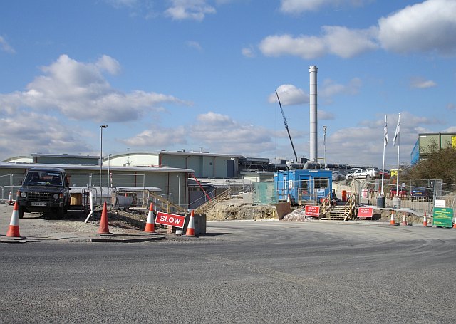
120:Integrated waste disposal facility, Allington
8:
838:
774:
366:– to copy, distribute and transmit the work
1222:
1187:Allington Quarry Waste Management Facility
1120:
427:
1197:The following other wikis use this file:
656:https://www.geograph.org.uk/photo/133813
1479:
1469:
1459:
1451:
1441:
1433:
1425:
1415:
1405:
1397:
1387:
1379:
1369:
1361:
1353:
1342:
1334:
1326:
1318:
1310:
1302:
1294:
1283:
1275:
1264:
1254:
1244:
1234:
1184:
1096:
1080:
1060:
1044:
1026:
1010:
989:
973:
955:
939:
918:
902:
862:
846:
798:
782:
754:
738:
720:
704:
633:
617:
597:
581:
561:
545:
478:
462:
445:
442:
423:
416:
235:
185:
499:https://www.geograph.org.uk/profile/93
264:View this and other nearby images on:
214:View this and other nearby images on:
1224:
7:
311:and is licensed for reuse under the
1109:
347:Attribution-Share Alike 2.0 Generic
335:
330:
315:Attribution-ShareAlike 2.0 license.
1215:
436:
430:
321:
298:
103:
49:
435:
1277:Date and time of data generation
785:coordinates of the point of view
421:
377:Under the following conditions:
342:This file is licensed under the
334:
329:
323:
291:
270:
256:
248:
220:
206:
198:
70:
31:
21:
1163:File Upload Bot (Magnus Manske)
418:
46:No higher resolution available.
14:
636:file available on the internet
417:
299:This image was taken from the
26:
1:
1412:Flash did not fire, auto mode
849:coordinates of depicted place
800:51°17'32.237"N, 0°29'40.420"E
36:
671:Geograph Britain and Ireland
507:object of statement has role
443:Items portrayed in this file
247:
197:
1355:Date and time of digitizing
864:51°17'33.14"N, 0°29'36.24"E
1503:
1201:Usage on www.wikidata.org
391:same or compatible license
1320:File change date and time
1110:
16:
757:Sony Cyber-shot DSC-P200
679:geograph.org.uk image ID
420:
357:
77:This is a file from the
1427:Custom image processing
1167:
164:
154:
134:
127:
124:
113:
81:. Information from its
1363:Image compression mode
305:this photograph's page
276:51.292540; 0.493400
226:51.292288; 0.494561
84:description page there
1381:Maximum land aperture
1304:Horizontal resolution
1251:1/640 sec (0.0015625)
1146:17:25, 1 October 2009
148:geograph_org2commons
1358:13:53, 6 March 2006
1328:Y and C positioning
1323:13:53, 6 March 2006
1312:Vertical resolution
1280:13:53, 6 March 2006
1226:Camera manufacturer
372:– to adapt the work
1453:Scene capture type
1448:Auto white balance
522:author name string
1490:
1489:
1193:Global file usage
1175:
840:
776:
584:copyright license
429:
320:
319:
303:collection. See
281:
280:
231:
230:
180:
179:
173:
170:Reusing this file
142:; transferred by
99:
98:
79:Wikimedia Commons
32:Global file usage
1494:
1336:Exposure Program
1223:
1158:
994:
923:
886:
885:
880:
822:
821:
816:
688:
683:
673:
668:
658:
653:
649:described at URL
548:copyright status
529:
526:
516:
511:
501:
496:
413:
410:
407:
404:
401:
393:as the original.
355:
344:Creative Commons
338:
337:
333:
332:
327:
326:
313:Creative Commons
301:Geograph project
295:
288:
277:
274:
260:
259:
253:
252:
251:
245:
244:
233:
227:
224:
210:
209:
203:
202:
201:
195:
194:
183:
167:
130:
117:
111:
95:
74:
73:
67:
61:
59:
1502:
1501:
1497:
1496:
1495:
1493:
1492:
1491:
1384:3 APEX (f/2.83)
1211:
1191:
1183:
1176:
1164:
1156:
1112:
1111:
1108:
1107:
1106:
1105:
1104:
1103:
1102:
1101:
1099:
1089:
1088:
1087:
1085:
1074:
1073:
1072:
1071:
1070:
1069:
1068:
1067:
1065:
1053:
1052:
1051:
1049:
1038:
1037:
1036:
1035:
1034:
1033:
1032:
1031:
1029:
1019:
1018:
1017:
1015:
1004:
1003:
1002:
1001:
1000:
999:
998:
997:
995:
992:
982:
981:
980:
978:
967:
966:
965:
964:
963:
962:
961:
960:
958:
948:
947:
946:
944:
933:
932:
931:
930:
929:
928:
927:
926:
924:
921:
911:
910:
909:
907:
896:
895:
894:
893:
892:
891:
890:
889:
888:
887:
883:
881:
878:
869:
868:
867:
865:
855:
854:
853:
851:
832:
831:
830:
829:
828:
827:
826:
825:
824:
823:
819:
817:
814:
805:
804:
803:
801:
791:
790:
789:
787:
768:
767:
766:
765:
764:
763:
762:
761:
759:
747:
746:
745:
743:
732:
731:
730:
729:
728:
727:
726:
725:
723:
713:
712:
711:
709:
698:
697:
696:
695:
694:
693:
692:
691:
690:
689:
684:
681:
675:
674:
669:
666:
660:
659:
654:
651:
642:
641:
640:
638:
626:
625:
624:
622:
611:
610:
609:
608:
607:
606:
605:
604:
602:
590:
589:
588:
586:
575:
574:
573:
572:
571:
570:
569:
568:
566:
554:
553:
552:
550:
539:
538:
537:
536:
535:
534:
533:
532:
531:
530:
527:
524:
518:
517:
512:
509:
503:
502:
497:
494:
485:
484:
483:
481:
471:
470:
469:
467:
456:
455:
454:
453:
452:
450:
434:
433:
432:
415:
414:
411:
408:
405:
402:
399:
398:
356:
353:
350:
339:
316:
286:
275:
249:
240:
239:
236:Object location
225:
199:
190:
189:
186:Camera location
181:
140:geograph.org.uk
115:
108:
101:
100:
89:
88:
87:is shown below.
63:
57:
55:
48:
47:
12:
11:
5:
1500:
1498:
1488:
1487:
1484:
1478:
1477:
1474:
1468:
1467:
1464:
1458:
1457:
1454:
1450:
1449:
1446:
1440:
1439:
1436:
1432:
1431:
1430:Normal process
1428:
1424:
1423:
1420:
1414:
1413:
1410:
1404:
1403:
1400:
1396:
1395:
1392:
1386:
1385:
1382:
1378:
1377:
1374:
1368:
1367:
1364:
1360:
1359:
1356:
1352:
1351:
1348:
1341:
1340:
1339:Normal program
1337:
1333:
1332:
1329:
1325:
1324:
1321:
1317:
1316:
1313:
1309:
1308:
1305:
1301:
1300:
1297:
1293:
1292:
1289:
1282:
1281:
1278:
1274:
1273:
1270:
1263:
1262:
1259:
1253:
1252:
1249:
1243:
1242:
1237:
1233:
1232:
1227:
1214:
1210:
1209:
1208:
1207:
1195:
1194:
1190:
1189:
1181:
1180:
1179:
1174:
1173:
1170:User:Fintan264
1166:
1162:
1159:
1153:
1148:
1143:
1139:
1138:
1135:
1132:
1129:
1126:
1123:
1116:
1115:
1100:
1097:
1095:
1094:
1093:
1092:
1091:
1090:
1086:
1081:
1079:
1078:
1077:
1076:
1075:
1066:
1061:
1059:
1058:
1057:
1056:
1055:
1054:
1050:
1045:
1043:
1042:
1041:
1040:
1039:
1030:
1027:
1025:
1024:
1023:
1022:
1021:
1020:
1016:
1011:
1009:
1008:
1007:
1006:
1005:
996:
990:
988:
987:
986:
985:
984:
983:
979:
974:
972:
971:
970:
969:
968:
959:
956:
954:
953:
952:
951:
950:
949:
945:
940:
938:
937:
936:
935:
934:
925:
919:
917:
916:
915:
914:
913:
912:
908:
903:
901:
900:
899:
898:
897:
874:
873:
872:
871:
870:
866:
863:
861:
860:
859:
858:
857:
856:
852:
847:
845:
844:
843:
842:
836:
810:
809:
808:
807:
806:
802:
799:
797:
796:
795:
794:
793:
792:
788:
783:
781:
780:
779:
778:
772:
760:
755:
753:
752:
751:
750:
749:
748:
744:
739:
737:
736:
735:
734:
733:
724:
721:
719:
718:
717:
716:
715:
714:
710:
705:
703:
702:
701:
700:
699:
677:
676:
662:
661:
647:
646:
645:
644:
643:
639:
634:
632:
631:
630:
629:
628:
627:
623:
620:source of file
618:
616:
615:
614:
613:
612:
603:
598:
596:
595:
594:
593:
592:
591:
587:
582:
580:
579:
578:
577:
576:
567:
562:
560:
559:
558:
557:
556:
555:
551:
546:
544:
543:
542:
541:
540:
520:
519:
505:
504:
490:
489:
488:
487:
486:
482:
479:
477:
476:
475:
474:
473:
472:
468:
463:
461:
460:
459:
458:
457:
451:
446:
444:
441:
440:
439:
438:
437:
426:
425:
422:
419:
397:
396:
395:
394:
384:
375:
374:
373:
367:
360:You are free:
351:
341:
340:
322:
318:
317:
296:
285:
282:
279:
278:
268:
262:
237:
229:
228:
218:
212:
187:
178:
177:
174:
162:
161:
156:
152:
151:
144:User:Fintan264
136:
132:
131:
126:
122:
121:
118:
109:
107:
104:
102:
97:
96:
75:
65:
64:
45:
41:
40:
39:
34:
29:
24:
19:
13:
10:
9:
6:
4:
3:
2:
1499:
1485:
1483:
1480:
1475:
1473:
1470:
1465:
1463:
1460:
1455:
1452:
1447:
1445:
1444:White balance
1442:
1438:Auto exposure
1437:
1435:Exposure mode
1434:
1429:
1426:
1421:
1419:
1416:
1411:
1409:
1406:
1401:
1398:
1393:
1391:
1390:Metering mode
1388:
1383:
1380:
1375:
1373:
1372:Exposure bias
1370:
1365:
1362:
1357:
1354:
1349:
1346:
1343:
1338:
1335:
1330:
1327:
1322:
1319:
1314:
1311:
1306:
1303:
1298:
1295:
1290:
1288:
1284:
1279:
1276:
1271:
1268:
1265:
1260:
1258:
1255:
1250:
1248:
1247:Exposure time
1245:
1241:
1238:
1235:
1231:
1228:
1225:
1221:
1218:
1212:
1206:
1203:
1202:
1200:
1199:
1198:
1192:
1188:
1185:
1177:
1171:
1165:
1160:
1154:
1152:
1149:
1147:
1144:
1141:
1140:
1136:
1133:
1130:
1127:
1124:
1122:
1121:
1119:
1113:
1084:
1064:
1048:
1014:
977:
943:
906:
905:exposure time
877:
850:
813:
786:
758:
742:
741:captured with
708:
687:
680:
672:
665:
657:
650:
637:
621:
601:
585:
565:
549:
523:
515:
508:
500:
493:
466:
449:
403:CC BY-SA 2.0
392:
388:
385:
382:
379:
378:
376:
371:
368:
365:
362:
361:
359:
358:
352:Attribution:
348:
345:
328:
314:
310:
306:
302:
297:
294:
290:
289:
283:
273:
269:
267:
266:OpenStreetMap
263:
261:
243:
238:
234:
223:
219:
217:
216:OpenStreetMap
213:
211:
193:
188:
184:
175:
171:
166:
163:
160:
157:
153:
149:
145:
141:
137:
133:
123:
119:
112:
105:
93:
86:
85:
80:
76:
69:
68:
62:
53:
44:
38:
35:
33:
30:
28:
25:
23:
20:
18:
15:
1399:Light source
1287:focal length
1236:Camera model
1219:
1216:
1196:
1117:
1114:File history
976:focal length
722:6 March 2006
514:photographer
386:
380:
369:
363:
308:
246:
196:
129:6 March 2006
92:You can help
82:
50:
22:File history
1418:Color space
1296:Orientation
1047:instance of
564:copyrighted
528:Penny Mayes
387:share alike
381:attribution
354:Penny Mayes
309:Penny Mayes
159:Penny Mayes
114:Description
1472:Saturation
1178:File usage
1155:640 × 455
1131:Dimensions
1098:image/jpeg
1083:media type
1063:photograph
993:millimetre
920:0.0015625
480:some value
165:Permission
58:image/jpeg
27:File usage
1482:Sharpness
1267:ISO speed
1128:Thumbnail
1125:Date/Time
1013:ISO speed
707:inception
284:Licensing
1462:Contrast
1456:Standard
1331:Co-sited
1257:F-number
1240:DSC-P200
1213:Metadata
1205:Q4732696
942:f-number
664:operator
424:Captions
370:to remix
364:to share
349:license.
37:Metadata
1402:Unknown
1394:Pattern
1347:version
1157:(84 KB)
1142:current
1137:Comment
876:heading
835:heading
812:heading
771:heading
465:creator
448:depicts
428:English
106:Summary
54:
1486:Normal
1476:Normal
1466:Normal
1315:72 dpi
1307:72 dpi
1299:Normal
1291:7.9 mm
1269:rating
922:second
884:degree
839:degree
820:degree
775:degree
686:133813
254:
204:
155:Author
146:using
135:Source
1408:Flash
1285:Lens
1261:f/5.6
138:From
1422:sRGB
1345:Exif
1230:SONY
1134:User
991:7.9
882:270
818:270
412:true
409:true
125:Date
17:File
1350:2.2
1272:100
1028:100
957:5.6
492:URL
879::
815::
682::
667::
652::
525::
510::
495::
1376:0
1366:8
172:)
168:(
150:.
94:.
60:)
Text is available under the Creative Commons Attribution-ShareAlike License. Additional terms may apply.
_region:GB-GBN_heading:270.00&language=en)
