348:
281:
231:
273:
223:
295:
245:
316:
354:
359:
72:
824:"}},"text\/plain":{"en":{"":"heading"}}},"{\"value\":{\"amount\":\"+270\",\"unit\":\"http:\\\/\\\/www.wikidata.org\\\/entity\\\/Q28390\"},\"type\":\"quantity\"}":{"text\/html":{"en":{"P7787":"270
760:"}},"text\/plain":{"en":{"":"heading"}}},"{\"value\":{\"amount\":\"+270\",\"unit\":\"http:\\\/\\\/www.wikidata.org\\\/entity\\\/Q28390\"},\"type\":\"quantity\"}":{"text\/html":{"en":{"P7787":"270
820:
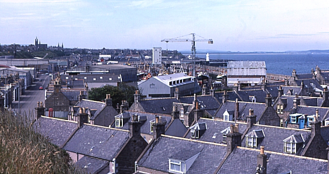
943:== {{int:filedesc}} == {{Information |description={{en|1=Ianstown. Ianstown is one of the villages linked together to form the town of Buckie. The crane is at Jones Buckie Shipyard, and the harbour is beyond.}} |date=1983-07-17 |source=From [http://www.g
264:
214:
406:– You must give appropriate credit, provide a link to the license, and indicate if changes were made. You may do so in any reasonable manner, but not in any way that suggests the licensor endorses you or your use.
43:
821:
757:
83:
51:
126:
Ianstown. Ianstown is one of the villages linked together to form the town of Buckie. The crane is at Jones Buckie
Shipyard, and the harbour is beyond.
692:
622:
586:
288:
238:
712:
323:
1008:
This file contains additional information, probably added from the digital camera or scanner used to create or digitize it.
413:
549:
862:
835:
798:
771:
720:
676:
570:
542:
529:
514:
735:
705:
642:
606:
487:
470:
310:
369:
1011:
If the file has been modified from its original state, some details may not fully reflect the modified file.
925:
920:
42:
412:– If you remix, transform, or build upon the material, you must distribute your contributions under the
330:
on the
Geograph website for the photographer's contact details. The copyright on this image is owned by
936:
366:
828:"}},"text\/plain":{"en":{"P7787":"270 degree"}}}}": -->
764:"}},"text\/plain":{"en":{"P7787":"270 degree"}}}}": -->
91:
183:
742:
727:
167:
521:
294:
244:
335:
78:
135:
278:
228:
146:
156:
957:
315:
327:
893:
Click on a date/time to view the file as it appeared at that time.
280:
230:
255:
205:
66:
265:
57° 41′ 00″ N, 2° 56′ 53″ W
215:
57° 41′ 01″ N, 2° 56′ 49″ W
454:
Add a one-line explanation of what this file represents
995:
985:
975:
110:
90:
Commons is a freely licensed media file repository.
623:
Creative
Commons Attribution-ShareAlike 2.0 Generic
56:(640 × 338 pixels, file size: 195 KB, MIME type:
423:https://creativecommons.org/licenses/by-sa/2.0
71:
429:Creative Commons Attribution-Share Alike 2.0
347:
8:
825:
761:
389:– to copy, distribute and transmit the work
1013:
895:
450:
968:The following other wikis use this file:
743:https://www.geograph.org.uk/photo/224625
1015:
955:
849:
833:
785:
769:
690:
674:
656:
640:
620:
604:
584:
568:
522:https://www.geograph.org.uk/profile/139
501:
485:
468:
465:
446:
439:
258:
208:
116:Ianstown - geograph.org.uk - 224625.jpg
52:Ianstown_-_geograph.org.uk_-_224625.jpg
287:View this and other nearby images on:
237:View this and other nearby images on:
7:
334:and is licensed for reuse under the
953:The following page uses this file:
884:
370:Attribution-Share Alike 2.0 Generic
358:
353:
338:Attribution-ShareAlike 2.0 license.
1006:
459:
453:
344:
321:
120:
103:
49:
458:
772:coordinates of the point of view
444:
400:Under the following conditions:
365:This file is licensed under the
357:
352:
346:
314:
293:
279:
271:
243:
229:
221:
70:
31:
21:
441:
121:
46:No higher resolution available.
14:
693:file available on the internet
440:
322:This image was taken from the
26:
1:
836:coordinates of depicted place
36:
713:Geograph Britain and Ireland
543:object of statement has role
466:Items portrayed in this file
270:
220:
1037:
992:Usage on www.wikidata.org
982:Usage on fr.wikipedia.org
972:Usage on eu.wikipedia.org
414:same or compatible license
885:
196:Anne Burgess /
177:Anne Burgess /
16:
851:57°41'0.2"N, 2°56'52.8"W
787:57°41'0.6"N, 2°56'49.2"W
721:geograph.org.uk image ID
443:
380:
77:This is a file from the
942:
168:required by the license
152:
141:
134:
131:
113:
81:. Information from its
921:22:42, 31 January 2010
328:this photograph's page
299:57.683400; -2.948000
249:57.683500; -2.947000
84:description page there
395:– to adapt the work
530:author name string
1024:
1023:
964:Global file usage
946:
827:
763:
607:copyright license
452:
343:
342:
326:collection. See
304:
303:
254:
253:
203:
202:
171:
99:
98:
79:Wikimedia Commons
32:Global file usage
1028:
1014:
933:
873:
872:
867:
809:
808:
803:
745:
740:
736:described at URL
730:
725:
715:
710:
571:copyright status
552:
547:
537:
534:
524:
519:
436:
433:
430:
427:
424:
416:as the original.
378:
367:Creative Commons
361:
360:
356:
355:
350:
349:
336:Creative Commons
324:Geograph project
318:
311:
300:
297:
283:
282:
276:
275:
274:
268:
267:
256:
250:
247:
233:
232:
226:
225:
224:
218:
217:
206:
165:
137:
125:
117:
111:
95:
74:
73:
67:
61:
59:
1036:
1035:
1031:
1030:
1029:
1027:
1026:
1025:
1002:
962:
947:
939:
931:
887:
886:
883:
882:
881:
880:
879:
878:
877:
876:
875:
874:
870:
868:
865:
856:
855:
854:
852:
842:
841:
840:
838:
819:
818:
817:
816:
815:
814:
813:
812:
811:
810:
806:
804:
801:
792:
791:
790:
788:
778:
777:
776:
774:
755:
754:
753:
752:
751:
750:
749:
748:
747:
746:
741:
738:
732:
731:
726:
723:
717:
716:
711:
708:
699:
698:
697:
695:
683:
682:
681:
679:
668:
667:
666:
665:
664:
663:
662:
661:
659:
649:
648:
647:
645:
634:
633:
632:
631:
630:
629:
628:
627:
625:
613:
612:
611:
609:
598:
597:
596:
595:
594:
593:
592:
591:
589:
577:
576:
575:
573:
562:
561:
560:
559:
558:
557:
556:
555:
554:
553:
548:
545:
539:
538:
535:
532:
526:
525:
520:
517:
508:
507:
506:
504:
494:
493:
492:
490:
479:
478:
477:
476:
475:
473:
457:
456:
455:
438:
437:
434:
431:
428:
425:
422:
421:
379:
376:
373:
362:
339:
309:
298:
272:
263:
262:
259:Object location
248:
222:
213:
212:
209:Camera location
204:
193:
186:
174:
147:geograph.org.uk
127:
115:
108:
101:
100:
89:
88:
87:is shown below.
63:
57:
55:
48:
47:
12:
11:
5:
1034:
1032:
1022:
1021:
1018:
1005:
1001:
1000:
999:
998:
990:
989:
988:
980:
979:
978:
966:
965:
961:
960:
951:
950:
945:
944:
941:
937:
934:
928:
923:
918:
914:
913:
910:
907:
904:
901:
898:
891:
890:
861:
860:
859:
858:
857:
853:
850:
848:
847:
846:
845:
844:
843:
839:
834:
832:
831:
830:
829:
823:
797:
796:
795:
794:
793:
789:
786:
784:
783:
782:
781:
780:
779:
775:
770:
768:
767:
766:
765:
759:
734:
733:
719:
718:
704:
703:
702:
701:
700:
696:
691:
689:
688:
687:
686:
685:
684:
680:
677:source of file
675:
673:
672:
671:
670:
669:
660:
657:
655:
654:
653:
652:
651:
650:
646:
641:
639:
638:
637:
636:
635:
626:
621:
619:
618:
617:
616:
615:
614:
610:
605:
603:
602:
601:
600:
599:
590:
585:
583:
582:
581:
580:
579:
578:
574:
569:
567:
566:
565:
564:
563:
541:
540:
528:
527:
513:
512:
511:
510:
509:
505:
502:
500:
499:
498:
497:
496:
495:
491:
486:
484:
483:
482:
481:
480:
474:
469:
467:
464:
463:
462:
461:
460:
449:
448:
445:
442:
420:
419:
418:
417:
407:
398:
397:
396:
390:
383:You are free:
374:
364:
363:
345:
341:
340:
319:
308:
305:
302:
301:
291:
285:
260:
252:
251:
241:
235:
210:
201:
200:
194:
191:
188:
187:
182:
175:
172:
160:
159:
154:
150:
149:
143:
139:
138:
133:
129:
128:
118:
109:
107:
104:
102:
97:
96:
75:
65:
64:
45:
41:
40:
39:
34:
29:
24:
19:
13:
10:
9:
6:
4:
3:
2:
1033:
1019:
1016:
1012:
1009:
1003:
997:
994:
993:
991:
987:
984:
983:
981:
977:
974:
973:
971:
970:
969:
963:
959:
956:
954:
948:
940:
935:
929:
927:
924:
922:
919:
916:
915:
911:
908:
905:
902:
899:
897:
896:
894:
888:
864:
837:
800:
773:
744:
737:
729:
722:
714:
707:
694:
678:
644:
624:
608:
588:
572:
551:
544:
531:
523:
516:
489:
472:
426:CC BY-SA 2.0
415:
411:
408:
405:
402:
401:
399:
394:
391:
388:
385:
384:
382:
381:
375:Attribution:
371:
368:
351:
337:
333:
329:
325:
320:
317:
313:
312:
306:
296:
292:
290:
289:OpenStreetMap
286:
284:
266:
261:
257:
246:
242:
240:
239:OpenStreetMap
236:
234:
216:
211:
207:
199:
195:
190:
189:
185:
181: /
180:
176:
169:
164:
162:
161:
158:
155:
151:
148:
144:
140:
130:
124:
119:
112:
105:
93:
86:
85:
80:
76:
69:
68:
62:
53:
44:
38:
35:
33:
30:
28:
25:
23:
20:
18:
15:
1010:
1007:
967:
952:
892:
889:File history
658:17 July 1983
550:photographer
536:Anne Burgess
409:
403:
392:
386:
377:Anne Burgess
332:Anne Burgess
331:
269:
219:
197:
184:CC BY-SA 2.0
178:
157:Anne Burgess
136:17 July 1983
122:
92:You can help
82:
50:
22:File history
938:GeographBot
587:copyrighted
410:share alike
404:attribution
163:Attribution
114:Description
1017:_error
949:File usage
930:640 × 338
906:Dimensions
503:some value
58:image/jpeg
27:File usage
903:Thumbnail
900:Date/Time
643:inception
307:Licensing
192:InfoField
173:InfoField
123:English:
1004:Metadata
996:Q5983376
986:Ianstown
976:Ianstown
958:Ianstown
932:(195 KB)
706:operator
447:Captions
393:to remix
387:to share
372:license.
198:Ianstown
179:Ianstown
37:Metadata
917:current
912:Comment
863:heading
822:heading
799:heading
758:heading
488:creator
471:depicts
451:English
106:Summary
54:
871:degree
826:degree
807:degree
762:degree
728:224625
277:
227:
153:Author
142:Source
145:From
909:User
869:270
805:270
435:true
432:true
132:Date
17:File
515:URL
866::
802::
739::
724::
709::
546::
533::
518::
1020:0
170:)
166:(
94:.
60:)
Text is available under the Creative Commons Attribution-ShareAlike License. Additional terms may apply.
_heading:270.00&language=en)
_heading:270.00&language=en)
