43:
292:
320:
262:
326:
331:
99:
872:
841:
889:{{Information |Description={{en|The island of Ireland, showing international border between Northern Ireland and Republic of Ireland, traditional provinces, traditional counties, and local authority areas in the Republic of Ireland and Northern Ireland.}}
858:
Per the Local
Government Reform Act 2014, joining both Tipperarys and both Waterfords (and removing Limerick City code). Colouring in islands, cleaning up and grouping code to remove stray objects and show Galway and Lough
372:– You must give appropriate credit, provide a link to the license, and indicate if changes were made. You may do so in any reasonable manner, but not in any way that suggests the licensor endorses you or your use.
148:
The island of
Ireland, showing international border between Northern Ireland and Republic of Ireland, traditional provinces, traditional counties, and local authority areas in the Republic of Ireland and Northern
438:{{Information |Description={{de|Positionskarte von ]}} Quadratische Plattkarte, N-S-Streckung 170 %. Geographische Begrenzung der Karte: * N: 55.6° N * S: 51.2° N * W: 11.0° W * O: 5.0° W {{en|Location
1700:
1363:
1358:
1173:
302:
73:
69:
65:
61:
57:
53:
47:
110:
82:
871:
866:
416:
286:
185:
171:
198:
785:
552:
516:
1178:
226:
207:
1711:
This file contains additional information, probably added from the digital camera or scanner used to create or digitize it.
379:
751:
714:
677:
640:
606:
500:
993:
778:
572:
536:
483:
433:
423:
222:
1353:
1348:
1328:
1288:
1198:
1088:
189:
341:
1714:
If the file has been modified from its original state, some details may not fully reflect the modified file.
1373:
1243:
1208:
918:
1188:
903:
899:
The following pages on the
English Knowledge (XXG) use this file (pages on other projects are not listed):
840:
835:
42:
1368:
1213:
1078:
1003:
998:
958:
378:– If you remix, transform, or build upon the material, you must distribute your contributions under the
1038:
338:
1391:
1283:
1258:
1253:
1118:
1333:
1248:
978:
851:
118:
953:
447:
1278:
1108:
280:, which means that it has been digitally altered from its original version. Modifications:
272:
1298:
1138:
938:
239:
202:
193:
1033:
158:
105:
313:
I, the copyright holder of this work, hereby publish it under the following license:
1343:
1158:
1098:
1083:
1073:
1013:
882:
291:
1616:
1521:
1338:
1193:
1183:
1113:
1043:
983:
963:
948:
215:
211:
1318:
1268:
1263:
1028:
1018:
973:
968:
933:
928:
1491:
297:
235:
1506:
1323:
1293:
1238:
1223:
1163:
1143:
1133:
1123:
1093:
988:
1511:
261:
1218:
1148:
1128:
1103:
1068:
1063:
943:
1631:
1496:
1273:
1168:
1153:
1053:
1048:
1023:
913:
1671:
1456:
1411:
1308:
1303:
1233:
1203:
1058:
1008:
923:
1621:
1626:
1441:
808:
Click on a date/time to view the file as it appeared at that time.
1313:
1228:
908:
1591:
1571:
1486:
1461:
255:
93:
87:(SVG file, nominally 1,450 × 1,807 pixels, file size: 642 KB)
1606:
1601:
1561:
1446:
1421:
1551:
1541:
1364:
Knowledge (XXG):Graphics Lab/Map workshop/Archive/Oct 2014
1359:
Knowledge (XXG):Graphics Lab/Map workshop/Archive/May 2020
1531:
1476:
1431:
412:
This image is a derivative work of the following images:
1676:
1666:
1686:
1681:
1611:
1596:
1451:
1691:
1466:
282:
Coloured in regions with county of article highlighted
1661:
1636:
1586:
1651:
1641:
1516:
553:
Creative
Commons Attribution-ShareAlike 3.0 Unported
132:
117:
Commons is a freely licensed media file repository.
1656:
1401:
1646:
1581:
1501:
1436:
1426:
389:https://creativecommons.org/licenses/by-sa/3.0
98:
395:Creative Commons Attribution-Share Alike 3.0
319:
8:
355:– to copy, distribute and transmit the work
46:Size of this PNG preview of this SVG file:
1716:
810:
463:
1384:The following other wikis use this file:
1174:Laytown–Bettystown–Mornington–Donacarney
767:b25342924c77bc832bfaed5e4a1aa9f3569dc1ac
284:. The original can be viewed here:
138:Island of Ireland location map Meath.svg
1726:
1718:
901:
765:
749:
728:
712:
691:
675:
654:
638:
620:
604:
586:
570:
550:
534:
514:
498:
481:
478:
459:
452:
417:File:Island_of_Ireland_location_map.svg
1617:Txantiloi:Meath konderriko udalerriak
7:
342:Attribution-Share Alike 3.0 Unported
799:
330:
325:
273:
271:
1709:
472:
466:
316:
312:
287:Island of Ireland location map.svg
186:Island_of_Ireland_location_map.svg
172:Island_of_Ireland_location_map.svg
142:
130:
80:
471:
199:Northern_Ireland_location_map.svg
1522:Wikipedista:Draceane/Plány/Irsko
457:
428:Fix incorrectly coloured isands.
366:Under the following conditions:
337:This file is licensed under the
329:
324:
318:
290:
260:
97:
31:
21:
454:
208:Northern_Ireland_-_Counties.png
143:
14:
1179:List of Ireland-related topics
453:
26:
1:
36:
479:Items portrayed in this file
1632:Ashbourne (Meath konderria)
1548:Usage on en.wikivoyage.org
1538:Usage on de.wikivoyage.org
1473:Usage on ceb.wikipedia.org
1398:Usage on ast.wikipedia.org
994:Castlejordan (civil parish)
419:licensed with Cc-by-sa-3.0
1748:
1578:Usage on eu.wikipedia.org
1568:Usage on es.wikipedia.org
1558:Usage on eo.wikipedia.org
1528:Usage on da.wikipedia.org
1507:Oldcastle (hrabství Meath)
1483:Usage on cs.wikipedia.org
1418:Usage on ca.wikipedia.org
1408:Usage on bg.wikipedia.org
1388:Usage on ar.wikipedia.org
380:same or compatible license
1672:Bective (Meath konderria)
800:
436:1450x1807 (679744 Bytes)
426:1450x1807 (679207 Bytes)
16:
1512:Enfield (hrabství Meath)
1354:User:Markreidyhp/vil met
1349:User:Drog lad/mornington
1329:Summerhill, County Meath
1289:Robinstown, County Meath
1199:Mornington, County Meath
1089:Gormanston, County Meath
456:
346:
296:. Modifications made by
190:Ireland_location_map.svg
104:This is a file from the
1622:Kells (Meath konderria)
1374:Template:Meath-geo-stub
1244:Oldcastle, County Meath
1209:Mountfortescue Hillfort
919:Ashbourne, County Meath
888:
857:
179:
165:
157:
154:
135:
108:. Information from its
1627:Trim (Meath konderria)
1497:Kells (hrabství Meath)
1492:Šablona:Hrabství Meath
1442:Plantilla:Comtat Meath
1189:Longwood, County Meath
904:2005 Meath by-election
111:description page there
1369:Template:County Meath
1214:Moylagh, County Meath
1079:Enfield, County Meath
1004:Clonard, County Meath
999:Castletown-Kilpatrick
959:Bective, County Meath
434:Rannpháirtí anaithnid
432:2010-03-03T22:19:29Z
424:Rannpháirtí anaithnid
422:2010-03-06T20:43:33Z
223:Rannpháirtí anaithnid
212:Maximilian Dörrbecker
1039:Donore, County Meath
979:Butlin's Mosney
779:determination method
74:1,450 × 1,807 pixels
70:1,643 × 2,048 pixels
1592:Lankide:Euskaldunaa
1572:Condados de Irlanda
1284:River Dee (Ireland)
1259:R149 road (Ireland)
1254:R135 road (Ireland)
1119:Kells, County Meath
867:01:00, 19 July 2010
408:Original upload log
361:– to adapt the work
159:19 July 2010, 00:55
52:Other resolutions:
1334:Trim, County Meath
1249:Pass, County Meath
836:09:16, 3 July 2020
66:822 × 1,024 pixels
1735:
1734:
1701:more global usage
1462:Oldcastle (Meath)
1380:Global file usage
954:Beamore, Drogheda
892:
537:copyright license
465:
309:
308:
274:retouched picture
250:
249:
234:derivative work:
221:derivative work:
126:
125:
106:Wikimedia Commons
32:Global file usage
1739:
1717:
1279:Ratoath (barony)
1109:Johnstown, Navan
879:
848:
788:
783:
733:
696:
659:
501:copyright status
402:
399:
396:
393:
390:
382:as the original.
339:Creative Commons
333:
332:
328:
327:
322:
321:
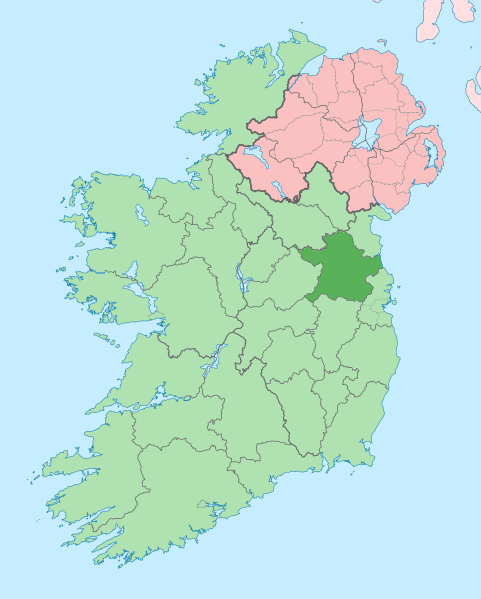
304:
294:
277:
275:
264:
256:
242:
229:
160:
147:
139:
133:
122:
101:
100:
94:
88:
77:
62:616 × 768 pixels
58:385 × 480 pixels
54:192 × 240 pixels
48:481 × 599 pixels
1747:
1746:
1742:
1741:
1740:
1738:
1737:
1736:
1705:
1607:Meath konderria
1562:Graflando Meath
1422:Comtat de Meath
1378:
900:
893:
885:
877:
854:
846:
802:
801:
798:
797:
796:
795:
794:
793:
792:
791:
790:
789:
784:
781:
772:
771:
770:
768:
758:
757:
756:
754:
743:
742:
741:
740:
739:
738:
737:
736:
734:
731:
721:
720:
719:
717:
706:
705:
704:
703:
702:
701:
700:
699:
697:
694:
684:
683:
682:
680:
669:
668:
667:
666:
665:
664:
663:
662:
660:
657:
647:
646:
645:
643:
632:
631:
630:
629:
628:
627:
626:
625:
623:
613:
612:
611:
609:
598:
597:
596:
595:
594:
593:
592:
591:
589:
579:
578:
577:
575:
564:
563:
562:
561:
560:
559:
558:
557:
555:
543:
542:
541:
539:
528:
527:
526:
525:
524:
523:
522:
521:
519:
507:
506:
505:
503:
492:
491:
490:
489:
488:
486:
470:
469:
468:
410:
405:
404:
403:
400:
397:
394:
391:
388:
387:
345:
334:
315:
314:
265:
251:
240:
227:
150:
137:
128:
127:
116:
115:
114:is shown below.
90:
86:
79:
78:
51:
12:
11:
5:
1745:
1743:
1733:
1732:
1729:
1725:
1724:
1721:
1708:
1703:of this file.
1697:
1696:
1695:
1694:
1689:
1684:
1679:
1674:
1669:
1664:
1659:
1654:
1649:
1644:
1639:
1634:
1629:
1624:
1619:
1614:
1609:
1604:
1599:
1594:
1589:
1584:
1576:
1575:
1574:
1566:
1565:
1564:
1556:
1555:
1554:
1546:
1545:
1544:
1536:
1535:
1534:
1526:
1525:
1524:
1519:
1514:
1509:
1504:
1499:
1494:
1489:
1487:Hrabství Meath
1481:
1480:
1479:
1471:
1470:
1469:
1464:
1459:
1457:Baile Átha Buí
1454:
1449:
1444:
1439:
1434:
1429:
1424:
1416:
1415:
1414:
1406:
1405:
1404:
1396:
1395:
1394:
1382:
1381:
1377:
1376:
1371:
1366:
1361:
1356:
1351:
1346:
1341:
1336:
1331:
1326:
1321:
1316:
1311:
1306:
1301:
1296:
1291:
1286:
1281:
1276:
1271:
1266:
1261:
1256:
1251:
1246:
1241:
1236:
1231:
1226:
1221:
1216:
1211:
1206:
1201:
1196:
1191:
1186:
1181:
1176:
1171:
1166:
1161:
1156:
1151:
1146:
1141:
1139:Kilmainhamwood
1136:
1131:
1126:
1121:
1116:
1111:
1106:
1101:
1096:
1091:
1086:
1081:
1076:
1071:
1066:
1061:
1056:
1051:
1046:
1041:
1036:
1031:
1026:
1021:
1016:
1011:
1006:
1001:
996:
991:
986:
981:
976:
971:
966:
961:
956:
951:
946:
941:
939:Ballinabrackey
936:
931:
926:
921:
916:
911:
906:
898:
897:
896:
891:
890:
887:
883:
880:
876:1,450 × 1,807
874:
869:
864:
861:
860:
856:
852:
849:
845:1,450 × 1,807
843:
838:
833:
829:
828:
825:
822:
819:
816:
813:
806:
805:
777:
776:
775:
774:
773:
769:
766:
764:
763:
762:
761:
760:
759:
755:
750:
748:
747:
746:
745:
744:
735:
729:
727:
726:
725:
724:
723:
722:
718:
713:
711:
710:
709:
708:
707:
698:
692:
690:
689:
688:
687:
686:
685:
681:
676:
674:
673:
672:
671:
670:
661:
655:
653:
652:
651:
650:
649:
648:
644:
639:
637:
636:
635:
634:
633:
624:
621:
619:
618:
617:
616:
615:
614:
610:
605:
603:
602:
601:
600:
599:
590:
587:
585:
584:
583:
582:
581:
580:
576:
571:
569:
568:
567:
566:
565:
556:
551:
549:
548:
547:
546:
545:
544:
540:
535:
533:
532:
531:
530:
529:
520:
515:
513:
512:
511:
510:
509:
508:
504:
499:
497:
496:
495:
494:
493:
487:
482:
480:
477:
476:
475:
474:
473:
467:Meath on a map
462:
461:
458:
455:
446:Uploaded with
443:
442:
441:
440:
430:
409:
406:
386:
385:
384:
383:
373:
364:
363:
362:
356:
349:You are free:
336:
335:
317:
311:
310:
307:
306:
266:
259:
248:
247:
246:
245:
232:
219:
205:
196:
181:
177:
176:
175:
174:
167:
163:
162:
156:
152:
151:
140:
131:
129:
124:
123:
102:
92:
91:
45:
41:
40:
39:
34:
29:
24:
19:
13:
10:
9:
6:
4:
3:
2:
1744:
1730:
1727:
1722:
1719:
1715:
1712:
1706:
1704:
1702:
1693:
1690:
1688:
1685:
1683:
1680:
1678:
1675:
1673:
1670:
1668:
1665:
1663:
1660:
1658:
1655:
1653:
1650:
1648:
1645:
1643:
1640:
1638:
1635:
1633:
1630:
1628:
1625:
1623:
1620:
1618:
1615:
1613:
1610:
1608:
1605:
1603:
1600:
1598:
1595:
1593:
1590:
1588:
1585:
1583:
1580:
1579:
1577:
1573:
1570:
1569:
1567:
1563:
1560:
1559:
1557:
1553:
1550:
1549:
1547:
1543:
1540:
1539:
1537:
1533:
1530:
1529:
1527:
1523:
1520:
1518:
1515:
1513:
1510:
1508:
1505:
1503:
1500:
1498:
1495:
1493:
1490:
1488:
1485:
1484:
1482:
1478:
1475:
1474:
1472:
1468:
1465:
1463:
1460:
1458:
1455:
1453:
1450:
1448:
1445:
1443:
1440:
1438:
1435:
1433:
1430:
1428:
1425:
1423:
1420:
1419:
1417:
1413:
1410:
1409:
1407:
1403:
1400:
1399:
1397:
1393:
1390:
1389:
1387:
1386:
1385:
1379:
1375:
1372:
1370:
1367:
1365:
1362:
1360:
1357:
1355:
1352:
1350:
1347:
1345:
1342:
1340:
1337:
1335:
1332:
1330:
1327:
1325:
1322:
1320:
1317:
1315:
1312:
1310:
1307:
1305:
1302:
1300:
1297:
1295:
1292:
1290:
1287:
1285:
1282:
1280:
1277:
1275:
1272:
1270:
1267:
1265:
1262:
1260:
1257:
1255:
1252:
1250:
1247:
1245:
1242:
1240:
1237:
1235:
1232:
1230:
1227:
1225:
1222:
1220:
1217:
1215:
1212:
1210:
1207:
1205:
1202:
1200:
1197:
1195:
1192:
1190:
1187:
1185:
1182:
1180:
1177:
1175:
1172:
1170:
1167:
1165:
1162:
1160:
1157:
1155:
1152:
1150:
1147:
1145:
1142:
1140:
1137:
1135:
1132:
1130:
1127:
1125:
1122:
1120:
1117:
1115:
1112:
1110:
1107:
1105:
1102:
1100:
1097:
1095:
1092:
1090:
1087:
1085:
1082:
1080:
1077:
1075:
1072:
1070:
1067:
1065:
1062:
1060:
1057:
1055:
1052:
1050:
1047:
1045:
1042:
1040:
1037:
1035:
1034:Donaghpatrick
1032:
1030:
1027:
1025:
1022:
1020:
1017:
1015:
1012:
1010:
1007:
1005:
1002:
1000:
997:
995:
992:
990:
987:
985:
982:
980:
977:
975:
972:
970:
967:
965:
962:
960:
957:
955:
952:
950:
947:
945:
942:
940:
937:
935:
932:
930:
927:
925:
922:
920:
917:
915:
912:
910:
907:
905:
902:
894:
886:
881:
875:
873:
870:
868:
865:
863:
862:
855:
853:Chipmunkdavis
850:
844:
842:
839:
837:
834:
831:
830:
826:
823:
820:
817:
814:
812:
811:
809:
803:
787:
780:
753:
716:
679:
642:
622:image/svg+xml
608:
574:
554:
538:
518:
502:
485:
451:
450:
449:
439:
435:
431:
429:
425:
421:
420:
418:
415:
414:
413:
407:
392:CC BY-SA 3.0
381:
377:
374:
371:
368:
367:
365:
360:
357:
354:
351:
350:
348:
347:
343:
340:
323:
305:
299:
295:
293:
288:
283:
279:
278:
276:
267:
263:
258:
257:
254:
253:
243:
237:
233:
230:
224:
220:
217:
213:
209:
206:
204:
200:
197:
195:
191:
187:
184:
183:
182:
178:
173:
170:
169:
168:
164:
153:
146:
141:
134:
120:
113:
112:
107:
103:
96:
95:
89:
84:
83:Original file
75:
71:
67:
63:
59:
55:
49:
44:
38:
35:
33:
30:
28:
25:
23:
20:
18:
15:
1713:
1710:
1698:
1552:County Meath
1542:County Meath
1532:County Meath
1432:Trim (Meath)
1383:
1344:Yellow Furze
1159:Knightsbrook
1099:Hill of Down
1084:Faughan Hill
1074:Dunshaughlin
1014:County Meath
807:
804:File history
588:19 July 2010
448:derivativeFX
445:
444:
437:
427:
411:
375:
369:
358:
352:
301:
285:
281:
270:
269:
252:
203:NordNordWest
194:NordNordWest
144:
119:You can help
109:
81:
22:File history
1677:Bellewstown
1667:Batterstown
1339:Wilkinstown
1299:Ráth Chairn
1194:Monknewtown
1184:Loch Gabhar
1114:Julianstown
1044:Drumconrath
984:Carlanstown
964:Bellewstown
949:Batterstown
517:copyrighted
376:share alike
370:attribution
268:This is a
136:Description
1723:1449.805px
1687:Boyerstown
1682:Bettystown
1612:Baile Ghib
1602:Ráth Cairn
1597:Monknewton
1452:Baile Ghib
1447:Ráth Cairn
1392:مقاطعة ميث
1319:Stackallan
1269:Rathmolyon
1264:Rath Meave
1029:Donacarney
1019:Crossakiel
974:Boyerstown
969:Bettystown
934:Baile Ghib
929:Augherskea
895:File usage
821:Dimensions
607:media type
27:File usage
1731:1807.07px
1692:Carnaross
1467:Ashbourne
1324:Stamullen
1294:Rossnaree
1239:Oldbridge
1224:Mulhussey
1164:Knockmark
1144:Kilmessan
1134:Kildalkey
1124:Kentstown
1094:Gortloney
989:Carnaross
818:Thumbnail
815:Date/Time
641:data size
573:inception
145:English:
1707:Metadata
1662:Ballivor
1637:Dunboyne
1587:Drogheda
1219:Moynalty
1149:Kilskeer
1129:Kilcloon
1104:Inishmot
1069:Dunderry
1064:Dunboyne
944:Ballivor
878:(815 KB)
847:(642 KB)
752:checksum
656:657,242
460:Captions
359:to remix
353:to share
344:license.
149:Ireland.
37:Metadata
1652:Ardcath
1642:Ratoath
1517:Ratoath
1274:Ratoath
1169:Laytown
1154:Kiltale
1054:Drumree
1049:Drumone
1024:Curraha
914:Ardcath
884:Mabuska
832:current
827:Comment
484:depicts
464:English
298:Mabuska
289::
236:Mabuska
85:
1728:Height
1657:Athboy
1477:An Mhí
1309:Skryne
1304:Siddan
1234:Nobber
1204:Mosney
1059:Duleek
1009:Clonee
924:Athboy
730:1,450
693:1,807
678:height
303:
216:Chumwa
180:Author
166:Source
1720:Width
1699:View
1647:Agher
1582:Navan
1502:Navan
1437:Kells
1427:Navan
1402:Meath
1314:Slane
1229:Navan
909:Agher
786:SHA-1
732:pixel
715:width
695:pixel
161:(UTC)
1412:Мийт
859:Ree.
824:User
658:byte
401:true
398:true
241:talk
228:talk
155:Date
17:File
188:: *
782::
300:.
210::
201::
192::
72:|
68:|
64:|
60:|
56:|
50:.
244:)
238:(
231:)
225:(
218:)
214:(
121:.
76:.
Text is available under the Creative Commons Attribution-ShareAlike License. Additional terms may apply.
