38:
242:
248:
253:
94:
554:
300:– You must give appropriate credit, provide a link to the license, and indicate if changes were made. You may do so in any reasonable manner, but not in any way that suggests the licensor endorses you or your use.
684:
732:
699:
694:
575:, UK. Equirectangular map projection on WGS 84 datum, with N/S stretched 155% Geographic limits: *West: 1.61W *East: 1.05W *North: 50.78N *South: 50.56N |Source=[[w:Ordnance S
634:
837:
60:
56:
52:
48:
42:
105:
609:
73:
340:
689:
827:
822:
231:
599:
1002:
465:
429:
997:
872:
307:
619:
413:
902:
624:
589:
485:
449:
396:
594:
674:
717:
202:
263:
957:
604:
585:
The following pages on the
English Knowledge (XXG) use this file (pages on other projects are not listed):
553:
548:
64:
37:
629:
306:– If you remix, transform, or build upon the material, you must distribute your contributions under the
1017:
977:
952:
260:
639:
1012:
967:
185:
777:
747:
113:
942:
1027:
817:
797:
882:
679:
727:
644:
182:
669:
564:
139:
852:
664:
572:
100:
987:
972:
654:
219:
1037:
892:
659:
649:
206:
171:
807:
614:
847:
772:
380:
Carte (muette, géoréférencée) du relief de l'île de Wight, du
Royaume-Uni
927:
917:
145:
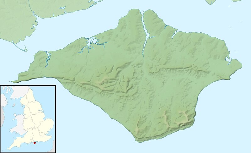
Equirectangular map projection on WGS 84 datum, with N/S stretched 155%
932:
912:
862:
737:
195:
Administrative borders and coastline data from
Boundary-Line product.
762:
521:
Click on a date/time to view the file as it appeared at that time.
685:
User:KnightStryker/sandbox/Freshwater
Independent Lifeboat Station
271:
Contains
Ordnance Survey data © Crown copyright and database right
767:
787:
88:
1003:
Modül:Konum haritası/veri/Birleşik Krallık Wight Adası/belge
1018:
Module:Location map/data/United
Kingdom Isle of Wight/doc
978:
Module:Location map/data/United
Kingdom Isle of Wight/doc
958:
Module:Location map/data/United
Kingdom Isle of Wight/doc
700:
Module:Location map/data/United
Kingdom Isle of Wight/doc
828:モジュール:Location map/data/United Kingdom Isle of Wight/doc
792:
757:
998:
Modül:Konum haritası/veri/Birleşik Krallık Wight Adası
1013:
Module:Location map/data/United
Kingdom Isle of Wight
968:
Module:Location map/data/United Kingdom Isle of Wight
953:
Module:Location map/data/United Kingdom Isle of Wight
802:
695:
Module:Location map/data/United Kingdom Isle of Wight
78:(1,999 × 1,218 pixels, file size: 158 KB, MIME type:
823:モジュール:Location map/data/United Kingdom Isle of Wight
466:
Creative Commons Attribution-ShareAlike 3.0 Unported
127:
112:
Commons is a freely licensed media file repository.
838:ಟೆಂಪ್ಲೇಟು:Location map United Kingdom Isle of Wight
748:
Plantilya:Location map United Kingdom Isle of Wight
943:Template:Location map United Kingdom Isle of Wight
818:Template:Location map United Kingdom Isle of Wight
198:All other geographic data from Meridian 2 product.
1028:Batakan:Location map United Kingdom Isle of Wight
883:Templat:Location map United Kingdom Isle of Wight
635:Sandown and Shanklin Independent Lifeboat Station
778:Plantilla:Mapa de localización de Isla de Wight
873:ഫലകം:Location map United Kingdom Isle of Wight
718:قالب:Location map United Kingdom Isle of Wight
341:File:Isle of Wight UK district map (blank).svg
317:https://creativecommons.org/licenses/by-sa/3.0
93:
571:{{Information |Description=Relief map of the
323:Creative Commons Attribution-Share Alike 3.0
241:
8:
192:Relief data from Land-Form Panorama product.
610:Freshwater Bay Independent Lifeboat Station
283:– to copy, distribute and transmit the work
523:
376:
368:
360:
853:Formula:Charta locatrix Vectae physicalis
710:The following other wikis use this file:
133:Isle of Wight UK relief location map.jpg
988:Mall:Kartposition England Isle of Wight
587:
499:
483:
463:
447:
427:
411:
394:
391:
356:
349:
973:Module:Location map/data/Isle of Wight
690:Module:Location map/data/Isle of Wight
7:
264:Attribution-Share Alike 3.0 Unported
222:, created using Ordnance Survey data
1038:Template:Location map Isle of Wight
893:Sjabloon:Positiekaart Isle of Wight
798:Modèle:Géolocalisation/Île de Wight
512:
364:Relief map of the Isle of Wight, UK
252:
247:
600:Brighstone Grange Lifeboat Station
385:
379:
371:
363:
238:
125:
71:
384:
354:
294:Under the following conditions:
259:This file is licensed under the
251:
246:
240:
92:
31:
21:
351:
14:
949:Usage on simple.wikipedia.org
848:Formula:Charta locatrix Vectae
773:Faro de Punta de St. Catherine
372:Relief-Karte der Isle of Wight
350:
26:
1:
733:Шаблон:ПК Великобритания Уайт
808:Abbaye Sainte-Cécile de Ryde
620:Isle of Wight Jewish Society
392:Items portrayed in this file
1024:Usage on war.wikipedia.org
939:Usage on sco.wikipedia.org
744:Usage on ceb.wikipedia.org
625:Ryde Inshore Rescue Service
590:Atherfield Lifeboat Station
1056:
1034:Usage on zh.wikipedia.org
1009:Usage on uz.wikipedia.org
994:Usage on tr.wikipedia.org
984:Usage on sv.wikipedia.org
964:Usage on si.wikipedia.org
924:Usage on pl.wikibooks.org
909:Usage on pl.wikipedia.org
899:Usage on os.wikipedia.org
889:Usage on nl.wikipedia.org
879:Usage on ms.wikipedia.org
869:Usage on ml.wikipedia.org
859:Usage on lv.wikipedia.org
844:Usage on la.wikipedia.org
834:Usage on kn.wikipedia.org
814:Usage on ja.wikipedia.org
784:Usage on fr.wikipedia.org
754:Usage on es.wikipedia.org
724:Usage on bg.wikipedia.org
714:Usage on ar.wikipedia.org
595:Bembridge Lifeboat Station
308:same or compatible license
675:Yarmouth Lifeboat Station
513:
16:
863:Veidne:VietasKarte Vaita
353:
274:
203:England location map.svg
99:This is a file from the
570:
549:01:41, 29 November 2011
336:
226:
215:
177:
170:
167:
130:
103:. Information from its
928:Moduł:Mapa/dane/GB-IOW
918:Moduł:Mapa/dane/GB-IOW
763:Punta de St. Catherine
605:Brook Lifeboat Station
106:description page there
41:Size of this preview:
933:Moduł:Mapa/dane/Wight
913:Moduł:Mapa/dane/Wight
640:Scratchell's Bay
630:Ryde Lifeboat Station
65:1,999 × 1,218 pixels
768:Faro de The Needles
289:– to adapt the work
201:Inset derived from
148:Geographic limits:
47:Other resolutions:
138:Relief map of the
61:1,280 × 780 pixels
57:1,024 × 624 pixels
706:Global file usage
680:User:Hassocks5489
578:
450:copyright license
378:
370:
362:
347:
346:
235:
232:Reusing this file
121:
120:
101:Wikimedia Commons
32:Global file usage
1047:
645:St Boniface Down
561:
501:29 November 2010
414:copyright status
330:
327:
324:
321:
318:
310:as the original.
272:
261:Creative Commons
255:
254:
250:
249:
244:
243:
229:
173:
172:29 November 2010
134:
128:
117:
96:
95:
89:
83:
81:
68:
53:640 × 390 pixels
49:320 × 195 pixels
43:800 × 487 pixels
1055:
1054:
1050:
1049:
1048:
1046:
1045:
1044:
704:
586:
579:
567:
559:
515:
514:
511:
510:
509:
508:
507:
506:
505:
504:
502:
492:
491:
490:
488:
477:
476:
475:
474:
473:
472:
471:
470:
468:
456:
455:
454:
452:
441:
440:
439:
438:
437:
436:
435:
434:
432:
420:
419:
418:
416:
405:
404:
403:
402:
401:
399:
383:
382:
381:
374:
373:
366:
365:
348:
332:
331:
328:
325:
322:
319:
316:
315:
273:
270:
267:
256:
183:Ordnance Survey
132:
123:
122:
111:
110:
109:is shown below.
85:
79:
77:
70:
69:
46:
12:
11:
5:
1053:
1051:
1043:
1042:
1041:
1040:
1032:
1031:
1030:
1022:
1021:
1020:
1015:
1007:
1006:
1005:
1000:
992:
991:
990:
982:
981:
980:
975:
970:
962:
961:
960:
955:
947:
946:
945:
937:
936:
935:
930:
922:
921:
920:
915:
907:
906:
905:
897:
896:
895:
887:
886:
885:
877:
876:
875:
867:
866:
865:
857:
856:
855:
850:
842:
841:
840:
832:
831:
830:
825:
820:
812:
811:
810:
805:
800:
795:
790:
782:
781:
780:
775:
770:
765:
760:
752:
751:
750:
742:
741:
740:
735:
730:
722:
721:
720:
708:
707:
703:
702:
697:
692:
687:
682:
677:
672:
670:Woodlands Vale
667:
662:
657:
652:
647:
642:
637:
632:
627:
622:
617:
612:
607:
602:
597:
592:
584:
583:
582:
577:
576:
569:
565:
562:
558:1,999 × 1,218
556:
551:
546:
542:
541:
538:
535:
532:
529:
526:
519:
518:
503:
500:
498:
497:
496:
495:
494:
493:
489:
484:
482:
481:
480:
479:
478:
469:
464:
462:
461:
460:
459:
458:
457:
453:
448:
446:
445:
444:
443:
442:
433:
428:
426:
425:
424:
423:
422:
421:
417:
412:
410:
409:
408:
407:
406:
400:
395:
393:
390:
389:
388:
387:
386:
375:
367:
359:
358:
355:
352:
345:
344:
338:
337:Other versions
334:
333:
314:
313:
312:
311:
301:
292:
291:
290:
284:
277:You are free:
268:
258:
257:
239:
236:
224:
223:
217:
213:
212:
211:
210:
199:
196:
193:
179:
175:
174:
169:
165:
164:
163:
162:
159:
156:
153:
135:
126:
124:
119:
118:
97:
87:
86:
40:
36:
35:
34:
29:
24:
19:
13:
10:
9:
6:
4:
3:
2:
1052:
1039:
1036:
1035:
1033:
1029:
1026:
1025:
1023:
1019:
1016:
1014:
1011:
1010:
1008:
1004:
1001:
999:
996:
995:
993:
989:
986:
985:
983:
979:
976:
974:
971:
969:
966:
965:
963:
959:
956:
954:
951:
950:
948:
944:
941:
940:
938:
934:
931:
929:
926:
925:
923:
919:
916:
914:
911:
910:
908:
904:
903:Сакъадах Уайт
901:
900:
898:
894:
891:
890:
888:
884:
881:
880:
878:
874:
871:
870:
868:
864:
861:
860:
858:
854:
851:
849:
846:
845:
843:
839:
836:
835:
833:
829:
826:
824:
821:
819:
816:
815:
813:
809:
806:
804:
801:
799:
796:
794:
791:
789:
786:
785:
783:
779:
776:
774:
771:
769:
766:
764:
761:
759:
756:
755:
753:
749:
746:
745:
743:
739:
736:
734:
731:
729:
726:
725:
723:
719:
716:
715:
713:
712:
711:
705:
701:
698:
696:
693:
691:
688:
686:
683:
681:
678:
676:
673:
671:
668:
666:
665:Widdick Chine
663:
661:
658:
656:
653:
651:
648:
646:
643:
641:
638:
636:
633:
631:
628:
626:
623:
621:
618:
616:
613:
611:
608:
606:
603:
601:
598:
596:
593:
591:
588:
580:
574:
573:Isle of Wight
568:
563:
557:
555:
552:
550:
547:
544:
543:
539:
536:
533:
530:
527:
525:
524:
522:
516:
487:
467:
451:
431:
415:
398:
342:
339:
335:
320:CC BY-SA 3.0
309:
305:
302:
299:
296:
295:
293:
288:
285:
282:
279:
278:
276:
275:
269:Attribution:
265:
262:
245:
237:
233:
228:
225:
221:
218:
214:
208:
204:
200:
197:
194:
191:
190:
189:
187:
184:
180:
176:
166:
161:South: 50.56N
160:
158:North: 50.78N
157:
154:
151:
150:
149:
146:
143:
141:
140:Isle of Wight
136:
129:
115:
108:
107:
102:
98:
91:
90:
84:
75:
74:Original file
66:
62:
58:
54:
50:
44:
39:
33:
30:
28:
25:
23:
20:
18:
15:
788:Île de Wight
709:
655:Watcombe Bay
520:
517:File history
303:
297:
286:
280:
181:
147:
144:
137:
114:You can help
104:
72:
22:File history
793:The Needles
758:The Needles
660:Whale Chine
650:Totland Bay
430:copyrighted
343:- Blank map
304:share alike
298:attribution
155:East: 1.05W
152:West: 1.61W
131:Description
615:Hunny Hill
581:File usage
534:Dimensions
227:Permission
80:image/jpeg
27:File usage
566:Nilfanion
531:Thumbnail
528:Date/Time
486:inception
220:Nilfanion
803:Wihtware
728:Бембридж
560:(158 KB)
357:Captions
287:to remix
281:to share
266:license.
207:Spischot
186:OpenData
545:current
540:Comment
397:depicts
361:English
76:
377:French
369:German
216:Author
178:Source
142:, UK.
738:Каус
537:User
329:true
326:true
168:Date
17:File
205:by
188:.
63:|
59:|
55:|
51:|
45:.
234:)
230:(
209:.
116:.
82:)
67:.
Text is available under the Creative Commons Attribution-ShareAlike License. Additional terms may apply.

.svg)