273:
206:
198:
220:
241:
279:
284:
72:
598:"}},"text\/plain":{"en":{"":"heading"}}},"{\"value\":{\"amount\":\"+315\",\"unit\":\"http:\\\/\\\/www.wikidata.org\\\/entity\\\/Q28390\"},\"type\":\"quantity\"}":{"text\/html":{"en":{"P7787":"315
787:
594:
189:
331:– You must give appropriate credit, provide a link to the license, and indicate if changes were made. You may do so in any reasonable manner, but not in any way that suggests the licensor endorses you or your use.
51:
83:
804:== {{int:filedesc}} == {{Information |Description={{en|1=Observation tower in RAF Tain bombing range}} |Source=From |Date=2010-04-16 |Author=[http://www.geograph.org.uk/profile/18375 sylvia duckwo
595:
786:
781:
42:
167:
681:
547:
511:
213:
701:
996:
248:
859:
This file contains additional information, probably added from the digital camera or scanner used to create or digitize it.
338:
474:
709:
665:
636:
609:
495:
467:
452:
439:
724:
694:
567:
531:
412:
395:
235:
294:
862:
If the file has been modified from its original state, some details may not fully reflect the modified file.
818:
1023:
337:– If you remix, transform, or build upon the material, you must distribute your contributions under the
255:
on the
Geograph website for the photographer's contact details. The copyright on this image is owned by
291:
602:"}},"text\/plain":{"en":{"P7787":"315 degree"}}}}": -->
1059:
91:
1140:
731:
716:
459:
797:
836:
219:
1103:
1041:
888:
260:
78:
1150:
1113:
928:
203:
1069:
135:
965:
908:
871:
156:
146:
1160:
898:
881:
240:
252:
754:
Click on a date/time to view the file as it appeared at that time.
991:
Landscape mode (for landscape photos with the background in focus)
116:
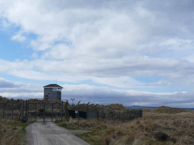
Observation tower in RAF Tain bombing range (geograph 1814686).jpg
52:
Observation_tower_in_RAF_Tain_bombing_range_(geograph_1814686).jpg
205:
190:
57° 49′ 48.4″ N, 3° 59′ 30.74″ W
180:
66:
379:
Add a one-line explanation of what this file represents
846:
174:
Creative
Commons Attribution Share-alike license 2.0
110:
90:
Commons is a freely licensed media file repository.
548:
Creative
Commons Attribution-ShareAlike 2.0 Generic
56:(640 × 481 pixels, file size: 149 KB, MIME type:
1064:Flash did not fire, compulsory flash suppression
348:https://creativecommons.org/licenses/by-sa/2.0
71:
354:Creative Commons Attribution-Share Alike 2.0
272:
8:
599:
314:– to copy, distribute and transmit the work
126:Observation tower in RAF Tain bombing range
864:
756:
375:
829:The following other wikis use this file:
732:https://www.geograph.org.uk/photo/1814686
460:https://www.geograph.org.uk/profile/18375
1168:
1158:
1148:
1138:
1130:
1122:
1111:
1101:
1093:
1085:
1077:
1067:
1057:
1049:
1039:
1031:
1021:
1013:
1005:
994:
986:
978:
970:
960:
952:
944:
936:
925:
917:
906:
896:
886:
876:
816:
679:
663:
623:
607:
581:
565:
545:
529:
509:
493:
426:
410:
393:
390:
371:
364:
183:
212:View this and other nearby images on:
866:
837:Bases aériennes de la Royal Air Force
7:
259:and is licensed for reuse under the
814:The following page uses this file:
745:
295:Attribution-Share Alike 2.0 Generic
283:
278:
263:Attribution-ShareAlike 2.0 license.
857:
384:
378:
269:
246:
120:
103:
49:
383:
1173:a2fa53e51bcb26f1c1e377687c5ae2d6
919:Date and time of data generation
610:coordinates of the point of view
369:
325:Under the following conditions:
290:This file is licensed under the
282:
277:
271:
239:
218:
204:
196:
70:
31:
21:
366:
121:
46:No higher resolution available.
14:
682:file available on the internet
365:
247:This image was taken from the
26:
1:
625:57°49'48.403"N, 3°59'30.739"W
36:
702:Geograph Britain and Ireland
468:object of statement has role
391:Items portrayed in this file
195:
1007:Date and time of digitizing
1190:
1124:Focal length in 35 mm film
1082:One-chip color area sensor
843:Usage on www.wikidata.org
833:Usage on fr.wikipedia.org
339:same or compatible license
972:File change date and time
746:
16:
710:geograph.org.uk image ID
368:
305:
77:This is a file from the
1087:Custom image processing
803:
162:
152:
141:
134:
131:
113:
81:. Information from its
1015:Image compression mode
819:Tain Air Weapons Range
253:this photograph's page
224:57.830112; -3.991872
84:description page there
1033:Maximum land aperture
946:Horizontal resolution
1010:15:42, 16 April 2010
975:15:42, 16 April 2010
922:15:42, 16 April 2010
980:Y and C positioning
954:Vertical resolution
868:Camera manufacturer
782:19:36, 15 July 2011
320:– to adapt the work
1132:Scene capture type
1108:Auto white balance
440:author name string
1177:
1176:
893:1/200 sec (0.005)
825:Global file usage
807:
601:
532:copyright license
377:
268:
267:
251:collection. See
229:
228:
178:
177:
171:
168:Reusing this file
99:
98:
79:Wikimedia Commons
32:Global file usage
1181:
988:Exposure Program
865:
794:
734:
729:
725:described at URL
719:
714:
704:
699:
647:
646:
641:
496:copyright status
477:
472:
462:
457:
447:
446:sylvia duckworth
444:
361:
358:
355:
352:
349:
341:as the original.
303:
302:sylvia duckworth
292:Creative Commons
286:
285:
281:
280:
275:
274:
261:Creative Commons
257:sylvia duckworth
249:Geograph project
243:
236:
225:
222:
208:
207:
201:
200:
199:
193:
192:
181:
165:
157:sylvia duckworth
137:
125:
117:
111:
95:
74:
73:
67:
61:
59:
1189:
1188:
1184:
1183:
1182:
1180:
1179:
1178:
1170:Unique image ID
1036:3 APEX (f/2.83)
853:
823:
808:
800:
792:
748:
747:
744:
743:
742:
741:
740:
739:
738:
737:
736:
735:
730:
727:
721:
720:
715:
712:
706:
705:
700:
697:
688:
687:
686:
684:
672:
671:
670:
668:
657:
656:
655:
654:
653:
652:
651:
650:
649:
648:
644:
642:
639:
630:
629:
628:
626:
616:
615:
614:
612:
593:
592:
591:
590:
589:
588:
587:
586:
584:
574:
573:
572:
570:
559:
558:
557:
556:
555:
554:
553:
552:
550:
538:
537:
536:
534:
523:
522:
521:
520:
519:
518:
517:
516:
514:
502:
501:
500:
498:
487:
486:
485:
484:
483:
482:
481:
480:
479:
478:
473:
470:
464:
463:
458:
455:
449:
448:
445:
442:
433:
432:
431:
429:
419:
418:
417:
415:
404:
403:
402:
401:
400:
398:
382:
381:
380:
363:
362:
359:
356:
353:
350:
347:
346:
304:
301:
298:
287:
264:
234:
223:
197:
188:
187:
184:Camera location
179:
147:geograph.org.uk
127:
115:
108:
101:
100:
89:
88:
87:is shown below.
63:
57:
55:
48:
47:
12:
11:
5:
1187:
1185:
1175:
1174:
1171:
1167:
1166:
1163:
1157:
1156:
1153:
1147:
1146:
1143:
1137:
1136:
1133:
1129:
1128:
1125:
1121:
1120:
1117:
1110:
1109:
1106:
1100:
1099:
1096:
1092:
1091:
1090:Normal process
1088:
1084:
1083:
1080:
1079:Sensing method
1076:
1075:
1072:
1066:
1065:
1062:
1056:
1055:
1052:
1048:
1047:
1044:
1038:
1037:
1034:
1030:
1029:
1026:
1020:
1019:
1016:
1012:
1011:
1008:
1004:
1003:
1000:
993:
992:
989:
985:
984:
981:
977:
976:
973:
969:
968:
963:
959:
958:
955:
951:
950:
947:
943:
942:
939:
935:
934:
931:
924:
923:
920:
916:
915:
912:
905:
904:
901:
895:
894:
891:
885:
884:
879:
875:
874:
869:
856:
852:
851:
850:
849:
841:
840:
839:
827:
826:
822:
821:
812:
811:
806:
805:
802:
798:
795:
789:
784:
779:
775:
774:
771:
768:
765:
762:
759:
752:
751:
723:
722:
708:
707:
693:
692:
691:
690:
689:
685:
680:
678:
677:
676:
675:
674:
673:
669:
666:source of file
664:
662:
661:
660:
659:
658:
635:
634:
633:
632:
631:
627:
624:
622:
621:
620:
619:
618:
617:
613:
608:
606:
605:
604:
603:
597:
585:
582:
580:
579:
578:
577:
576:
575:
571:
566:
564:
563:
562:
561:
560:
551:
546:
544:
543:
542:
541:
540:
539:
535:
530:
528:
527:
526:
525:
524:
515:
510:
508:
507:
506:
505:
504:
503:
499:
494:
492:
491:
490:
489:
488:
466:
465:
451:
450:
438:
437:
436:
435:
434:
430:
427:
425:
424:
423:
422:
421:
420:
416:
411:
409:
408:
407:
406:
405:
399:
394:
392:
389:
388:
387:
386:
385:
374:
373:
370:
367:
345:
344:
343:
342:
332:
323:
322:
321:
315:
308:You are free:
299:
289:
288:
270:
266:
265:
244:
233:
230:
227:
226:
216:
210:
185:
176:
175:
172:
160:
159:
154:
150:
149:
143:
139:
138:
133:
129:
128:
118:
109:
107:
104:
102:
97:
96:
75:
65:
64:
45:
41:
40:
39:
34:
29:
24:
19:
13:
10:
9:
6:
4:
3:
2:
1186:
1172:
1169:
1164:
1162:
1159:
1154:
1152:
1149:
1144:
1142:
1139:
1134:
1131:
1126:
1123:
1118:
1115:
1112:
1107:
1105:
1104:White balance
1102:
1098:Auto exposure
1097:
1095:Exposure mode
1094:
1089:
1086:
1081:
1078:
1073:
1071:
1068:
1063:
1061:
1058:
1053:
1050:
1045:
1043:
1042:Metering mode
1040:
1035:
1032:
1027:
1025:
1024:Exposure bias
1022:
1017:
1014:
1009:
1006:
1001:
998:
995:
990:
987:
982:
979:
974:
971:
967:
964:
962:Software used
961:
956:
953:
948:
945:
940:
937:
932:
930:
926:
921:
918:
913:
910:
907:
902:
900:
897:
892:
890:
889:Exposure time
887:
883:
880:
877:
873:
870:
867:
863:
860:
854:
848:
845:
844:
842:
838:
835:
834:
832:
831:
830:
824:
820:
817:
815:
809:
801:
796:
790:
788:
785:
783:
780:
777:
776:
772:
769:
766:
763:
760:
758:
757:
755:
749:
733:
726:
718:
711:
703:
696:
683:
667:
638:
611:
583:16 April 2010
569:
549:
533:
513:
497:
476:
469:
461:
454:
441:
414:
397:
351:CC BY-SA 2.0
340:
336:
333:
330:
327:
326:
324:
319:
316:
313:
310:
309:
307:
306:
300:Attribution:
296:
293:
276:
262:
258:
254:
250:
245:
242:
238:
237:
231:
221:
217:
215:
214:OpenStreetMap
211:
209:
191:
186:
182:
173:
169:
164:
161:
158:
155:
151:
148:
144:
140:
136:16 April 2010
130:
124:
119:
112:
105:
93:
86:
85:
80:
76:
69:
68:
62:
53:
44:
38:
35:
33:
30:
28:
25:
23:
20:
18:
15:
1114:Digital zoom
1074:Uncalibrated
1051:Light source
929:focal length
878:Camera model
861:
858:
828:
813:
753:
750:File history
475:photographer
334:
328:
317:
311:
256:
194:
122:
92:You can help
82:
50:
22:File history
1070:Color space
938:Orientation
512:copyrighted
335:share alike
329:attribution
114:Description
1151:Saturation
966:Picasa 3.0
810:File usage
799:Harrison49
791:640 × 481
767:Dimensions
428:some value
163:Permission
58:image/jpeg
27:File usage
1161:Sharpness
909:ISO speed
872:Panasonic
764:Thumbnail
761:Date/Time
568:inception
232:Licensing
123:English:
1141:Contrast
1135:Standard
983:Co-sited
899:F-number
882:DMC-FZ18
855:Metadata
847:Q7275624
793:(149 KB)
695:operator
372:Captions
318:to remix
312:to share
297:license.
37:Metadata
1054:Unknown
1046:Pattern
999:version
778:current
773:Comment
717:1814686
637:heading
596:heading
413:creator
396:depicts
376:English
106:Summary
54:
1165:Normal
1155:Normal
1145:Normal
957:72 dpi
949:72 dpi
933:4.6 mm
911:rating
645:degree
600:degree
202:
153:Author
142:Source
1127:28 mm
1116:ratio
1060:Flash
927:Lens
145:From
1002:2.21
997:Exif
770:User
643:315
360:true
357:true
132:Date
17:File
914:100
903:f/5
453:URL
728::
713::
698::
640::
471::
456::
443::
1119:0
1028:0
1018:4
941:0
170:)
166:(
94:.
60:)
Text is available under the Creative Commons Attribution-ShareAlike License. Additional terms may apply.
.jpg)
.jpg¶ms=057.830112_N_-003.991872_E_globe:Earth_type:camera_heading:315.00&language=en)
