291:
180:
130:
172:
122:
194:
144:
259:
297:
302:
72:
597:"}},"text\/plain":{"en":{"":"heading"}}},"{\"value\":{\"amount\":\"+22\",\"unit\":\"http:\\\/\\\/www.wikidata.org\\\/entity\\\/Q28390\"},\"type\":\"quantity\"}":{"text\/html":{"en":{"P7787":"22
533:"}},"text\/plain":{"en":{"":"heading"}}},"{\"value\":{\"amount\":\"+22\",\"unit\":\"http:\\\/\\\/www.wikidata.org\\\/entity\\\/Q28390\"},\"type\":\"quantity\"}":{"text\/html":{"en":{"P7787":"22
529:
699:
716:{{Information |Description=The village green, Osmotherly, N. Yorks. |Source=Geograph http://www.geograph.org.uk/photo/582726 |Date=Monday, 6 September, 1999 |Author=Graham Horn |Permission= |other_versions= }} {{geograph|582726|Graham Horn}} [[Category:N
349:– You must give appropriate credit, provide a link to the license, and indicate if changes were made. You may do so in any reasonable manner, but not in any way that suggests the licensor endorses you or your use.
113:
43:
594:
530:
83:
51:
482:
446:
187:
137:
266:
811:
This file contains additional information, probably added from the digital camera or scanner used to create or digitize it.
356:
730:
635:
608:
571:
544:
430:
502:
466:
413:
253:
312:
814:
If the file has been modified from its original state, some details may not fully reflect the modified file.
726:
The following pages on the
English Knowledge (XXG) use this file (pages on other projects are not listed):
355:– If you remix, transform, or build upon the material, you must distribute your contributions under the
273:
on the
Geograph website for the photographer's contact details. The copyright on this image is owned by
309:
601:"}},"text\/plain":{"en":{"P7787":"22 degree"}}}}": -->
537:"}},"text\/plain":{"en":{"P7787":"22 degree"}}}}": -->
709:
91:
698:
693:
42:
193:
143:
278:
78:
127:
223:
177:
768:
778:
234:
788:
258:
270:
748:
666:
Click on a date/time to view the file as it appeared at that time.
179:
129:
114:
54° 22′ 05.17″ N, 1° 17′ 58.77″ W
154:
104:
66:
164:
54° 22′ 07″ N, 1° 17′ 57″ W
758:
397:
Add a one-line explanation of what this file represents
798:
205:
90:
Commons is a freely licensed media file repository.
483:
Creative
Commons Attribution-ShareAlike 2.0 Generic
56:(640 × 426 pixels, file size: 80 KB, MIME type:
366:https://creativecommons.org/licenses/by-sa/2.0
71:
372:Creative Commons Attribution-Share Alike 2.0
290:
8:
598:
534:
332:– to copy, distribute and transmit the work
816:
668:
393:
741:The following other wikis use this file:
235:https://www.geograph.org.uk/photo/582726
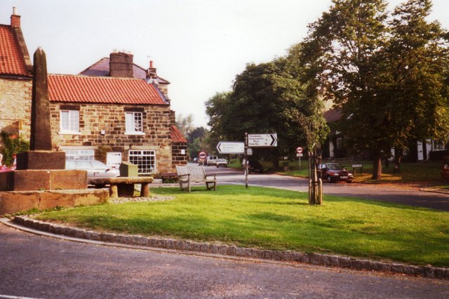
215:The village green, Osmotherly, N. Yorks.
818:
728:
622:
606:
558:
542:
516:
500:
480:
464:
444:
428:
411:
408:
389:
382:
157:
107:
186:View this and other nearby images on:
136:View this and other nearby images on:
7:
277:and is licensed for reuse under the
657:
313:Attribution-Share Alike 2.0 Generic
301:
296:
281:Attribution-ShareAlike 2.0 license.
809:
402:
396:
287:
264:
103:
49:
401:
545:coordinates of the point of view
387:
343:Under the following conditions:
308:This file is licensed under the
300:
295:
289:
257:
192:
178:
170:
142:
128:
120:
70:
31:
21:
769:Osmotherley (Yorkshire du Nord)
384:
46:No higher resolution available.
14:
383:
265:This image was taken from the
26:
1:
789:Osmotherley (North Yorkshire)
779:Osmotherley (North Yorkshire)
609:coordinates of depicted place
211:Osmotherley village green.jpg
52:Osmotherley_village_green.jpg
36:
731:Osmotherley, North Yorkshire
560:54°22'5.167"N, 1°17'58.765"W
409:Items portrayed in this file
775:Usage on lld.wikipedia.org
745:Usage on ceb.wikipedia.org
169:
119:
840:
795:Usage on www.wikidata.org
785:Usage on pl.wikipedia.org
765:Usage on fr.wikipedia.org
755:Usage on es.wikipedia.org
624:54°22'6.92"N, 1°17'57.48"W
357:same or compatible license
658:
16:
386:
323:
77:This is a file from the
715:
240:
229:
222:
219:
208:
81:. Information from its
271:this photograph's page
198:54.368590; -1.299300
148:54.368102; -1.299657
84:description page there
749:Osmotherley (lungsod)
823:hnologies Inc. V1.01
694:12:24, 10 July 2008
338:– to adapt the work
827:
826:
737:Global file usage
719:
600:
536:
467:copyright license
395:
286:
285:
269:collection. See
248:
247:
203:
202:
153:
152:
99:
98:
79:Wikimedia Commons
32:Global file usage
831:
817:
706:
646:
645:
640:
582:
581:
576:
518:6 September 1999
431:copyright status
379:
376:
373:
370:
367:
359:as the original.
321:
310:Creative Commons
304:
303:
299:
298:
293:
292:
279:Creative Commons
267:Geograph project
261:
254:
225:
224:6 September 1999
212:
206:
199:
196:
182:
181:
175:
174:
173:
167:
166:
155:
149:
146:
132:
131:
125:
124:
123:
117:
116:
105:
95:
74:
73:
67:
61:
59:
839:
838:
834:
833:
832:
830:
829:
828:
805:
735:
727:
720:
712:
704:
660:
659:
656:
655:
654:
653:
652:
651:
650:
649:
648:
647:
643:
641:
638:
629:
628:
627:
625:
615:
614:
613:
611:
592:
591:
590:
589:
588:
587:
586:
585:
584:
583:
579:
577:
574:
565:
564:
563:
561:
551:
550:
549:
547:
528:
527:
526:
525:
524:
523:
522:
521:
519:
509:
508:
507:
505:
494:
493:
492:
491:
490:
489:
488:
487:
485:
473:
472:
471:
469:
458:
457:
456:
455:
454:
453:
452:
451:
449:
437:
436:
435:
433:
422:
421:
420:
419:
418:
416:
400:
399:
398:
381:
380:
377:
374:
371:
368:
365:
364:
322:
319:
316:
305:
282:
249:
210:
197:
171:
162:
161:
158:Object location
147:
121:
112:
111:
108:Camera location
101:
100:
89:
88:
87:is shown below.
63:
57:
55:
48:
47:
12:
11:
5:
837:
835:
825:
824:
821:
808:
804:
803:
802:
801:
793:
792:
791:
783:
782:
781:
773:
772:
771:
763:
762:
761:
753:
752:
751:
739:
738:
734:
733:
725:
724:
723:
718:
717:
714:
710:
707:
701:
696:
691:
687:
686:
683:
680:
677:
674:
671:
664:
663:
634:
633:
632:
631:
630:
626:
623:
621:
620:
619:
618:
617:
616:
612:
607:
605:
604:
603:
602:
596:
570:
569:
568:
567:
566:
562:
559:
557:
556:
555:
554:
553:
552:
548:
543:
541:
540:
539:
538:
532:
520:
517:
515:
514:
513:
512:
511:
510:
506:
501:
499:
498:
497:
496:
495:
486:
481:
479:
478:
477:
476:
475:
474:
470:
465:
463:
462:
461:
460:
459:
450:
445:
443:
442:
441:
440:
439:
438:
434:
429:
427:
426:
425:
424:
423:
417:
412:
410:
407:
406:
405:
404:
403:
392:
391:
388:
385:
363:
362:
361:
360:
350:
341:
340:
339:
333:
326:You are free:
317:
307:
306:
288:
284:
283:
262:
246:
245:
242:
238:
237:
231:
227:
226:
221:
217:
216:
213:
204:
201:
200:
190:
184:
159:
151:
150:
140:
134:
109:
102:
97:
96:
75:
65:
64:
45:
41:
40:
39:
34:
29:
24:
19:
13:
10:
9:
6:
4:
3:
2:
836:
822:
820:User comments
819:
815:
812:
806:
800:
797:
796:
794:
790:
787:
786:
784:
780:
777:
776:
774:
770:
767:
766:
764:
760:
757:
756:
754:
750:
747:
746:
744:
743:
742:
736:
732:
729:
721:
713:
711:Angusmclellan
708:
702:
700:
697:
695:
692:
689:
688:
684:
681:
678:
675:
672:
670:
669:
667:
661:
637:
610:
573:
546:
504:
484:
468:
448:
432:
415:
369:CC BY-SA 2.0
358:
354:
351:
348:
345:
344:
342:
337:
334:
331:
328:
327:
325:
324:
318:Attribution:
314:
311:
294:
280:
276:
272:
268:
263:
260:
256:
255:
252:
251:
243:
239:
236:
232:
228:
218:
214:
207:
195:
191:
189:
188:OpenStreetMap
185:
183:
165:
160:
156:
145:
141:
139:
138:OpenStreetMap
135:
133:
115:
110:
106:
93:
86:
85:
80:
76:
69:
68:
62:
53:
44:
38:
35:
33:
30:
28:
25:
23:
20:
18:
15:
813:
810:
740:
665:
662:File history
352:
346:
335:
329:
274:
250:
168:
118:
92:You can help
82:
50:
22:File history
759:Osmotherley
447:copyrighted
353:share alike
347:attribution
320:Graham Horn
275:Graham Horn
244:Graham Horn
209:Description
722:File usage
703:640 × 426
679:Dimensions
58:image/jpeg
27:File usage
676:Thumbnail
673:Date/Time
503:inception
233:Geograph
807:Metadata
799:Q7107230
390:Captions
336:to remix
330:to share
315:license.
37:Metadata
705:(80 KB)
690:current
685:Comment
636:heading
595:heading
572:heading
531:heading
414:depicts
394:English
54:
644:degree
599:degree
580:degree
535:degree
241:Author
230:Source
176:
126:
682:User
378:true
375:true
220:Date
17:File
642:22
578:22
639::
575::
94:.
60:)
Text is available under the Creative Commons Attribution-ShareAlike License. Additional terms may apply.
_region:GB-ENG_heading:22.00&language=en)
