38:
274:
235:
249:
280:
94:
694:
321:– You must give appropriate credit, provide a link to the license, and indicate if changes were made. You may do so in any reasonable manner, but not in any way that suggests the licensor endorses you or your use.
226:
711:{{BotMoveToCommons|en.wikipedia|year={{subst:CURRENTYEAR}}|month={{subst:CURRENTMONTHNAME}}|day={{subst:CURRENTDAY}}}} I took this picture myself from just off of Kirtland Road, south of
393:
I took this picture myself from just off of
Kirtland Road, south of ]. The coordinates are approximately {{coor d|42.4291|N|122.9345|display=inline,title}}
60:
56:
52:
48:
42:
105:
73:
154:
571:
535:
499:
463:
242:
864:
745:
This file contains additional information, probably added from the digital camera or scanner used to create or digitize it.
729:
591:
555:
519:
447:
625:
483:
430:
149:
734:
712:
704:
748:
If the file has been modified from its original state, some details may not fully reflect the modified file.
909:
290:
767:
693:
688:
287:
64:
37:
937:
113:
381:
209:
757:
248:
1005:
927:
891:
774:
100:
267:
I, the copyright holder of this work, hereby publish it under the following license:
1015:
814:
947:
232:
189:
794:
169:
156:
784:
148:
I took this picture myself from just off of
Kirtland Road, south of
661:
Click on a date/time to view the file as it appeared at that time.
234:
227:
42° 25′ 44.76″ N, 122° 56′ 04.2″ W
584:
217:
88:
414:
Add a one-line explanation of what this file represents
352:
78:(3,072 × 1,728 pixels, file size: 2.14 MB, MIME type:
132:
112:
Commons is a freely licensed media file repository.
355:. All following user names refer to en.wikipedia.
942:Flash did not fire, compulsory flash suppression
93:
273:
8:
328:https://creativecommons.org/licenses/by/3.0
304:– to copy, distribute and transmit the work
750:
663:
410:
500:Creative Commons Attribution 3.0 Unported
1024:
1013:
1003:
995:
987:
979:
971:
963:
955:
945:
935:
925:
917:
907:
899:
889:
881:
873:
862:
854:
846:
838:
830:
822:
811:
803:
792:
782:
772:
762:
727:
639:
623:
605:
589:
569:
553:
533:
517:
497:
481:
461:
445:
428:
425:
406:
399:
220:
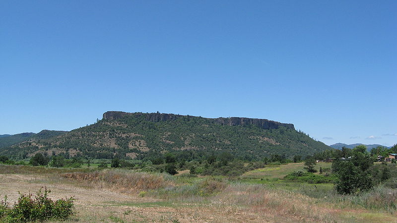
241:View this and other nearby images on:
752:
725:The following 2 pages use this file:
7:
152:. The coordinates are approximately
652:
279:
138:Lower Table Rock from the south.jpg
743:
419:
413:
351:The original description page was
350:
295:
270:
266:
142:
125:
71:
418:
334:Creative Commons Attribution 3.0
805:Date and time of data generation
592:coordinates of the point of view
404:
315:Under the following conditions:
286:This file is licensed under the
278:
272:
247:
233:
92:
21:
401:
143:
14:
400:
26:
1:
730:Table Rock Indian Reservation
572:original creation by uploader
31:
426:Items portrayed in this file
973:Focal plane resolution unit
875:Date and time of digitizing
357:
1046:
984:One-chip color area sensor
735:Upper and Lower Table Rock
607:42°25'44.8"N, 122°56'4.2"W
848:File change date and time
653:
199:
16:
965:Focal plane Y resolution
957:Focal plane X resolution
403:
291:Attribution 3.0 Unported
99:This is a file from the
989:Custom image processing
932:Center weighted average
710:
388:
385:
380:
377:
205:
195:
188:
185:
135:
103:. Information from its
883:Image compression mode
253:42.429100; -122.934500
106:description page there
41:Size of this preview:
919:Maximum land aperture
878:00:00, 1 January 1980
851:00:00, 1 January 1980
832:Horizontal resolution
808:00:00, 1 January 1980
689:23:55, 8 October 2009
1010:Manual white balance
768:Canon PowerShot A560
536:Canon PowerShot A560
170:42.4291°N 122.9345°W
65:3,072 × 1,728 pixels
856:Y and C positioning
840:Vertical resolution
754:Camera manufacturer
378:2009-06-07 22:01:13
347:Original upload log
310:– to adapt the work
47:Other resolutions:
1026:Scene capture type
922:2.75 APEX (f/2.59)
706:CommonsHelper2 Bot
175:42.4291; -122.9345
61:1,280 × 720 pixels
57:1,024 × 576 pixels
1033:
1032:
779:1/250 sec (0.004)
718:
484:copyright license
412:
398:
397:
394:
258:
257:
215:
214:
121:
120:
101:Wikimedia Commons
1037:
968:10,224.852071006
960:13,653.333333333
751:
713:Lower Table Rock
701:
448:copyright status
392:
358:
341:
338:
335:
332:
329:
288:Creative Commons
282:
281:
276:
275:
254:
251:
237:
236:
230:
229:
218:
201:
191:
180:
178:
177:
176:
171:
167:
166:
163:
162:
159:
150:Lower Table Rock
147:
139:
133:
117:
96:
95:
89:
83:
81:
68:
53:640 × 360 pixels
49:320 × 180 pixels
43:800 × 450 pixels
1045:
1044:
1040:
1039:
1038:
1036:
1035:
1034:
739:
719:
715:. The coordinat
707:
699:
655:
654:
651:
650:
649:
648:
647:
646:
645:
644:
642:
632:
631:
630:
628:
617:
616:
615:
614:
613:
612:
611:
610:
608:
598:
597:
596:
594:
583:
582:
581:
580:
579:
578:
577:
576:
574:
562:
561:
560:
558:
547:
546:
545:
544:
543:
542:
541:
540:
538:
526:
525:
524:
522:
511:
510:
509:
508:
507:
506:
505:
504:
502:
490:
489:
488:
486:
475:
474:
473:
472:
471:
470:
469:
468:
466:
454:
453:
452:
450:
439:
438:
437:
436:
435:
433:
417:
416:
415:
356:
349:
344:
343:
342:
339:
336:
333:
330:
327:
326:
294:
283:
269:
268:
263:
252:
225:
224:
221:Camera location
216:
181:
174:
172:
168:
164:
160:
157:
155:
153:
137:
130:
123:
122:
111:
110:
109:is shown below.
85:
79:
77:
70:
69:
46:
12:
11:
5:
1043:
1041:
1031:
1030:
1027:
1023:
1022:
1019:
1012:
1011:
1008:
1002:
1001:
998:
994:
993:
992:Normal process
990:
986:
985:
982:
981:Sensing method
978:
977:
974:
970:
969:
966:
962:
961:
958:
954:
953:
950:
944:
943:
940:
934:
933:
930:
924:
923:
920:
916:
915:
912:
906:
905:
902:
898:
897:
894:
888:
887:
884:
880:
879:
876:
872:
871:
868:
861:
860:
857:
853:
852:
849:
845:
844:
841:
837:
836:
833:
829:
828:
825:
821:
820:
817:
810:
809:
806:
802:
801:
798:
791:
790:
787:
781:
780:
777:
771:
770:
765:
761:
760:
755:
742:
738:
737:
732:
723:
722:
717:
716:
709:
705:
702:
698:3,072 × 1,728
696:
691:
686:
682:
681:
678:
675:
672:
669:
666:
659:
658:
643:
640:
638:
637:
636:
635:
634:
633:
629:
624:
622:
621:
620:
619:
618:
609:
606:
604:
603:
602:
601:
600:
599:
595:
590:
588:
587:
586:
585:
575:
570:
568:
567:
566:
565:
564:
563:
559:
556:source of file
554:
552:
551:
550:
549:
548:
539:
534:
532:
531:
530:
529:
528:
527:
523:
518:
516:
515:
514:
513:
512:
503:
498:
496:
495:
494:
493:
492:
491:
487:
482:
480:
479:
478:
477:
476:
467:
462:
460:
459:
458:
457:
456:
455:
451:
446:
444:
443:
442:
441:
440:
434:
429:
427:
424:
423:
422:
421:
420:
409:
408:
405:
402:
396:
395:
390:
387:
384:
379:
375:
374:
371:
368:
365:
362:
348:
345:
325:
324:
323:
322:
313:
312:
311:
305:
298:You are free:
285:
284:
271:
265:
264:
262:
259:
256:
255:
245:
239:
222:
213:
212:
207:
203:
202:
197:
193:
192:
187:
183:
182:
140:
131:
129:
126:
124:
119:
118:
97:
87:
86:
40:
36:
35:
34:
29:
24:
19:
13:
10:
9:
6:
4:
3:
2:
1042:
1028:
1025:
1020:
1017:
1014:
1009:
1007:
1006:White balance
1004:
1000:Auto exposure
999:
997:Exposure mode
996:
991:
988:
983:
980:
975:
972:
967:
964:
959:
956:
951:
949:
946:
941:
939:
936:
931:
929:
928:Metering mode
926:
921:
918:
913:
911:
910:Exposure bias
908:
903:
901:APEX aperture
900:
895:
893:
892:Shutter speed
890:
885:
882:
877:
874:
869:
866:
863:
858:
855:
850:
847:
842:
839:
834:
831:
826:
823:
818:
816:
812:
807:
804:
799:
796:
793:
788:
786:
783:
778:
776:
775:Exposure time
773:
769:
766:
763:
759:
756:
753:
749:
746:
740:
736:
733:
731:
728:
726:
720:
714:
708:
703:
697:
695:
692:
690:
687:
684:
683:
679:
676:
673:
670:
667:
665:
664:
662:
656:
627:
593:
573:
557:
537:
521:
520:captured with
501:
485:
465:
449:
432:
391:
383:
376:
372:
369:
366:
363:
360:
359:
354:
346:
320:
317:
316:
314:
309:
306:
303:
300:
299:
297:
296:
292:
289:
277:
260:
250:
246:
244:
243:OpenStreetMap
240:
238:
228:
223:
219:
211:
208:
204:
198:
194:
184:
179:
151:
146:
141:
134:
127:
115:
108:
107:
102:
98:
91:
90:
84:
75:
74:Original file
66:
62:
58:
54:
50:
44:
39:
33:
30:
28:
25:
23:
20:
18:
15:
1016:Digital zoom
815:focal length
764:Camera model
747:
744:
724:
660:
657:File history
318:
307:
301:
144:
114:You can help
104:
72:
22:File history
948:Color space
824:Orientation
641:7 June 2009
464:copyrighted
361:Upload date
319:attribution
190:7 June 2009
161:122°56′04″W
136:Description
721:File usage
674:Dimensions
382:ZabMilenko
370:Dimensions
331:CC BY 3.0
210:ZabMilenko
158:42°25′45″N
80:image/jpeg
27:File usage
795:ISO speed
700:(2.14 MB)
671:Thumbnail
668:Date/Time
626:inception
389:3072×1728
261:Licensing
145:English:
1029:Standard
859:Centered
785:F-number
741:Metadata
407:Captions
373:Comment
308:to remix
302:to share
293:license.
200:Own work
32:Metadata
904:5.65625
896:7.96875
867:version
843:180 dpi
835:180 dpi
685:current
680:Comment
431:depicts
411:English
386:2246001
128:Summary
76:
976:inches
827:Normal
819:5.8 mm
797:rating
231:
206:Author
196:Source
1018:ratio
938:Flash
813:Lens
789:f/7.1
758:Canon
367:Bytes
952:sRGB
865:Exif
677:User
364:User
353:here
340:true
337:true
186:Date
17:File
870:2.2
165:/
800:80
173:/
63:|
59:|
55:|
51:|
45:.
1021:1
914:0
886:5
116:.
82:)
67:.
Text is available under the Creative Commons Attribution-ShareAlike License. Additional terms may apply.
