244:
197:
250:
67:
255:
595:
557:
38:
303:– You must give appropriate credit, provide a link to the license, and indicate if changes were made. You may do so in any reasonable manner, but not in any way that suggests the licensor endorses you or your use.
78:
46:
214:
594:
589:
212:; with no Invariant Sections, no Front-Cover Texts, and no Back-Cover Texts. A copy of the license is included in the section entitled
204:
502:
466:
449:
413:
310:
574:{{Information |Description=Location of Curug district, Tangerang county, Banten province, Java island, Indonesia |Source=
486:
397:
209:
433:
380:
556:
551:
37:
264:
625:
The following pages on the
English Knowledge (XXG) use this file (pages on other projects are not listed):
309:– If you remix, transform, or build upon the material, you must distribute your contributions under the
613:
261:
605:
86:
191:
579:
324:
202:
Permission is granted to copy, distribute and/or modify this document under the terms of the
164:
629:
575:
567:
121:
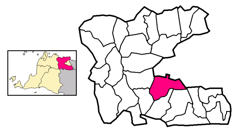
Location of Curug district, Tangerang county, Banten province, Java island, Indonesia
73:
188:
I, the copyright holder of this work, hereby publish it under the following license:
170:
149:
130:
647:
524:
Click on a date/time to view the file as it appeared at that time.
662:
323:
This licensing tag was added to this file as part of the GFDL
238:
61:
657:
364:
Add a one-line explanation of what this file represents
672:
682:
582:|Permission= |other_versions= }} [[Category:Cities i
467:
450:
Creative
Commons Attribution-ShareAlike 3.0 Unported
208:, Version 1.2 or any later version published by the
105:
85:
Commons is a freely licensed media file repository.
111:Locator Kecamatan Curug di Kabupaten Tangerang.png
47:Locator_Kecamatan_Curug_di_Kabupaten_Tangerang.png
51:(800 × 455 pixels, file size: 83 KB, MIME type:
330:http://creativecommons.org/licenses/by-sa/3.0/
66:
243:
8:
336:Creative Commons Attribution-Share Alike 3.0
286:– to copy, distribute and transmit the work
526:
360:
640:The following other wikis use this file:
627:
500:
484:
464:
447:
431:
411:
395:
378:
375:
356:
349:
7:
265:Attribution-Share Alike 3.0 Unported
220:http://www.gnu.org/copyleft/fdl.html
515:
254:
249:
369:
363:
187:
124:
123:
115:
98:
44:
368:
354:
297:Under the following conditions:
260:This file is licensed under the
253:
248:
242:
196:
195:
65:
31:
21:
351:
116:
41:No higher resolution available.
14:
578:|Date=4 Oktober 2006 |Author=
350:
226:GNU Free Documentation License
215:GNU Free Documentation License
205:GNU Free Documentation License
26:
1:
503:original creation by uploader
376:Items portrayed in this file
701:
679:Usage on www.wikidata.org
669:Usage on sw.wikipedia.org
654:Usage on ms.wikipedia.org
644:Usage on fr.wikipedia.org
612:Berdasarkan locator karya
311:same or compatible license
129:Berdasarkan locator karya
516:
269:
241:
142:
16:
353:
210:Free Software Foundation
72:This is a file from the
611:
573:
157:
137:
108:
76:. Information from its
79:description page there
590:16:32, 4 October 2006
580:id:user:Meursault2004
663:Sukamulya, Tangerang
576:id:Curug, Tangerang
552:15:34, 17 July 2009
292:– to adapt the work
148:Based on a map by
126:Bahasa Indonesia:
648:Curug (Indonésie)
636:Global file usage
618:
434:copyright license
362:
347:
346:
237:
236:
178:
177:
94:
93:
74:Wikimedia Commons
32:Global file usage
692:
658:Curug, Tangerang
630:Curug, Tangerang
602:
564:
398:copyright status
343:
340:
337:
334:
331:
328:
325:licensing update
313:as the original.
262:Creative Commons
257:
256:
252:
251:
246:
245:
239:
233:
230:
227:
224:
221:
199:
198:
192:
144:
128:
120:
112:
106:
90:
69:
68:
62:
56:
54:
700:
699:
695:
694:
693:
691:
690:
689:
634:
626:
619:
608:
600:
570:
562:
518:
517:
514:
513:
512:
511:
510:
509:
508:
507:
505:
493:
492:
491:
489:
478:
477:
476:
475:
474:
473:
472:
471:
469:
458:
457:
456:
455:
454:
452:
440:
439:
438:
436:
425:
424:
423:
422:
421:
420:
419:
418:
416:
404:
403:
402:
400:
389:
388:
387:
386:
385:
383:
367:
366:
365:
348:
341:
338:
335:
332:
329:
322:
231:
228:
225:
222:
219:
190:
189:
184:
179:
133:
122:
110:
103:
96:
95:
84:
83:
82:is shown below.
58:
52:
50:
43:
42:
12:
11:
5:
698:
696:
688:
687:
686:
685:
677:
676:
675:
667:
666:
665:
660:
652:
651:
650:
638:
637:
633:
632:
624:
623:
622:
617:
616:
610:
606:
603:
597:
592:
587:
584:
583:
572:
568:
565:
559:
554:
549:
545:
544:
541:
538:
535:
532:
529:
522:
521:
506:
501:
499:
498:
497:
496:
495:
494:
490:
487:source of file
485:
483:
482:
481:
480:
479:
470:
465:
463:
462:
461:
460:
459:
453:
448:
446:
445:
444:
443:
442:
441:
437:
432:
430:
429:
428:
427:
426:
417:
412:
410:
409:
408:
407:
406:
405:
401:
396:
394:
393:
392:
391:
390:
384:
379:
377:
374:
373:
372:
371:
370:
359:
358:
355:
352:
345:
344:
319:
318:
317:
316:
315:
314:
304:
295:
294:
293:
287:
280:You are free:
275:
274:
271:
270:
268:
258:
235:
234:
200:
186:
185:
183:
180:
176:
175:
174:
173:
169:Original map:
167:
163:This version:
159:
155:
154:
153:
152:
139:
135:
134:
113:
104:
102:
99:
97:
92:
91:
70:
60:
59:
40:
36:
35:
34:
29:
24:
19:
13:
10:
9:
6:
4:
3:
2:
697:
684:
681:
680:
678:
674:
671:
670:
668:
664:
661:
659:
656:
655:
653:
649:
646:
645:
643:
642:
641:
635:
631:
628:
620:
615:
609:
607:Meursault2004
604:
598:
596:
593:
591:
588:
586:
585:
581:
577:
571:
566:
560:
558:
555:
553:
550:
547:
546:
542:
539:
536:
533:
530:
528:
527:
525:
519:
504:
488:
468:
451:
435:
415:
399:
382:
326:
321:
320:
312:
308:
305:
302:
299:
298:
296:
291:
288:
285:
282:
281:
279:
278:
277:
276:
273:
272:
266:
263:
259:
247:
240:
217:
216:
211:
207:
206:
201:
194:
193:
181:
172:
168:
166:
165:Meursault2004
162:
161:
160:
156:
151:
147:
146:
145:
140:
136:
132:
127:
119:
114:
107:
100:
88:
81:
80:
75:
71:
64:
63:
57:
48:
39:
33:
30:
28:
25:
23:
20:
18:
15:
639:
523:
520:File history
333:CC BY-SA 3.0
306:
300:
289:
283:
213:
203:
141:
125:
117:
87:You can help
77:
45:
22:File history
414:copyrighted
307:share alike
301:attribution
109:Description
621:File usage
599:840 × 478
561:800 × 455
537:Dimensions
27:File usage
673:Tangerang
534:Thumbnail
531:Date/Time
267:license.
182:Licensing
118:English:
53:image/png
683:Q2362990
569:Humboldt
357:Captions
290:to remix
284:to share
143:Own work
614:Wic2020
601:(14 KB)
563:(83 KB)
548:current
543:Comment
381:depicts
361:English
171:Wic2020
150:Wic2020
131:Wic2020
101:Summary
49:
158:Author
138:Source
540:User
342:true
339:true
232:true
229:true
223:GFDL
17:File
327:.
218:.
89:.
55:)
Text is available under the Creative Commons Attribution-ShareAlike License. Additional terms may apply.