195:
201:
206:
95:
43:
729:
699:
669:
247:– You must give appropriate credit, provide a link to the license, and indicate if changes were made. You may do so in any reasonable manner, but not in any way that suggests the licensor endorses you or your use.
785:
835:
885:
795:
790:
880:
810:
815:
780:
805:
61:
57:
53:
47:
106:
74:
840:
613:
380:
344:
728:
723:
698:
693:
981:
This file contains additional information, probably added from the digital camera or scanner used to create or digitize it.
760:
254:
875:
820:
579:
542:
505:
468:
434:
328:
830:
606:
400:
364:
311:
870:
800:
216:
984:
If the file has been modified from its original state, some details may not fully reflect the modified file.
168:
865:
253:– If you remix, transform, or build upon the material, you must distribute your contributions under the
213:
928:
668:
663:
65:
42:
855:
825:
968:
943:
114:
963:
938:
775:
908:
850:
923:
770:
739:
709:
679:
101:
860:
765:
178:
158:
845:
903:
636:
Click on a date/time to view the file as it appeared at that time.
89:
953:
786:
Convent of Nossa
Senhora da Conceição (Angra do Heroísmo)
295:
Add a one-line explanation of what this file represents
913:
969:
Module:Location map/data/Portugal Azores
Terceira/doc
944:
Module:Location map/data/Portugal Azores
Terceira/doc
886:
Module:Location map/data/Portugal Azores
Terceira/doc
381:
Creative
Commons Attribution-ShareAlike 3.0 Unported
133:
113:
Commons is a freely licensed media file repository.
79:(1,085 × 870 pixels, file size: 595 KB, MIME type:
964:Module:Location map/data/Portugal Azores Terceira
939:Module:Location map/data/Portugal Azores Terceira
881:Module:Location map/data/Portugal Azores Terceira
836:Fortress of São João Baptista (Angra do Heroísmo)
909:Vorlage:Positionskarte Portugal Azoren Terceira
264:https://creativecommons.org/licenses/by-sa/3.0
94:
929:Modèle:Géolocalisation/Terceira/Documentation
270:Creative Commons Attribution-Share Alike 3.0
194:
8:
791:Convent of São Francisco (Angra do Heroísmo)
816:Fort of the Church of São Mateus da Calheta
230:– to copy, distribute and transmit the work
986:
796:Convent of São Gonçalo (Angra do Heroísmo)
638:
291:
896:The following other wikis use this file:
811:Fort of São João (São Mateus da Calheta)
781:Convent of Esperança (Angra do Heroísmo)
595:b30cad4ff800b093f47935f95ae977700d2bfeee
996:
988:
758:
593:
577:
556:
540:
519:
503:
482:
466:
448:
432:
414:
398:
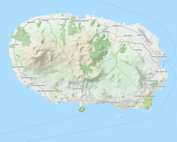
378:
362:
342:
326:
309:
306:
287:
280:
756:The following 26 pages use this file:
806:Fort of Santo António do Monte Brasil
7:
217:Attribution-Share Alike 3.0 Unported
746:User created page with UploadWizard
627:
205:
200:
979:
300:
294:
191:
143:
139:Locator map AZO TER OSM relief.png
126:
72:
841:Fortress of São Mateus da Calheta
299:
149:Map of Terceira, Azores, Portugal
285:
241:Under the following conditions:
212:This file is licensed under the
204:
199:
193:
93:
31:
21:
924:Modèle:Géolocalisation/Terceira
282:
144:
14:
281:
26:
1:
876:Solar de D. Violante do Canto
36:
307:Items portrayed in this file
761:Angra do Heroísmo City Hall
1018:
960:Usage on uz.wikipedia.org
950:Usage on sl.wikipedia.org
935:Usage on si.wikipedia.org
920:Usage on fr.wikipedia.org
900:Usage on de.wikipedia.org
821:Fort of the Espírito Santo
255:same or compatible license
628:
16:
284:
221:
100:This is a file from the
745:
715:
685:
174:
164:
157:
154:
136:
104:. Information from its
871:Serra de Santa Bárbara
831:Forte de São Sebastião
107:description page there
46:Size of this preview:
990:Horizontal resolution
866:Santa Catarina Palace
801:Fort of Má Ferramenta
607:determination method
998:Vertical resolution
856:Madre de Deus Manor
724:17:01, 6 April 2018
694:17:55, 6 April 2018
664:18:01, 6 April 2018
236:– to adapt the work
52:Other resolutions:
66:1,085 × 870 pixels
1005:
1004:
904:Ilhéus das Cabras
892:Global file usage
776:Castle of Moinhos
749:
365:copyright license
293:
184:
183:
122:
121:
102:Wikimedia Commons
32:Global file usage
1009:
987:
826:Fort of the Maré
736:
706:
676:
616:
611:
561:
524:
487:
329:copyright status
277:
274:
271:
268:
265:
257:as the original.
214:Creative Commons
208:
207:
203:
202:
197:
196:
160:
148:
140:
134:
118:
97:
96:
90:
84:
82:
69:
62:958 × 768 pixels
58:599 × 480 pixels
54:299 × 240 pixels
48:748 × 600 pixels
1017:
1016:
1012:
1011:
1010:
1008:
1007:
1006:
975:
890:
750:
742:
734:
712:
704:
682:
674:
630:
629:
626:
625:
624:
623:
622:
621:
620:
619:
618:
617:
612:
609:
600:
599:
598:
596:
586:
585:
584:
582:
571:
570:
569:
568:
567:
566:
565:
564:
562:
559:
549:
548:
547:
545:
534:
533:
532:
531:
530:
529:
528:
527:
525:
522:
512:
511:
510:
508:
497:
496:
495:
494:
493:
492:
491:
490:
488:
485:
475:
474:
473:
471:
460:
459:
458:
457:
456:
455:
454:
453:
451:
441:
440:
439:
437:
426:
425:
424:
423:
422:
421:
420:
419:
417:
407:
406:
405:
403:
392:
391:
390:
389:
388:
387:
386:
385:
383:
371:
370:
369:
367:
356:
355:
354:
353:
352:
351:
350:
349:
347:
335:
334:
333:
331:
320:
319:
318:
317:
316:
314:
298:
297:
296:
279:
278:
275:
272:
269:
266:
263:
262:
220:
209:
190:
185:
150:
138:
131:
124:
123:
112:
111:
110:is shown below.
86:
80:
78:
71:
70:
51:
12:
11:
5:
1015:
1013:
1003:
1002:
999:
995:
994:
991:
978:
974:
973:
972:
971:
966:
958:
957:
956:
948:
947:
946:
941:
933:
932:
931:
926:
918:
917:
916:
911:
906:
894:
893:
889:
888:
883:
878:
873:
868:
863:
858:
853:
851:Lagoa do Negro
848:
843:
838:
833:
828:
823:
818:
813:
808:
803:
798:
793:
788:
783:
778:
773:
768:
763:
754:
753:
748:
747:
744:
740:
737:
731:
726:
721:
718:
717:
714:
710:
707:
701:
696:
691:
688:
687:
684:
680:
677:
671:
666:
661:
657:
656:
653:
650:
647:
644:
641:
634:
633:
605:
604:
603:
602:
601:
597:
594:
592:
591:
590:
589:
588:
587:
583:
578:
576:
575:
574:
573:
572:
563:
557:
555:
554:
553:
552:
551:
550:
546:
541:
539:
538:
537:
536:
535:
526:
520:
518:
517:
516:
515:
514:
513:
509:
504:
502:
501:
500:
499:
498:
489:
483:
481:
480:
479:
478:
477:
476:
472:
467:
465:
464:
463:
462:
461:
452:
449:
447:
446:
445:
444:
443:
442:
438:
433:
431:
430:
429:
428:
427:
418:
415:
413:
412:
411:
410:
409:
408:
404:
399:
397:
396:
395:
394:
393:
384:
379:
377:
376:
375:
374:
373:
372:
368:
363:
361:
360:
359:
358:
357:
348:
343:
341:
340:
339:
338:
337:
336:
332:
327:
325:
324:
323:
322:
321:
315:
310:
308:
305:
304:
303:
302:
301:
290:
289:
286:
283:
261:
260:
259:
258:
248:
239:
238:
237:
231:
224:You are free:
211:
210:
192:
189:
186:
182:
181:
176:
172:
171:
169:OpenStreet Map
166:
162:
161:
156:
152:
151:
141:
132:
130:
127:
125:
120:
119:
98:
88:
87:
45:
41:
40:
39:
34:
29:
24:
19:
13:
10:
9:
6:
4:
3:
2:
1014:
1000:
997:
992:
989:
985:
982:
976:
970:
967:
965:
962:
961:
959:
955:
952:
951:
949:
945:
942:
940:
937:
936:
934:
930:
927:
925:
922:
921:
919:
915:
912:
910:
907:
905:
902:
901:
899:
898:
897:
891:
887:
884:
882:
879:
877:
874:
872:
869:
867:
864:
862:
859:
857:
854:
852:
849:
847:
844:
842:
839:
837:
834:
832:
829:
827:
824:
822:
819:
817:
814:
812:
809:
807:
804:
802:
799:
797:
794:
792:
789:
787:
784:
782:
779:
777:
774:
772:
771:Cabras Islets
769:
767:
764:
762:
759:
757:
751:
743:
738:
732:
730:
727:
725:
722:
720:
719:
716:retouch edges
713:
708:
702:
700:
697:
695:
692:
690:
689:
686:retouch edges
683:
678:
672:
670:
667:
665:
662:
659:
658:
654:
651:
648:
645:
642:
640:
639:
637:
631:
615:
608:
581:
544:
507:
470:
436:
402:
382:
366:
346:
330:
313:
267:CC BY-SA 3.0
256:
252:
249:
246:
243:
242:
240:
235:
232:
229:
226:
225:
223:
222:
218:
215:
198:
187:
180:
179:OpenStreetMap
177:
173:
170:
167:
163:
153:
147:
142:
135:
128:
116:
109:
108:
103:
99:
92:
91:
85:
76:
75:Original file
67:
63:
59:
55:
49:
44:
38:
35:
33:
30:
28:
25:
23:
20:
18:
15:
983:
980:
954:Monte Brasil
895:
861:Monte Brasil
766:Bay of Salga
755:
733:1,085 × 870
703:1,085 × 870
673:1,085 × 870
635:
632:File history
416:6 April 2018
250:
244:
233:
227:
159:6 April 2018
145:
115:You can help
105:
73:
22:File history
345:copyrighted
251:share alike
245:attribution
137:Description
752:File usage
649:Dimensions
435:media type
27:File usage
914:Fradinhos
846:Fradinhos
646:Thumbnail
643:Date/Time
469:data size
450:image/png
401:inception
188:Licensing
146:English:
81:image/png
1001:37.8 dpc
993:37.8 dpc
977:Metadata
741:Frietjes
735:(596 KB)
711:Frietjes
705:(595 KB)
681:Frietjes
675:(595 KB)
580:checksum
484:608,954
288:Captions
234:to remix
228:to share
219:license.
37:Metadata
660:current
655:Comment
312:depicts
292:English
129:Summary
77:
558:1,085
506:height
175:Author
165:Source
614:SHA-1
560:pixel
543:width
523:pixel
652:User
521:870
486:byte
276:true
273:true
155:Date
17:File
610::
64:|
60:|
56:|
50:.
117:.
83:)
68:.
Text is available under the Creative Commons Attribution-ShareAlike License. Additional terms may apply.
