268:
201:
193:
215:
236:
274:
279:
67:
680:"}},"text\/plain":{"en":{"":"heading"}}},"{\"value\":{\"amount\":\"+292\",\"unit\":\"http:\\\/\\\/www.wikidata.org\\\/entity\\\/Q28390\"},\"type\":\"quantity\"}":{"text\/html":{"en":{"P7787":"292
676:
184:
326:– You must give appropriate credit, provide a link to the license, and indicate if changes were made. You may do so in any reasonable manner, but not in any way that suggests the licensor endorses you or your use.
38:
1046:
1081:
677:
1051:
828:
818:
799:
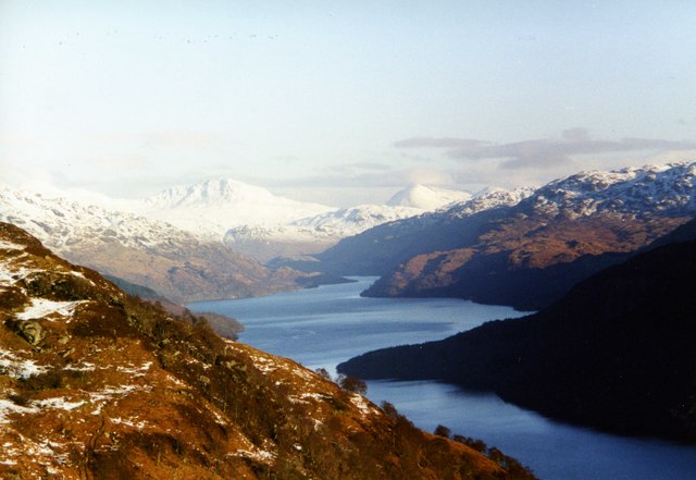
Loch Lomond, Argyll and Bute, Scotland, Great
Britain Taken from just below Beinn Dubh and Creag an t-Seilich. {{geograph|297191|wfmillar}}
46:
78:
162:
843:
813:
612:
542:
506:
208:
632:
243:
333:
469:
718:
691:
640:
596:
490:
462:
449:
434:
936:
823:
655:
625:
562:
526:
407:
390:
230:
838:
289:
809:
The following pages on the
English Knowledge (XXG) use this file (pages on other projects are not listed):
332:– If you remix, transform, or build upon the material, you must distribute your contributions under the
250:
on the
Geograph website for the photographer's contact details. The copyright on this image is owned by
991:
781:
776:
286:
37:
684:"}},"text\/plain":{"en":{"P7787":"292 degree"}}}}": -->
1011:
1071:
86:
662:
647:
441:
926:
792:
911:
214:
1036:
255:
73:
961:
971:
871:
198:
833:
130:
981:
956:
151:
141:
946:
235:
1031:
1021:
247:
121:
Loch Lomond. Taken from just below Beinn Dubh and Creag an t-Seilich.
749:
Click on a date/time to view the file as it appeared at that time.
200:
185:
56° 06′ 49.16″ N, 4° 39′ 36.28″ W
175:
61:
1061:
1001:
901:
891:
881:
861:
374:
Add a one-line explanation of what this file represents
921:
169:
Creative
Commons Attribution Share-alike license 2.0
105:
85:
Commons is a freely licensed media file repository.
543:
Creative
Commons Attribution-ShareAlike 2.0 Generic
51:(640 × 441 pixels, file size: 54 KB, MIME type:
343:https://creativecommons.org/licenses/by-sa/2.0
66:
927:Loch Lomond eta The Trossachs Parke Nazionala
829:List of lakes and lochs of the United Kingdom
349:Creative Commons Attribution-Share Alike 2.0
267:
8:
1037:Sinru qillqa: Iskusya suyupi wat'akuna
912:Parque nacional Lago Lomond y los Trossachs
681:
309:– to copy, distribute and transmit the work
751:
370:
1072:Birleşik Krallık'taki göller listesi
854:The following other wikis use this file:
663:https://www.geograph.org.uk/photo/297191
442:https://www.geograph.org.uk/profile/7544
811:
705:
689:
610:
594:
576:
560:
540:
524:
504:
488:
421:
405:
388:
385:
366:
359:
178:
992:Loch Lomond og Trossachs-þjóðgarðurinn
819:List of freshwater islands in Scotland
207:View this and other nearby images on:
7:
254:and is licensed for reuse under the
740:
290:Attribution-Share Alike 2.0 Generic
278:
273:
258:Attribution-ShareAlike 2.0 license.
872:Llista de les illes d'Escòcia
844:User:The world tour/Scottish lochs
379:
373:
264:
241:
115:
98:
44:
978:Usage on incubator.wikimedia.org
378:
962:Liste des sites Ramsar en Écosse
814:List of Ramsar sites in Scotland
692:coordinates of the point of view
364:
320:Under the following conditions:
285:This file is licensed under the
277:
272:
266:
234:
213:
199:
191:
65:
31:
21:
361:
116:
111:LochLomond(wfmillar)Jan2000.jpg
47:LochLomond(wfmillar)Jan2000.jpg
41:No higher resolution available.
14:
613:file available on the internet
360:
242:This image was taken from the
26:
1:
957:Liste des lochs d'Écosse
947:Luettelo Skotlannin saarista
707:56°6'49.162"N, 4°39'36.284"W
633:Geograph Britain and Ireland
463:object of statement has role
386:Items portrayed in this file
190:
824:List of islands of Scotland
1100:
1078:Usage on uk.wikipedia.org
1068:Usage on tr.wikipedia.org
1058:Usage on sh.wikipedia.org
1043:Usage on ru.wikipedia.org
1032:Hukllachasqa Qhapaq Llaqta
1028:Usage on qu.wikipedia.org
1018:Usage on nn.wikipedia.org
1008:Usage on ja.wikipedia.org
998:Usage on it.wikipedia.org
988:Usage on is.wikipedia.org
972:Skócia szigeteinek listája
968:Usage on hu.wikipedia.org
953:Usage on fr.wikipedia.org
943:Usage on fi.wikipedia.org
933:Usage on fa.wikipedia.org
918:Usage on eu.wikipedia.org
908:Usage on es.wikipedia.org
898:Usage on eo.wikipedia.org
888:Usage on de.wikipedia.org
878:Usage on da.wikipedia.org
868:Usage on ca.wikipedia.org
858:Usage on af.wikipedia.org
334:same or compatible license
1047:Список островов Шотландии
741:
16:
839:User:Euchiasmus/geograph
641:geograph.org.uk image ID
363:
300:
72:This is a file from the
798:
157:
147:
136:
129:
126:
108:
76:. Information from its
1082:Озера Великої Британії
777:22:35, 19 January 2007
248:this photograph's page
219:56.113656; -4.660079
79:description page there
1052:Озёра Великобритании
1022:Innsjøar i Skottland
315:– to adapt the work
450:author name string
850:Global file usage
802:
683:
527:copyright license
372:
263:
262:
246:collection. See
224:
223:
173:
172:
166:
163:Reusing this file
94:
93:
74:Wikimedia Commons
32:Global file usage
1091:
789:
729:
728:
723:
665:
660:
656:described at URL
650:
645:
635:
630:
491:copyright status
472:
467:
457:
454:
444:
439:
356:
353:
350:
347:
344:
336:as the original.
298:
287:Creative Commons
281:
280:
276:
275:
270:
269:
256:Creative Commons
244:Geograph project
238:
231:
220:
217:
203:
202:
196:
195:
194:
188:
187:
176:
160:
132:
120:
112:
106:
90:
69:
68:
62:
56:
54:
1099:
1098:
1094:
1093:
1092:
1090:
1089:
1088:
848:
810:
803:
795:
787:
743:
742:
739:
738:
737:
736:
735:
734:
733:
732:
731:
730:
726:
724:
721:
712:
711:
710:
708:
698:
697:
696:
694:
675:
674:
673:
672:
671:
670:
669:
668:
667:
666:
661:
658:
652:
651:
646:
643:
637:
636:
631:
628:
619:
618:
617:
615:
603:
602:
601:
599:
588:
587:
586:
585:
584:
583:
582:
581:
579:
578:15 January 2000
569:
568:
567:
565:
554:
553:
552:
551:
550:
549:
548:
547:
545:
533:
532:
531:
529:
518:
517:
516:
515:
514:
513:
512:
511:
509:
497:
496:
495:
493:
482:
481:
480:
479:
478:
477:
476:
475:
474:
473:
468:
465:
459:
458:
455:
452:
446:
445:
440:
437:
428:
427:
426:
424:
414:
413:
412:
410:
399:
398:
397:
396:
395:
393:
377:
376:
375:
358:
357:
354:
351:
348:
345:
342:
341:
299:
296:
293:
282:
259:
229:
218:
192:
183:
182:
179:Camera location
174:
142:geograph.org.uk
131:15 January 2000
122:
110:
103:
96:
95:
84:
83:
82:is shown below.
58:
52:
50:
43:
42:
12:
11:
5:
1097:
1095:
1087:
1086:
1085:
1084:
1076:
1075:
1074:
1066:
1065:
1064:
1056:
1055:
1054:
1049:
1041:
1040:
1039:
1034:
1026:
1025:
1024:
1016:
1015:
1014:
1006:
1005:
1004:
996:
995:
994:
986:
985:
984:
982:Wy/diq/İsqoçya
976:
975:
974:
966:
965:
964:
959:
951:
950:
949:
941:
940:
939:
931:
930:
929:
924:
916:
915:
914:
906:
905:
904:
896:
895:
894:
886:
885:
884:
876:
875:
874:
866:
865:
864:
852:
851:
847:
846:
841:
836:
831:
826:
821:
816:
808:
807:
806:
801:
800:
797:
793:
790:
784:
779:
774:
770:
769:
766:
763:
760:
757:
754:
747:
746:
717:
716:
715:
714:
713:
709:
706:
704:
703:
702:
701:
700:
699:
695:
690:
688:
687:
686:
685:
679:
654:
653:
639:
638:
624:
623:
622:
621:
620:
616:
611:
609:
608:
607:
606:
605:
604:
600:
597:source of file
595:
593:
592:
591:
590:
589:
580:
577:
575:
574:
573:
572:
571:
570:
566:
561:
559:
558:
557:
556:
555:
546:
541:
539:
538:
537:
536:
535:
534:
530:
525:
523:
522:
521:
520:
519:
510:
505:
503:
502:
501:
500:
499:
498:
494:
489:
487:
486:
485:
484:
483:
461:
460:
448:
447:
433:
432:
431:
430:
429:
425:
422:
420:
419:
418:
417:
416:
415:
411:
406:
404:
403:
402:
401:
400:
394:
389:
387:
384:
383:
382:
381:
380:
369:
368:
365:
362:
340:
339:
338:
337:
327:
318:
317:
316:
310:
303:You are free:
294:
284:
283:
265:
261:
260:
239:
228:
225:
222:
221:
211:
205:
180:
171:
170:
167:
155:
154:
149:
145:
144:
138:
134:
133:
128:
124:
123:
113:
104:
102:
99:
97:
92:
91:
70:
60:
59:
40:
36:
35:
34:
29:
24:
19:
13:
10:
9:
6:
4:
3:
2:
1096:
1083:
1080:
1079:
1077:
1073:
1070:
1069:
1067:
1063:
1060:
1059:
1057:
1053:
1050:
1048:
1045:
1044:
1042:
1038:
1035:
1033:
1030:
1029:
1027:
1023:
1020:
1019:
1017:
1013:
1010:
1009:
1007:
1003:
1000:
999:
997:
993:
990:
989:
987:
983:
980:
979:
977:
973:
970:
969:
967:
963:
960:
958:
955:
954:
952:
948:
945:
944:
942:
938:
937:دریاچه لوموند
935:
934:
932:
928:
925:
923:
920:
919:
917:
913:
910:
909:
907:
903:
900:
899:
897:
893:
890:
889:
887:
883:
880:
879:
877:
873:
870:
869:
867:
863:
860:
859:
857:
856:
855:
849:
845:
842:
840:
837:
835:
832:
830:
827:
825:
822:
820:
817:
815:
812:
804:
796:
791:
785:
783:
780:
778:
775:
772:
771:
767:
764:
761:
758:
755:
753:
752:
750:
744:
720:
693:
664:
657:
649:
642:
634:
627:
614:
598:
564:
544:
528:
508:
492:
471:
464:
451:
443:
436:
409:
392:
346:CC BY-SA 2.0
335:
331:
328:
325:
322:
321:
319:
314:
311:
308:
305:
304:
302:
301:
295:Attribution:
291:
288:
271:
257:
253:
249:
245:
240:
237:
233:
232:
226:
216:
212:
210:
209:OpenStreetMap
206:
204:
186:
181:
177:
168:
164:
159:
156:
153:
150:
146:
143:
139:
135:
125:
119:
114:
107:
100:
88:
81:
80:
75:
71:
64:
63:
57:
48:
39:
33:
30:
28:
25:
23:
20:
18:
15:
853:
748:
745:File history
470:photographer
329:
323:
312:
306:
251:
189:
117:
87:You can help
77:
45:
22:File history
1062:Loch Lomond
1002:Loch Lomond
902:Loch Lomond
892:Loch Lomond
882:Loch Lomond
862:Loch Lomond
834:Loch Lomond
507:copyrighted
330:share alike
324:attribution
109:Description
805:File usage
794:Euchiasmus
786:640 × 441
762:Dimensions
423:some value
158:Permission
53:image/jpeg
27:File usage
759:Thumbnail
756:Date/Time
563:inception
227:Licensing
118:English:
626:operator
456:wfmillar
367:Captions
313:to remix
307:to share
297:wfmillar
292:license.
252:wfmillar
152:wfmillar
922:Eskozia
788:(54 KB)
773:current
768:Comment
719:heading
678:heading
408:creator
391:depicts
371:English
101:Summary
49:
1012:ローモンド湖
727:degree
682:degree
648:297191
197:
148:Author
137:Source
140:From
765:User
725:292
355:true
352:true
127:Date
17:File
435:URL
722::
659::
644::
629::
466::
453::
438::
165:)
161:(
89:.
55:)
Text is available under the Creative Commons Attribution-ShareAlike License. Additional terms may apply.
Jan2000.jpg)
Jan2000.jpg¶ms=056.113656_N_-004.660079_E_globe:Earth_type:camera_heading:292.00_source:geograph&language=en)
