348:
281:
231:
273:
223:
295:
245:
316:
354:
359:
72:
824:"}},"text\/plain":{"en":{"":"heading"}}},"{\"value\":{\"amount\":\"+135\",\"unit\":\"http:\\\/\\\/www.wikidata.org\\\/entity\\\/Q28390\"},\"type\":\"quantity\"}":{"text\/html":{"en":{"P7787":"135
760:"}},"text\/plain":{"en":{"":"heading"}}},"{\"value\":{\"amount\":\"+135\",\"unit\":\"http:\\\/\\\/www.wikidata.org\\\/entity\\\/Q28390\"},\"type\":\"quantity\"}":{"text\/html":{"en":{"P7787":"135
926:
820:
214:
43:
406:– You must give appropriate credit, provide a link to the license, and indicate if changes were made. You may do so in any reasonable manner, but not in any way that suggests the licensor endorses you or your use.
83:
51:
821:
757:
943:== {{int:filedesc}} == {{Information |description={{en|1=Lodge Farm, Southern Green}} |date=2007-08-06 |source=From |author= |permission= |oth
692:
622:
586:
288:
238:
742:
1117:
925:
920:
323:
42:
988:
This file contains additional information, probably added from the digital camera or scanner used to create or digitize it.
413:
521:
862:
835:
798:
771:
720:
676:
570:
544:
529:
514:
735:
705:
642:
606:
487:
470:
310:
957:
369:
991:
If the file has been modified from its original state, some details may not fully reflect the modified file.
953:
The following pages on the
English Knowledge (XXG) use this file (pages on other projects are not listed):
1136:
412:– If you remix, transform, or build upon the material, you must distribute your contributions under the
330:
on the
Geograph website for the photographer's contact details. The copyright on this image is owned by
936:
366:
828:"}},"text\/plain":{"en":{"P7787":"135 degree"}}}}": -->
764:"}},"text\/plain":{"en":{"P7787":"135 degree"}}}}": -->
1172:
91:
183:
1086:
536:
727:
712:
167:
294:
244:
1154:
1017:
335:
78:
1057:
1182:
135:
1037:
228:
278:
156:
146:
1027:
315:
975:
327:
893:
Click on a date/time to view the file as it appeared at that time.
1000:
1010:
280:
230:
255:
205:
66:
265:
51° 57′ 53″ N, 0° 04′ 37″ W
215:
51° 57′ 58″ N, 0° 04′ 44″ W
116:
Lodge Farm, Southern Green - geograph.org.uk - 517476.jpg
52:
Lodge_Farm,_Southern_Green_-_geograph.org.uk_-_517476.jpg
454:
Add a one-line explanation of what this file represents
110:
90:
Commons is a freely licensed media file repository.
623:
Creative
Commons Attribution-ShareAlike 2.0 Generic
56:(640 × 480 pixels, file size: 115 KB, MIME type:
423:https://creativecommons.org/licenses/by-sa/2.0
71:
429:Creative Commons Attribution-Share Alike 2.0
347:
8:
825:
761:
389:– to copy, distribute and transmit the work
993:
895:
450:
968:The following other wikis use this file:
537:https://www.geograph.org.uk/profile/11413
713:https://www.geograph.org.uk/photo/517476
1180:
1170:
1162:
1152:
1144:
1134:
1126:
1115:
1107:
1099:
1091:
1081:
1073:
1065:
1054:
1046:
1035:
1025:
1015:
1005:
955:
849:
833:
785:
769:
690:
674:
656:
640:
620:
604:
584:
568:
501:
485:
468:
465:
446:
439:
258:
208:
287:View this and other nearby images on:
237:View this and other nearby images on:
995:
7:
334:and is licensed for reuse under the
884:
370:Attribution-Share Alike 2.0 Generic
358:
353:
338:Attribution-ShareAlike 2.0 license.
986:
459:
453:
344:
321:
120:
103:
49:
458:
1048:Date and time of data generation
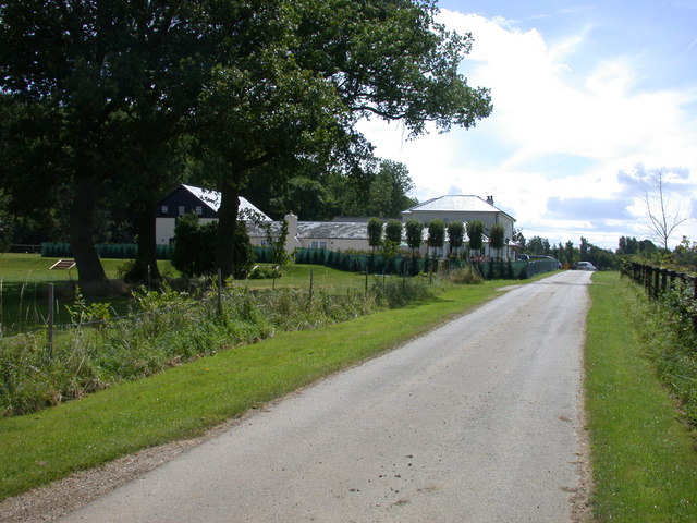
1022:15,883/5,000,000 sec (0.0031766)
772:coordinates of the point of view
444:
400:Under the following conditions:
365:This file is licensed under the
357:
352:
346:
314:
293:
279:
271:
243:
229:
221:
70:
31:
21:
441:
121:
46:No higher resolution available.
14:
693:file available on the internet
440:
322:This image was taken from the
26:
1:
836:coordinates of depicted place
36:
743:Geograph Britain and Ireland
515:object of statement has role
466:Items portrayed in this file
270:
220:
1128:Date and time of digitizing
1204:
972:Usage on sv.wikipedia.org
851:51°57'52.56"N, 0°4'37.20"W
787:51°57'57.53"N, 0°4'43.68"W
414:same or compatible license
198:Lodge Farm, Southern Green
179:Lodge Farm, Southern Green
126:Lodge Farm, Southern Green
1093:File change date and time
976:Broadfield, Hertfordshire
958:Broadfield, Hertfordshire
885:
196:Keith Edkins /
177:Keith Edkins /
16:
721:geograph.org.uk image ID
443:
380:
77:This is a file from the
942:
168:required by the license
152:
141:
134:
131:
113:
81:. Information from its
921:13:05, 5 February 2011
328:this photograph's page
299:51.964600; -0.077000
249:51.965980; -0.078800
84:description page there
1146:Maximum land aperture
1067:Horizontal resolution
1131:11:38, 6 August 2007
1096:11:38, 6 August 2007
1051:11:38, 6 August 2007
1101:Y and C positioning
1075:Vertical resolution
997:Camera manufacturer
395:– to adapt the work
1177:Flash did not fire
545:author name string
1191:
1190:
964:Global file usage
946:
827:
763:
607:copyright license
452:
343:
342:
326:collection. See
304:
303:
254:
253:
203:
202:
171:
99:
98:
79:Wikimedia Commons
32:Global file usage
1195:
1109:Exposure Program
994:
933:
873:
872:
867:
809:
808:
803:
745:
740:
730:
725:
715:
710:
706:described at URL
571:copyright status
552:
549:
539:
534:
524:
519:
436:
433:
430:
427:
424:
416:as the original.
378:
367:Creative Commons
361:
360:
356:
355:
350:
349:
336:Creative Commons
324:Geograph project
318:
311:
300:
297:
283:
282:
276:
275:
274:
268:
267:
256:
250:
247:
233:
232:
226:
225:
224:
218:
217:
206:
165:
137:
125:
117:
111:
95:
74:
73:
67:
61:
59:
1203:
1202:
1198:
1197:
1196:
1194:
1193:
1192:
982:
962:
954:
947:
939:
931:
887:
886:
883:
882:
881:
880:
879:
878:
877:
876:
875:
874:
870:
868:
865:
856:
855:
854:
852:
842:
841:
840:
838:
819:
818:
817:
816:
815:
814:
813:
812:
811:
810:
806:
804:
801:
792:
791:
790:
788:
778:
777:
776:
774:
755:
754:
753:
752:
751:
750:
749:
748:
747:
746:
741:
738:
732:
731:
726:
723:
717:
716:
711:
708:
699:
698:
697:
695:
683:
682:
681:
679:
668:
667:
666:
665:
664:
663:
662:
661:
659:
649:
648:
647:
645:
634:
633:
632:
631:
630:
629:
628:
627:
625:
613:
612:
611:
609:
598:
597:
596:
595:
594:
593:
592:
591:
589:
577:
576:
575:
573:
562:
561:
560:
559:
558:
557:
556:
555:
554:
553:
550:
547:
541:
540:
535:
532:
526:
525:
520:
517:
508:
507:
506:
504:
494:
493:
492:
490:
479:
478:
477:
476:
475:
473:
457:
456:
455:
438:
437:
434:
431:
428:
425:
422:
421:
379:
376:
373:
362:
339:
309:
298:
272:
263:
262:
259:Object location
248:
222:
213:
212:
209:Camera location
204:
193:
186:
174:
147:geograph.org.uk
127:
115:
108:
101:
100:
89:
88:
87:is shown below.
63:
57:
55:
48:
47:
12:
11:
5:
1201:
1199:
1189:
1188:
1185:
1179:
1178:
1175:
1169:
1168:
1165:
1161:
1160:
1157:
1151:
1150:
1147:
1143:
1142:
1139:
1133:
1132:
1129:
1125:
1124:
1121:
1114:
1113:
1112:Normal program
1110:
1106:
1105:
1102:
1098:
1097:
1094:
1090:
1089:
1084:
1080:
1079:
1076:
1072:
1071:
1068:
1064:
1063:
1060:
1053:
1052:
1049:
1045:
1044:
1041:
1034:
1033:
1030:
1024:
1023:
1020:
1014:
1013:
1008:
1004:
1003:
998:
985:
981:
980:
979:
978:
966:
965:
961:
960:
952:
951:
950:
945:
944:
941:
937:
934:
928:
923:
918:
914:
913:
910:
907:
904:
901:
898:
891:
890:
861:
860:
859:
858:
857:
853:
850:
848:
847:
846:
845:
844:
843:
839:
834:
832:
831:
830:
829:
823:
797:
796:
795:
794:
793:
789:
786:
784:
783:
782:
781:
780:
779:
775:
770:
768:
767:
766:
765:
759:
734:
733:
719:
718:
704:
703:
702:
701:
700:
696:
691:
689:
688:
687:
686:
685:
684:
680:
677:source of file
675:
673:
672:
671:
670:
669:
660:
657:
655:
654:
653:
652:
651:
650:
646:
641:
639:
638:
637:
636:
635:
626:
621:
619:
618:
617:
616:
615:
614:
610:
605:
603:
602:
601:
600:
599:
590:
585:
583:
582:
581:
580:
579:
578:
574:
569:
567:
566:
565:
564:
563:
543:
542:
528:
527:
513:
512:
511:
510:
509:
505:
502:
500:
499:
498:
497:
496:
495:
491:
486:
484:
483:
482:
481:
480:
474:
469:
467:
464:
463:
462:
461:
460:
449:
448:
445:
442:
420:
419:
418:
417:
407:
398:
397:
396:
390:
383:You are free:
374:
364:
363:
345:
341:
340:
319:
308:
305:
302:
301:
291:
285:
260:
252:
251:
241:
235:
210:
201:
200:
194:
191:
188:
187:
182:
175:
172:
160:
159:
154:
150:
149:
143:
139:
138:
133:
129:
128:
118:
109:
107:
104:
102:
97:
96:
75:
65:
64:
45:
41:
40:
39:
34:
29:
24:
19:
13:
10:
9:
6:
4:
3:
2:
1200:
1186:
1184:
1181:
1176:
1174:
1171:
1166:
1163:
1158:
1156:
1155:Metering mode
1153:
1148:
1145:
1140:
1138:
1137:Exposure bias
1135:
1130:
1127:
1122:
1119:
1116:
1111:
1108:
1103:
1100:
1095:
1092:
1088:
1085:
1083:Software used
1082:
1077:
1074:
1069:
1066:
1061:
1059:
1055:
1050:
1047:
1042:
1039:
1036:
1031:
1029:
1026:
1021:
1019:
1018:Exposure time
1016:
1012:
1009:
1006:
1002:
999:
996:
992:
989:
983:
977:
974:
973:
971:
970:
969:
963:
959:
956:
948:
940:
935:
929:
927:
924:
922:
919:
916:
915:
911:
908:
905:
902:
899:
897:
896:
894:
888:
864:
837:
800:
773:
744:
737:
729:
722:
714:
707:
694:
678:
658:6 August 2007
644:
624:
608:
588:
572:
546:
538:
531:
523:
516:
489:
472:
426:CC BY-SA 2.0
415:
411:
408:
405:
402:
401:
399:
394:
391:
388:
385:
384:
382:
381:
375:Attribution:
371:
368:
351:
337:
333:
329:
325:
320:
317:
313:
312:
306:
296:
292:
290:
289:OpenStreetMap
286:
284:
266:
261:
257:
246:
242:
240:
239:OpenStreetMap
236:
234:
216:
211:
207:
199:
195:
190:
189:
185:
181: /
180:
176:
169:
164:
162:
161:
158:
155:
151:
148:
144:
140:
136:6 August 2007
130:
124:
119:
112:
105:
93:
86:
85:
80:
76:
69:
68:
62:
53:
44:
38:
35:
33:
30:
28:
25:
23:
20:
18:
15:
1164:Light source
1149:0 APEX (f/1)
1058:focal length
1007:Camera model
990:
987:
967:
892:
889:File history
551:Keith Edkins
522:photographer
409:
403:
392:
386:
377:Keith Edkins
332:Keith Edkins
331:
269:
219:
197:
184:CC BY-SA 2.0
178:
157:Keith Edkins
122:
92:You can help
82:
50:
22:File history
1183:Color space
938:GeographBot
587:copyrighted
410:share alike
404:attribution
163:Attribution
114:Description
949:File usage
930:640 × 480
906:Dimensions
503:some value
58:image/jpeg
27:File usage
1038:ISO speed
903:Thumbnail
900:Date/Time
643:inception
307:Licensing
192:InfoField
173:InfoField
123:English:
1104:Centered
1087:E995v1.6
1028:F-number
984:Metadata
932:(115 KB)
736:operator
447:Captions
393:to remix
387:to share
372:license.
37:Metadata
1167:Unknown
1159:Pattern
1120:version
917:current
912:Comment
863:heading
822:heading
799:heading
758:heading
488:creator
471:depicts
451:English
106:Summary
54:
1078:72 dpi
1070:72 dpi
1062:9.3 mm
1040:rating
871:degree
826:degree
807:degree
762:degree
728:517476
277:
227:
153:Author
142:Source
1173:Flash
1056:Lens
1032:f/6.2
1001:NIKON
145:From
1187:sRGB
1118:Exif
1011:E995
909:User
869:135
805:135
435:true
432:true
132:Date
17:File
1123:2.1
1043:100
530:URL
866::
802::
739::
724::
709::
548::
533::
518::
1141:0
170:)
166:(
94:.
60:)
Text is available under the Creative Commons Attribution-ShareAlike License. Additional terms may apply.
_heading:135.00&language=en)
_heading:135.00&language=en)
