297:
227:
219:
396:
241:
265:
303:
308:
67:
825:"}},"text\/plain":{"en":{"":"heading"}}},"{\"value\":{\"amount\":\"+225\",\"unit\":\"http:\\\/\\\/www.wikidata.org\\\/entity\\\/Q28390\"},\"type\":\"quantity\"}":{"text\/html":{"en":{"P7787":"225
927:
821:
38:
944:== {{int:filedesc}} == {{Information |description={{en|1=Longdon Road Station Level Crossing. The site of the level crossing on the former Moreton-in-Marsh to Shipston-on-Stour branch, right on the southern edge of the square. The station was to the left
355:– You must give appropriate credit, provide a link to the license, and indicate if changes were made. You may do so in any reasonable manner, but not in any way that suggests the licensor endorses you or your use.
122:
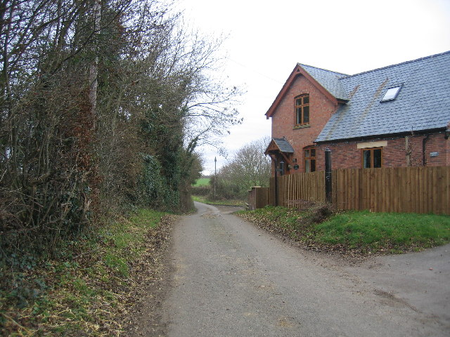
two surviving cast iron gateposts in the new fence on the right. The former crossing keepers cottage seems to have survived as a small annex of a much larger complex of housing built on the old railway formation.
78:
46:
404:
822:
421:
926:
921:
37:
757:
687:
651:
234:
777:
1077:
272:
969:
This file contains additional information, probably added from the digital camera or scanner used to create or digitize it.
362:
614:
958:
863:
836:
785:
741:
635:
607:
594:
579:
497:
800:
770:
707:
671:
552:
535:
444:
259:
436:
318:
972:
If the file has been modified from its original state, some details may not fully reflect the modified file.
417:
991:
954:
The following pages on the
English Knowledge (XXG) use this file (pages on other projects are not listed):
1122:
361:– If you remix, transform, or build upon the material, you must distribute your contributions under the
279:
on the
Geograph website for the photographer's contact details. The copyright on this image is owned by
937:
315:
829:"}},"text\/plain":{"en":{"P7787":"225 degree"}}}}": -->
1150:
425:
86:
179:
410:
Remove redundant categories and try to put this image in the most specific category/categories
163:
981:
807:
792:
586:
488:
492:
484:
480:
476:
472:
468:
464:
460:
456:
452:
240:
1218:
1140:
1104:
998:
284:
73:
1228:
1027:
1160:
131:
224:
152:
142:
1008:
264:
276:
894:
Click on a date/time to view the file as it appeared at that time.
111:
Longdon Road
Station Level Crossing - geograph.org.uk - 93426.jpg
47:
Longdon_Road_Station_Level_Crossing_-_geograph.org.uk_-_93426.jpg
226:
201:
61:
211:
52° 04′ 35″ N, 1° 40′ 16″ W
519:
Add a one-line explanation of what this file represents
424:
combined with a database. You can also have a look at
416:
The location categories are based on information from
105:
85:
Commons is a freely licensed media file repository.
688:
Creative
Commons Attribution-ShareAlike 2.0 Generic
51:(640 × 480 pixels, file size: 121 KB, MIME type:
401:The categories of this image should be checked.
372:https://creativecommons.org/licenses/by-sa/2.0
66:
378:Creative Commons Attribution-Share Alike 2.0
296:
8:
826:
338:– to copy, distribute and transmit the work
974:
896:
515:
496:
1237:
1226:
1216:
1208:
1200:
1192:
1184:
1176:
1168:
1158:
1148:
1138:
1130:
1120:
1112:
1102:
1094:
1086:
1075:
1067:
1059:
1051:
1043:
1035:
1024:
1016:
1006:
996:
986:
956:
850:
834:
808:https://www.geograph.org.uk/photo/93426
755:
739:
721:
705:
685:
669:
649:
633:
587:https://www.geograph.org.uk/profile/120
566:
550:
533:
530:
511:
504:
443:This image was uploaded as part of the
204:
233:View this and other nearby images on:
976:
431:The topic category from Geograph was
7:
283:and is licensed for reuse under the
885:
319:Attribution-Share Alike 2.0 Generic
307:
302:
287:Attribution-ShareAlike 2.0 license.
194:Longdon Road Station Level Crossing
175:Longdon Road Station Level Crossing
967:
524:
518:
293:
270:
115:
98:
44:
523:
1018:Date and time of data generation
509:
394:
349:Under the following conditions:
314:This file is licensed under the
306:
301:
295:
263:
239:
225:
217:
65:
21:
506:
116:
41:No higher resolution available.
14:
758:file available on the internet
505:
271:This image was taken from the
26:
1:
1155:Flash did not fire, auto mode
837:coordinates of depicted place
31:
959:Longdon Road railway station
778:Geograph Britain and Ireland
608:object of statement has role
531:Items portrayed in this file
216:
1186:Focal plane resolution unit
1088:Date and time of digitizing
1259:
1197:One-chip color area sensor
363:same or compatible license
192:David Stowell /
173:David Stowell /
1061:File change date and time
886:
16:
1178:Focal plane Y resolution
1170:Focal plane X resolution
852:52°4'35.0"N, 1°40'15.6"W
786:geograph.org.uk image ID
508:
426:this tool from mysociety
392:
391:
329:
72:This is a file from the
1202:Custom image processing
1091:13:11, 18 December 2005
1064:13:11, 18 December 2005
1021:13:11, 18 December 2005
943:
422:this OpenStreetMap tool
164:required by the license
148:
137:
130:
127:
108:
76:. Information from its
1096:Image compression mode
992:Canon DIGITAL IXUS 500
922:23:21, 30 January 2010
277:this photograph's page
245:52.076400; -1.671000
79:description page there
1132:Maximum land aperture
1045:Horizontal resolution
445:Geograph batch upload
435:(find similar images
1135:2.96875 APEX (f/2.8)
437:crossing at Geograph
413:Remove this template
1069:Y and C positioning
1053:Vertical resolution
978:Camera manufacturer
489:português do Brasil
344:– to adapt the work
1239:Scene capture type
1223:Auto white balance
595:author name string
418:this geonames tool
1246:
1245:
947:
828:
672:copyright license
517:
500:
447:
292:
291:
275:collection. See
250:
249:
199:
198:
167:
94:
93:
74:Wikimedia Commons
1250:
1181:7,245.2830188679
1173:7,236.7491166078
1003:1/100 sec (0.01)
975:
934:
874:
873:
868:
810:
805:
801:described at URL
795:
790:
780:
775:
723:18 December 2005
636:copyright status
617:
612:
602:
599:
589:
584:
501:
442:
399:
398:
397:
385:
382:
379:
376:
373:
365:as the original.
327:
316:Creative Commons
310:
309:
305:
304:
299:
298:
285:Creative Commons
273:Geograph project
267:
260:
246:
243:
229:
228:
222:
221:
220:
214:
213:
202:
161:
133:
132:18 December 2005
120:
112:
106:
90:
69:
68:
62:
56:
54:
1258:
1257:
1253:
1252:
1251:
1249:
1248:
1247:
963:
955:
948:
940:
932:
888:
887:
884:
883:
882:
881:
880:
879:
878:
877:
876:
875:
871:
869:
866:
857:
856:
855:
853:
843:
842:
841:
839:
820:
819:
818:
817:
816:
815:
814:
813:
812:
811:
806:
803:
797:
796:
791:
788:
782:
781:
776:
773:
764:
763:
762:
760:
748:
747:
746:
744:
733:
732:
731:
730:
729:
728:
727:
726:
724:
714:
713:
712:
710:
699:
698:
697:
696:
695:
694:
693:
692:
690:
678:
677:
676:
674:
663:
662:
661:
660:
659:
658:
657:
656:
654:
642:
641:
640:
638:
627:
626:
625:
624:
623:
622:
621:
620:
619:
618:
613:
610:
604:
603:
600:
597:
591:
590:
585:
582:
573:
572:
571:
569:
559:
558:
557:
555:
544:
543:
542:
541:
540:
538:
522:
521:
520:
503:
451:
448:
405:Check them now!
395:
393:
387:
386:
383:
380:
377:
374:
371:
370:
328:
325:
322:
311:
288:
258:
244:
218:
209:
208:
205:Object location
200:
189:
182:
170:
143:geograph.org.uk
123:
110:
103:
96:
95:
84:
83:
82:is shown below.
58:
52:
50:
43:
42:
12:
11:
5:
1256:
1254:
1244:
1243:
1240:
1236:
1235:
1232:
1225:
1224:
1221:
1215:
1214:
1211:
1207:
1206:
1205:Normal process
1203:
1199:
1198:
1195:
1194:Sensing method
1191:
1190:
1187:
1183:
1182:
1179:
1175:
1174:
1171:
1167:
1166:
1163:
1157:
1156:
1153:
1147:
1146:
1143:
1137:
1136:
1133:
1129:
1128:
1125:
1119:
1118:
1115:
1111:
1110:
1107:
1101:
1100:
1097:
1093:
1092:
1089:
1085:
1084:
1081:
1074:
1073:
1070:
1066:
1065:
1062:
1058:
1057:
1054:
1050:
1049:
1046:
1042:
1041:
1038:
1034:
1033:
1030:
1023:
1022:
1019:
1015:
1014:
1011:
1005:
1004:
1001:
995:
994:
989:
985:
984:
979:
966:
962:
961:
953:
952:
951:
946:
945:
942:
938:
935:
929:
924:
919:
915:
914:
911:
908:
905:
902:
899:
892:
891:
862:
861:
860:
859:
858:
854:
851:
849:
848:
847:
846:
845:
844:
840:
835:
833:
832:
831:
830:
824:
799:
798:
784:
783:
769:
768:
767:
766:
765:
761:
756:
754:
753:
752:
751:
750:
749:
745:
742:source of file
740:
738:
737:
736:
735:
734:
725:
722:
720:
719:
718:
717:
716:
715:
711:
706:
704:
703:
702:
701:
700:
691:
686:
684:
683:
682:
681:
680:
679:
675:
670:
668:
667:
666:
665:
664:
655:
650:
648:
647:
646:
645:
644:
643:
639:
634:
632:
631:
630:
629:
628:
606:
605:
593:
592:
578:
577:
576:
575:
574:
570:
567:
565:
564:
563:
562:
561:
560:
556:
551:
549:
548:
547:
546:
545:
539:
534:
532:
529:
528:
527:
526:
525:
514:
513:
510:
507:
441:
440:
433:Level crossing
429:
414:
411:
369:
368:
367:
366:
356:
347:
346:
345:
339:
332:You are free:
323:
313:
312:
294:
290:
289:
268:
257:
254:
248:
247:
237:
231:
206:
197:
196:
190:
187:
184:
183:
178:
171:
168:
156:
155:
150:
146:
145:
139:
135:
134:
129:
125:
124:
113:
104:
102:
99:
97:
92:
91:
70:
60:
59:
40:
36:
35:
34:
29:
24:
19:
13:
10:
9:
6:
4:
3:
2:
1255:
1241:
1238:
1233:
1230:
1227:
1222:
1220:
1219:White balance
1217:
1213:Auto exposure
1212:
1210:Exposure mode
1209:
1204:
1201:
1196:
1193:
1188:
1185:
1180:
1177:
1172:
1169:
1164:
1162:
1159:
1154:
1152:
1149:
1144:
1142:
1141:Metering mode
1139:
1134:
1131:
1126:
1124:
1123:Exposure bias
1121:
1116:
1114:APEX aperture
1113:
1108:
1106:
1105:Shutter speed
1103:
1098:
1095:
1090:
1087:
1082:
1079:
1076:
1071:
1068:
1063:
1060:
1055:
1052:
1047:
1044:
1039:
1036:
1031:
1029:
1025:
1020:
1017:
1012:
1010:
1007:
1002:
1000:
999:Exposure time
997:
993:
990:
987:
983:
980:
977:
973:
970:
964:
960:
957:
949:
941:
936:
930:
928:
925:
923:
920:
917:
916:
912:
909:
906:
903:
900:
898:
897:
895:
889:
865:
838:
809:
802:
794:
787:
779:
772:
759:
743:
709:
689:
673:
653:
637:
616:
609:
601:David Stowell
596:
588:
581:
554:
537:
502:
499:
494:
490:
486:
482:
478:
474:
470:
466:
462:
458:
454:
449:
446:
438:
434:
430:
427:
423:
419:
415:
412:
409:
408:
407:
406:
402:
390:
389:
375:CC BY-SA 2.0
364:
360:
357:
354:
351:
350:
348:
343:
340:
337:
334:
333:
331:
330:
326:David Stowell
324:Attribution:
320:
317:
300:
286:
282:
281:David Stowell
278:
274:
269:
266:
262:
261:
255:
253:
252:
242:
238:
236:
235:OpenStreetMap
232:
230:
212:
207:
203:
195:
191:
186:
185:
181:
177: /
176:
172:
165:
160:
158:
157:
154:
153:David Stowell
151:
147:
144:
140:
136:
126:
119:
114:
107:
100:
88:
81:
80:
75:
71:
64:
63:
57:
48:
39:
33:
30:
28:
25:
23:
20:
18:
15:
1229:Digital zoom
1028:focal length
988:Camera model
971:
968:
893:
890:File history
615:photographer
450:
432:
403:
400:
388:
358:
352:
341:
335:
280:
251:
215:
193:
180:CC BY-SA 2.0
174:
117:
87:You can help
77:
45:
22:File history
1161:Color space
1037:Orientation
939:GeographBot
652:copyrighted
359:share alike
353:attribution
159:Attribution
109:Description
1032:7.40625 mm
950:File usage
931:640 × 480
907:Dimensions
568:some value
477:македонски
53:image/jpeg
27:File usage
904:Thumbnail
901:Date/Time
708:inception
485:português
256:Licensing
188:InfoField
169:InfoField
118:English:
1242:Standard
1072:Centered
1009:F-number
965:Metadata
933:(121 KB)
771:operator
512:Captions
495: |
491: |
487: |
483: |
479: |
475: |
471: |
467: |
463: |
461:français
459: |
455: |
342:to remix
336:to share
321:license.
32:Metadata
1145:Pattern
1117:2.96875
1109:6.65625
1080:version
1056:180 dpi
1048:180 dpi
918:current
913:Comment
864:heading
823:heading
553:creator
536:depicts
516:English
453:English
101:Summary
49:
1189:inches
1040:Normal
872:degree
827:degree
493:Türkçe
481:മലയാളം
473:magyar
465:galego
223:
149:Author
138:Source
1231:ratio
1151:Flash
1026:Lens
1013:f/2.8
982:Canon
793:93426
469:עברית
457:suomi
141:From
1165:sRGB
1078:Exif
910:User
870:225
420:and
384:true
381:true
128:Date
17:File
1083:2.2
580:URL
498:+/−
867::
804::
789::
774::
611::
598::
583::
1234:1
1127:0
1099:3
439:)
428:.
166:)
162:(
89:.
55:)
Text is available under the Creative Commons Attribution-ShareAlike License. Additional terms may apply.
_heading:225.00&language=en)
