377:
310:
260:
302:
252:
324:
274:
345:
383:
388:
72:
853:"}},"text\/plain":{"en":{"":"heading"}}},"{\"value\":{\"amount\":\"+22\",\"unit\":\"http:\\\/\\\/www.wikidata.org\\\/entity\\\/Q28390\"},\"type\":\"quantity\"}":{"text\/html":{"en":{"P7787":"22
789:"}},"text\/plain":{"en":{"":"heading"}}},"{\"value\":{\"amount\":\"+22\",\"unit\":\"http:\\\/\\\/www.wikidata.org\\\/entity\\\/Q28390\"},\"type\":\"quantity\"}":{"text\/html":{"en":{"P7787":"22
955:
785:
43:
243:
83:
51:
435:– You must give appropriate credit, provide a link to the license, and indicate if changes were made. You may do so in any reasonable manner, but not in any way that suggests the licensor endorses you or your use.
972:== {{int:filedesc}} == {{Information |Description={{en|1=Looking back along the ridge I've walked, near to Carnedd Penyborth-Goch , Gwynedd, Great Britain. }} |Source=From at
850:
786:
954:
949:
42:
180:
687:
651:
615:
317:
267:
737:
352:
1047:
This file contains additional information, probably added from the digital camera or scanner used to create or digitize it.
442:
965:
550:
891:
864:
827:
800:
715:
671:
599:
571:
558:
543:
758:
730:
700:
635:
516:
499:
339:
398:
1050:
If the file has been modified from its original state, some details may not fully reflect the modified file.
982:
The following pages on the
English Knowledge (XXG) use this file (pages on other projects are not listed):
441:– If you remix, transform, or build upon the material, you must distribute your contributions under the
359:
on the
Geograph website for the photographer's contact details. The copyright on this image is owned by
395:
857:"}},"text\/plain":{"en":{"P7787":"22 degree"}}}}": -->
793:"}},"text\/plain":{"en":{"P7787":"22 degree"}}}}": -->
91:
212:
126:
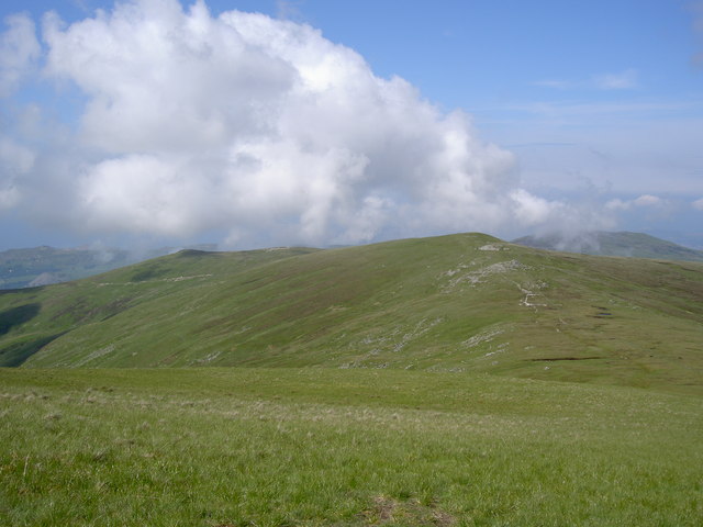
Looking back along the ridge I've walked, near to
Carnedd Pen-y-dorth-Goch , Gwynedd, Wales.
722:
707:
578:
196:
1004:
323:
273:
364:
78:
986:
257:
154:
135:
307:
169:
146:
52:
Looking_back_along_the_ridge_I've_walked_-_geograph.org.uk_-_835185.jpg
344:
116:
Looking back along the ridge I've walked - geograph.org.uk - 835185.jpg
356:
922:
Click on a date/time to view the file as it appeared at that time.
309:
259:
158:
284:
244:
53° 11′ 50.45″ N, 3° 56′ 35.9″ W
234:
150:
66:
294:
53° 12′ 27″ N, 3° 56′ 10″ W
483:
Add a one-line explanation of what this file represents
1034:
187:
Creative
Commons Attribution Share-alike license 2.0
110:
90:
Commons is a freely licensed media file repository.
652:
Creative
Commons Attribution-ShareAlike 2.0 Generic
1024:
1014:
56:(640 × 480 pixels, file size: 55 KB, MIME type:
452:https://creativecommons.org/licenses/by-sa/2.0
71:
458:Creative Commons Attribution-Share Alike 2.0
376:
8:
854:
790:
418:– to copy, distribute and transmit the work
1052:
924:
479:
997:The following other wikis use this file:
708:https://www.geograph.org.uk/photo/835185
579:https://www.geograph.org.uk/profile/9857
227:Looking back along the ridge I've walked
208:Looking back along the ridge I've walked
1054:
984:
878:
862:
814:
798:
772:
756:
685:
669:
649:
633:
613:
597:
530:
514:
497:
494:
475:
468:
287:
237:
316:View this and other nearby images on:
266:View this and other nearby images on:
7:
363:and is licensed for reuse under the
913:
399:Attribution-Share Alike 2.0 Generic
387:
382:
367:Attribution-ShareAlike 2.0 license.
1045:
488:
482:
373:
350:
120:
103:
49:
487:
801:coordinates of the point of view
473:
429:Under the following conditions:
394:This file is licensed under the
386:
381:
375:
343:
322:
308:
300:
272:
258:
250:
70:
31:
21:
967:File Upload Bot (Magnus Manske)
470:
121:
46:No higher resolution available.
14:
688:file available on the internet
469:
351:This image was taken from the
26:
1:
865:coordinates of depicted place
816:53°11'50.453"N, 3°56'35.898"W
36:
738:Geograph Britain and Ireland
544:object of statement has role
495:Items portrayed in this file
1021:Usage on lld.wikipedia.org
1001:Usage on arz.wikipedia.org
880:53°12'27.29"N, 3°56'10.32"W
299:
249:
1076:
1031:Usage on www.wikidata.org
1011:Usage on cy.wikipedia.org
443:same or compatible license
914:
16:
716:geograph.org.uk image ID
472:
409:
77:This is a file from the
971:
197:required by the license
175:
165:
141:
134:
131:
113:
81:. Information from its
357:this photograph's page
328:53.207580; -3.936200
278:53.197348; -3.943305
225:Ian Greig /
206:Ian Greig /
84:description page there
159:geograph_org2commons
424:– to adapt the work
950:04:48, 15 May 2010
559:author name string
1063:
1062:
993:Global file usage
975:
856:
792:
636:copyright license
481:
372:
371:
355:collection. See
333:
332:
283:
282:
232:
231:
200:
184:
181:Reusing this file
153:; transferred by
99:
98:
79:Wikimedia Commons
32:Global file usage
1067:
1053:
962:
902:
901:
896:
838:
837:
832:
740:
735:
725:
720:
710:
705:
701:described at URL
600:copyright status
581:
576:
566:
563:
553:
548:
465:
462:
459:
456:
453:
445:as the original.
407:
396:Creative Commons
390:
389:
385:
384:
379:
378:
365:Creative Commons
353:Geograph project
347:
340:
329:
326:
312:
311:
305:
304:
303:
297:
296:
285:
279:
276:
262:
261:
255:
254:
253:
247:
246:
235:
194:
178:
137:
125:
117:
111:
95:
74:
73:
67:
61:
59:
1075:
1074:
1070:
1069:
1068:
1066:
1065:
1064:
1041:
991:
983:
976:
968:
960:
916:
915:
912:
911:
910:
909:
908:
907:
906:
905:
904:
903:
899:
897:
894:
885:
884:
883:
881:
871:
870:
869:
867:
848:
847:
846:
845:
844:
843:
842:
841:
840:
839:
835:
833:
830:
821:
820:
819:
817:
807:
806:
805:
803:
784:
783:
782:
781:
780:
779:
778:
777:
775:
765:
764:
763:
761:
750:
749:
748:
747:
746:
745:
744:
743:
742:
741:
736:
733:
727:
726:
721:
718:
712:
711:
706:
703:
694:
693:
692:
690:
678:
677:
676:
674:
663:
662:
661:
660:
659:
658:
657:
656:
654:
642:
641:
640:
638:
627:
626:
625:
624:
623:
622:
621:
620:
618:
606:
605:
604:
602:
591:
590:
589:
588:
587:
586:
585:
584:
583:
582:
577:
574:
568:
567:
564:
561:
555:
554:
549:
546:
537:
536:
535:
533:
523:
522:
521:
519:
508:
507:
506:
505:
504:
502:
486:
485:
484:
467:
466:
463:
460:
457:
454:
451:
450:
408:
405:
402:
391:
368:
338:
327:
301:
292:
291:
288:Object location
277:
251:
242:
241:
238:Camera location
233:
222:
215:
203:
151:geograph.org.uk
127:
115:
108:
101:
100:
89:
88:
87:is shown below.
63:
57:
55:
48:
47:
12:
11:
5:
1073:
1071:
1061:
1060:
1057:
1044:
1040:
1039:
1038:
1037:
1029:
1028:
1027:
1019:
1018:
1017:
1009:
1008:
1007:
995:
994:
990:
989:
981:
980:
979:
974:
973:
970:
966:
963:
957:
952:
947:
943:
942:
939:
936:
933:
930:
927:
920:
919:
890:
889:
888:
887:
886:
882:
879:
877:
876:
875:
874:
873:
872:
868:
863:
861:
860:
859:
858:
852:
826:
825:
824:
823:
822:
818:
815:
813:
812:
811:
810:
809:
808:
804:
799:
797:
796:
795:
794:
788:
776:
773:
771:
770:
769:
768:
767:
766:
762:
757:
755:
754:
753:
752:
751:
729:
728:
714:
713:
699:
698:
697:
696:
695:
691:
686:
684:
683:
682:
681:
680:
679:
675:
672:source of file
670:
668:
667:
666:
665:
664:
655:
650:
648:
647:
646:
645:
644:
643:
639:
634:
632:
631:
630:
629:
628:
619:
614:
612:
611:
610:
609:
608:
607:
603:
598:
596:
595:
594:
593:
592:
570:
569:
557:
556:
542:
541:
540:
539:
538:
534:
531:
529:
528:
527:
526:
525:
524:
520:
515:
513:
512:
511:
510:
509:
503:
498:
496:
493:
492:
491:
490:
489:
478:
477:
474:
471:
449:
448:
447:
446:
436:
427:
426:
425:
419:
412:You are free:
403:
393:
392:
374:
370:
369:
348:
337:
334:
331:
330:
320:
314:
289:
281:
280:
270:
264:
239:
230:
229:
223:
220:
217:
216:
211:
204:
201:
189:
188:
185:
173:
172:
167:
163:
162:
143:
139:
138:
133:
129:
128:
118:
109:
107:
104:
102:
97:
96:
75:
65:
64:
45:
41:
40:
39:
34:
29:
24:
19:
13:
10:
9:
6:
4:
3:
2:
1072:
1058:
1055:
1051:
1048:
1042:
1036:
1033:
1032:
1030:
1026:
1023:
1022:
1020:
1016:
1013:
1012:
1010:
1006:
1003:
1002:
1000:
999:
998:
992:
988:
985:
977:
969:
964:
958:
956:
953:
951:
948:
945:
944:
940:
937:
934:
931:
928:
926:
925:
923:
917:
893:
866:
829:
802:
760:
739:
732:
724:
717:
709:
702:
689:
673:
653:
637:
617:
601:
580:
573:
560:
552:
545:
518:
501:
455:CC BY-SA 2.0
444:
440:
437:
434:
431:
430:
428:
423:
420:
417:
414:
413:
411:
410:
404:Attribution:
400:
397:
380:
366:
362:
358:
354:
349:
346:
342:
341:
335:
325:
321:
319:
318:OpenStreetMap
315:
313:
295:
290:
286:
275:
271:
269:
268:OpenStreetMap
265:
263:
245:
240:
236:
228:
224:
219:
218:
214:
210: /
209:
205:
198:
193:
191:
190:
186:
182:
177:
174:
171:
168:
164:
160:
156:
155:User:RHaworth
152:
148:
144:
140:
130:
124:
119:
112:
105:
93:
86:
85:
80:
76:
69:
68:
62:
53:
44:
38:
35:
33:
30:
28:
25:
23:
20:
18:
15:
1049:
1046:
996:
987:Drum (Wales)
921:
918:File history
551:photographer
438:
432:
421:
415:
360:
298:
248:
226:
213:CC BY-SA 2.0
207:
122:
92:You can help
82:
50:
22:File history
774:6 June 2008
616:copyrighted
439:share alike
433:attribution
192:Attribution
136:6 June 2008
114:Description
1056:_error
978:File usage
959:640 × 480
935:Dimensions
532:some value
176:Permission
147:this image
58:image/jpeg
27:File usage
932:Thumbnail
929:Date/Time
759:inception
565:Ian Greig
406:Ian Greig
361:Ian Greig
336:Licensing
221:InfoField
202:InfoField
170:Ian Greig
123:English:
1043:Metadata
1035:Q5309044
1005:جبل دروم
731:operator
476:Captions
422:to remix
416:to share
401:license.
37:Metadata
961:(55 KB)
946:current
941:Comment
892:heading
851:heading
828:heading
787:heading
517:creator
500:depicts
480:English
106:Summary
54:
900:degree
855:degree
836:degree
791:degree
723:835185
306:
256:
166:Author
157:using
142:Source
145:From
1025:Drum
1015:Drum
938:User
464:true
461:true
132:Date
17:File
898:22
834:22
572:URL
149:at
895::
831::
734::
719::
704::
575::
562::
547::
1059:0
199:)
195:(
183:)
179:(
161:.
94:.
60:)
Text is available under the Creative Commons Attribution-ShareAlike License. Additional terms may apply.
_region:GB-GBN_heading:22.00&language=en)
