332:
265:
223:
279:
237:
300:
338:
343:
72:
1080:
256:
214:
390:– You must give appropriate credit, provide a link to the license, and indicate if changes were made. You may do so in any reasonable manner, but not in any way that suggests the licensor endorses you or your use.
43:
83:
51:
1097:== {{int:filedesc}} == {{Information |description={{en|1=Letham.}} |date=2006-02-13 |source=From |author= |permission= |other_versions= }} {{Loc
816:
661:
625:
589:
272:
230:
696:
1309:
307:
1182:
This file contains additional information, probably added from the digital camera or scanner used to create or digitize it.
1025:
397:
539:
470:
975:
941:
904:
870:
836:
800:
732:
704:
645:
573:
547:
532:
517:
766:
689:
674:
609:
490:
454:
1009:
294:
353:
1278:
1185:
If the file has been modified from its original state, some details may not fully reflect the modified file.
1107:
The following pages on the
English Knowledge (XXG) use this file (pages on other projects are not listed):
1354:
396:– If you remix, transform, or build upon the material, you must distribute your contributions under the
314:
on the
Geograph website for the photographer's contact details. The copyright on this image is owned by
1079:
1074:
42:
1090:
1204:
350:
1382:
91:
183:
711:
681:
524:
167:
278:
236:
1444:
1372:
1328:
319:
78:
1241:
1111:
1392:
135:
1221:
262:
220:
156:
146:
1434:
1211:
1194:
299:
311:
1047:
Click on a date/time to view the file as it appeared at that time.
264:
222:
247:
205:
66:
829:
725:
1139:
1129:
1159:
257:
56° 19′ 03″ N, 3° 07′ 16″ W
215:
56° 18′ 59″ N, 3° 07′ 05″ W
438:
Add a one-line explanation of what this file represents
1169:
110:
90:
Commons is a freely licensed media file repository.
1149:
626:
Creative
Commons Attribution-ShareAlike 2.0 Generic
56:(640 × 480 pixels, file size: 96 KB, MIME type:
407:https://creativecommons.org/licenses/by-sa/2.0
71:
413:Creative Commons Attribution-Share Alike 2.0
331:
8:
373:– to copy, distribute and transmit the work
1187:
1049:
434:
1122:The following other wikis use this file:
682:https://www.geograph.org.uk/photo/121797
525:https://www.geograph.org.uk/profile/4202
1442:
1432:
1424:
1416:
1408:
1400:
1390:
1380:
1370:
1362:
1352:
1344:
1336:
1326:
1318:
1307:
1299:
1291:
1283:
1273:
1265:
1257:
1249:
1238:
1230:
1219:
1209:
1199:
1109:
1023:
1007:
989:
973:
955:
939:
918:
902:
884:
868:
850:
834:
814:
798:
780:
764:
746:
730:
659:
643:
623:
607:
587:
571:
504:
488:
468:
452:
449:
430:
423:
250:
208:
271:View this and other nearby images on:
229:View this and other nearby images on:
1189:
116:Letham - geograph.org.uk - 121797.jpg
52:Letham_-_geograph.org.uk_-_121797.jpg
7:
318:and is licensed for reuse under the
1038:
354:Attribution-Share Alike 2.0 Generic
342:
337:
322:Attribution-ShareAlike 2.0 license.
1180:
443:
437:
328:
305:
120:
103:
49:
442:
1232:Date and time of data generation
733:coordinates of the point of view
428:
384:Under the following conditions:
349:This file is licensed under the
341:
336:
330:
298:
277:
263:
235:
221:
70:
31:
21:
425:
121:
46:No higher resolution available.
14:
662:file available on the internet
424:
306:This image was taken from the
26:
1:
837:coordinates of depicted place
36:
697:Geograph Britain and Ireland
533:object of statement has role
450:Items portrayed in this file
1418:Focal plane resolution unit
1320:Date and time of digitizing
1466:
1429:One-chip color area sensor
1166:Usage on www.wikidata.org
1156:Usage on sv.wikipedia.org
1146:Usage on it.wikipedia.org
1136:Usage on eu.wikipedia.org
1126:Usage on de.wikipedia.org
398:same or compatible license
1285:File change date and time
1039:
16:
1410:Focal plane Y resolution
1402:Focal plane X resolution
705:geograph.org.uk image ID
427:
364:
196:James Allan /
177:James Allan /
77:This is a file from the
1323:10:21, 13 February 2006
1288:18:13, 13 February 2006
1235:10:21, 13 February 2006
1096:
852:56°19'2.6"N, 3°7'15.6"W
748:56°18'59.4"N, 3°7'4.8"W
168:required by the license
152:
141:
134:
131:
113:
81:. Information from its
1279:FinePix Viewer Ver.2.0
1075:03:36, 31 January 2010
312:this photograph's page
283:56.317400; -3.121000
241:56.316500; -3.118000
84:description page there
1364:Maximum land aperture
1259:Horizontal resolution
801:location of creation
1293:Y and C positioning
1267:Vertical resolution
1191:Camera manufacturer
379:– to adapt the work
1449:Auto white balance
1387:Flash did not fire
548:author name string
1453:
1452:
1118:Global file usage
1100:
610:copyright license
436:
327:
326:
310:collection. See
288:
287:
246:
245:
203:
202:
171:
99:
98:
79:Wikimedia Commons
32:Global file usage
1457:
1301:Exposure Program
1188:
1087:
923:
782:13 February 2006
714:
709:
699:
694:
684:
679:
675:described at URL
574:copyright status
555:
552:
542:
537:
527:
522:
420:
417:
414:
411:
408:
400:as the original.
362:
351:Creative Commons
345:
344:
340:
339:
334:
333:
320:Creative Commons
308:Geograph project
302:
295:
284:
281:
267:
266:
260:
259:
248:
242:
239:
225:
224:
218:
217:
206:
165:
137:
136:13 February 2006
125:
117:
111:
95:
74:
73:
67:
61:
59:
1465:
1464:
1460:
1459:
1458:
1456:
1455:
1454:
1367:3 APEX (f/2.83)
1346:APEX brightness
1205:FinePix6900ZOOM
1176:
1116:
1108:
1101:
1093:
1085:
1041:
1040:
1037:
1036:
1035:
1034:
1033:
1032:
1031:
1030:
1028:
1016:
1015:
1014:
1012:
1001:
1000:
999:
998:
997:
996:
995:
994:
992:
982:
981:
980:
978:
967:
966:
965:
964:
963:
962:
961:
960:
958:
948:
947:
946:
944:
933:
932:
931:
930:
929:
928:
927:
926:
924:
921:
911:
910:
909:
907:
896:
895:
894:
893:
892:
891:
890:
889:
887:
877:
876:
875:
873:
862:
861:
860:
859:
858:
857:
856:
855:
853:
843:
842:
841:
839:
828:
827:
826:
825:
824:
823:
822:
821:
819:
807:
806:
805:
803:
792:
791:
790:
789:
788:
787:
786:
785:
783:
773:
772:
771:
769:
758:
757:
756:
755:
754:
753:
752:
751:
749:
739:
738:
737:
735:
724:
723:
722:
721:
720:
719:
718:
717:
716:
715:
710:
707:
701:
700:
695:
692:
686:
685:
680:
677:
668:
667:
666:
664:
652:
651:
650:
648:
637:
636:
635:
634:
633:
632:
631:
630:
628:
616:
615:
614:
612:
601:
600:
599:
598:
597:
596:
595:
594:
592:
580:
579:
578:
576:
565:
564:
563:
562:
561:
560:
559:
558:
557:
556:
553:
550:
544:
543:
538:
535:
529:
528:
523:
520:
511:
510:
509:
507:
497:
496:
495:
493:
482:
481:
480:
479:
478:
477:
476:
475:
473:
461:
460:
459:
457:
441:
440:
439:
422:
421:
418:
415:
412:
409:
406:
405:
363:
360:
357:
346:
323:
293:
282:
255:
254:
251:Object location
240:
213:
212:
209:Camera location
204:
193:
186:
174:
147:geograph.org.uk
127:
115:
108:
101:
100:
89:
88:
87:is shown below.
63:
57:
55:
48:
47:
12:
11:
5:
1463:
1461:
1451:
1450:
1447:
1441:
1440:
1437:
1431:
1430:
1427:
1426:Sensing method
1423:
1422:
1419:
1415:
1414:
1411:
1407:
1406:
1403:
1399:
1398:
1395:
1389:
1388:
1385:
1379:
1378:
1375:
1369:
1368:
1365:
1361:
1360:
1357:
1351:
1350:
1347:
1343:
1342:
1339:
1335:
1334:
1331:
1325:
1324:
1321:
1317:
1316:
1313:
1306:
1305:
1304:Normal program
1302:
1298:
1297:
1294:
1290:
1289:
1286:
1282:
1281:
1276:
1272:
1271:
1268:
1264:
1263:
1260:
1256:
1255:
1252:
1248:
1247:
1244:
1237:
1236:
1233:
1229:
1228:
1225:
1218:
1217:
1214:
1208:
1207:
1202:
1198:
1197:
1192:
1179:
1175:
1174:
1173:
1172:
1164:
1163:
1162:
1154:
1153:
1152:
1144:
1143:
1142:
1134:
1133:
1132:
1120:
1119:
1115:
1114:
1106:
1105:
1104:
1099:
1098:
1095:
1091:
1088:
1082:
1077:
1072:
1068:
1067:
1064:
1061:
1058:
1055:
1052:
1045:
1044:
1029:
1024:
1022:
1021:
1020:
1019:
1018:
1017:
1013:
1008:
1006:
1005:
1004:
1003:
1002:
993:
990:
988:
987:
986:
985:
984:
983:
979:
974:
972:
971:
970:
969:
968:
959:
956:
954:
953:
952:
951:
950:
949:
945:
940:
938:
937:
936:
935:
934:
925:
919:
917:
916:
915:
914:
913:
912:
908:
903:
901:
900:
899:
898:
897:
888:
885:
883:
882:
881:
880:
879:
878:
874:
869:
867:
866:
865:
864:
863:
854:
851:
849:
848:
847:
846:
845:
844:
840:
835:
833:
832:
831:
830:
820:
815:
813:
812:
811:
810:
809:
808:
804:
799:
797:
796:
795:
794:
793:
784:
781:
779:
778:
777:
776:
775:
774:
770:
765:
763:
762:
761:
760:
759:
750:
747:
745:
744:
743:
742:
741:
740:
736:
731:
729:
728:
727:
726:
703:
702:
688:
687:
673:
672:
671:
670:
669:
665:
660:
658:
657:
656:
655:
654:
653:
649:
646:source of file
644:
642:
641:
640:
639:
638:
629:
624:
622:
621:
620:
619:
618:
617:
613:
608:
606:
605:
604:
603:
602:
593:
588:
586:
585:
584:
583:
582:
581:
577:
572:
570:
569:
568:
567:
566:
546:
545:
531:
530:
516:
515:
514:
513:
512:
508:
505:
503:
502:
501:
500:
499:
498:
494:
489:
487:
486:
485:
484:
483:
474:
469:
467:
466:
465:
464:
463:
462:
458:
453:
451:
448:
447:
446:
445:
444:
433:
432:
429:
426:
404:
403:
402:
401:
391:
382:
381:
380:
374:
367:You are free:
358:
348:
347:
329:
325:
324:
303:
292:
289:
286:
285:
275:
269:
252:
244:
243:
233:
227:
210:
201:
200:
194:
191:
188:
187:
182:
175:
172:
160:
159:
154:
150:
149:
143:
139:
138:
133:
129:
128:
118:
109:
107:
104:
102:
97:
96:
75:
65:
64:
45:
41:
40:
39:
34:
29:
24:
19:
13:
10:
9:
6:
4:
3:
2:
1462:
1448:
1446:
1445:White balance
1443:
1438:
1436:
1433:
1428:
1425:
1420:
1417:
1412:
1409:
1404:
1401:
1396:
1394:
1391:
1386:
1384:
1381:
1376:
1374:
1373:Metering mode
1371:
1366:
1363:
1358:
1356:
1355:Exposure bias
1353:
1348:
1345:
1340:
1338:APEX aperture
1337:
1332:
1330:
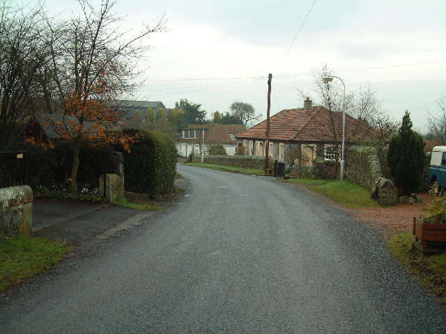
1329:Shutter speed
1327:
1322:
1319:
1314:
1311:
1308:
1303:
1300:
1295:
1292:
1287:
1284:
1280:
1277:
1275:Software used
1274:
1269:
1266:
1261:
1258:
1253:
1250:
1245:
1243:
1239:
1234:
1231:
1226:
1223:
1220:
1215:
1213:
1210:
1206:
1203:
1200:
1196:
1193:
1190:
1186:
1183:
1177:
1171:
1168:
1167:
1165:
1161:
1158:
1157:
1155:
1151:
1148:
1147:
1145:
1141:
1140:Letham (Fife)
1138:
1137:
1135:
1131:
1130:Letham (Fife)
1128:
1127:
1125:
1124:
1123:
1117:
1113:
1110:
1102:
1094:
1089:
1083:
1081:
1078:
1076:
1073:
1070:
1069:
1065:
1062:
1059:
1056:
1053:
1051:
1050:
1048:
1042:
1027:
1011:
977:
943:
906:
872:
838:
818:
802:
768:
734:
713:
706:
698:
691:
683:
676:
663:
647:
627:
611:
591:
575:
549:
541:
534:
526:
519:
492:
472:
456:
410:CC BY-SA 2.0
399:
395:
392:
389:
386:
385:
383:
378:
375:
372:
369:
368:
366:
365:
359:Attribution:
355:
352:
335:
321:
317:
313:
309:
304:
301:
297:
296:
290:
280:
276:
274:
273:OpenStreetMap
270:
268:
258:
253:
249:
238:
234:
232:
231:OpenStreetMap
228:
226:
216:
211:
207:
199:
195:
190:
189:
185:
181: /
180:
176:
169:
164:
162:
161:
158:
155:
151:
148:
144:
140:
130:
124:
119:
112:
105:
93:
86:
85:
80:
76:
69:
68:
62:
53:
44:
38:
35:
33:
30:
28:
25:
23:
20:
18:
15:
1242:focal length
1201:Camera model
1184:
1181:
1160:Letham, Fife
1121:
1112:Letham, Fife
1046:
1043:File history
905:focal length
540:photographer
393:
387:
376:
370:
315:
197:
184:CC BY-SA 2.0
178:
122:
92:You can help
82:
50:
22:File history
1393:Color space
1251:Orientation
1092:GeographBot
1010:instance of
590:copyrighted
554:James Allan
394:share alike
388:attribution
361:James Allan
316:James Allan
163:Attribution
157:James Allan
114:Description
1103:File usage
1084:640 × 480
1060:Dimensions
1026:photograph
991:image/jpeg
976:media type
922:millimetre
506:some value
58:image/jpeg
27:File usage
1435:Sharpness
1222:ISO speed
1057:Thumbnail
1054:Date/Time
942:ISO speed
767:inception
291:Licensing
192:InfoField
173:InfoField
123:English:
1296:Co-sited
1212:F-number
1195:FUJIFILM
1178:Metadata
1170:Q3831051
871:f-number
817:Monimail
690:operator
431:Captions
377:to remix
371:to share
356:license.
37:Metadata
1377:Pattern
1312:version
1086:(96 KB)
1071:current
1066:Comment
491:creator
455:depicts
435:English
126:Letham.
106:Summary
54:
1270:72 dpi
1262:72 dpi
1254:Normal
1246:9.7 mm
1224:rating
1150:Letham
712:121797
471:street
261:
219:
198:Letham
179:Letham
153:Author
142:Source
1413:2,674
1405:2,678
1383:Flash
1240:Lens
1216:f/3.2
145:From
1397:sRGB
1349:5.58
1341:3.33
1310:Exif
1063:User
920:9.7
419:true
416:true
132:Date
17:File
1333:7.3
1315:2.1
1227:100
957:100
886:3.2
518:URL
708::
693::
678::
551::
536::
521::
1439:3
1421:3
1359:0
170:)
166:(
94:.
60:)
Text is available under the Creative Commons Attribution-ShareAlike License. Additional terms may apply.
_&language=en)
_&language=en)
