212:
425:
375:
417:
367:
439:
389:
180:
218:
223:
87:
600:"}},"text\/plain":{"en":{"":"heading"}}},"{\"value\":{\"amount\":\"+247.0\",\"unit\":\"http:\\\/\\\/www.wikidata.org\\\/entity\\\/Q28390\"},\"type\":\"quantity\"}":{"text\/html":{"en":{"P7787":"247.0
664:"}},"text\/plain":{"en":{"":"heading"}}},"{\"value\":{\"amount\":\"+247\",\"unit\":\"http:\\\/\\\/www.wikidata.org\\\/entity\\\/Q28390\"},\"type\":\"quantity\"}":{"text\/html":{"en":{"P7787":"247
43:
660:
783:{{Information |Description= The village sign for Lexiate and Ashwicken, Norfolk |Source=http://www.geograph.org.uk/photo/436867 |Date=Friday, 18 May, 2007 |Author=Martin Pearman |Permission= {{Geograph|436867|Martin Pearman }} |other_versions= }} [[Cat
408:
358:
270:– You must give appropriate credit, provide a link to the license, and indicate if changes were made. You may do so in any reasonable manner, but not in any way that suggests the licensor endorses you or your use.
661:
597:
53:
47:
98:
66:
167:
549:
513:
432:
382:
187:
828:
This file contains additional information, probably added from the digital camera or scanner used to create or digitize it.
277:
702:
675:
638:
611:
497:
569:
533:
480:
174:
233:
831:
If the file has been modified from its original state, some details may not fully reflect the modified file.
765:
760:
276:– If you remix, transform, or build upon the material, you must distribute your contributions under the
194:
on the
Geograph website for the photographer's contact details. The copyright on this image is owned by
57:
42:
604:"}},"text\/plain":{"en":{"P7787":"247.0 degree"}}}}": -->
230:
668:"}},"text\/plain":{"en":{"P7787":"247 degree"}}}}": -->
106:
327:
311:
438:
388:
776:
199:
93:
138:
422:
372:
148:
179:
797:
191:
733:
Click on a date/time to view the file as it appeared at that time.
424:
374:
399:
349:
81:
409:
52° 44′ 51″ N, 0° 30′ 01″ E
359:
52° 44′ 52″ N, 0° 30′ 06″ E
464:
Add a one-line explanation of what this file represents
815:
120:
105:
Commons is a freely licensed media file repository.
550:
Creative
Commons Attribution-ShareAlike 2.0 Generic
130:
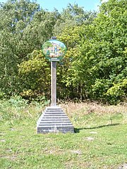
The village sign for
Leziate and Ashwicken, Norfolk
71:(480 × 640 pixels, file size: 103 KB, MIME type:
287:https://creativecommons.org/licenses/by-sa/2.0
86:
293:Creative Commons Attribution-Share Alike 2.0
211:
8:
665:
601:
253:– to copy, distribute and transmit the work
833:
735:
460:
808:The following other wikis use this file:
149:https://www.geograph.org.uk/photo/436867
835:
795:
689:
673:
625:
609:
583:
567:
547:
531:
511:
495:
478:
475:
456:
449:
402:
352:
431:View this and other nearby images on:
381:View this and other nearby images on:
126:Leziate and Ashwicken village sign.jpg
7:
198:and is licensed for reuse under the
793:The following page uses this file:
724:
234:Attribution-Share Alike 2.0 Generic
222:
217:
202:Attribution-ShareAlike 2.0 license.
826:
469:
463:
342:Leziate and Ashwicken village sign
323:Leziate and Ashwicken village sign
208:
185:
118:
64:
468:
612:coordinates of the point of view
454:
437:
423:
415:
387:
373:
365:
264:Under the following conditions:
229:This file is licensed under the
221:
216:
210:
178:
85:
31:
21:
451:
14:
450:
186:This image was taken from the
26:
1:
676:coordinates of depicted place
36:
476:Items portrayed in this file
414:
364:
340:Martin Pearman /
321:Martin Pearman /
857:
812:Usage on nl.wikipedia.org
691:52°44'51.04"N, 0°30'0.72"E
627:52°44'52.22"N, 0°30'5.76"E
278:same or compatible license
725:
16:
453:
244:
92:This is a file from the
782:
312:required by the license
162:
154:
144:
137:
134:
123:
96:. Information from its
443:52.747510; 0.500200
393:52.747840; 0.501600
192:this photograph's page
99:description page there
46:Size of this preview:
761:21:59, 1 March 2009
259:– to adapt the work
52:Other resolutions:
844:
843:
804:Global file usage
786:
667:
603:
534:copyright license
462:
448:
447:
398:
397:
347:
346:
315:
207:
206:
190:collection. See
171:
168:Reusing this file
114:
113:
94:Wikimedia Commons
32:Global file usage
848:
834:
773:
713:
712:
707:
649:
648:
643:
498:copyright status
444:
441:
427:
426:
420:
419:
418:
412:
411:
400:
394:
391:
377:
376:
370:
369:
368:
362:
361:
350:
309:
300:
297:
294:
291:
288:
280:as the original.
242:
231:Creative Commons
225:
224:
220:
219:
214:
213:
200:Creative Commons
188:Geograph project
182:
175:
165:
140:
127:
121:
110:
89:
88:
82:
76:
74:
61:
58:480 × 640 pixels
54:180 × 240 pixels
48:450 × 600 pixels
856:
855:
851:
850:
849:
847:
846:
845:
822:
802:
787:
779:
771:
727:
726:
723:
722:
721:
720:
719:
718:
717:
716:
715:
714:
710:
708:
705:
696:
695:
694:
692:
682:
681:
680:
678:
659:
658:
657:
656:
655:
654:
653:
652:
651:
650:
646:
644:
641:
632:
631:
630:
628:
618:
617:
616:
614:
595:
594:
593:
592:
591:
590:
589:
588:
586:
576:
575:
574:
572:
561:
560:
559:
558:
557:
556:
555:
554:
552:
540:
539:
538:
536:
525:
524:
523:
522:
521:
520:
519:
518:
516:
504:
503:
502:
500:
489:
488:
487:
486:
485:
483:
467:
466:
465:
442:
416:
407:
406:
403:Object location
392:
366:
357:
356:
353:Camera location
348:
337:
330:
318:
302:
301:
298:
295:
292:
289:
286:
285:
243:
240:
237:
226:
203:
125:
116:
115:
104:
103:
102:is shown below.
78:
72:
70:
63:
62:
51:
12:
11:
5:
854:
852:
842:
841:
838:
825:
821:
820:
819:
818:
806:
805:
801:
800:
791:
790:
785:
784:
781:
777:
774:
768:
763:
758:
754:
753:
750:
747:
744:
741:
738:
731:
730:
701:
700:
699:
698:
697:
693:
690:
688:
687:
686:
685:
684:
683:
679:
674:
672:
671:
670:
669:
663:
637:
636:
635:
634:
633:
629:
626:
624:
623:
622:
621:
620:
619:
615:
610:
608:
607:
606:
605:
599:
587:
584:
582:
581:
580:
579:
578:
577:
573:
568:
566:
565:
564:
563:
562:
553:
548:
546:
545:
544:
543:
542:
541:
537:
532:
530:
529:
528:
527:
526:
517:
512:
510:
509:
508:
507:
506:
505:
501:
496:
494:
493:
492:
491:
490:
484:
479:
477:
474:
473:
472:
471:
470:
459:
458:
455:
452:
446:
445:
435:
429:
404:
396:
395:
385:
379:
354:
345:
344:
338:
335:
332:
331:
326:
319:
316:
304:
303:
284:
283:
282:
281:
271:
262:
261:
260:
254:
247:You are free:
241:Martin Pearman
238:
228:
227:
209:
205:
204:
196:Martin Pearman
183:
172:
160:
159:
158:Martin Pearman
156:
152:
151:
146:
142:
141:
136:
132:
131:
128:
119:
117:
112:
111:
90:
80:
79:
45:
41:
40:
39:
34:
29:
24:
19:
13:
10:
9:
6:
4:
3:
2:
853:
839:
836:
832:
829:
823:
817:
814:
813:
811:
810:
809:
803:
799:
796:
794:
788:
780:
775:
769:
767:
764:
762:
759:
756:
755:
751:
748:
745:
742:
739:
737:
736:
734:
728:
704:
677:
640:
613:
571:
551:
535:
515:
499:
482:
440:
436:
434:
433:OpenStreetMap
430:
428:
410:
405:
401:
390:
386:
384:
383:OpenStreetMap
380:
378:
360:
355:
351:
343:
339:
334:
333:
329:
325: /
324:
320:
313:
308:
306:
305:
290:CC BY-SA 2.0
279:
275:
272:
269:
266:
265:
263:
258:
255:
252:
249:
248:
246:
245:
239:Attribution:
235:
232:
215:
201:
197:
193:
189:
184:
181:
177:
176:
173:
169:
164:
161:
157:
153:
150:
147:
143:
133:
129:
122:
108:
101:
100:
95:
91:
84:
83:
77:
68:
67:Original file
59:
55:
49:
44:
38:
35:
33:
30:
28:
25:
23:
20:
18:
15:
830:
827:
807:
792:
732:
729:File history
413:
363:
341:
328:CC BY-SA 2.0
322:
273:
267:
256:
250:
195:
107:You can help
97:
65:
22:File history
585:18 May 2007
514:copyrighted
307:Attribution
274:share alike
268:attribution
139:18 May 2007
124:Description
837:_error
789:File usage
770:480 × 640
746:Dimensions
163:Permission
73:image/jpeg
27:File usage
743:Thumbnail
740:Date/Time
570:inception
336:InfoField
317:InfoField
824:Metadata
778:Stavros1
772:(103 KB)
457:Captions
257:to remix
251:to share
236:license.
37:Metadata
816:Leziate
798:Leziate
757:current
752:Comment
703:heading
662:heading
639:heading
598:heading
481:depicts
461:English
69:
711:degree
666:degree
647:degree
645:247.0
602:degree
421:
371:
155:Author
145:Source
749:User
709:247
299:true
296:true
135:Date
17:File
706::
642::
56:|
50:.
840:0
314:)
310:(
170:)
166:(
109:.
75:)
60:.
Text is available under the Creative Commons Attribution-ShareAlike License. Additional terms may apply.


_heading:247.00&language=en)
_heading:247.00&language=en)