212:
43:
218:
223:
99:
531:
270:– You must give appropriate credit, provide a link to the license, and indicate if changes were made. You may do so in any reasonable manner, but not in any way that suggests the licensor endorses you or your use.
703:
698:
693:
201:
73:
69:
65:
61:
57:
53:
47:
408:
372:
110:
951:
This file contains additional information, probably added from the digital camera or scanner used to create or digitize it.
277:
82:
462:
356:
428:
392:
339:
608:
174:
552:, UK with Leeds highlighted. Equirectangular map projection on WGS 84 datum, with N/S stretched 165% |Source=
233:
954:
If the file has been modified from its original state, some details may not fully reflect the modified file.
813:
566:
The following pages on the
English Knowledge (XXG) use this file (pages on other projects are not listed):
276:– If you remix, transform, or build upon the material, you must distribute your contributions under the
575:
230:
733:
713:
673:
170:
118:
598:
653:
173:. Most data from Boundary-Line product. Lake data from Meridian 2 product. Inset derived from
167:
873:
683:
553:
530:
525:
42:
144:
883:
549:
541:
570:
105:
773:
618:
189:
178:
157:
149:
Equirectangular map projection on WGS 84 datum, with N/S stretched 165%
593:
908:
888:
803:
648:
928:
498:
Click on a date/time to view the file as it appeared at that time.
918:
241:
Contains
Ordnance Survey data © Crown copyright and database right
938:
723:
93:
87:(SVG file, nominally 1,425 × 1,039 pixels, file size: 765 KB)
863:
843:
783:
763:
753:
743:
674:
Liste des paroisses civiles du
Yorkshire de l'Ouest
638:
323:
Add a one-line explanation of what this file represents
898:
409:
Creative
Commons Attribution-ShareAlike 3.0 Unported
132:
117:
Commons is a freely licensed media file repository.
823:
793:
853:
833:
663:
628:
287:https://creativecommons.org/licenses/by-sa/3.0
98:
293:Creative Commons Attribution-Share Alike 3.0
211:
8:
253:– to copy, distribute and transmit the work
46:Size of this PNG preview of this SVG file:
956:
500:
319:
586:The following other wikis use this file:
966:
958:
568:
476:
460:
442:
426:
406:
390:
370:
354:
337:
334:
315:
308:
556:[https://www.ordnancesurvey.co.uk/o...
7:
234:Attribution-Share Alike 3.0 Unported
192:, created using Ordnance Survey data
489:
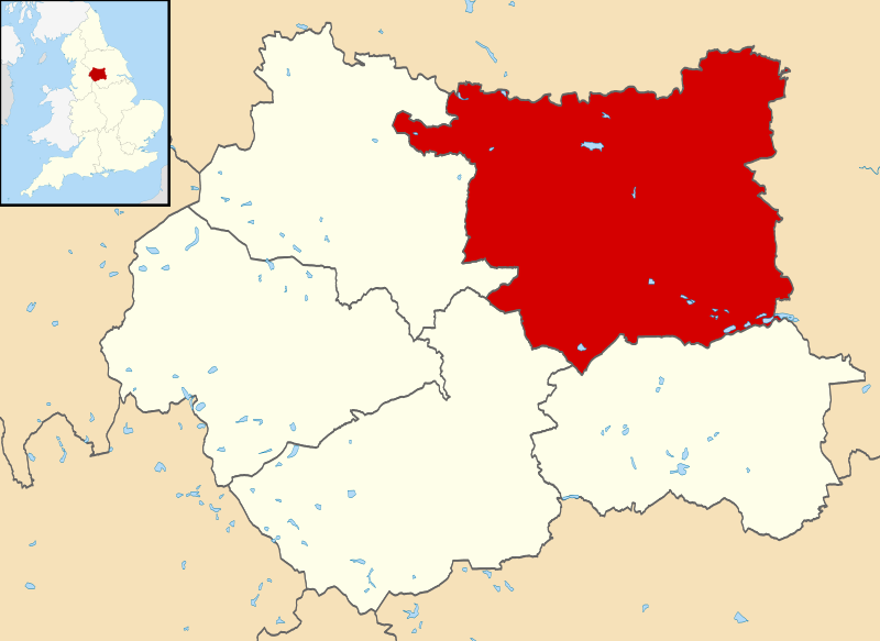
222:
217:
949:
915:Usage on zh-min-nan.wikipedia.org
548:{{Information |Description=Map of
328:
322:
208:
130:
80:
327:
313:
264:Under the following conditions:
229:This file is licensed under the
221:
216:
210:
97:
31:
21:
310:
14:
925:Usage on zh-yue.wikipedia.org
309:
26:
1:
147:, UK with Leeds highlighted.
36:
820:Usage on sco.wikipedia.org
790:Usage on pl.wikivoyage.org
590:Usage on azb.wikipedia.org
988:
935:Usage on zh.wikipedia.org
905:Usage on yi.wikipedia.org
895:Usage on www.wikidata.org
880:Usage on ur.wikipedia.org
870:Usage on th.wikipedia.org
860:Usage on sv.wikipedia.org
850:Usage on sl.wikipedia.org
840:Usage on sh.wikipedia.org
830:Usage on sc.wikipedia.org
810:Usage on ru.wikipedia.org
800:Usage on ps.wikipedia.org
780:Usage on pl.wikipedia.org
770:Usage on pa.wikipedia.org
760:Usage on no.wikipedia.org
750:Usage on nn.wikipedia.org
740:Usage on nl.wikipedia.org
730:Usage on ml.wikipedia.org
720:Usage on lv.wikipedia.org
710:Usage on ko.wikipedia.org
690:Usage on ja.wikipedia.org
680:Usage on gu.wikipedia.org
670:Usage on fr.wikipedia.org
660:Usage on fi.wikipedia.org
645:Usage on fa.wikipedia.org
635:Usage on cy.wikipedia.org
625:Usage on bs.wikipedia.org
615:Usage on bn.wikipedia.org
605:Usage on bg.wikipedia.org
278:same or compatible license
490:
16:
704:Category:シティ・オブ・リーズ出身の人物
312:
244:
175:England location map.svg
138:Leeds UK locator map.svg
104:This is a file from the
547:
526:21:01, 1 September 2013
196:
185:
163:
156:
153:
135:
108:. Information from its
111:description page there
576:User:Nilfanion/Leeds
74:1,425 × 1,039 pixels
70:2,560 × 1,867 pixels
699:Category:シティ・オブ・リーズ
259:– to adapt the work
52:Other resolutions:
66:1,280 × 933 pixels
62:1,024 × 747 pixels
975:
974:
582:Global file usage
559:
393:copyright license
321:
306:
305:
205:
202:Reusing this file
126:
125:
106:Wikimedia Commons
32:Global file usage
979:
957:
538:
444:1 September 2013
357:copyright status
300:
297:
294:
291:
288:
280:as the original.
242:
231:Creative Commons
225:
224:
220:
219:
214:
213:
199:
159:
158:1 September 2013
139:
133:
122:
101:
100:
94:
88:
77:
58:640 × 467 pixels
54:320 × 233 pixels
48:800 × 583 pixels
987:
986:
982:
981:
980:
978:
977:
976:
945:
580:
567:
560:
554:Ordnance Survey
544:
536:
492:
491:
488:
487:
486:
485:
484:
483:
482:
481:
479:
469:
468:
467:
465:
454:
453:
452:
451:
450:
449:
448:
447:
445:
435:
434:
433:
431:
420:
419:
418:
417:
416:
415:
414:
413:
411:
399:
398:
397:
395:
384:
383:
382:
381:
380:
379:
378:
377:
375:
363:
362:
361:
359:
348:
347:
346:
345:
344:
342:
326:
325:
324:
307:
302:
301:
298:
295:
292:
289:
286:
285:
243:
240:
237:
226:
168:Ordnance Survey
137:
128:
127:
116:
115:
114:is shown below.
90:
86:
79:
78:
51:
12:
11:
5:
985:
983:
973:
972:
969:
965:
964:
961:
948:
944:
943:
942:
941:
933:
932:
931:
923:
922:
921:
913:
912:
911:
903:
902:
901:
893:
892:
891:
886:
878:
877:
876:
868:
867:
866:
858:
857:
856:
848:
847:
846:
838:
837:
836:
828:
827:
826:
818:
817:
816:
808:
807:
806:
798:
797:
796:
788:
787:
786:
778:
777:
776:
768:
767:
766:
758:
757:
756:
748:
747:
746:
738:
737:
736:
728:
727:
726:
718:
717:
716:
708:
707:
706:
701:
696:
688:
687:
686:
678:
677:
676:
668:
667:
666:
658:
657:
656:
651:
643:
642:
641:
633:
632:
631:
623:
622:
621:
613:
612:
611:
609:Лийдс (община)
603:
602:
601:
596:
584:
583:
579:
578:
573:
565:
564:
563:
558:
557:
550:West Yorkshire
546:
542:
539:
535:1,425 × 1,039
533:
528:
523:
519:
518:
515:
512:
509:
506:
503:
496:
495:
480:
477:
475:
474:
473:
472:
471:
470:
466:
461:
459:
458:
457:
456:
455:
446:
443:
441:
440:
439:
438:
437:
436:
432:
427:
425:
424:
423:
422:
421:
412:
407:
405:
404:
403:
402:
401:
400:
396:
391:
389:
388:
387:
386:
385:
376:
371:
369:
368:
367:
366:
365:
364:
360:
355:
353:
352:
351:
350:
349:
343:
338:
336:
333:
332:
331:
330:
329:
318:
317:
314:
311:
304:
303:
284:
283:
282:
281:
271:
262:
261:
260:
254:
247:You are free:
238:
228:
227:
209:
206:
194:
193:
187:
183:
182:
165:
161:
160:
155:
151:
150:
145:West Yorkshire
140:
131:
129:
124:
123:
102:
92:
91:
45:
41:
40:
39:
34:
29:
24:
19:
13:
10:
9:
6:
4:
3:
2:
984:
970:
967:
962:
959:
955:
952:
946:
940:
937:
936:
934:
930:
927:
926:
924:
920:
919:City of Leeds
917:
916:
914:
910:
907:
906:
904:
900:
897:
896:
894:
890:
887:
885:
882:
881:
879:
875:
872:
871:
869:
865:
864:City of Leeds
862:
861:
859:
855:
852:
851:
849:
845:
844:City of Leeds
842:
841:
839:
835:
832:
831:
829:
825:
822:
821:
819:
815:
812:
811:
809:
805:
802:
801:
799:
795:
792:
791:
789:
785:
784:City of Leeds
782:
781:
779:
775:
772:
771:
769:
765:
764:City of Leeds
762:
761:
759:
755:
754:City of Leeds
752:
751:
749:
745:
744:City of Leeds
742:
741:
739:
735:
732:
731:
729:
725:
722:
721:
719:
715:
712:
711:
709:
705:
702:
700:
697:
695:
692:
691:
689:
685:
682:
681:
679:
675:
672:
671:
669:
665:
662:
661:
659:
655:
652:
650:
647:
646:
644:
640:
637:
636:
634:
630:
627:
626:
624:
620:
617:
616:
614:
610:
607:
606:
604:
600:
597:
595:
592:
591:
589:
588:
587:
581:
577:
574:
572:
571:City of Leeds
569:
561:
555:
551:
545:
540:
534:
532:
529:
527:
524:
521:
520:
516:
513:
510:
507:
504:
502:
501:
499:
493:
478:image/svg+xml
464:
430:
410:
394:
374:
358:
341:
290:CC BY-SA 3.0
279:
275:
272:
269:
266:
265:
263:
258:
255:
252:
249:
248:
246:
245:
239:Attribution:
235:
232:
215:
207:
203:
198:
195:
191:
188:
184:
180:
176:
172:
169:
166:
162:
152:
148:
146:
141:
134:
120:
113:
112:
107:
103:
96:
95:
89:
84:
83:Original file
75:
71:
67:
63:
59:
55:
49:
44:
38:
35:
33:
30:
28:
25:
23:
20:
18:
15:
953:
950:
814:Сити-оф-Лидс
724:Līdsa (boro)
585:
497:
494:File history
273:
267:
256:
250:
142:
119:You can help
109:
81:
22:File history
639:Dinas Leeds
373:copyrighted
274:share alike
268:attribution
136:Description
694:シティ・オブ・リーズ
562:File usage
511:Dimensions
463:media type
197:Permission
27:File usage
654:سیتی لیدز
599:سیتی لیدز
543:Nilfanion
508:Thumbnail
505:Date/Time
429:inception
335:此文件中描述的项目
190:Nilfanion
947:Metadata
884:لیڈز شہر
537:(765 KB)
316:Captions
257:to remix
251:to share
236:license.
179:Spischot
171:OpenData
37:Metadata
899:Q774015
522:current
517:Comment
340:depicts
320:English
143:Map of
85:
968:Height
734:ലീഡ്സ്
714:시티오브리즈
186:Author
164:Source
960:Width
874:ลีดส์
854:Leeds
834:Leeds
824:Leeds
794:Leeds
684:લીડ્ઝ
664:Leeds
629:Leeds
971:1039
963:1425
909:לידז
889:لیڈز
804:لیډز
774:ਲੀਡਸ
649:لیدز
619:লিডস
594:لیدز
514:User
299:true
296:true
154:Date
17:File
177:by
939:利兹
929:列斯
72:|
68:|
64:|
60:|
56:|
50:.
204:)
200:(
181:.
121:.
76:.
Text is available under the Creative Commons Attribution-ShareAlike License. Additional terms may apply.
