38:
373:
306:
256:
298:
248:
320:
270:
341:
379:
384:
94:
849:"}},"text\/plain":{"en":{"":"heading"}}},"{\"value\":{\"amount\":\"+90\",\"unit\":\"http:\\\/\\\/www.wikidata.org\\\/entity\\\/Q28390\"},\"type\":\"quantity\"}":{"text\/html":{"en":{"P7787":"90
785:"}},"text\/plain":{"en":{"":"heading"}}},"{\"value\":{\"amount\":\"+90\",\"unit\":\"http:\\\/\\\/www.wikidata.org\\\/entity\\\/Q28390\"},\"type\":\"quantity\"}":{"text\/html":{"en":{"P7787":"90
981:
951:
845:
239:
998:== {{int:filedesc}} == {{Information |description={{en|1=Leith Hall (rear elevation) For its history, see: http://www.undiscoveredscotland.co.uk/rhynie/leithhall/index.html}} |date=2009-04-26 |source=From [http://www.geograph.org.uk/photo/1273765 geograph
431:– You must give appropriate credit, provide a link to the license, and indicate if changes were made. You may do so in any reasonable manner, but not in any way that suggests the licensor endorses you or your use.
60:
56:
52:
48:
42:
73:
105:
846:
782:
980:
975:
950:
945:
64:
37:
683:
647:
611:
313:
263:
703:
348:
438:
574:
887:
860:
823:
796:
711:
667:
595:
567:
552:
539:
754:
726:
696:
631:
512:
495:
335:
961:
394:
1008:
The following pages on the
English Knowledge (XXG) use this file (pages on other projects are not listed):
437:– If you remix, transform, or build upon the material, you must distribute your contributions under the
355:
on the
Geograph website for the photographer's contact details. The copyright on this image is owned by
991:
391:
149:
853:"}},"text\/plain":{"en":{"P7787":"90 degree"}}}}": -->
789:"}},"text\/plain":{"en":{"P7787":"90 degree"}}}}": -->
113:
208:
733:
718:
559:
192:
319:
269:
360:
100:
160:
1012:
303:
253:
181:
171:
340:
1040:
352:
918:
Click on a date/time to view the file as it appeared at that time.
150:
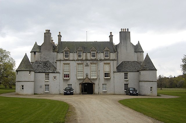
http://www.undiscoveredscotland.co.uk/rhynie/leithhall/index.html
305:
255:
1030:
280:
230:
88:
138:
Leith Hall (rear elevation) - geograph.org.uk - 1273765.jpg
290:
57° 21′ 22″ N, 2° 45′ 51″ W
240:
57° 21′ 23″ N, 2° 45′ 54″ W
479:
Add a one-line explanation of what this file represents
78:(1,600 × 1,064 pixels, file size: 257 KB, MIME type:
132:
112:
Commons is a freely licensed media file repository.
648:
Creative
Commons Attribution-ShareAlike 2.0 Generic
148:Leith Hall (rear elevation) For its history, see:
448:https://creativecommons.org/licenses/by-sa/2.0
93:
454:Creative Commons Attribution-Share Alike 2.0
372:
8:
850:
786:
414:– to copy, distribute and transmit the work
920:
475:
1023:The following other wikis use this file:
734:https://www.geograph.org.uk/photo/1273765
560:https://www.geograph.org.uk/profile/15400
968:Higher-resolution version from Geograph.
1010:
874:
858:
810:
794:
768:
752:
681:
665:
645:
629:
609:
593:
526:
510:
493:
490:
471:
464:
283:
233:
312:View this and other nearby images on:
262:View this and other nearby images on:
7:
359:and is licensed for reuse under the
909:
395:Attribution-Share Alike 2.0 Generic
383:
378:
363:Attribution-ShareAlike 2.0 license.
484:
478:
369:
346:
142:
125:
71:
483:
797:coordinates of the point of view
469:
425:Under the following conditions:
390:This file is licensed under the
382:
377:
371:
339:
318:
304:
296:
268:
254:
246:
92:
31:
21:
466:
143:
14:
684:file available on the internet
465:
347:This image was taken from the
26:
1:
861:coordinates of depicted place
704:Geograph Britain and Ireland
568:object of statement has role
491:Items portrayed in this file
1027:Usage on en.wikivoyage.org
876:57°21'22.43"N, 2°45'51.48"W
812:57°21'22.72"N, 2°45'54.36"W
295:
245:
223:Leith Hall (rear elevation)
204:Leith Hall (rear elevation)
1059:
1037:Usage on zh.wikipedia.org
439:same or compatible license
221:Bill Harrison /
202:Bill Harrison /
910:
16:
712:geograph.org.uk image ID
468:
405:
99:This is a file from the
997:
976:03:01, 27 February 2011
967:
946:23:02, 7 September 2017
193:required by the license
177:
166:
159:
156:
135:
103:. Information from its
353:this photograph's page
324:57.356230; -2.764300
274:57.356310; -2.765100
106:description page there
41:Size of this preview:
65:1,600 × 1,064 pixels
963:Geograph Update Bot
420:– to adapt the work
47:Other resolutions:
540:author name string
61:1,280 × 851 pixels
57:1,024 × 681 pixels
1031:Huntly (Scotland)
1019:Global file usage
1001:
852:
788:
632:copyright license
477:
368:
367:
351:collection. See
329:
328:
279:
278:
228:
227:
196:
121:
120:
101:Wikimedia Commons
32:Global file usage
1050:
988:
958:
898:
897:
892:
834:
833:
828:
736:
731:
727:described at URL
721:
716:
706:
701:
596:copyright status
577:
572:
562:
557:
547:
544:
461:
458:
455:
452:
449:
441:as the original.
403:
392:Creative Commons
386:
385:
381:
380:
375:
374:
361:Creative Commons
349:Geograph project
343:
336:
325:
322:
308:
307:
301:
300:
299:
293:
292:
281:
275:
272:
258:
257:
251:
250:
249:
243:
242:
231:
190:
162:
147:
139:
133:
117:
96:
95:
89:
83:
81:
68:
53:640 × 426 pixels
49:320 × 213 pixels
43:800 × 532 pixels
1058:
1057:
1053:
1052:
1051:
1049:
1048:
1047:
1017:
1009:
1002:
994:
986:
964:
956:
912:
911:
908:
907:
906:
905:
904:
903:
902:
901:
900:
899:
895:
893:
890:
881:
880:
879:
877:
867:
866:
865:
863:
844:
843:
842:
841:
840:
839:
838:
837:
836:
835:
831:
829:
826:
817:
816:
815:
813:
803:
802:
801:
799:
780:
779:
778:
777:
776:
775:
774:
773:
771:
761:
760:
759:
757:
746:
745:
744:
743:
742:
741:
740:
739:
738:
737:
732:
729:
723:
722:
717:
714:
708:
707:
702:
699:
690:
689:
688:
686:
674:
673:
672:
670:
659:
658:
657:
656:
655:
654:
653:
652:
650:
638:
637:
636:
634:
623:
622:
621:
620:
619:
618:
617:
616:
614:
602:
601:
600:
598:
587:
586:
585:
584:
583:
582:
581:
580:
579:
578:
573:
570:
564:
563:
558:
555:
549:
548:
545:
542:
533:
532:
531:
529:
519:
518:
517:
515:
504:
503:
502:
501:
500:
498:
482:
481:
480:
463:
462:
459:
456:
453:
450:
447:
446:
404:
401:
398:
387:
364:
334:
323:
297:
288:
287:
284:Object location
273:
247:
238:
237:
234:Camera location
229:
218:
211:
199:
172:geograph.org.uk
152:
137:
130:
123:
122:
111:
110:
109:is shown below.
85:
79:
77:
70:
69:
46:
12:
11:
5:
1056:
1054:
1046:
1045:
1044:
1043:
1035:
1034:
1033:
1021:
1020:
1016:
1015:
1007:
1006:
1005:
1000:
999:
996:
992:
989:
983:
978:
973:
970:
969:
966:
962:
959:
955:1,600 × 1,064
953:
948:
943:
939:
938:
935:
932:
929:
926:
923:
916:
915:
886:
885:
884:
883:
882:
878:
875:
873:
872:
871:
870:
869:
868:
864:
859:
857:
856:
855:
854:
848:
822:
821:
820:
819:
818:
814:
811:
809:
808:
807:
806:
805:
804:
800:
795:
793:
792:
791:
790:
784:
772:
769:
767:
766:
765:
764:
763:
762:
758:
753:
751:
750:
749:
748:
747:
725:
724:
710:
709:
695:
694:
693:
692:
691:
687:
682:
680:
679:
678:
677:
676:
675:
671:
668:source of file
666:
664:
663:
662:
661:
660:
651:
646:
644:
643:
642:
641:
640:
639:
635:
630:
628:
627:
626:
625:
624:
615:
610:
608:
607:
606:
605:
604:
603:
599:
594:
592:
591:
590:
589:
588:
566:
565:
551:
550:
538:
537:
536:
535:
534:
530:
527:
525:
524:
523:
522:
521:
520:
516:
511:
509:
508:
507:
506:
505:
499:
494:
492:
489:
488:
487:
486:
485:
474:
473:
470:
467:
445:
444:
443:
442:
432:
423:
422:
421:
415:
408:You are free:
399:
389:
388:
370:
366:
365:
344:
333:
330:
327:
326:
316:
310:
285:
277:
276:
266:
260:
235:
226:
225:
219:
216:
213:
212:
207:
200:
197:
185:
184:
179:
175:
174:
168:
164:
163:
158:
154:
153:
140:
131:
129:
126:
124:
119:
118:
97:
87:
86:
40:
36:
35:
34:
29:
24:
19:
13:
10:
9:
6:
4:
3:
2:
1055:
1042:
1039:
1038:
1036:
1032:
1029:
1028:
1026:
1025:
1024:
1018:
1014:
1011:
1003:
995:
990:
984:
982:
979:
977:
974:
972:
971:
965:
960:
954:
952:
949:
947:
944:
941:
940:
936:
933:
930:
927:
924:
922:
921:
919:
913:
889:
862:
825:
798:
770:26 April 2009
756:
735:
728:
720:
713:
705:
698:
685:
669:
649:
633:
613:
597:
576:
569:
561:
554:
546:Bill Harrison
541:
514:
497:
451:CC BY-SA 2.0
440:
436:
433:
430:
427:
426:
424:
419:
416:
413:
410:
409:
407:
406:
402:Bill Harrison
400:Attribution:
396:
393:
376:
362:
358:
357:Bill Harrison
354:
350:
345:
342:
338:
337:
331:
321:
317:
315:
314:OpenStreetMap
311:
309:
291:
286:
282:
271:
267:
265:
264:OpenStreetMap
261:
259:
241:
236:
232:
224:
220:
215:
214:
210:
206: /
205:
201:
194:
189:
187:
186:
183:
182:Bill Harrison
180:
176:
173:
169:
165:
161:26 April 2009
155:
151:
146:
141:
134:
127:
115:
108:
107:
102:
98:
91:
90:
84:
75:
74:Original file
66:
62:
58:
54:
50:
44:
39:
33:
30:
28:
25:
23:
20:
18:
15:
1022:
917:
914:File history
575:photographer
434:
428:
417:
411:
356:
294:
244:
222:
209:CC BY-SA 2.0
203:
144:
114:You can help
104:
72:
22:File history
993:GeographBot
612:copyrighted
435:share alike
429:attribution
188:Attribution
136:Description
1013:Leith Hall
1004:File usage
985:640 × 426
931:Dimensions
528:some value
80:image/jpeg
27:File usage
928:Thumbnail
925:Date/Time
755:inception
332:Licensing
217:InfoField
198:InfoField
145:English:
957:(257 KB)
697:operator
472:Captions
418:to remix
412:to share
397:license.
987:(56 KB)
942:current
937:Comment
888:heading
847:heading
824:heading
783:heading
719:1273765
513:creator
496:depicts
476:English
128:Summary
76:
896:degree
851:degree
832:degree
787:degree
302:
252:
178:Author
167:Source
170:From
934:User
460:true
457:true
157:Date
17:File
1041:萊斯廳
894:90
830:90
553:URL
891::
827::
730::
715::
700::
571::
556::
543::
63:|
59:|
55:|
51:|
45:.
195:)
191:(
116:.
82:)
67:.
Text is available under the Creative Commons Attribution-ShareAlike License. Additional terms may apply.

_-_geograph.org.uk_-_1273765.jpg)
_-_geograph.org.uk_-_1273765.jpg¶ms=057.356310_N_-002.765100_E_globe:Earth_type:camera_source:geograph-osgb36(NJ54062979)_heading:90.00&language=en)
_-_geograph.org.uk_-_1273765.jpg¶ms=057.356230_N_-002.764300_E_globe:Earth_class:object_type:object_source:geograph-osgb36(NJ54112978)_heading:90.00&language=en)
