314:
247:
239:
261:
282:
320:
325:
72:
639:"}},"text\/plain":{"en":{"":"heading"}}},"{\"value\":{\"amount\":\"+90\",\"unit\":\"http:\\\/\\\/www.wikidata.org\\\/entity\\\/Q28390\"},\"type\":\"quantity\"}":{"text\/html":{"en":{"P7787":"90
635:
879:== {{int:filedesc}} == {{Information |Description={{en|1=A view across Little Langdale with Little Langdale Tarn clearly visible in the middle of the photo. Taken from a high point on the Wrynose Pass looking eastwards}} |Source=From [http://www.geograph.
372:– You must give appropriate credit, provide a link to the license, and indicate if changes were made. You may do so in any reasonable manner, but not in any way that suggests the licensor endorses you or your use.
43:
230:
636:
126:
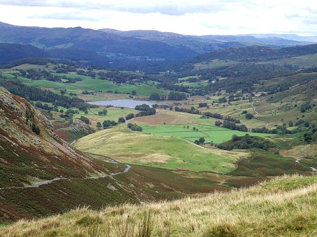
A view across Little
Langdale with Little Langdale Tarn clearly visible in the middle of the photo. Taken from a high point on the Wrynose Pass looking eastwards
51:
83:
167:
722:
588:
552:
254:
742:
1076:
289:
939:
This file contains additional information, probably added from the digital camera or scanner used to create or digitize it.
379:
502:
1045:
793:
765:
706:
677:
650:
536:
510:
495:
480:
898:
750:
735:
608:
572:
453:
436:
276:
335:
942:
If the file has been modified from its original state, some details may not fully reflect the modified file.
861:
856:
42:
889:
The following pages on the
English Knowledge (XXG) use this file (pages on other projects are not listed):
1129:
378:– If you remix, transform, or build upon the material, you must distribute your contributions under the
296:
on the
Geograph website for the photographer's contact details. The copyright on this image is owned by
332:
1165:
643:"}},"text\/plain":{"en":{"P7787":"90 degree"}}}}": -->
961:
91:
199:
772:
757:
487:
183:
893:
260:
1233:
1147:
1103:
968:
301:
78:
1008:
916:
244:
1175:
872:
135:
988:
156:
146:
1251:
978:
951:
281:
293:
829:
Click on a date/time to view the file as it appeared at that time.
246:
231:
54° 25′ 02.47″ N, 3° 06′ 28.61″ W
221:
66:
420:
Add a one-line explanation of what this file represents
926:
174:
Creative
Commons Attribution Share-alike license 2.0
110:
90:
Commons is a freely licensed media file repository.
589:
Creative
Commons Attribution-ShareAlike 2.0 Generic
56:(640 × 480 pixels, file size: 191 KB, MIME type:
1170:Flash did not fire, compulsory flash suppression
389:https://creativecommons.org/licenses/by-sa/2.0
71:
395:Creative Commons Attribution-Share Alike 2.0
313:
8:
640:
355:– to copy, distribute and transmit the work
944:
831:
416:
909:The following other wikis use this file:
758:https://www.geograph.org.uk/photo/546676
488:https://www.geograph.org.uk/profile/3546
1259:
1249:
1241:
1231:
1223:
1215:
1207:
1199:
1191:
1183:
1173:
1163:
1155:
1145:
1137:
1127:
1119:
1111:
1101:
1093:
1085:
1074:
1066:
1058:
1050:
1040:
1032:
1024:
1016:
1005:
997:
986:
976:
966:
956:
891:
807:
791:
720:
704:
664:
648:
622:
606:
586:
570:
550:
534:
467:
451:
434:
431:
412:
405:
224:
1046:Digital Camera FinePix V10 Ver1.00
253:View this and other nearby images on:
946:
116:Little Langdale (geograph 546676).jpg
52:Little_Langdale_(geograph_546676).jpg
7:
300:and is licensed for reuse under the
820:
336:Attribution-Share Alike 2.0 Generic
324:
319:
304:Attribution-ShareAlike 2.0 license.
937:
425:
419:
310:
287:
120:
103:
49:
424:
999:Date and time of data generation
651:coordinates of the point of view
410:
366:Under the following conditions:
331:This file is licensed under the
323:
318:
312:
280:
259:
245:
237:
70:
31:
21:
407:
121:
46:No higher resolution available.
14:
973:1/350 sec (0.0028571428571429)
723:file available on the internet
406:
288:This image was taken from the
26:
1:
36:
743:Geograph Britain and Ireland
496:object of statement has role
432:Items portrayed in this file
1201:Focal plane resolution unit
1087:Date and time of digitizing
899:User:JMiall/Little Langdale
666:54°25'2.471"N, 3°6'28.613"W
236:
1281:
1212:One-chip color area sensor
923:Usage on www.wikidata.org
913:Usage on vi.wikipedia.org
380:same or compatible license
1052:File change date and time
821:
16:
1193:Focal plane Y resolution
1185:Focal plane X resolution
766:geograph.org.uk image ID
409:
346:
77:This is a file from the
1217:Custom image processing
1090:14:35, 2 September 2007
1055:14:35, 2 September 2007
1002:14:35, 2 September 2007
917:Thung lũng Langdale Nhỏ
878:
212:Rob Farrow /
193:Rob Farrow /
184:required by the license
162:
152:
141:
134:
131:
113:
81:. Information from its
1261:Subject distance range
1095:Image compression mode
857:01:07, 2 February 2011
294:this photograph's page
265:54.417353; -3.107948
84:description page there
1139:Maximum land aperture
1026:Horizontal resolution
1060:Y and C positioning
1034:Vertical resolution
948:Camera manufacturer
361:– to adapt the work
1243:Scene capture type
1238:Auto white balance
511:author name string
1268:
1267:
905:Global file usage
882:
642:
573:copyright license
418:
309:
308:
292:collection. See
270:
269:
219:
218:
187:
171:
168:Reusing this file
99:
98:
79:Wikimedia Commons
32:Global file usage
1272:
1068:Exposure Program
945:
869:
775:
770:
760:
755:
751:described at URL
745:
740:
688:
687:
682:
624:2 September 2007
537:copyright status
518:
515:
505:
500:
490:
485:
402:
399:
396:
393:
390:
382:as the original.
344:
333:Creative Commons
327:
326:
322:
321:
316:
315:
302:Creative Commons
290:Geograph project
284:
277:
266:
263:
249:
248:
242:
241:
240:
234:
233:
222:
181:
165:
137:
136:2 September 2007
125:
117:
111:
95:
74:
73:
67:
61:
59:
1280:
1279:
1275:
1274:
1273:
1271:
1270:
1269:
1142:3 APEX (f/2.83)
1121:APEX brightness
962:FinePix V10
933:
903:
894:Little Langdale
890:
883:
875:
867:
823:
822:
819:
818:
817:
816:
815:
814:
813:
812:
810:
800:
799:
798:
796:
785:
784:
783:
782:
781:
780:
779:
778:
777:
776:
771:
768:
762:
761:
756:
753:
747:
746:
741:
738:
729:
728:
727:
725:
713:
712:
711:
709:
698:
697:
696:
695:
694:
693:
692:
691:
690:
689:
685:
683:
680:
671:
670:
669:
667:
657:
656:
655:
653:
634:
633:
632:
631:
630:
629:
628:
627:
625:
615:
614:
613:
611:
600:
599:
598:
597:
596:
595:
594:
593:
591:
579:
578:
577:
575:
564:
563:
562:
561:
560:
559:
558:
557:
555:
543:
542:
541:
539:
528:
527:
526:
525:
524:
523:
522:
521:
520:
519:
516:
513:
507:
506:
501:
498:
492:
491:
486:
483:
474:
473:
472:
470:
460:
459:
458:
456:
445:
444:
443:
442:
441:
439:
423:
422:
421:
404:
403:
400:
397:
394:
391:
388:
387:
345:
342:
339:
328:
305:
275:
264:
238:
229:
228:
225:Camera location
220:
214:Little Langdale
209:
202:
195:Little Langdale
190:
147:geograph.org.uk
127:
115:
108:
101:
100:
89:
88:
87:is shown below.
63:
57:
55:
48:
47:
12:
11:
5:
1278:
1276:
1266:
1265:
1262:
1258:
1257:
1254:
1248:
1247:
1244:
1240:
1239:
1236:
1230:
1229:
1226:
1222:
1221:
1220:Normal process
1218:
1214:
1213:
1210:
1209:Sensing method
1206:
1205:
1202:
1198:
1197:
1194:
1190:
1189:
1186:
1182:
1181:
1178:
1172:
1171:
1168:
1162:
1161:
1158:
1154:
1153:
1150:
1144:
1143:
1140:
1136:
1135:
1132:
1126:
1125:
1122:
1118:
1117:
1114:
1110:
1109:
1106:
1100:
1099:
1096:
1092:
1091:
1088:
1084:
1083:
1080:
1073:
1072:
1071:Normal program
1069:
1065:
1064:
1061:
1057:
1056:
1053:
1049:
1048:
1043:
1039:
1038:
1035:
1031:
1030:
1027:
1023:
1022:
1019:
1015:
1014:
1011:
1004:
1003:
1000:
996:
995:
992:
985:
984:
981:
975:
974:
971:
965:
964:
959:
955:
954:
949:
936:
932:
931:
930:
929:
921:
920:
919:
907:
906:
902:
901:
896:
888:
887:
886:
881:
880:
877:
873:
870:
864:
859:
854:
850:
849:
846:
843:
840:
837:
834:
827:
826:
811:
808:
806:
805:
804:
803:
802:
801:
797:
792:
790:
789:
788:
787:
786:
764:
763:
749:
748:
734:
733:
732:
731:
730:
726:
721:
719:
718:
717:
716:
715:
714:
710:
707:source of file
705:
703:
702:
701:
700:
699:
676:
675:
674:
673:
672:
668:
665:
663:
662:
661:
660:
659:
658:
654:
649:
647:
646:
645:
644:
638:
626:
623:
621:
620:
619:
618:
617:
616:
612:
607:
605:
604:
603:
602:
601:
592:
587:
585:
584:
583:
582:
581:
580:
576:
571:
569:
568:
567:
566:
565:
556:
551:
549:
548:
547:
546:
545:
544:
540:
535:
533:
532:
531:
530:
529:
509:
508:
494:
493:
479:
478:
477:
476:
475:
471:
468:
466:
465:
464:
463:
462:
461:
457:
452:
450:
449:
448:
447:
446:
440:
435:
433:
430:
429:
428:
427:
426:
415:
414:
411:
408:
386:
385:
384:
383:
373:
364:
363:
362:
356:
349:You are free:
340:
330:
329:
311:
307:
306:
285:
274:
271:
268:
267:
257:
251:
226:
217:
216:
210:
207:
204:
203:
198:
191:
188:
176:
175:
172:
160:
159:
154:
150:
149:
143:
139:
138:
133:
129:
128:
118:
109:
107:
104:
102:
97:
96:
75:
65:
64:
45:
41:
40:
39:
34:
29:
24:
19:
13:
10:
9:
6:
4:
3:
2:
1277:
1263:
1260:
1255:
1253:
1250:
1245:
1242:
1237:
1235:
1234:White balance
1232:
1228:Auto exposure
1227:
1225:Exposure mode
1224:
1219:
1216:
1211:
1208:
1203:
1200:
1195:
1192:
1187:
1184:
1179:
1177:
1174:
1169:
1167:
1164:
1159:
1156:
1151:
1149:
1148:Metering mode
1146:
1141:
1138:
1133:
1131:
1130:Exposure bias
1128:
1123:
1120:
1115:
1113:APEX aperture
1112:
1107:
1105:
1104:Shutter speed
1102:
1097:
1094:
1089:
1086:
1081:
1078:
1075:
1070:
1067:
1062:
1059:
1054:
1051:
1047:
1044:
1042:Software used
1041:
1036:
1033:
1028:
1025:
1020:
1017:
1012:
1010:
1006:
1001:
998:
993:
990:
987:
982:
980:
977:
972:
970:
969:Exposure time
967:
963:
960:
957:
953:
950:
947:
943:
940:
934:
928:
925:
924:
922:
918:
915:
914:
912:
911:
910:
904:
900:
897:
895:
892:
884:
876:
871:
865:
863:
860:
858:
855:
852:
851:
847:
844:
841:
838:
835:
833:
832:
830:
824:
795:
774:
767:
759:
752:
744:
737:
724:
708:
679:
652:
610:
590:
574:
554:
538:
512:
504:
497:
489:
482:
455:
438:
392:CC BY-SA 2.0
381:
377:
374:
371:
368:
367:
365:
360:
357:
354:
351:
350:
348:
347:
341:Attribution:
337:
334:
317:
303:
299:
295:
291:
286:
283:
279:
278:
272:
262:
258:
256:
255:OpenStreetMap
252:
250:
232:
227:
223:
215:
211:
206:
205:
201:
197: /
196:
192:
185:
180:
178:
177:
173:
169:
164:
161:
158:
155:
151:
148:
144:
140:
130:
124:
119:
112:
105:
93:
86:
85:
80:
76:
69:
68:
62:
53:
44:
38:
35:
33:
30:
28:
25:
23:
20:
18:
15:
1157:Light source
1009:focal length
958:Camera model
941:
938:
908:
828:
825:File history
503:photographer
375:
369:
358:
352:
297:
235:
213:
200:CC BY-SA 2.0
194:
122:
92:You can help
82:
50:
22:File history
1176:Color space
1018:Orientation
553:copyrighted
376:share alike
370:attribution
179:Attribution
114:Description
885:File usage
866:640 × 480
842:Dimensions
809:image/jpeg
794:media type
517:Rob Farrow
469:some value
343:Rob Farrow
298:Rob Farrow
163:Permission
157:Rob Farrow
58:image/jpeg
27:File usage
1252:Sharpness
989:ISO speed
839:Thumbnail
836:Date/Time
609:inception
273:Licensing
208:InfoField
189:InfoField
123:English:
1246:Standard
1063:Co-sited
979:F-number
952:FUJIFILM
935:Metadata
927:Q6650630
868:(191 KB)
736:operator
413:Captions
359:to remix
353:to share
338:license.
37:Metadata
1264:Unknown
1160:Unknown
1152:Pattern
1079:version
1013:13.6 mm
853:current
848:Comment
678:heading
637:heading
454:creator
437:depicts
417:English
106:Summary
54:
1037:72 dpi
1029:72 dpi
1021:Normal
991:rating
874:JMiall
773:546676
686:degree
641:degree
243:
153:Author
142:Source
1196:4,442
1188:4,442
1166:Flash
1007:Lens
983:f/4.2
145:From
1180:sRGB
1124:6.71
1108:8.53
1077:Exif
845:User
401:true
398:true
132:Date
17:File
1116:4.1
1082:2.2
994:200
684:90
481:URL
769::
754::
739::
681::
514::
499::
484::
1256:3
1204:3
1134:0
1098:4
186:)
182:(
170:)
166:(
94:.
60:)
Text is available under the Creative Commons Attribution-ShareAlike License. Additional terms may apply.
.jpg)
.jpg¶ms=054.417353_N_-003.107948_E_globe:Earth_type:camera_heading:90.00&language=en)
