43:
239:
206:
315:
220:
245:
103:
1078:
1048:
286:– You must give appropriate credit, provide a link to the license, and indicate if changes were made. You may do so in any reasonable manner, but not in any way that suggests the licensor endorses you or your use.
1124:
197:
1149:
1095:{{Information |Description=One of the original concrete bridges on the "Lincoln Highway" |Source= |Date=2009-07-12 11:28 |Author=[http://www.flickr.com/peopl
1129:
69:
65:
61:
57:
53:
47:
1139:
82:
114:
1114:
1144:
1134:
1077:
1072:
641:
605:
569:
213:
395:
1317:
1180:
This file contains additional information, probably added from the digital camera or scanner used to create or digitize it.
957:
676:
514:
977:
907:
873:
836:
802:
765:
731:
625:
553:
498:
470:
455:
442:
1109:
697:
669:
654:
589:
527:
415:
379:
941:
1183:
If the file has been modified from its original state, some details may not fully reflect the modified file.
1047:
1042:
73:
42:
661:
1370:
1119:
255:
1058:
252:
1406:
993:
122:
477:
1500:
462:
169:
327:
333:
219:
1474:
1388:
1344:
1209:
1202:
1088:
159:
109:
1510:
1249:
203:
1416:
1286:
1229:
179:
1520:
1219:
1192:
322:
1125:
Knowledge:WikiProject U.S. Roads/Newsletter/Issues/Volume04/Issue03
1015:
Click on a date/time to view the file as it appeared at that time.
338:
and was confirmed to be licensed under the terms of the cc-by-2.0.
724:
205:
198:
41° 57′ 49.76″ N, 92° 33′ 44.79″ W
188:
97:
151:
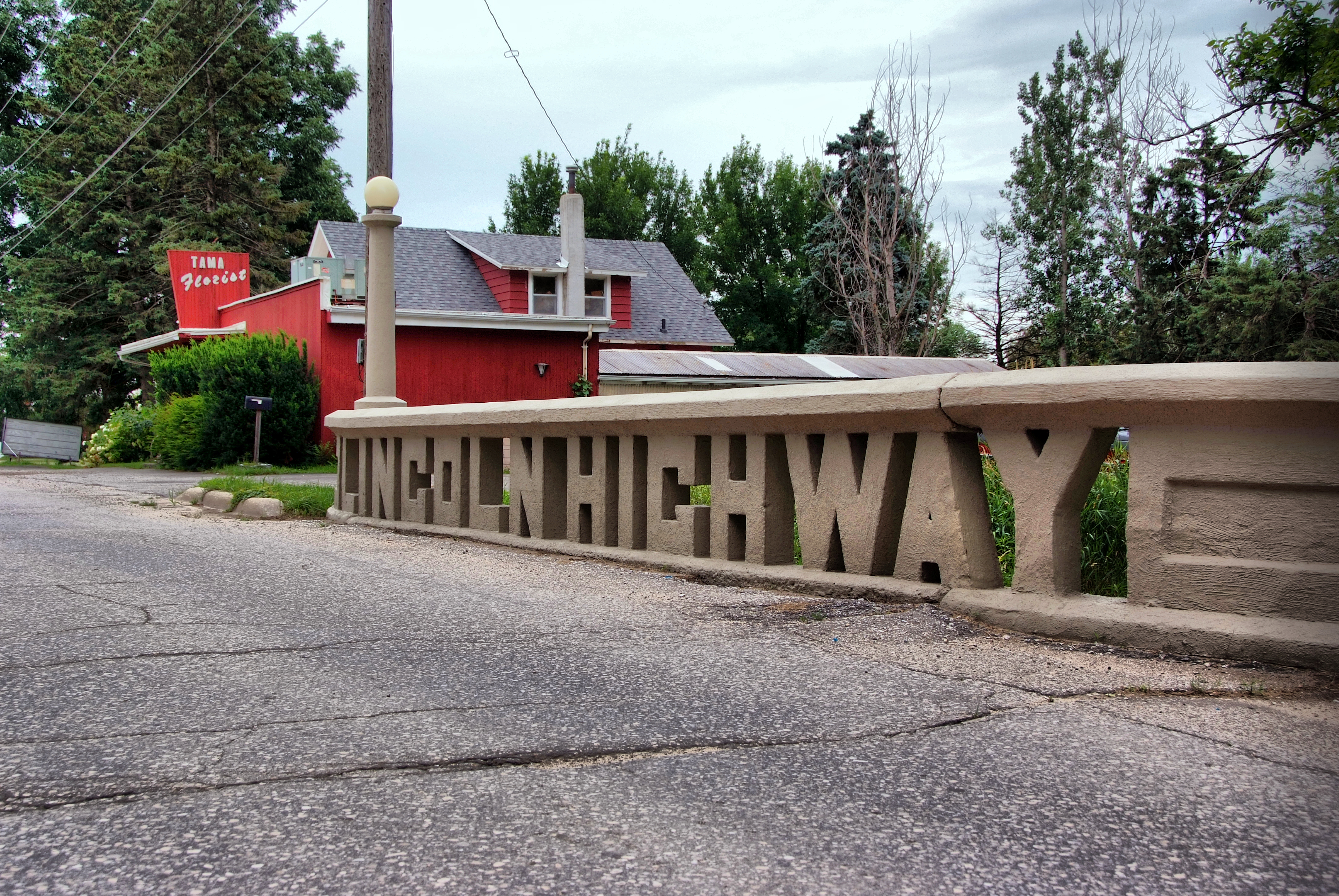
One of the original concrete bridges on the "Lincoln
Highway"
363:
Add a one-line explanation of what this file represents
87:(4,256 × 2,848 pixels, file size: 13.63 MB, MIME type:
662:
https://www.flickr.com/photos/80909625@N00/3714920627/
1167:
328:
https://www.flickr.com/photos/80909625@N00/3714920627
141:
121:
Commons is a freely licensed media file repository.
1150:Portal:U.S. roads/Selected picture/September 2018
1065:Replacing image by its original image from Flickr
1411:Flash did not fire, compulsory flash suppression
1130:File talk:Lincoln Highway Bridge, Tama, IA.jpg
102:
238:
8:
1140:Portal:U.S. roads/Selected article/May 2011
293:https://creativecommons.org/licenses/by/2.0
269:– to copy, distribute and transmit the work
1185:
1017:
463:https://www.flickr.com/people/80909625@N00
359:
1160:The following other wikis use this file:
606:Creative Commons Attribution 2.0 Generic
330:. It was reviewed on 19 January 2010 by
1536:
1528:
1518:
1508:
1498:
1490:
1482:
1472:
1464:
1456:
1448:
1440:
1432:
1424:
1414:
1404:
1396:
1386:
1378:
1368:
1360:
1352:
1342:
1334:
1326:
1315:
1307:
1299:
1291:
1281:
1273:
1265:
1257:
1246:
1238:
1227:
1217:
1207:
1197:
1107:
991:
975:
955:
939:
921:
905:
887:
871:
850:
834:
816:
800:
779:
763:
745:
729:
711:
695:
639:
623:
603:
587:
567:
551:
512:
496:
429:
413:
393:
377:
374:
355:
348:
191:
212:View this and other nearby images on:
1187:
1105:The following 9 pages use this file:
7:
320:This image was originally posted to
309:
147:Lincoln Highway Bridge, Tama, IA.jpg
1115:Lincoln Highway Bridge (Tama, Iowa)
1006:
244:
1178:
1145:Portal:U.S. roads/Selected picture
1135:Portal:U.S. roads/Selected article
368:
362:
260:
235:
134:
80:
367:
299:Creative Commons Attribution 2.0
1541:422f0095cfebf4035e6e7a18aff8bdfc
1240:Date and time of data generation
732:coordinates of the point of view
353:
313:
280:Under the following conditions:
251:This file is licensed under the
243:
237:
218:
204:
170:Lincoln Highway Bridge, Tama, IA
101:
31:
21:
350:
14:
1214:1/180 sec (0.0055555555555556)
747:41°57'49.759"N, 92°33'44.791"W
642:file available on the internet
349:
26:
1:
36:
375:Items portrayed in this file
1442:Focal plane resolution unit
1328:Date and time of digitizing
1110:Iowa Primary Highway System
1558:
1484:Focal length in 35 mm film
1453:One-chip color area sensor
1164:Usage on www.wikidata.org
1293:File change date and time
1007:
16:
1434:Focal plane Y resolution
1426:Focal plane X resolution
352:
108:This is a file from the
1458:Custom image processing
1094:
1064:
781:0.00555555555555555555
256:Attribution 2.0 Generic
175:
165:
158:
155:
144:
112:. Information from its
1530:Subject distance range
1336:Image compression mode
1073:02:18, 19 January 2010
1043:06:15, 19 January 2010
396:Lincoln Highway Bridge
224:41.963822; -92.562442
115:description page there
46:Size of this preview:
1380:Maximum land aperture
1267:Horizontal resolution
1120:U.S. Route 30 in Iowa
74:4,256 × 2,848 pixels
70:2,560 × 1,713 pixels
1331:11:28, 12 July 2009
1301:Y and C positioning
1296:11:28, 12 July 2009
1275:Vertical resolution
1243:11:28, 12 July 2009
1189:Camera manufacturer
275:– to adapt the work
160:12 July 2009, 11:28
52:Other resolutions:
1492:Scene capture type
443:author name string
66:1,280 × 857 pixels
62:1,024 × 685 pixels
1545:
1544:
1156:Global file usage
1098:
590:copyright license
361:
342:
341:
229:
228:
186:
185:
130:
129:
110:Wikimedia Commons
32:Global file usage
1549:
1309:Exposure Program
1186:
1085:
1055:
978:Flickr photo ID
855:
784:
679:
674:
664:
659:
655:described at URL
554:copyright status
535:
532:
528:publication date
480:
475:
465:
460:
450:
447:
346:
336:
326:by cwwycoff1 at
317:
316:
310:
306:
303:
300:
297:
294:
253:Creative Commons
247:
246:
241:
240:
225:
222:
208:
207:
201:
200:
189:
182:from Nevada, USA
161:
148:
142:
126:
105:
104:
98:
92:
90:
77:
58:640 × 428 pixels
54:320 × 214 pixels
48:800 × 535 pixels
1557:
1556:
1552:
1551:
1550:
1548:
1547:
1546:
1538:Unique image ID
1362:APEX brightness
1203:FinePix S5Pro
1174:
1154:
1099:
1091:
1083:
1061:
1053:
1009:
1008:
1005:
1004:
1003:
1002:
1001:
1000:
999:
998:
996:
984:
983:
982:
980:
969:
968:
967:
966:
965:
964:
963:
962:
960:
948:
947:
946:
944:
933:
932:
931:
930:
929:
928:
927:
926:
924:
914:
913:
912:
910:
899:
898:
897:
896:
895:
894:
893:
892:
890:
880:
879:
878:
876:
865:
864:
863:
862:
861:
860:
859:
858:
856:
853:
843:
842:
841:
839:
828:
827:
826:
825:
824:
823:
822:
821:
819:
809:
808:
807:
805:
794:
793:
792:
791:
790:
789:
788:
787:
785:
782:
772:
771:
770:
768:
757:
756:
755:
754:
753:
752:
751:
750:
748:
738:
737:
736:
734:
723:
722:
721:
720:
719:
718:
717:
716:
714:
704:
703:
702:
700:
689:
688:
687:
686:
685:
684:
683:
682:
681:
680:
675:
672:
666:
665:
660:
657:
648:
647:
646:
644:
632:
631:
630:
628:
617:
616:
615:
614:
613:
612:
611:
610:
608:
596:
595:
594:
592:
581:
580:
579:
578:
577:
576:
575:
574:
572:
560:
559:
558:
556:
545:
544:
543:
542:
541:
540:
539:
538:
537:
536:
533:
530:
521:
520:
519:
517:
505:
504:
503:
501:
490:
489:
488:
487:
486:
485:
484:
483:
482:
481:
476:
473:
467:
466:
461:
458:
452:
451:
448:
445:
436:
435:
434:
432:
422:
421:
420:
418:
407:
406:
405:
404:
403:
402:
401:
400:
398:
386:
385:
384:
382:
366:
365:
364:
345:19 January 2010
344:
332:
314:
308:
307:
304:
301:
298:
295:
292:
291:
259:
248:
234:
223:
196:
195:
192:Camera location
187:
146:
139:
132:
131:
120:
119:
118:is shown below.
94:
88:
86:
79:
78:
51:
12:
11:
5:
1555:
1553:
1543:
1542:
1539:
1535:
1534:
1531:
1527:
1526:
1523:
1517:
1516:
1513:
1507:
1506:
1503:
1497:
1496:
1493:
1489:
1488:
1485:
1481:
1480:
1477:
1471:
1470:
1467:
1463:
1462:
1461:Normal process
1459:
1455:
1454:
1451:
1450:Sensing method
1447:
1446:
1443:
1439:
1438:
1435:
1431:
1430:
1427:
1423:
1422:
1419:
1413:
1412:
1409:
1403:
1402:
1399:
1395:
1394:
1391:
1385:
1384:
1381:
1377:
1376:
1373:
1367:
1366:
1363:
1359:
1358:
1355:
1351:
1350:
1347:
1341:
1340:
1337:
1333:
1332:
1329:
1325:
1324:
1321:
1314:
1313:
1312:Normal program
1310:
1306:
1305:
1302:
1298:
1297:
1294:
1290:
1289:
1284:
1280:
1279:
1276:
1272:
1271:
1268:
1264:
1263:
1260:
1256:
1255:
1252:
1245:
1244:
1241:
1237:
1236:
1233:
1226:
1225:
1222:
1216:
1215:
1212:
1206:
1205:
1200:
1196:
1195:
1190:
1177:
1173:
1172:
1171:
1170:
1158:
1157:
1153:
1152:
1147:
1142:
1137:
1132:
1127:
1122:
1117:
1112:
1103:
1102:
1097:
1096:
1093:
1089:
1086:
1080:
1075:
1070:
1067:
1066:
1063:
1059:
1056:
1052:4,256 × 2,848
1050:
1045:
1040:
1036:
1035:
1032:
1029:
1026:
1023:
1020:
1013:
1012:
997:
992:
990:
989:
988:
987:
986:
985:
981:
976:
974:
973:
972:
971:
970:
961:
956:
954:
953:
952:
951:
950:
949:
945:
940:
938:
937:
936:
935:
934:
925:
922:
920:
919:
918:
917:
916:
915:
911:
906:
904:
903:
902:
901:
900:
891:
888:
886:
885:
884:
883:
882:
881:
877:
872:
870:
869:
868:
867:
866:
857:
851:
849:
848:
847:
846:
845:
844:
840:
835:
833:
832:
831:
830:
829:
820:
817:
815:
814:
813:
812:
811:
810:
806:
801:
799:
798:
797:
796:
795:
786:
780:
778:
777:
776:
775:
774:
773:
769:
764:
762:
761:
760:
759:
758:
749:
746:
744:
743:
742:
741:
740:
739:
735:
730:
728:
727:
726:
725:
715:
712:
710:
709:
708:
707:
706:
705:
701:
696:
694:
693:
692:
691:
690:
668:
667:
653:
652:
651:
650:
649:
645:
640:
638:
637:
636:
635:
634:
633:
629:
626:source of file
624:
622:
621:
620:
619:
618:
609:
604:
602:
601:
600:
599:
598:
597:
593:
588:
586:
585:
584:
583:
582:
573:
568:
566:
565:
564:
563:
562:
561:
557:
552:
550:
549:
548:
547:
546:
526:
525:
524:
523:
522:
518:
513:
511:
510:
509:
508:
507:
506:
502:
497:
495:
494:
493:
492:
491:
471:Flickr user ID
469:
468:
454:
453:
441:
440:
439:
438:
437:
433:
430:
428:
427:
426:
425:
424:
423:
419:
414:
412:
411:
410:
409:
408:
399:
394:
392:
391:
390:
389:
388:
387:
383:
378:
376:
373:
372:
371:
370:
369:
358:
357:
354:
351:
340:
339:
318:
290:
289:
288:
287:
278:
277:
276:
270:
263:You are free:
250:
249:
236:
233:
230:
227:
226:
216:
210:
193:
184:
183:
177:
173:
172:
167:
163:
162:
157:
153:
152:
149:
140:
138:
135:
133:
128:
127:
106:
96:
95:
45:
41:
40:
39:
34:
29:
24:
19:
13:
10:
9:
6:
4:
3:
2:
1554:
1540:
1537:
1532:
1529:
1524:
1522:
1519:
1514:
1512:
1509:
1504:
1502:
1499:
1494:
1491:
1486:
1483:
1478:
1476:
1475:White balance
1473:
1469:Auto exposure
1468:
1466:Exposure mode
1465:
1460:
1457:
1452:
1449:
1444:
1441:
1436:
1433:
1428:
1425:
1420:
1418:
1415:
1410:
1408:
1405:
1400:
1397:
1392:
1390:
1389:Metering mode
1387:
1382:
1379:
1374:
1372:
1371:Exposure bias
1369:
1364:
1361:
1356:
1354:APEX aperture
1353:
1348:
1346:
1345:Shutter speed
1343:
1338:
1335:
1330:
1327:
1322:
1319:
1316:
1311:
1308:
1303:
1300:
1295:
1292:
1288:
1285:
1283:Software used
1282:
1277:
1274:
1269:
1266:
1261:
1258:
1253:
1251:
1247:
1242:
1239:
1234:
1231:
1228:
1223:
1221:
1218:
1213:
1211:
1210:Exposure time
1208:
1204:
1201:
1198:
1194:
1191:
1188:
1184:
1181:
1175:
1169:
1166:
1165:
1163:
1162:
1161:
1155:
1151:
1148:
1146:
1143:
1141:
1138:
1136:
1133:
1131:
1128:
1126:
1123:
1121:
1118:
1116:
1113:
1111:
1108:
1106:
1100:
1092:
1087:
1081:
1079:
1076:
1074:
1071:
1069:
1068:
1062:
1057:
1051:
1049:
1046:
1044:
1041:
1038:
1037:
1033:
1030:
1027:
1024:
1021:
1019:
1018:
1016:
1010:
995:
979:
959:
943:
909:
875:
838:
804:
767:
766:exposure time
733:
699:
678:
671:
663:
656:
643:
627:
607:
591:
571:
555:
529:
516:
500:
479:
472:
464:
457:
444:
417:
397:
381:
347:
337:
335:
329:
325:
324:
319:
312:
311:
285:
282:
281:
279:
274:
271:
268:
265:
264:
262:
261:
257:
254:
242:
231:
221:
217:
215:
214:OpenStreetMap
211:
209:
199:
194:
190:
181:
178:
174:
171:
168:
164:
154:
150:
143:
136:
124:
117:
116:
111:
107:
100:
99:
93:
84:
83:Original file
75:
71:
67:
63:
59:
55:
49:
44:
38:
35:
33:
30:
28:
25:
23:
20:
18:
15:
1421:Uncalibrated
1398:Light source
1383:4 APEX (f/4)
1250:focal length
1199:Camera model
1182:
1179:
1159:
1104:
1082:1,024 × 685
1060:FlickreviewR
1014:
1011:File history
837:focal length
713:12 July 2009
534:13 July 2009
499:published in
478:80909625@N00
343:
334:FlickreviewR
331:
321:
283:
272:
266:
123:You can help
113:
81:
22:File history
1417:Color space
1259:Orientation
942:instance of
570:copyrighted
449:Carl Wycoff
284:attribution
180:Carl Wycoff
145:Description
1511:Saturation
1287:Picasa 3.0
1101:File usage
1054:(13.63 MB)
1028:Dimensions
994:3714920627
958:photograph
923:image/jpeg
908:media type
854:millimetre
431:some value
296:CC BY 2.0
89:image/jpeg
27:File usage
1521:Sharpness
1230:ISO speed
1025:Thumbnail
1022:Date/Time
874:ISO speed
698:inception
232:Licensing
1501:Contrast
1495:Standard
1304:Co-sited
1220:F-number
1193:FUJIFILM
1176:Metadata
1168:Q6550742
1090:Fredddie
1084:(516 KB)
803:f-number
670:operator
356:Captions
273:to remix
267:to share
258:license.
37:Metadata
1533:Unknown
1401:Unknown
1393:Pattern
1320:version
1278:300 dpi
1270:300 dpi
1039:current
1034:Comment
416:creator
380:depicts
360:English
137:Summary
85:
1515:Normal
1505:Normal
1232:rating
783:second
677:Flickr
515:Flickr
323:Flickr
202:
176:Author
166:Source
1487:42 mm
1437:1,861
1429:1,861
1407:Flash
1254:28 mm
1248:Lens
1224:f/7.1
1479:3840
1357:5.66
1323:2.21
1318:Exif
1031:User
305:true
302:true
156:Date
17:File
1349:7.5
1339:3.2
1235:100
889:100
852:28
818:7.1
456:URL
673::
658::
531::
474::
459::
446::
72:|
68:|
64:|
60:|
56:|
50:.
1525:3
1445:3
1375:0
1365:8
1262:0
125:.
91:)
76:.
Text is available under the Creative Commons Attribution-ShareAlike License. Additional terms may apply.