239:
200:
214:
245:
250:
91:
43:
718:
291:– You must give appropriate credit, provide a link to the license, and indicate if changes were made. You may do so in any reasonable manner, but not in any way that suggests the licensor endorses you or your use.
191:
57:
53:
47:
102:
70:
145:
The Lund
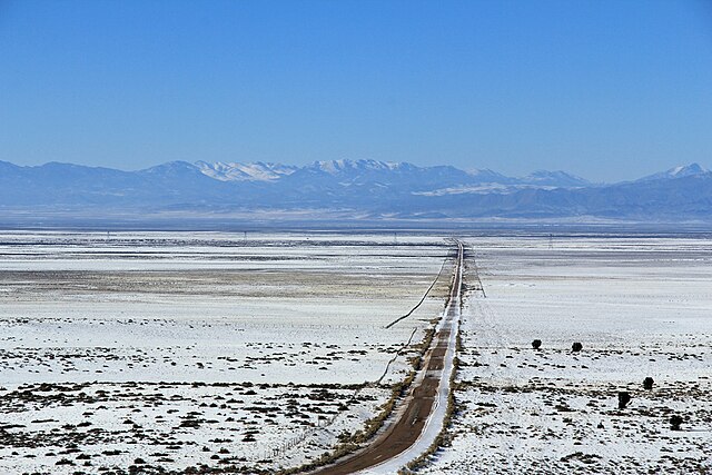
Highway runs from Lund to Cedar City in Iron County, Utah. The is the gravel section crossing the Escalante Desert to Lund.
663:
523:
487:
207:
917:
780:
This file contains additional information, probably added from the digital camera or scanner used to create or digitize it.
886:
298:
627:
407:
647:
611:
577:
471:
443:
428:
415:
400:
543:
507:
373:
356:
435:
260:
783:
If the file has been modified from its original state, some details may not fully reflect the modified file.
745:
The following pages on the
English Knowledge (XXG) use this file (pages on other projects are not listed):
975:
717:
712:
297:– If you remix, transform, or build upon the material, you must distribute your contributions under the
61:
42:
257:
995:
110:
450:
792:
154:
728:
213:
1087:
985:
957:
809:
802:
97:
232:
I, the copyright holder of this work, hereby publish it under the following license:
849:
749:
174:
1037:
197:
829:
819:
685:
Click on a date/time to view the file as it appeared at that time.
199:
192:
37° 53′ 45.6″ N, 113° 12′ 44.6″ W
767:
182:
85:
570:
340:
Add a one-line explanation of what this file represents
524:
Creative
Commons Attribution-ShareAlike 3.0 Unported
129:
109:
Commons is a freely licensed media file repository.
75:(1,000 × 667 pixels, file size: 318 KB, MIME type:
1000:Flash did not fire, compulsory flash suppression
308:https://creativecommons.org/licenses/by-sa/3.0
90:
314:Creative Commons Attribution-Share Alike 3.0
238:
8:
451:http://commons.wikimedia.org/User:Bob_Palin
274:– to copy, distribute and transmit the work
785:
687:
336:
760:The following other wikis use this file:
1148:xmp.did:C56E90EE3C60E211A870A623E391B129
1151:
1143:
1135:
1127:
1119:
1111:
1103:
1095:
1085:
1077:
1069:
1061:
1053:
1045:
1035:
1027:
1019:
1011:
1003:
993:
983:
973:
965:
955:
934:
926:
915:
907:
899:
891:
881:
873:
865:
857:
846:
838:
827:
817:
807:
797:
747:
661:
645:
625:
609:
591:
575:
557:
541:
521:
505:
485:
469:
387:
371:
354:
351:
332:
325:
185:
206:View this and other nearby images on:
887:Adobe Photoshop Elements 10.0 Windows
787:
7:
261:Attribution-Share Alike 3.0 Unported
135:Lund Highway, Utah. West to Lund.jpg
735:User created page with UploadWizard
676:
249:
244:
778:
345:
339:
235:
231:
139:
122:
68:
344:
840:Date and time of data generation
578:coordinates of the point of view
330:
285:Under the following conditions:
256:This file is licensed under the
248:
243:
237:
212:
198:
89:
31:
21:
1137:Date metadata was last modified
327:
140:
14:
1145:Unique ID of original document
326:
26:
1:
664:original creation by uploader
36:
1021:DateTimeDigitized subseconds
401:object of statement has role
352:Items portrayed in this file
1063:Focal plane resolution unit
1013:DateTimeOriginal subseconds
928:Date and time of digitizing
1173:
1105:Supported Flashpix version
1029:Supported Flashpix version
764:Usage on sv.wikipedia.org
299:same or compatible license
936:Meaning of each component
893:File change date and time
677:
164:
155:16 January 2013, 14:34:47
16:
1055:Focal plane Y resolution
1047:Focal plane X resolution
329:
265:
96:This is a file from the
1071:Custom image processing
734:
593:37°53'46"N, 113°12'43"W
170:
160:
153:
150:
132:
100:. Information from its
1140:10:31, 16 January 2013
931:14:34, 16 January 2013
896:17:31, 16 January 2013
843:14:34, 16 January 2013
713:00:45, 17 January 2013
218:37.896000; -113.212390
103:description page there
46:Size of this preview:
867:Horizontal resolution
814:1/640 sec (0.0015625)
1092:Manual white balance
1005:DateTime subseconds
901:Y and C positioning
875:Vertical resolution
789:Camera manufacturer
280:– to adapt the work
52:Other resolutions:
1097:Scene capture type
429:Wikimedia username
416:author name string
62:1,000 × 667 pixels
1160:
1159:
1129:Rating (out of 5)
912:Aperture priority
768:Iron County, Utah
756:Global file usage
738:
508:copyright license
338:
223:
222:
180:
179:
118:
117:
98:Wikimedia Commons
32:Global file usage
1164:
1058:5,808.4033613445
1050:5,728.1767955801
909:Exposure Program
786:
725:
472:copyright status
453:
448:
438:
433:
423:
420:
410:
405:
321:
318:
315:
312:
309:
301:as the original.
258:Creative Commons
252:
251:
247:
246:
241:
240:
219:
216:
202:
201:
195:
194:
183:
166:
156:
144:
136:
130:
114:
93:
92:
86:
80:
78:
65:
58:640 × 427 pixels
54:320 × 213 pixels
48:800 × 534 pixels
1172:
1171:
1167:
1166:
1165:
1163:
1162:
1161:
774:
754:
746:
739:
731:
723:
679:
678:
675:
674:
673:
672:
671:
670:
669:
668:
666:
654:
653:
652:
650:
639:
638:
637:
636:
635:
634:
633:
632:
630:
618:
617:
616:
614:
603:
602:
601:
600:
599:
598:
597:
596:
594:
584:
583:
582:
580:
569:
568:
567:
566:
565:
564:
563:
562:
560:
559:16 January 2013
550:
549:
548:
546:
535:
534:
533:
532:
531:
530:
529:
528:
526:
514:
513:
512:
510:
499:
498:
497:
496:
495:
494:
493:
492:
490:
478:
477:
476:
474:
463:
462:
461:
460:
459:
458:
457:
456:
455:
454:
449:
446:
440:
439:
434:
431:
425:
424:
421:
418:
412:
411:
406:
403:
394:
393:
392:
390:
380:
379:
378:
376:
365:
364:
363:
362:
361:
359:
343:
342:
341:
324:
323:
322:
319:
316:
313:
310:
307:
306:
264:
253:
234:
233:
228:
217:
190:
189:
186:Camera location
181:
146:
134:
127:
120:
119:
108:
107:
106:is shown below.
82:
76:
74:
67:
66:
51:
12:
11:
5:
1170:
1168:
1158:
1157:
1154:
1150:
1149:
1146:
1142:
1141:
1138:
1134:
1133:
1130:
1126:
1125:
1122:
1118:
1117:
1114:
1110:
1109:
1106:
1102:
1101:
1098:
1094:
1093:
1090:
1084:
1083:
1080:
1076:
1075:
1074:Normal process
1072:
1068:
1067:
1064:
1060:
1059:
1056:
1052:
1051:
1048:
1044:
1043:
1040:
1034:
1033:
1030:
1026:
1025:
1022:
1018:
1017:
1014:
1010:
1009:
1006:
1002:
1001:
998:
992:
991:
988:
982:
981:
978:
972:
971:
968:
964:
963:
960:
954:
953:
952:
951:
950:does not exist
948:
945:
942:
937:
933:
932:
929:
925:
924:
921:
914:
913:
910:
906:
905:
902:
898:
897:
894:
890:
889:
884:
880:
879:
876:
872:
871:
868:
864:
863:
860:
856:
855:
852:
845:
844:
841:
837:
836:
833:
826:
825:
822:
816:
815:
812:
806:
805:
800:
796:
795:
790:
777:
773:
772:
771:
770:
758:
757:
753:
752:
744:
743:
742:
737:
736:
733:
729:
726:
720:
715:
710:
706:
705:
702:
699:
696:
693:
690:
683:
682:
667:
662:
660:
659:
658:
657:
656:
655:
651:
648:source of file
646:
644:
643:
642:
641:
640:
631:
626:
624:
623:
622:
621:
620:
619:
615:
610:
608:
607:
606:
605:
604:
595:
592:
590:
589:
588:
587:
586:
585:
581:
576:
574:
573:
572:
571:
561:
558:
556:
555:
554:
553:
552:
551:
547:
542:
540:
539:
538:
537:
536:
527:
522:
520:
519:
518:
517:
516:
515:
511:
506:
504:
503:
502:
501:
500:
491:
486:
484:
483:
482:
481:
480:
479:
475:
470:
468:
467:
466:
465:
464:
442:
441:
427:
426:
414:
413:
399:
398:
397:
396:
395:
391:
388:
386:
385:
384:
383:
382:
381:
377:
372:
370:
369:
368:
367:
366:
360:
355:
353:
350:
349:
348:
347:
346:
335:
334:
331:
328:
305:
304:
303:
302:
292:
283:
282:
281:
275:
268:You are free:
255:
254:
236:
230:
229:
227:
224:
221:
220:
210:
204:
187:
178:
177:
172:
168:
167:
162:
158:
157:
152:
148:
147:
137:
128:
126:
123:
121:
116:
115:
94:
84:
83:
45:
41:
40:
39:
34:
29:
24:
19:
13:
10:
9:
6:
4:
3:
2:
1169:
1155:
1152:
1147:
1144:
1139:
1136:
1131:
1128:
1123:
1120:
1115:
1112:
1107:
1104:
1099:
1096:
1091:
1089:
1088:White balance
1086:
1082:Auto exposure
1081:
1079:Exposure mode
1078:
1073:
1070:
1065:
1062:
1057:
1054:
1049:
1046:
1041:
1039:
1036:
1031:
1028:
1023:
1020:
1015:
1012:
1007:
1004:
999:
997:
994:
989:
987:
986:Metering mode
984:
979:
977:
976:Exposure bias
974:
969:
967:APEX aperture
966:
961:
959:
958:Shutter speed
956:
949:
946:
943:
940:
939:
938:
935:
930:
927:
922:
919:
916:
911:
908:
903:
900:
895:
892:
888:
885:
883:Software used
882:
877:
874:
869:
866:
861:
858:
853:
851:
847:
842:
839:
834:
831:
828:
823:
821:
818:
813:
811:
810:Exposure time
808:
804:
803:Canon EOS 60D
801:
798:
794:
791:
788:
784:
781:
775:
769:
766:
765:
763:
762:
761:
755:
751:
748:
740:
732:
727:
721:
719:
716:
714:
711:
708:
707:
703:
700:
697:
694:
691:
689:
688:
686:
680:
665:
649:
629:
628:Canon EOS 60D
613:
612:captured with
579:
545:
525:
509:
489:
473:
452:
445:
437:
430:
417:
409:
402:
375:
358:
311:CC BY-SA 3.0
300:
296:
293:
290:
287:
286:
284:
279:
276:
273:
270:
269:
267:
266:
262:
259:
242:
225:
215:
211:
209:
208:OpenStreetMap
205:
203:
193:
188:
184:
176:
173:
169:
163:
159:
149:
143:
138:
131:
124:
112:
105:
104:
99:
95:
88:
87:
81:
72:
71:Original file
63:
59:
55:
49:
44:
38:
35:
33:
30:
28:
25:
23:
20:
18:
15:
1121:Image height
850:focal length
799:Camera model
782:
779:
759:
750:Lund Highway
722:1,000 × 667
684:
681:File history
408:photographer
294:
288:
277:
271:
141:
111:You can help
101:
69:
22:File history
1153:IIM version
1113:Image width
1038:Color space
859:Orientation
488:copyrighted
295:share alike
289:attribution
133:Description
741:File usage
698:Dimensions
389:some value
77:image/jpeg
27:File usage
830:ISO speed
730:Bob Palin
695:Thumbnail
692:Date/Time
544:inception
436:Bob Palin
422:Bob Palin
226:Licensing
175:Bob Palin
142:English:
1116:1,000 px
1100:Standard
904:Co-sited
820:F-number
776:Metadata
724:(318 KB)
333:Captions
278:to remix
272:to share
263:license.
165:Own work
37:Metadata
990:Pattern
920:version
709:current
704:Comment
374:creator
357:depicts
337:English
125:Summary
73:
1156:65,090
1124:667 px
1066:inches
878:72 dpi
870:72 dpi
862:Normal
832:rating
196:
171:Author
161:Source
996:Flash
962:9.375
854:92 mm
848:Lens
793:Canon
1042:sRGB
918:Exif
824:f/11
701:User
320:true
317:true
151:Date
17:File
923:2.3
835:100
444:URL
1024:00
1016:00
1008:00
947:Cr
944:Cb
447::
432::
419::
404::
60:|
56:|
50:.
1132:0
1108:1
1032:1
980:0
970:7
941:Y
113:.
79:)
64:.
Text is available under the Creative Commons Attribution-ShareAlike License. Additional terms may apply.
