38:
272:
233:
225:
247:
278:
283:
594:"}},"text\/plain":{"en":{"":"heading"}}},"{\"value\":{\"amount\":\"+219.39021164021165\",\"unit\":\"http:\\\/\\\/www.wikidata.org\\\/entity\\\/Q28390\"},\"type\":\"quantity\"}":{"text\/html":{"en":{"P7787":"219.39021164021165
98:
590:
324:– You must give appropriate credit, provide a link to the license, and indicate if changes were made. You may do so in any reasonable manner, but not in any way that suggests the licensor endorses you or your use.
216:
64:
60:
56:
591:
52:
48:
42:
109:
77:
711:
577:
541:
505:
240:
1179:
1020:
This file contains additional information, probably added from the digital camera or scanner used to create or digitize it.
923:
331:
873:
839:
802:
768:
731:
695:
632:
605:
561:
489:
463:
448:
433:
661:
525:
406:
389:
907:
598:"}},"text\/plain":{"en":{"P7787":"219.39021164021165 degree"}}}}": -->
455:
977:
972:
293:
68:
37:
1023:
If the file has been modified from its original state, some details may not fully reflect the modified file.
1245:
330:– If you remix, transform, or build upon the material, you must distribute your contributions under the
290:
1005:
The following pages on the
English Knowledge use this file (pages on other projects are not listed):
1265:
117:
440:
152:
988:
168:
179:
246:
1333:
1255:
1219:
1049:
1042:
104:
265:
I, the copyright holder of this work, hereby publish it under the following license:
1089:
199:
230:
1299:
1156:
1069:
1032:
156:
1009:
160:
1059:
164:
945:
Click on a date/time to view the file as it appeared at that time.
373:
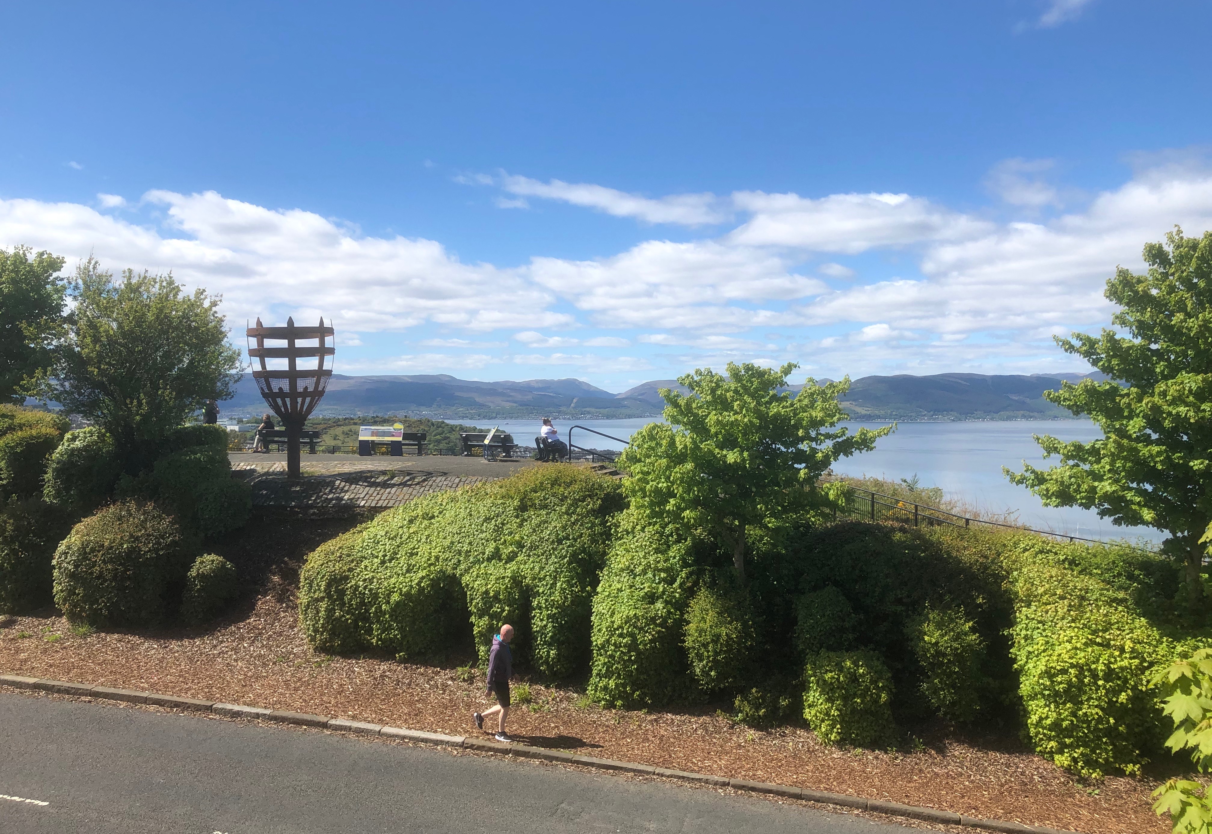
View across Lyle Road to the Lyle Hill scenic viewpoint and beacon
232:
217:
55° 57′ 19.86″ N, 4° 47′ 39.27″ W
207:
92:
542:
Creative
Commons Attribution-ShareAlike 4.0 International
82:(4,030 × 2,774 pixels, file size: 3.18 MB, MIME type:
136:
116:
Commons is a freely licensed media file repository.
1270:Flash did not fire, compulsory flash suppression
341:https://creativecommons.org/licenses/by-sa/4.0
97:
441:https://commons.wikimedia.org/user:Dave_souza
347:Creative Commons Attribution-Share Alike 4.0
271:
8:
142:Lyle Hill viewpoint with road and beacon.jpg
595:
307:– to copy, distribute and transmit the work
1025:
947:
369:
294:Attribution-Share Alike 4.0 International
222:
1405:
1397:
1389:
1381:
1373:
1365:
1357:
1349:
1341:
1331:
1323:
1315:
1307:
1297:
1289:
1281:
1273:
1263:
1253:
1243:
1235:
1227:
1217:
1196:
1188:
1177:
1169:
1161:
1151:
1143:
1135:
1126:
1121:
1113:
1105:
1097:
1086:
1078:
1067:
1057:
1047:
1037:
1007:
921:
905:
887:
871:
853:
837:
816:
800:
782:
766:
745:
729:
709:
693:
675:
659:
619:
603:
575:
559:
539:
523:
503:
487:
420:
404:
387:
384:
365:
358:
210:
239:View this and other nearby images on:
1027:
7:
1391:Reference for bearing of destination
995:Uploaded own work with UploadWizard
936:
282:
277:
1018:
378:
372:
268:
264:
146:
129:
75:
1054:1/2,404 sec (0.00041597337770383)
377:
1375:Reference for direction of image
1129:Lyle Hill road, viewopint beacon
1080:Date and time of data generation
606:coordinates of the point of view
363:
318:Under the following conditions:
289:This file is licensed under the
281:
276:
270:
245:
231:
223:
96:
21:
360:
147:
14:
359:
26:
1:
1320:A directly photographed image
621:55°57'19.861"N, 4°47'39.271"W
578:original creation by uploader
31:
1283:DateTimeDigitized subseconds
385:Items portrayed in this file
1275:DateTimeOriginal subseconds
1190:Date and time of digitizing
1427:
1343:Focal length in 35 mm film
1312:One-chip color area sensor
1291:Supported Flashpix version
1118:120 meters above sea level
332:same or compatible license
1198:Meaning of each component
1163:File change date and time
937:
189:
16:
362:
298:
103:This is a file from the
994:
747:0.00041597337770382695
195:
185:
178:
175:
139:
107:. Information from its
1399:Bearing of destination
251:55.955517; -4.794242
110:description page there
41:Size of this preview:
1367:Speed of GPS receiver
1137:Horizontal resolution
180:13 May 2020, 14:06:45
155:at the high point of
69:4,030 × 2,774 pixels
65:2,560 × 1,762 pixels
1362:Kilometers per hour
1145:Vertical resolution
1029:Camera manufacturer
639:219.39021164021165
313:– to adapt the work
163:. To the west over
47:Other resolutions:
1383:Direction of image
1351:Scene capture type
1338:Auto white balance
1193:14:06, 13 May 2020
1166:14:06, 13 May 2020
1083:14:06, 13 May 2020
973:15:47, 8 June 2020
712:iPhone 8 Plus
464:author name string
449:Wikimedia username
61:1,280 × 881 pixels
57:1,024 × 705 pixels
1414:
1413:
998:
597:
526:copyright license
371:
256:
255:
205:
204:
125:
124:
105:Wikimedia Commons
1418:
1370:0.13836246550138
1171:Exposure Program
1130:
1102:55° 57′ 19.86″ N
1026:
985:
821:
750:
643:
642:
637:
490:copyright status
471:
468:
458:
453:
443:
438:
354:
351:
348:
345:
342:
334:as the original.
291:Creative Commons
285:
284:
280:
279:
274:
273:
252:
249:
235:
234:
228:
227:
226:
220:
219:
208:
191:
181:
153:scenic viewpoint
151:
143:
137:
121:
100:
99:
93:
87:
85:
72:
53:640 × 441 pixels
49:320 × 220 pixels
43:800 × 551 pixels
1426:
1425:
1421:
1420:
1419:
1417:
1416:
1415:
1402:219.39021164021
1386:219.39021164021
1240:10.606653620352
1237:APEX brightness
1232:1.6959937156324
1224:11.231127679404
1128:
1110:4° 47′ 39.27″ W
1014:
1006:
999:
991:
983:
939:
938:
935:
934:
933:
932:
931:
930:
929:
928:
926:
914:
913:
912:
910:
899:
898:
897:
896:
895:
894:
893:
892:
890:
880:
879:
878:
876:
865:
864:
863:
862:
861:
860:
859:
858:
856:
846:
845:
844:
842:
831:
830:
829:
828:
827:
826:
825:
824:
822:
819:
809:
808:
807:
805:
794:
793:
792:
791:
790:
789:
788:
787:
785:
775:
774:
773:
771:
760:
759:
758:
757:
756:
755:
754:
753:
751:
748:
738:
737:
736:
734:
723:
722:
721:
720:
719:
718:
717:
716:
714:
702:
701:
700:
698:
687:
686:
685:
684:
683:
682:
681:
680:
678:
668:
667:
666:
664:
653:
652:
651:
650:
649:
648:
647:
646:
645:
644:
640:
638:
635:
626:
625:
624:
622:
612:
611:
610:
608:
589:
588:
587:
586:
585:
584:
583:
582:
580:
568:
567:
566:
564:
553:
552:
551:
550:
549:
548:
547:
546:
544:
532:
531:
530:
528:
517:
516:
515:
514:
513:
512:
511:
510:
508:
496:
495:
494:
492:
481:
480:
479:
478:
477:
476:
475:
474:
473:
472:
469:
466:
460:
459:
454:
451:
445:
444:
439:
436:
427:
426:
425:
423:
413:
412:
411:
409:
398:
397:
396:
395:
394:
392:
376:
375:
374:
357:
356:
355:
352:
349:
346:
343:
340:
339:
297:
286:
267:
266:
261:
250:
224:
215:
214:
211:Camera location
206:
171:
141:
134:
127:
126:
115:
114:
113:is shown below.
89:
83:
81:
74:
73:
46:
12:
11:
5:
1424:
1422:
1412:
1411:
1408:
1404:
1403:
1400:
1396:
1395:
1394:True direction
1392:
1388:
1387:
1384:
1380:
1379:
1378:True direction
1376:
1372:
1371:
1368:
1364:
1363:
1360:
1356:
1355:
1352:
1348:
1347:
1344:
1340:
1339:
1336:
1330:
1329:
1326:
1322:
1321:
1318:
1314:
1313:
1310:
1309:Sensing method
1306:
1305:
1302:
1296:
1295:
1292:
1288:
1287:
1284:
1280:
1279:
1276:
1272:
1271:
1268:
1262:
1261:
1258:
1252:
1251:
1248:
1242:
1241:
1238:
1234:
1233:
1230:
1226:
1225:
1222:
1216:
1215:
1214:
1213:
1212:does not exist
1210:
1207:
1204:
1199:
1195:
1194:
1191:
1187:
1186:
1183:
1176:
1175:
1174:Normal program
1172:
1168:
1167:
1164:
1160:
1159:
1154:
1150:
1149:
1146:
1142:
1141:
1138:
1134:
1133:
1132:
1131:
1124:
1120:
1119:
1116:
1112:
1111:
1108:
1104:
1103:
1100:
1096:
1095:
1092:
1085:
1084:
1081:
1077:
1076:
1073:
1066:
1065:
1062:
1056:
1055:
1052:
1046:
1045:
1040:
1036:
1035:
1030:
1017:
1013:
1012:
1004:
1003:
1002:
997:
996:
993:
989:
986:
982:4,030 × 2,774
980:
975:
970:
966:
965:
962:
959:
956:
953:
950:
943:
942:
927:
922:
920:
919:
918:
917:
916:
915:
911:
906:
904:
903:
902:
901:
900:
891:
888:
886:
885:
884:
883:
882:
881:
877:
872:
870:
869:
868:
867:
866:
857:
854:
852:
851:
850:
849:
848:
847:
843:
838:
836:
835:
834:
833:
832:
823:
817:
815:
814:
813:
812:
811:
810:
806:
801:
799:
798:
797:
796:
795:
786:
783:
781:
780:
779:
778:
777:
776:
772:
767:
765:
764:
763:
762:
761:
752:
746:
744:
743:
742:
741:
740:
739:
735:
730:
728:
727:
726:
725:
724:
715:
710:
708:
707:
706:
705:
704:
703:
699:
694:
692:
691:
690:
689:
688:
679:
676:
674:
673:
672:
671:
670:
669:
665:
660:
658:
657:
656:
655:
654:
631:
630:
629:
628:
627:
623:
620:
618:
617:
616:
615:
614:
613:
609:
604:
602:
601:
600:
599:
593:
581:
576:
574:
573:
572:
571:
570:
569:
565:
562:source of file
560:
558:
557:
556:
555:
554:
545:
540:
538:
537:
536:
535:
534:
533:
529:
524:
522:
521:
520:
519:
518:
509:
504:
502:
501:
500:
499:
498:
497:
493:
488:
486:
485:
484:
483:
482:
462:
461:
447:
446:
432:
431:
430:
429:
428:
424:
421:
419:
418:
417:
416:
415:
414:
410:
405:
403:
402:
401:
400:
399:
393:
388:
386:
383:
382:
381:
380:
379:
368:
367:
364:
361:
338:
337:
336:
335:
325:
316:
315:
314:
308:
301:You are free:
288:
287:
269:
263:
262:
260:
257:
254:
253:
243:
237:
212:
203:
202:
197:
193:
192:
187:
183:
182:
177:
173:
172:
169:Firth of Clyde
144:
135:
133:
130:
128:
123:
122:
101:
91:
90:
40:
36:
35:
34:
29:
24:
19:
13:
10:
9:
6:
4:
3:
2:
1423:
1409:
1406:
1401:
1398:
1393:
1390:
1385:
1382:
1377:
1374:
1369:
1366:
1361:
1358:
1353:
1350:
1345:
1342:
1337:
1335:
1334:White balance
1332:
1328:Auto exposure
1327:
1325:Exposure mode
1324:
1319:
1316:
1311:
1308:
1303:
1301:
1298:
1293:
1290:
1285:
1282:
1277:
1274:
1269:
1267:
1264:
1259:
1257:
1256:Metering mode
1254:
1249:
1247:
1246:Exposure bias
1244:
1239:
1236:
1231:
1229:APEX aperture
1228:
1223:
1221:
1220:Shutter speed
1218:
1211:
1208:
1205:
1202:
1201:
1200:
1197:
1192:
1189:
1184:
1181:
1178:
1173:
1170:
1165:
1162:
1158:
1155:
1153:Software used
1152:
1147:
1144:
1139:
1136:
1127:
1125:
1122:
1117:
1114:
1109:
1106:
1101:
1098:
1093:
1091:
1087:
1082:
1079:
1074:
1071:
1068:
1063:
1061:
1058:
1053:
1051:
1050:Exposure time
1048:
1044:
1043:iPhone 8 Plus
1041:
1038:
1034:
1031:
1028:
1024:
1021:
1015:
1011:
1008:
1000:
992:
987:
981:
979:
976:
974:
971:
968:
967:
963:
960:
957:
954:
951:
949:
948:
946:
940:
925:
909:
875:
841:
804:
770:
733:
732:exposure time
713:
697:
696:captured with
663:
634:
607:
579:
563:
543:
527:
507:
491:
465:
457:
450:
442:
435:
408:
391:
344:CC BY-SA 4.0
333:
329:
326:
323:
320:
319:
317:
312:
309:
306:
303:
302:
300:
299:
295:
292:
275:
258:
248:
244:
242:
241:OpenStreetMap
238:
236:
218:
213:
209:
201:
198:
194:
188:
184:
174:
170:
166:
162:
158:
154:
150:
145:
138:
131:
119:
112:
111:
106:
102:
95:
94:
88:
79:
78:Original file
70:
66:
62:
58:
54:
50:
44:
39:
33:
30:
28:
25:
23:
20:
18:
15:
1090:focal length
1039:Camera model
1022:
1019:
944:
941:File history
803:focal length
327:
321:
310:
304:
221:
148:
118:You can help
108:
76:
22:File history
1407:IIM version
1300:Color space
1123:Short title
908:instance of
677:13 May 2020
506:copyrighted
328:share alike
322:attribution
140:Description
1359:Speed unit
1317:Scene type
1157:Photos 3.0
1001:File usage
990:Dave souza
958:Dimensions
924:photograph
889:image/jpeg
874:media type
820:millimetre
470:dave souza
456:Dave souza
422:some value
200:dave souza
84:image/jpeg
27:File usage
1107:Longitude
1070:ISO speed
1010:Lyle Hill
984:(3.18 MB)
955:Thumbnail
952:Date/Time
840:ISO speed
662:inception
259:Licensing
157:Lyle Hill
149:English:
1354:Standard
1115:Altitude
1099:Latitude
1060:F-number
1016:Metadata
769:f-number
366:Captions
311:to remix
305:to share
296:license.
190:Own work
167:and the
161:Greenock
32:Metadata
1260:Pattern
1182:version
1094:3.99 mm
969:current
964:Comment
633:heading
592:heading
407:creator
390:depicts
370:English
165:Gourock
132:Summary
80:
1148:72 dpi
1140:72 dpi
1072:rating
749:second
641:degree
596:degree
229:
196:Author
186:Source
1346:28 mm
1266:Flash
1088:Lens
1064:f/1.8
1033:Apple
818:3.99
1304:sRGB
1185:2.31
1180:Exif
961:User
353:true
350:true
176:Date
17:File
1286:543
1278:543
784:1.8
434:URL
159:in
1209:Cr
1206:Cb
1075:20
855:20
636::
467::
452::
437::
67:|
63:|
59:|
55:|
51:|
45:.
1410:2
1294:1
1250:0
1203:Y
120:.
86:)
71:.
Text is available under the Creative Commons Attribution-ShareAlike License. Additional terms may apply.