343:
276:
226:
268:
218:
290:
240:
311:
349:
354:
67:
819:"}},"text\/plain":{"en":{"":"heading"}}},"{\"value\":{\"amount\":\"+247\",\"unit\":\"http:\\\/\\\/www.wikidata.org\\\/entity\\\/Q28390\"},\"type\":\"quantity\"}":{"text\/html":{"en":{"P7787":"247
755:"}},"text\/plain":{"en":{"":"heading"}}},"{\"value\":{\"amount\":\"+247\",\"unit\":\"http:\\\/\\\/www.wikidata.org\\\/entity\\\/Q28390\"},\"type\":\"quantity\"}":{"text\/html":{"en":{"P7787":"247
815:
259:
209:
401:– You must give appropriate credit, provide a link to the license, and indicate if changes were made. You may do so in any reasonable manner, but not in any way that suggests the licensor endorses you or your use.
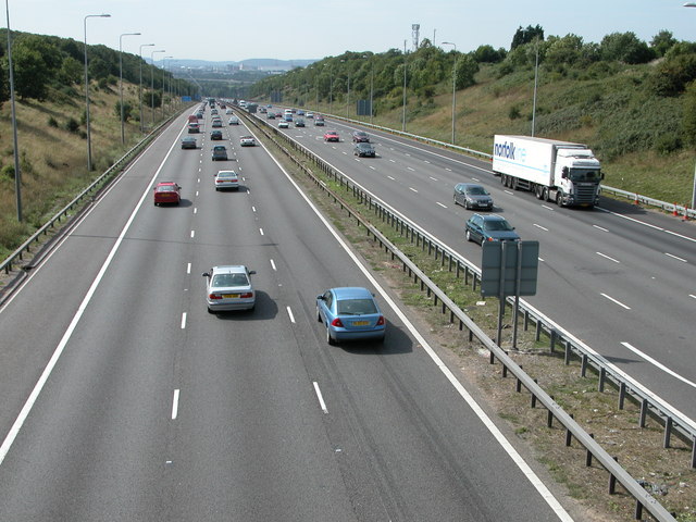
1150:== {{int:filedesc}} == {{Information |description={{en|1=M5. View of the M5 to the south towards Avonmouth, viewed from the bridge carrying the road to Norton Farm.}} |date=2006-09-09 |source=From
38:
816:
752:
78:
46:
687:
617:
581:
283:
233:
707:
1312:
318:
1175:
This file contains additional information, probably added from the digital camera or scanner used to create or digitize it.
1078:
408:
544:
1028:
994:
957:
923:
886:
857:
830:
793:
766:
715:
671:
565:
537:
524:
509:
730:
700:
637:
601:
482:
465:
1062:
305:
364:
1178:
If the file has been modified from its original state, some details may not fully reflect the modified file.
121:
M5. View of the M5 to the south towards
Avonmouth, viewed from the bridge carrying the road to Norton Farm.
1160:
The following pages on the
English Knowledge (XXG) use this file (pages on other projects are not listed):
1339:
407:– If you remix, transform, or build upon the material, you must distribute your contributions under the
325:
on the
Geograph website for the photographer's contact details. The copyright on this image is owned by
1143:
361:
823:"}},"text\/plain":{"en":{"P7787":"247 degree"}}}}": -->
759:"}},"text\/plain":{"en":{"P7787":"247 degree"}}}}": -->
1375:
1132:
1127:
37:
1164:
86:
178:
1448:
737:
722:
516:
162:
289:
239:
1411:
1357:
1204:
330:
73:
1458:
1421:
1244:
1385:
130:
1224:
273:
1281:
223:
151:
141:
1468:
1214:
310:
322:
1100:
Click on a date/time to view the file as it appeared at that time.
1197:
1187:
275:
225:
250:
200:
61:
260:
51° 31′ 15.7″ N, 2° 37′ 55″ W
210:
51° 31′ 17″ N, 2° 37′ 52″ W
449:
Add a one-line explanation of what this file represents
105:
85:
Commons is a freely licensed media file repository.
618:
Creative
Commons Attribution-ShareAlike 2.0 Generic
51:(640 × 480 pixels, file size: 121 KB, MIME type:
1380:Flash did not fire, compulsory flash suppression
418:https://creativecommons.org/licenses/by-sa/2.0
66:
424:Creative Commons Attribution-Share Alike 2.0
342:
8:
820:
756:
384:– to copy, distribute and transmit the work
1180:
1102:
445:
738:https://www.geograph.org.uk/photo/238980
517:https://www.geograph.org.uk/profile/1837
1476:
1466:
1456:
1446:
1438:
1430:
1419:
1409:
1401:
1393:
1383:
1373:
1365:
1355:
1347:
1337:
1329:
1321:
1310:
1302:
1294:
1286:
1276:
1268:
1260:
1252:
1241:
1233:
1222:
1212:
1202:
1192:
1162:
1076:
1060:
1042:
1026:
1008:
992:
971:
955:
937:
921:
900:
884:
844:
828:
780:
764:
685:
669:
651:
635:
615:
599:
579:
563:
496:
480:
463:
460:
441:
434:
253:
203:
282:View this and other nearby images on:
232:View this and other nearby images on:
1182:
7:
329:and is licensed for reuse under the
1091:
365:Attribution-Share Alike 2.0 Generic
353:
348:
333:Attribution-ShareAlike 2.0 license.
1173:
454:
448:
339:
316:
115:
98:
44:
1209:10/3,313 sec (0.0030184123151222)
453:
111:M5 - geograph.org.uk - 238980.jpg
47:M5_-_geograph.org.uk_-_238980.jpg
1235:Date and time of data generation
767:coordinates of the point of view
439:
395:Under the following conditions:
360:This file is licensed under the
352:
347:
341:
309:
288:
274:
266:
238:
224:
216:
65:
21:
436:
116:
41:No higher resolution available.
14:
688:file available on the internet
435:
317:This image was taken from the
26:
1:
831:coordinates of depicted place
31:
708:Geograph Britain and Ireland
538:object of statement has role
461:Items portrayed in this file
265:
215:
1323:Date and time of digitizing
846:51°31'15.74"N, 2°37'54.84"W
191:Philip Halling /
172:Philip Halling /
1498:
1432:Focal length in 35 mm film
409:same or compatible license
1288:File change date and time
1092:
782:51°31'17.0"N, 2°37'51.6"W
16:
716:geograph.org.uk image ID
438:
375:
72:This is a file from the
1395:Custom image processing
1326:13:13, 9 September 2006
1291:13:13, 9 September 2006
1238:13:13, 9 September 2006
1149:
902:0.00301841231512224569
163:required by the license
147:
136:
129:
126:
108:
76:. Information from its
1478:Subject distance range
1331:Image compression mode
1128:01:12, 1 February 2010
323:this photograph's page
294:51.521040; -2.631900
244:51.521400; -2.631000
79:description page there
1349:Maximum land aperture
1262:Horizontal resolution
1296:Y and C positioning
1270:Vertical resolution
1184:Camera manufacturer
390:– to adapt the work
1440:Scene capture type
1416:Auto white balance
1165:South West England
525:author name string
1485:
1484:
1153:
822:
758:
602:copyright license
447:
338:
337:
321:collection. See
299:
298:
249:
248:
198:
197:
166:
94:
93:
74:Wikimedia Commons
1489:
1304:Exposure Program
1181:
1140:
976:
905:
868:
867:
862:
804:
803:
798:
740:
735:
731:described at URL
725:
720:
710:
705:
653:9 September 2006
566:copyright status
547:
542:
532:
529:
519:
514:
431:
428:
425:
422:
419:
411:as the original.
373:
362:Creative Commons
356:
355:
351:
350:
345:
344:
331:Creative Commons
319:Geograph project
313:
306:
295:
292:
278:
277:
271:
270:
269:
263:
262:
251:
245:
242:
228:
227:
221:
220:
219:
213:
212:
201:
160:
132:
131:9 September 2006
120:
112:
106:
90:
69:
68:
62:
56:
54:
1497:
1496:
1492:
1491:
1490:
1488:
1487:
1486:
1352:3 APEX (f/2.83)
1169:
1161:
1154:
1146:
1138:
1094:
1093:
1090:
1089:
1088:
1087:
1086:
1085:
1084:
1083:
1081:
1069:
1068:
1067:
1065:
1054:
1053:
1052:
1051:
1050:
1049:
1048:
1047:
1045:
1035:
1034:
1033:
1031:
1020:
1019:
1018:
1017:
1016:
1015:
1014:
1013:
1011:
1001:
1000:
999:
997:
986:
985:
984:
983:
982:
981:
980:
979:
977:
974:
964:
963:
962:
960:
949:
948:
947:
946:
945:
944:
943:
942:
940:
930:
929:
928:
926:
915:
914:
913:
912:
911:
910:
909:
908:
906:
903:
893:
892:
891:
889:
878:
877:
876:
875:
874:
873:
872:
871:
870:
869:
865:
863:
860:
851:
850:
849:
847:
837:
836:
835:
833:
814:
813:
812:
811:
810:
809:
808:
807:
806:
805:
801:
799:
796:
787:
786:
785:
783:
773:
772:
771:
769:
750:
749:
748:
747:
746:
745:
744:
743:
742:
741:
736:
733:
727:
726:
721:
718:
712:
711:
706:
703:
694:
693:
692:
690:
678:
677:
676:
674:
663:
662:
661:
660:
659:
658:
657:
656:
654:
644:
643:
642:
640:
629:
628:
627:
626:
625:
624:
623:
622:
620:
608:
607:
606:
604:
593:
592:
591:
590:
589:
588:
587:
586:
584:
572:
571:
570:
568:
557:
556:
555:
554:
553:
552:
551:
550:
549:
548:
543:
540:
534:
533:
530:
527:
521:
520:
515:
512:
503:
502:
501:
499:
489:
488:
487:
485:
474:
473:
472:
471:
470:
468:
452:
451:
450:
433:
432:
429:
426:
423:
420:
417:
416:
374:
371:
368:
357:
334:
304:
293:
267:
258:
257:
254:Object location
243:
217:
208:
207:
204:Camera location
199:
188:
181:
169:
142:geograph.org.uk
122:
110:
103:
96:
95:
84:
83:
82:is shown below.
58:
52:
50:
43:
42:
12:
11:
5:
1495:
1493:
1483:
1482:
1479:
1475:
1474:
1471:
1465:
1464:
1461:
1455:
1454:
1451:
1445:
1444:
1441:
1437:
1436:
1433:
1429:
1428:
1425:
1418:
1417:
1414:
1408:
1407:
1404:
1400:
1399:
1398:Normal process
1396:
1392:
1391:
1388:
1382:
1381:
1378:
1372:
1371:
1368:
1364:
1363:
1360:
1354:
1353:
1350:
1346:
1345:
1342:
1336:
1335:
1332:
1328:
1327:
1324:
1320:
1319:
1316:
1309:
1308:
1307:Normal program
1305:
1301:
1300:
1297:
1293:
1292:
1289:
1285:
1284:
1279:
1275:
1274:
1271:
1267:
1266:
1263:
1259:
1258:
1255:
1251:
1250:
1247:
1240:
1239:
1236:
1232:
1231:
1228:
1221:
1220:
1217:
1211:
1210:
1207:
1201:
1200:
1195:
1191:
1190:
1185:
1172:
1168:
1167:
1159:
1158:
1157:
1152:
1151:
1148:
1144:
1141:
1135:
1130:
1125:
1121:
1120:
1117:
1114:
1111:
1108:
1105:
1098:
1097:
1082:
1077:
1075:
1074:
1073:
1072:
1071:
1070:
1066:
1061:
1059:
1058:
1057:
1056:
1055:
1046:
1043:
1041:
1040:
1039:
1038:
1037:
1036:
1032:
1027:
1025:
1024:
1023:
1022:
1021:
1012:
1009:
1007:
1006:
1005:
1004:
1003:
1002:
998:
993:
991:
990:
989:
988:
987:
978:
972:
970:
969:
968:
967:
966:
965:
961:
956:
954:
953:
952:
951:
950:
941:
938:
936:
935:
934:
933:
932:
931:
927:
922:
920:
919:
918:
917:
916:
907:
901:
899:
898:
897:
896:
895:
894:
890:
885:
883:
882:
881:
880:
879:
856:
855:
854:
853:
852:
848:
845:
843:
842:
841:
840:
839:
838:
834:
829:
827:
826:
825:
824:
818:
792:
791:
790:
789:
788:
784:
781:
779:
778:
777:
776:
775:
774:
770:
765:
763:
762:
761:
760:
754:
729:
728:
714:
713:
699:
698:
697:
696:
695:
691:
686:
684:
683:
682:
681:
680:
679:
675:
672:source of file
670:
668:
667:
666:
665:
664:
655:
652:
650:
649:
648:
647:
646:
645:
641:
636:
634:
633:
632:
631:
630:
621:
616:
614:
613:
612:
611:
610:
609:
605:
600:
598:
597:
596:
595:
594:
585:
580:
578:
577:
576:
575:
574:
573:
569:
564:
562:
561:
560:
559:
558:
536:
535:
531:Philip Halling
523:
522:
508:
507:
506:
505:
504:
500:
497:
495:
494:
493:
492:
491:
490:
486:
481:
479:
478:
477:
476:
475:
469:
464:
462:
459:
458:
457:
456:
455:
444:
443:
440:
437:
415:
414:
413:
412:
402:
393:
392:
391:
385:
378:You are free:
372:Philip Halling
369:
359:
358:
340:
336:
335:
327:Philip Halling
314:
303:
300:
297:
296:
286:
280:
255:
247:
246:
236:
230:
205:
196:
195:
189:
186:
183:
182:
177:
170:
167:
155:
154:
152:Philip Halling
149:
145:
144:
138:
134:
133:
128:
124:
123:
113:
104:
102:
99:
97:
92:
91:
70:
60:
59:
40:
36:
35:
34:
29:
24:
19:
13:
10:
9:
6:
4:
3:
2:
1494:
1480:
1477:
1472:
1470:
1467:
1462:
1460:
1457:
1452:
1450:
1447:
1442:
1439:
1434:
1431:
1426:
1423:
1420:
1415:
1413:
1412:White balance
1410:
1406:Auto exposure
1405:
1403:Exposure mode
1402:
1397:
1394:
1389:
1387:
1384:
1379:
1377:
1374:
1369:
1366:
1361:
1359:
1358:Metering mode
1356:
1351:
1348:
1343:
1341:
1340:Exposure bias
1338:
1333:
1330:
1325:
1322:
1317:
1314:
1311:
1306:
1303:
1298:
1295:
1290:
1287:
1283:
1280:
1278:Software used
1277:
1272:
1269:
1264:
1261:
1256:
1253:
1248:
1246:
1242:
1237:
1234:
1229:
1226:
1223:
1218:
1216:
1213:
1208:
1206:
1205:Exposure time
1203:
1199:
1196:
1193:
1189:
1186:
1183:
1179:
1176:
1170:
1166:
1163:
1155:
1147:
1142:
1136:
1134:
1131:
1129:
1126:
1123:
1122:
1118:
1115:
1112:
1109:
1106:
1104:
1103:
1101:
1095:
1080:
1064:
1030:
996:
959:
925:
888:
887:exposure time
859:
832:
795:
768:
739:
732:
724:
717:
709:
702:
689:
673:
639:
619:
603:
583:
567:
546:
539:
526:
518:
511:
484:
467:
421:CC BY-SA 2.0
410:
406:
403:
400:
397:
396:
394:
389:
386:
383:
380:
379:
377:
376:
370:Attribution:
366:
363:
346:
332:
328:
324:
320:
315:
312:
308:
307:
301:
291:
287:
285:
284:OpenStreetMap
281:
279:
261:
256:
252:
241:
237:
235:
234:OpenStreetMap
231:
229:
211:
206:
202:
194:
190:
185:
184:
180:
176: /
175:
171:
164:
159:
157:
156:
153:
150:
146:
143:
139:
135:
125:
119:
114:
107:
100:
88:
81:
80:
75:
71:
64:
63:
57:
48:
39:
33:
30:
28:
25:
23:
20:
18:
15:
1422:Digital zoom
1367:Light source
1245:focal length
1194:Camera model
1177:
1174:
1099:
1096:File history
958:focal length
545:photographer
404:
398:
387:
381:
326:
264:
214:
192:
179:CC BY-SA 2.0
173:
117:
87:You can help
77:
45:
22:File history
1386:Color space
1254:Orientation
1145:GeographBot
1063:instance of
582:copyrighted
405:share alike
399:attribution
158:Attribution
109:Description
1459:Saturation
1156:File usage
1137:640 × 480
1113:Dimensions
1079:photograph
1044:image/jpeg
1029:media type
975:millimetre
498:some value
53:image/jpeg
27:File usage
1469:Sharpness
1282:E5700v1.1
1225:ISO speed
1110:Thumbnail
1107:Date/Time
995:ISO speed
638:inception
302:Licensing
187:InfoField
168:InfoField
118:English:
1449:Contrast
1443:Standard
1299:Co-sited
1215:F-number
1171:Metadata
1139:(121 KB)
924:f-number
701:operator
442:Captions
388:to remix
382:to share
367:license.
32:Metadata
1481:Unknown
1370:Unknown
1362:Pattern
1315:version
1273:300 dpi
1265:300 dpi
1249:11.6 mm
1124:current
1119:Comment
858:heading
817:heading
794:heading
753:heading
483:creator
466:depicts
446:English
101:Summary
49:
1473:Normal
1463:Normal
1453:Normal
1257:Normal
1227:rating
904:second
866:degree
821:degree
802:degree
757:degree
723:238980
272:
222:
148:Author
137:Source
1435:46 mm
1424:ratio
1376:Flash
1243:Lens
1219:f/5.9
1198:E5700
1188:NIKON
973:11.6
140:From
1390:sRGB
1313:Exif
1116:User
864:247
800:247
430:true
427:true
127:Date
17:File
1318:2.2
1230:100
1010:100
939:5.9
510:URL
861::
797::
734::
719::
704::
541::
528::
513::
193:M5
174:M5
1427:0
1344:0
1334:3
165:)
161:(
89:.
55:)
Text is available under the Creative Commons Attribution-ShareAlike License. Additional terms may apply.
_heading:247.00&language=en)
_heading:247.00&language=en)
