263:
224:
216:
43:
238:
269:
274:
103:
500:"}},"text\/plain":{"en":{"":"heading"}}},"{\"value\":{\"amount\":\"+180\",\"unit\":\"http:\\\/\\\/www.wikidata.org\\\/entity\\\/Q28390\"},\"type\":\"quantity\"}":{"text\/html":{"en":{"P7787":"180
496:
689:{{Information |Description={{en|1=Mount Chōkai, Yuri-honjo city, Akita pref., Japan}} {{ja|1=鳥海山 秋田県由利本荘市から}} |Source=Qwert1234's file |Author=Qwert1234 |Date=2014-07-05 |Permission= |other_versions= }} {{location dec|39.1439...
315:– You must give appropriate credit, provide a link to the license, and indicate if changes were made. You may do so in any reasonable manner, but not in any way that suggests the licensor endorses you or your use.
771:
207:
708:
497:
781:
910:
791:
583:
449:
413:
231:
761:
933:
804:
This file contains additional information, probably added from the digital camera or scanner used to create or digitize it.
322:
69:
65:
61:
57:
53:
47:
603:
567:
538:
511:
397:
469:
433:
380:
114:
82:
284:
807:
If the file has been modified from its original state, some details may not fully reflect the modified file.
699:
The following pages on the
English Knowledge (XXG) use this file (pages on other projects are not listed):
999:
321:– If you remix, transform, or build upon the material, you must distribute your contributions under the
281:
682:
504:"}},"text\/plain":{"en":{"P7787":"180 degree"}}}}": -->
1027:
826:
122:
816:
736:
703:
671:
666:
237:
73:
42:
1111:
1017:
981:
833:
109:
256:
I, the copyright holder of this work, hereby publish it under the following license:
1121:
873:
221:
766:
1045:
174:
853:
843:
756:
639:
Click on a date/time to view the file as it appeared at that time.
223:
208:
39° 08′ 38.08″ N, 140° 04′ 22.4″ E
198:
97:
746:
726:
364:
Add a one-line explanation of what this file represents
87:(2,977 × 2,235 pixels, file size: 1.15 MB, MIME type:
450:
Creative
Commons Attribution-ShareAlike 3.0 Unported
141:
121:
Commons is a freely licensed media file repository.
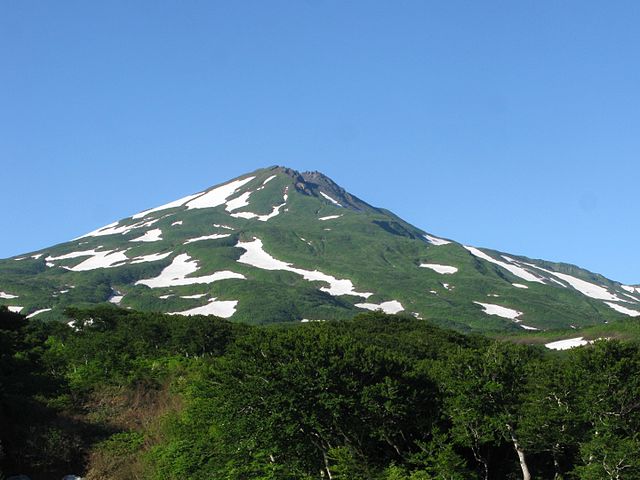
157:Mount Chōkai, Yuri-honjo city, Akita pref., Japan
1032:Flash did not fire, compulsory flash suppression
709:List of Japanese prefectures by highest mountain
332:https://creativecommons.org/licenses/by-sa/3.0
102:
338:Creative Commons Attribution-Share Alike 3.0
262:
8:
501:
298:– to copy, distribute and transmit the work
809:
641:
360:
719:The following other wikis use this file:
1130:
1119:
1109:
1101:
1093:
1085:
1077:
1069:
1061:
1053:
1043:
1035:
1025:
1015:
1007:
997:
989:
979:
971:
950:
942:
931:
923:
915:
905:
897:
889:
881:
870:
862:
851:
841:
831:
821:
701:
617:
601:
581:
565:
525:
509:
483:
467:
447:
431:
411:
395:
378:
375:
356:
349:
201:
230:View this and other nearby images on:
811:
7:
285:Attribution-Share Alike 3.0 Unported
911:Windows Photo Editor 6.3.9600.17418
630:
273:
268:
802:
369:
363:
259:
255:
159:
151:
134:
80:
737:Anexo:Montañas y colinas de Japón
368:
864:Date and time of data generation
512:coordinates of the point of view
354:
309:Under the following conditions:
280:This file is licensed under the
272:
267:
261:
236:
222:
214:
160:
101:
31:
21:
351:
152:
14:
350:
26:
1:
772:Portal:日本の都道府県/秋田県/新着画像/2016年
527:39°8'38.083"N, 140°4'22.400"E
36:
213:
1071:Focal plane resolution unit
944:Date and time of digitizing
743:Usage on fr.wikivoyage.org
723:Usage on en.wikivoyage.org
1152:
1082:One-chip color area sensor
1037:Supported Flashpix version
788:Usage on zh.wikipedia.org
778:Usage on th.wikipedia.org
753:Usage on ja.wikipedia.org
733:Usage on es.wikipedia.org
323:same or compatible license
952:Meaning of each component
917:File change date and time
631:
16:
1063:Focal plane Y resolution
1055:Focal plane X resolution
353:
289:
108:This is a file from the
1095:Custom image processing
688:
188:
180:
173:
170:
144:
112:. Information from its
973:Image compression mode
242:39.143912; 140.072889
115:description page there
46:Size of this preview:
1012:3.34375 APEX (f/3.19)
1009:Maximum land aperture
920:21:15, 9 January 2016
891:Horizontal resolution
667:13:06, 9 January 2016
1090:Digital still camera
74:2,977 × 2,235 pixels
70:2,560 × 1,922 pixels
925:Y and C positioning
899:Vertical resolution
838:1/160 sec (0.00625)
813:Camera manufacturer
304:– to adapt the work
52:Other resolutions:
1132:Scene capture type
1116:Auto white balance
947:06:23, 5 July 2014
867:06:23, 5 July 2014
827:Canon PowerShot G9
584:Canon PowerShot G9
66:1,280 × 961 pixels
62:1,023 × 768 pixels
1139:
1138:
715:Global file usage
692:
503:
434:copyright license
362:
247:
246:
196:
195:
130:
129:
110:Wikimedia Commons
32:Global file usage
1143:
1066:11,178.082191781
1058:11,216.494845361
810:
679:
549:
548:
543:
398:copyright status
345:
342:
339:
336:
333:
325:as the original.
282:Creative Commons
276:
275:
271:
270:
265:
264:
243:
240:
226:
225:
219:
218:
217:
211:
210:
199:
184:Qwert1234's file
176:
164:
156:
148:
147:Mount Chōkai.JPG
142:
126:
105:
104:
98:
92:
90:
77:
58:640 × 480 pixels
54:320 × 240 pixels
48:799 × 600 pixels
1151:
1150:
1146:
1145:
1144:
1142:
1141:
1140:
798:
713:
700:
693:
685:
677:
633:
632:
629:
628:
627:
626:
625:
624:
623:
622:
620:
610:
609:
608:
606:
595:
594:
593:
592:
591:
590:
589:
588:
586:
574:
573:
572:
570:
559:
558:
557:
556:
555:
554:
553:
552:
551:
550:
546:
544:
541:
532:
531:
530:
528:
518:
517:
516:
514:
495:
494:
493:
492:
491:
490:
489:
488:
486:
476:
475:
474:
472:
461:
460:
459:
458:
457:
456:
455:
454:
452:
440:
439:
438:
436:
425:
424:
423:
422:
421:
420:
419:
418:
416:
404:
403:
402:
400:
389:
388:
387:
386:
385:
383:
367:
366:
365:
348:
347:
346:
343:
340:
337:
334:
331:
330:
288:
277:
258:
257:
252:
241:
215:
206:
205:
202:Camera location
197:
166:
158:
146:
139:
132:
131:
120:
119:
118:is shown below.
94:
88:
86:
79:
78:
51:
12:
11:
5:
1149:
1147:
1137:
1136:
1133:
1129:
1128:
1125:
1118:
1117:
1114:
1108:
1107:
1104:
1100:
1099:
1098:Normal process
1096:
1092:
1091:
1088:
1084:
1083:
1080:
1079:Sensing method
1076:
1075:
1072:
1068:
1067:
1064:
1060:
1059:
1056:
1052:
1051:
1048:
1042:
1041:
1038:
1034:
1033:
1030:
1024:
1023:
1020:
1014:
1013:
1010:
1006:
1005:
1002:
996:
995:
992:
988:
987:
984:
978:
977:
974:
970:
969:
968:
967:
966:does not exist
964:
961:
958:
953:
949:
948:
945:
941:
940:
937:
930:
929:
926:
922:
921:
918:
914:
913:
908:
904:
903:
900:
896:
895:
892:
888:
887:
884:
880:
879:
876:
869:
868:
865:
861:
860:
857:
850:
849:
846:
840:
839:
836:
830:
829:
824:
820:
819:
814:
801:
797:
796:
795:
794:
786:
785:
784:
776:
775:
774:
769:
764:
759:
751:
750:
749:
741:
740:
739:
731:
730:
729:
717:
716:
712:
711:
706:
704:Dewa Mountains
698:
697:
696:
691:
690:
687:
683:
680:
676:2,977 × 2,235
674:
669:
664:
660:
659:
656:
653:
650:
647:
644:
637:
636:
621:
618:
616:
615:
614:
613:
612:
611:
607:
602:
600:
599:
598:
597:
596:
587:
582:
580:
579:
578:
577:
576:
575:
571:
566:
564:
563:
562:
561:
560:
537:
536:
535:
534:
533:
529:
526:
524:
523:
522:
521:
520:
519:
515:
510:
508:
507:
506:
505:
499:
487:
484:
482:
481:
480:
479:
478:
477:
473:
468:
466:
465:
464:
463:
462:
453:
448:
446:
445:
444:
443:
442:
441:
437:
432:
430:
429:
428:
427:
426:
417:
412:
410:
409:
408:
407:
406:
405:
401:
396:
394:
393:
392:
391:
390:
384:
379:
377:
374:
373:
372:
371:
370:
359:
358:
355:
352:
329:
328:
327:
326:
316:
307:
306:
305:
299:
292:You are free:
279:
278:
260:
254:
253:
251:
248:
245:
244:
234:
228:
203:
194:
193:
190:
186:
185:
182:
178:
177:
172:
168:
167:
165:鳥海山 秋田県由利本荘市から
149:
140:
138:
135:
133:
128:
127:
106:
96:
95:
45:
41:
40:
39:
34:
29:
24:
19:
13:
10:
9:
6:
4:
3:
2:
1148:
1134:
1131:
1126:
1123:
1120:
1115:
1113:
1112:White balance
1110:
1106:Auto exposure
1105:
1103:Exposure mode
1102:
1097:
1094:
1089:
1086:
1081:
1078:
1073:
1070:
1065:
1062:
1057:
1054:
1049:
1047:
1044:
1039:
1036:
1031:
1029:
1026:
1021:
1019:
1018:Metering mode
1016:
1011:
1008:
1003:
1001:
1000:Exposure bias
998:
993:
991:APEX aperture
990:
985:
983:
982:Shutter speed
980:
975:
972:
965:
962:
959:
956:
955:
954:
951:
946:
943:
938:
935:
932:
927:
924:
919:
916:
912:
909:
907:Software used
906:
901:
898:
893:
890:
885:
882:
877:
875:
871:
866:
863:
858:
855:
852:
847:
845:
842:
837:
835:
834:Exposure time
832:
828:
825:
822:
818:
815:
812:
808:
805:
799:
793:
790:
789:
787:
783:
780:
779:
777:
773:
770:
768:
765:
763:
760:
758:
755:
754:
752:
748:
745:
744:
742:
738:
735:
734:
732:
728:
725:
724:
722:
721:
720:
714:
710:
707:
705:
702:
694:
686:
681:
675:
673:
670:
668:
665:
662:
661:
657:
654:
651:
648:
645:
643:
642:
640:
634:
605:
585:
569:
568:captured with
540:
513:
471:
451:
435:
415:
399:
382:
335:CC BY-SA 3.0
324:
320:
317:
314:
311:
310:
308:
303:
300:
297:
294:
293:
291:
290:
286:
283:
266:
249:
239:
235:
233:
232:OpenStreetMap
229:
227:
209:
204:
200:
191:
187:
183:
179:
169:
163:
155:
150:
143:
136:
124:
117:
116:
111:
107:
100:
99:
93:
84:
83:Original file
75:
71:
67:
63:
59:
55:
49:
44:
38:
35:
33:
30:
28:
25:
23:
20:
18:
15:
1122:Digital zoom
874:focal length
823:Camera model
806:
803:
782:เทือกเขาเดวะ
718:
638:
635:File history
318:
312:
301:
295:
212:
161:
153:
123:You can help
113:
81:
22:File history
1087:File source
1046:Color space
883:Orientation
485:5 July 2014
414:copyrighted
319:share alike
313:attribution
175:5 July 2014
145:Description
792:日本各都道府縣最高峰
695:File usage
652:Dimensions
619:image/jpeg
604:media type
89:image/jpeg
27:File usage
878:14.783 mm
854:ISO speed
762:各都道府県の最高峰
747:Yurihonjō
727:Yurihonjo
684:Qwert1234
678:(1.15 MB)
649:Thumbnail
646:Date/Time
470:inception
376:此文件中描述的项目
250:Licensing
192:Qwert1234
154:English:
1135:Standard
928:Centered
844:F-number
800:Metadata
357:Captions
302:to remix
296:to share
287:license.
37:Metadata
1022:Pattern
936:version
902:180 dpi
894:180 dpi
663:current
658:Comment
539:heading
498:heading
381:depicts
361:English
137:Summary
85:
1074:inches
986:7.3125
886:Normal
856:rating
547:degree
502:degree
220:
189:Author
181:Source
1124:ratio
1028:Flash
872:Lens
817:Canon
1050:sRGB
934:Exif
767:出羽山地
655:User
545:180
344:true
341:true
171:Date
162:日本語:
17:File
939:2.2
848:f/8
757:鳥海山
963:Cr
960:Cb
859:80
542::
72:|
68:|
64:|
60:|
56:|
50:.
1127:1
1040:1
1004:0
994:6
976:5
957:Y
125:.
91:)
76:.
Text is available under the Creative Commons Attribution-ShareAlike License. Additional terms may apply.
