38:
353:
245:
198:
359:
251:
364:
710:
90:
256:
64:
60:
56:
52:
48:
42:
101:
73:
414:– You must give appropriate credit, provide a link to the license, and indicate if changes were made. You may do so in any reasonable manner, but not in any way that suggests the licensor endorses you or your use.
304:– You must give appropriate credit, provide a link to the license, and indicate if changes were made. You may do so in any reasonable manner, but not in any way that suggests the licensor endorses you or your use.
885:
709:
704:
37:
875:
775:
215:
795:
845:
213:; with no Invariant Sections, no Front-Cover Texts, and no Back-Cover Texts. A copy of the license is included in the section entitled
205:
915:
621:
604:
587:
570:
553:
517:
421:
311:
138:
501:
210:
732:
641:
537:
484:
720:
383:
379:
375:
265:
146:
168:
785:
757:
753:
The following pages on the
English Knowledge (XXG) use this file (pages on other projects are not listed):
740:
420:– If you remix, transform, or build upon the material, you must distribute your contributions under the
310:– If you remix, transform, or build upon the material, you must distribute your contributions under the
371:
262:
149:
in red. It was created with a custom script with US Census Bureau data and modified with
Inkscape.
109:
192:
325:
203:
Permission is granted to copy, distribute and/or modify this document under the terms of the
129:
Montgomery County
Maryland Incorporated and Unincorporated areas Laytonsville Highlighted.svg
134:
189:
I, the copyright holder of this work, hereby publish it under the following licenses:
96:
728:
178:
167:
My own work, based on public domain information. Based on similar map concepts by
157:
905:
142:
736:
835:
825:
865:
815:
677:
Click on a date/time to view the file as it appeared at that time.
324:
This licensing tag was added to this file as part of the GFDL
239:
84:
855:
805:
78:(SVG file, nominally 700 × 500 pixels, file size: 143 KB)
468:
Add a one-line explanation of what this file represents
895:
622:
588:
Creative
Commons Attribution-ShareAlike 3.0 Unported
209:, Version 1.2 or any later version published by the
123:
108:
Commons is a freely licensed media file repository.
605:
Creative
Commons Attribution-ShareAlike 1.0 Generic
571:
Creative
Commons Attribution-ShareAlike 2.0 Generic
554:
Creative
Commons Attribution-ShareAlike 2.5 Generic
727:{{Information |Description=This map shows the
431:https://creativecommons.org/licenses/by-sa/2.5
331:http://creativecommons.org/licenses/by-sa/3.0/
89:
437:Creative Commons Attribution-Share Alike 2.5
352:
244:
8:
337:Creative Commons Attribution-Share Alike 3.0
397:– to copy, distribute and transmit the work
287:– to copy, distribute and transmit the work
41:Size of this PNG preview of this SVG file:
679:
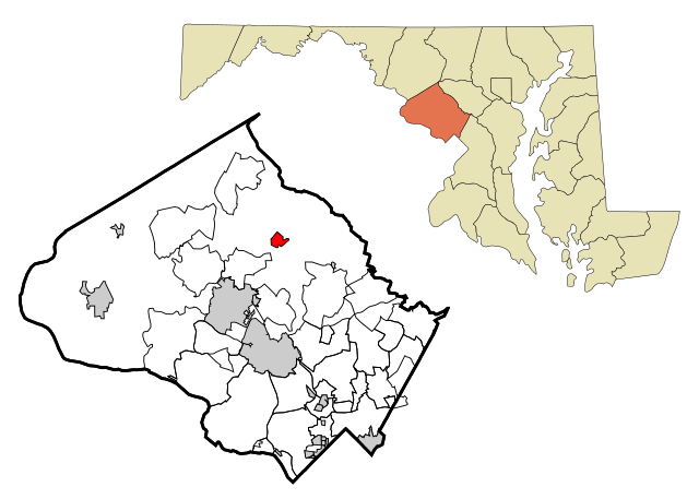
464:
449:You may select the license of your choice.
768:The following other wikis use this file:
755:
655:
639:
619:
602:
585:
568:
551:
535:
515:
499:
482:
479:
460:
453:
7:
266:Attribution-Share Alike 3.0 Unported
221:http://www.gnu.org/copyleft/fdl.html
668:
363:
358:
255:
250:
902:Usage on zh-min-nan.wikipedia.org
473:
467:
448:
349:
188:
121:
71:
472:
458:
408:Under the following conditions:
370:This file is licensed under the
362:
357:
351:
298:Under the following conditions:
261:This file is licensed under the
254:
249:
243:
197:
196:
88:
31:
21:
455:
14:
454:
227:GNU Free Documentation License
216:GNU Free Documentation License
206:GNU Free Documentation License
26:
1:
731:and unincorporated areas in
480:Items portrayed in this file
137:and unincorporated areas in
792:Usage on azb.wikipedia.org
782:Usage on arz.wikipedia.org
934:
912:Usage on zh.wikipedia.org
892:Usage on www.wikidata.org
882:Usage on tt.wikipedia.org
872:Usage on sr.wikipedia.org
862:Usage on sh.wikipedia.org
852:Usage on fr.wikipedia.org
842:Usage on fa.wikipedia.org
832:Usage on eu.wikipedia.org
822:Usage on es.wikipedia.org
812:Usage on cy.wikipedia.org
802:Usage on ca.wikipedia.org
772:Usage on ar.wikipedia.org
422:same or compatible license
312:same or compatible license
669:
270:
242:
16:
457:
388:
374:Attribution-Share Alike
211:Free Software Foundation
95:This is a file from the
906:Laytonsville (Maryland)
836:Laytonsville (Maryland)
826:Laytonsville (Maryland)
726:
174:
163:
156:
153:
126:
99:. Information from its
886:Лейтонсвилл (Мэриленд)
866:Laytonsville, Maryland
816:Laytonsville, Maryland
758:Laytonsville, Maryland
705:16:19, 16 October 2007
102:description page there
876:Лејтонсвил (Мериленд)
776:لايتونسفيل (ماريلاند)
65:2,560 × 1,829 pixels
722:ArkyBot~commonswiki
403:– to adapt the work
293:– to adapt the work
133:This map shows the
47:Other resolutions:
846:لایتونسویل، مریلند
796:لایتونزویل، مریلند
61:1,280 × 914 pixels
57:1,024 × 731 pixels
764:Global file usage
746:
733:Montgomery County
538:copyright license
466:
348:
347:
238:
237:
184:
183:
139:Montgomery County
117:
116:
97:Wikimedia Commons
32:Global file usage
925:
717:
502:copyright status
444:
441:
438:
435:
432:
424:as the original.
372:Creative Commons
366:
365:
361:
360:
355:
354:
344:
341:
338:
335:
332:
329:
326:licensing update
314:as the original.
263:Creative Commons
258:
257:
253:
252:
247:
246:
240:
234:
231:
228:
225:
222:
200:
199:
193:
169:Ixnayonthetimmay
159:
130:
124:
113:
92:
91:
85:
79:
68:
53:640 × 457 pixels
49:320 × 229 pixels
43:700 × 500 pixels
933:
932:
928:
927:
926:
924:
923:
922:
762:
754:
747:
739:, highlighting
723:
715:
671:
670:
667:
666:
665:
664:
663:
662:
661:
660:
658:
657:16 October 2007
648:
647:
646:
644:
633:
632:
631:
630:
629:
628:
627:
626:
624:
613:
612:
611:
610:
609:
607:
596:
595:
594:
593:
592:
590:
579:
578:
577:
576:
575:
573:
562:
561:
560:
559:
558:
556:
544:
543:
542:
540:
529:
528:
527:
526:
525:
524:
523:
522:
520:
508:
507:
506:
504:
493:
492:
491:
490:
489:
487:
471:
470:
469:
452:
451:
450:
446:
445:
442:
439:
436:
433:
430:
429:
387:
367:
342:
339:
336:
333:
330:
323:
232:
229:
226:
223:
220:
191:
190:
185:
158:16 October 2007
145:, highlighting
128:
119:
118:
107:
106:
105:is shown below.
81:
77:
70:
69:
46:
12:
11:
5:
931:
929:
921:
920:
919:
918:
910:
909:
908:
900:
899:
898:
890:
889:
888:
880:
879:
878:
870:
869:
868:
860:
859:
858:
850:
849:
848:
840:
839:
838:
830:
829:
828:
820:
819:
818:
810:
809:
808:
800:
799:
798:
790:
789:
788:
780:
779:
778:
766:
765:
761:
760:
752:
751:
750:
745:
744:
725:
721:
718:
712:
707:
702:
698:
697:
694:
691:
688:
685:
682:
675:
674:
659:
656:
654:
653:
652:
651:
650:
649:
645:
640:
638:
637:
636:
635:
634:
625:
620:
618:
617:
616:
615:
614:
608:
603:
601:
600:
599:
598:
597:
591:
586:
584:
583:
582:
581:
580:
574:
569:
567:
566:
565:
564:
563:
557:
552:
550:
549:
548:
547:
546:
545:
541:
536:
534:
533:
532:
531:
530:
521:
516:
514:
513:
512:
511:
510:
509:
505:
500:
498:
497:
496:
495:
494:
488:
483:
481:
478:
477:
476:
475:
474:
463:
462:
459:
456:
447:
428:
427:
426:
425:
415:
406:
405:
404:
398:
391:You are free:
369:
368:
350:
346:
345:
320:
319:
318:
317:
316:
315:
305:
296:
295:
294:
288:
281:You are free:
276:
275:
272:
271:
269:
259:
236:
235:
201:
187:
186:
182:
181:
176:
172:
171:
165:
161:
160:
155:
151:
150:
131:
122:
120:
115:
114:
93:
83:
82:
40:
36:
35:
34:
29:
24:
19:
13:
10:
9:
6:
4:
3:
2:
930:
917:
914:
913:
911:
907:
904:
903:
901:
897:
894:
893:
891:
887:
884:
883:
881:
877:
874:
873:
871:
867:
864:
863:
861:
857:
854:
853:
851:
847:
844:
843:
841:
837:
834:
833:
831:
827:
824:
823:
821:
817:
814:
813:
811:
807:
804:
803:
801:
797:
794:
793:
791:
787:
784:
783:
781:
777:
774:
773:
771:
770:
769:
763:
759:
756:
748:
742:
738:
734:
730:
724:
719:
713:
711:
708:
706:
703:
700:
699:
695:
692:
689:
686:
683:
681:
680:
678:
672:
643:
623:
606:
589:
572:
555:
539:
519:
503:
486:
434:CC BY-SA 2.5
423:
419:
416:
413:
410:
409:
407:
402:
399:
396:
393:
392:
390:
389:
385:
381:
377:
373:
356:
327:
322:
321:
313:
309:
306:
303:
300:
299:
297:
292:
289:
286:
283:
282:
280:
279:
278:
277:
274:
273:
267:
264:
260:
248:
241:
218:
217:
212:
208:
207:
202:
195:
194:
180:
177:
173:
170:
166:
162:
152:
148:
144:
140:
136:
132:
125:
111:
104:
103:
98:
94:
87:
86:
80:
75:
74:Original file
66:
62:
58:
54:
50:
44:
39:
33:
30:
28:
25:
23:
20:
18:
15:
916:萊頓斯維爾 (馬里蘭州)
856:Laytonsville
806:Laytonsville
767:
741:Laytonsville
729:incorporated
676:
673:File history
417:
411:
400:
394:
334:CC BY-SA 3.0
307:
301:
290:
284:
214:
204:
147:Laytonsville
135:incorporated
110:You can help
100:
72:
22:File history
518:copyrighted
418:share alike
412:attribution
384:1.0 Generic
380:2.0 Generic
376:2.5 Generic
308:share alike
302:attribution
127:Description
786:لايتونسفيل
749:File usage
714:700 × 500
690:Dimensions
27:File usage
687:Thumbnail
684:Date/Time
642:inception
268:license.
737:Maryland
716:(143 KB)
461:Captions
401:to remix
395:to share
386:license.
291:to remix
285:to share
143:Maryland
896:Q753798
701:current
696:Comment
485:depicts
465:English
76:
179:Arkyan
175:Author
164:Source
743:in re
693:User
443:true
440:true
382:and
343:true
340:true
233:true
230:true
224:GFDL
154:Date
17:File
735:,
378:,
141:,
63:|
59:|
55:|
51:|
45:.
328:.
219:.
112:.
67:.
Text is available under the Creative Commons Attribution-ShareAlike License. Additional terms may apply.
