386:
315:
347:
43:
477:
361:
392:
397:
95:
1091:
1061:
1031:
1001:
971:
941:
438:– You must give appropriate credit, provide a link to the license, and indicate if changes were made. You may do so in any reasonable manner, but not in any way that suggests the licensor endorses you or your use.
338:
1636:
1127:
1948:
1669:
1829:
1844:
494:
1694:
1709:
61:
57:
53:
47:
106:
1108:== {{int:filedesc}} == {{Location|31|46|30|N|7|04|30|W|scale:5000000}} <br/> {{Information |Description={{en|Blank physical map of
74:
492:; with no Invariant Sections, no Front-Cover Texts, and no Back-Cover Texts. A copy of the license is included in the section entitled
272:
484:
1674:
2012:
1939:
748:
712:
695:
659:
354:
1784:
1704:
1959:
This file contains additional information, probably added from the digital camera or scanner used to create or digitize it.
1149:
445:
1090:
1085:
1060:
1055:
1030:
1025:
1000:
995:
970:
965:
622:
294:) as the author and distribute the copies and derivative works under the same license(s) that the one(s) stated below. A
878:
863:
836:
802:
768:
732:
643:
615:
489:
1689:
1684:
1679:
679:
588:
571:
1664:
1139:
1544:
1879:
1874:
1699:
1164:
314:
295:
407:
1962:
If the file has been modified from its original state, some details may not fully reflect the modified file.
1404:
870:
1126:
More than 100 pages use this file. The following list shows the first 100 pages that use this file only. A
1884:
1134:
1919:
1724:
1609:
1584:
1534:
1459:
1449:
1324:
1309:
444:– If you remix, transform, or build upon the material, you must distribute your contributions under the
1739:
1779:
1354:
1319:
404:
1719:
1809:
1304:
1794:
1759:
940:
935:
114:
65:
42:
1859:
1559:
471:
1849:
482:
Permission is granted to copy, distribute and/or modify this document under the terms of the
1399:
1199:
885:
260:
1619:
1018:
Putting back the southern dotted boundary (regarding
Western Sahara's location map)
1899:
1854:
1839:
1364:
1204:
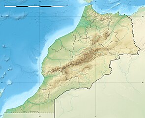
360:
1574:
1499:
1484:
1454:
1394:
1369:
1184:
379:
I, the copyright holder of this work, hereby publish it under the following licenses:
101:
1464:
1349:
1344:
1174:
1754:
1749:
1975:
1934:
1929:
1924:
1904:
2027:
1494:
1339:
1279:
1244:
1219:
1169:
1614:
1529:
1444:
1269:
1239:
1234:
1224:
1214:
1159:
1101:
1071:
1041:
1011:
981:
951:
1864:
1774:
1764:
1734:
1569:
1524:
1474:
1424:
1414:
1389:
1379:
1274:
1259:
1229:
1914:
1869:
1819:
1509:
1209:
344:
1419:
150:
1384:
1334:
1329:
1294:
256:
1799:
1629:
1604:
1594:
1564:
1554:
1549:
1539:
1504:
1409:
1374:
1299:
1249:
1109:
1744:
1654:
290:
Any use of this map can be made as long as you credit me (Eric Gaba –
1599:
1589:
1519:
1514:
1439:
1434:
1429:
1359:
1314:
1289:
1284:
1264:
1254:
1189:
1179:
1144:
1113:
908:
Click on a date/time to view the file as it appeared at that time.
162:
1489:
1479:
1469:
1194:
1769:
1624:
1579:
1154:
346:
1909:
1889:
329:
89:
1112:, for geo-location purposes.}} {{fr|Carte physique vierge du
291:
1804:
339:
31° 46′ 30″ N, 7° 04′ 30″ W
795:
298:
with a reply address would also be greatly appreciated.
713:
Creative
Commons Attribution-ShareAlike 3.0 Unported
696:
488:, Version 1.2 or any later version published by the
133:
113:
Commons is a freely licensed media file repository.
79:(1,223 × 995 pixels, file size: 265 KB, MIME type:
1725:Módulu:Mapa de llocalización/datos/Marruecos/usu
547:Carte administrative du Royaume du nord du Maroc
1976:http://creativecommons.org/licenses/by-sa/3.0/
455:https://creativecommons.org/licenses/by-sa/3.0
94:
461:Creative Commons Attribution-Share Alike 3.0
385:
8:
2064:xmp.did:8fe4fd5b-10d9-8140-8db7-d94401a90cb6
1720:Módulu:Mapa de llocalización/datos/Marruecos
421:– to copy, distribute and transmit the work
1964:
910:
551:
543:
535:
520:You may select the license of your choice.
279:
1647:The following other wikis use this file:
235:NGDC World Data Bank II (public domain);
2067:
2059:
2051:
2043:
2035:
2025:
2017:
2007:
1999:
1991:
1983:
1971:
1966:
1132:
1048:Drawback for one "correction"
886:http://commons.wikimedia.org/User:Sting
850:
834:
816:
800:
782:
766:
746:
730:
710:
693:
677:
657:
641:
602:
586:
569:
566:
531:
524:
332:
310:
288:
171:Equirectangular projection, WGS84 datum
169:Scale: 1:4,000,000 (precision: 1,000 m)
353:View this and other nearby images on:
958:Updated regions borders as since 2015
7:
1785:ماژول:Location map/data/Morocco/بلگه
500:http://www.gnu.org/copyleft/fdl.html
408:Attribution-Share Alike 3.0 Unported
284:Attribution and Share-Alike required
899:
396:
391:
1957:
560:
554:
546:
538:
519:
382:
378:
155:
143:
126:
72:
2013:Adobe Photoshop CC 2017 (Windows)
559:
803:coordinates of the point of view
529:
476:
475:
432:Under the following conditions:
403:This file is licensed under the
395:
390:
384:
359:
345:
313:
180:Standard parallel: 31° 46' 30" N
176:Central meridian: 007° 04' 30" W
165:, destinée à la géolocalisation.
93:
31:
21:
2045:Date metadata was last modified
1780:ماژول:Location map/data/Morocco
526:
144:
139:Morocco relief location map.jpg
14:
2061:Unique ID of original document
525:
506:GNU Free Documentation License
495:GNU Free Documentation License
485:GNU Free Documentation License
156:
26:
1:
1820:Vorlog:Positionskarte Marokko
1810:Mərakeş-Safi zəlzələsi (2023)
749:original creation by uploader
320:Equivalent administrative map
292:Wikimedia Commons user: Sting
185:Geographic limits of the map:
36:
616:object of statement has role
567:Items portrayed in this file
281:
243:Map Library (public domain).
153:, for geo-location purposes.
2037:Date and time of digitizing
1816:Usage on bar.wikipedia.org
1795:Şablon:Yer xəritəsi Mərakeş
1731:Usage on azb.wikipedia.org
1716:Usage on ast.wikipedia.org
239:NGDC GSHHS (public domain);
2089:
1974:CC Attribution-ShareAlike
1896:Usage on bg.wikipedia.org
1836:Usage on be.wikipedia.org
1826:Usage on ba.wikipedia.org
1791:Usage on az.wikipedia.org
1661:Usage on ar.wikipedia.org
1651:Usage on af.wikipedia.org
1140:2004 Al Hoceima earthquake
1078:Several little corrections
446:same or compatible license
2019:File change date and time
1655:Agadir-Al Massira-lughawe
1545:Souss-Massa National Park
1150:Agadir–Al Massira Airport
900:
221:
161:Carte physique vierge du
16:
1165:Al Hoceima National Park
528:
490:Free Software Foundation
412:
212:2009-11, updated 2017-02
100:This is a file from the
2048:16:52, 10 February 2017
2040:16:50, 10 February 2017
2022:18:52, 10 February 2017
1670:قالب:خريطة مواقع المغرب
1405:Lake Aguelmame Sidi Ali
1107:
1086:00:09, 21 November 2009
1077:
1056:01:10, 21 November 2009
1047:
1026:01:23, 21 November 2009
1017:
996:20:31, 21 November 2009
987:
957:
936:20:55, 10 February 2017
539:Northern Map of Morocco
306:
267:
251:
216:
211:
208:
136:
104:. Information from its
1845:Шаблон:На карце/Марока
1830:Ҡалып:ПозКарта Марокко
1135:1960 Agadir earthquake
555:خريطة المملكة المغربية
365:31.775000; -7.075000
149:Blank physical map of
107:description page there
46:Size of this preview:
1993:Horizontal resolution
1610:Toubkal National Park
1585:Tazekka National Park
1535:Sidi Slimane, Morocco
1460:Moulay Idriss Zerhoun
1450:Moroccan Golf Classic
1325:Imlil, Marrakesh-Safi
1310:Hassan II Golf Trophy
1355:Jebel Musa (Morocco)
1320:Ifrane National Park
818:31°46'30"N, 7°4'30"W
2001:Vertical resolution
1695:مزرعة الرياح أخفنير
1305:Guettioua Formation
966:13:11, 19 July 2010
427:– to adapt the work
52:Other resolutions:
1710:منطقة مكون المحمية
1675:سد الوحدة (المغرب)
1116:, destinée à la gé
864:Wikimedia username
837:author name string
66:1,223 × 995 pixels
2076:
2075:
1949:more global usage
1800:Herakl mağaraları
1665:زلزال أكادير 1960
1643:Global file usage
1560:Taourirt, Morocco
1119:
680:copyright license
553:
545:
537:
517:
516:
370:
369:
327:
326:
302:
301:
276:
273:Reusing this file
202:Right: 000° 36' W
194:Bottom: 27° 18' N
122:
121:
102:Wikimedia Commons
32:Global file usage
2080:
2053:Copyright status
1978:
1968:Copyright holder
1965:
1400:Kutubiyya Mosque
1098:
1068:
1038:
1008:
978:
948:
888:
883:
873:
868:
644:copyright status
625:
620:
513:
510:
507:
504:
501:
479:
478:
472:
468:
465:
462:
459:
456:
448:as the original.
405:Creative Commons
399:
398:
394:
393:
388:
387:
366:
363:
349:
348:
342:
341:
330:
317:
280:
270:
227:Sources of data:
223:
198:Left: 013° 33' W
160:
158:Français :
148:
140:
134:
118:
97:
96:
90:
84:
82:
69:
62:944 × 768 pixels
58:590 × 480 pixels
54:295 × 240 pixels
48:737 × 600 pixels
2088:
2087:
2083:
2082:
2081:
2079:
2078:
2077:
1973:
1953:
1940:Атласки планини
1705:حوض أولاد عبدون
1641:
1620:Zagora, Morocco
1120:
1104:
1096:
1074:
1066:
1044:
1036:
1014:
1006:
984:
976:
954:
946:
902:
901:
898:
897:
896:
895:
894:
893:
892:
891:
890:
889:
884:
881:
875:
874:
869:
866:
857:
856:
855:
853:
843:
842:
841:
839:
828:
827:
826:
825:
824:
823:
822:
821:
819:
809:
808:
807:
805:
794:
793:
792:
791:
790:
789:
788:
787:
785:
775:
774:
773:
771:
760:
759:
758:
757:
756:
755:
754:
753:
751:
739:
738:
737:
735:
724:
723:
722:
721:
720:
719:
718:
717:
715:
704:
703:
702:
701:
700:
698:
686:
685:
684:
682:
671:
670:
669:
668:
667:
666:
665:
664:
662:
650:
649:
648:
646:
635:
634:
633:
632:
631:
630:
629:
628:
627:
626:
621:
618:
609:
608:
607:
605:
595:
594:
593:
591:
580:
579:
578:
577:
576:
574:
558:
557:
556:
549:
548:
541:
540:
523:
522:
521:
511:
508:
505:
502:
499:
470:
469:
466:
463:
460:
457:
454:
453:
411:
400:
381:
380:
375:
364:
337:
336:
333:Camera location
328:
321:
318:
166:
154:
138:
131:
124:
123:
112:
111:
110:is shown below.
86:
80:
78:
71:
70:
51:
12:
11:
5:
2086:
2084:
2074:
2073:
2070:
2066:
2065:
2062:
2058:
2057:
2054:
2050:
2049:
2046:
2042:
2041:
2038:
2034:
2033:
2030:
2024:
2023:
2020:
2016:
2015:
2010:
2006:
2005:
2002:
1998:
1997:
1994:
1990:
1989:
1986:
1982:
1981:
1980:
1979:
1969:
1956:
1951:of this file.
1945:
1944:
1943:
1942:
1937:
1932:
1927:
1922:
1917:
1912:
1907:
1902:
1894:
1893:
1892:
1887:
1882:
1877:
1872:
1867:
1862:
1857:
1852:
1847:
1842:
1834:
1833:
1832:
1824:
1823:
1822:
1814:
1813:
1812:
1807:
1802:
1797:
1789:
1788:
1787:
1782:
1777:
1772:
1767:
1762:
1757:
1752:
1747:
1742:
1737:
1729:
1728:
1727:
1722:
1714:
1713:
1712:
1707:
1702:
1697:
1692:
1690:سد علال الفاسى
1687:
1685:سد محمد الخامس
1682:
1680:سد الحسن الأول
1677:
1672:
1667:
1659:
1658:
1657:
1645:
1644:
1639:to this file.
1633:
1632:
1627:
1622:
1617:
1612:
1607:
1602:
1597:
1592:
1587:
1582:
1577:
1572:
1567:
1562:
1557:
1552:
1547:
1542:
1537:
1532:
1527:
1522:
1517:
1512:
1507:
1502:
1497:
1492:
1487:
1482:
1477:
1472:
1467:
1462:
1457:
1452:
1447:
1442:
1437:
1432:
1427:
1422:
1417:
1412:
1407:
1402:
1397:
1392:
1387:
1382:
1377:
1372:
1367:
1365:Kalaat Sraghna
1362:
1357:
1352:
1347:
1342:
1337:
1332:
1327:
1322:
1317:
1312:
1307:
1302:
1297:
1292:
1287:
1282:
1277:
1272:
1267:
1262:
1257:
1252:
1247:
1242:
1237:
1232:
1227:
1222:
1217:
1212:
1207:
1202:
1197:
1192:
1187:
1182:
1177:
1172:
1167:
1162:
1157:
1152:
1147:
1142:
1137:
1130:is available.
1124:
1123:
1118:
1117:
1106:
1102:
1099:
1093:
1088:
1083:
1080:
1079:
1076:
1072:
1069:
1063:
1058:
1053:
1050:
1049:
1046:
1042:
1039:
1033:
1028:
1023:
1020:
1019:
1016:
1012:
1009:
1003:
998:
993:
990:
989:
986:
982:
979:
973:
968:
963:
960:
959:
956:
952:
949:
943:
938:
933:
929:
928:
925:
922:
919:
916:
913:
906:
905:
877:
876:
862:
861:
860:
859:
858:
854:
851:
849:
848:
847:
846:
845:
844:
840:
835:
833:
832:
831:
830:
829:
820:
817:
815:
814:
813:
812:
811:
810:
806:
801:
799:
798:
797:
796:
786:
783:
781:
780:
779:
778:
777:
776:
772:
767:
765:
764:
763:
762:
761:
752:
747:
745:
744:
743:
742:
741:
740:
736:
733:source of file
731:
729:
728:
727:
726:
725:
716:
711:
709:
708:
707:
706:
705:
699:
694:
692:
691:
690:
689:
688:
687:
683:
678:
676:
675:
674:
673:
672:
663:
658:
656:
655:
654:
653:
652:
651:
647:
642:
640:
639:
638:
637:
636:
614:
613:
612:
611:
610:
606:
603:
601:
600:
599:
598:
597:
596:
592:
587:
585:
584:
583:
582:
581:
575:
570:
568:
565:
564:
563:
562:
561:
550:
542:
534:
533:
530:
527:
518:
515:
514:
480:
452:
451:
450:
449:
439:
430:
429:
428:
422:
415:You are free:
402:
401:
383:
377:
376:
374:
371:
368:
367:
357:
351:
334:
325:
324:
323:
322:
319:
312:
308:
307:Other versions
304:
303:
300:
299:
287:
286:
277:
265:
264:
253:
249:
248:
247:
246:
245:
244:
241:
237:
233:
218:
214:
213:
210:
206:
205:
204:
203:
200:
196:
192:
190:Top: 36° 15' N
183:
182:
178:
141:
132:
130:
127:
125:
120:
119:
98:
88:
87:
45:
41:
40:
39:
34:
29:
24:
19:
13:
10:
9:
6:
4:
3:
2:
2085:
2071:
2068:
2063:
2060:
2055:
2052:
2047:
2044:
2039:
2036:
2031:
2029:
2026:
2021:
2018:
2014:
2011:
2009:Software used
2008:
2003:
2000:
1995:
1992:
1987:
1984:
1977:
1972:
1970:
1967:
1963:
1960:
1954:
1952:
1950:
1941:
1938:
1936:
1933:
1931:
1928:
1926:
1923:
1921:
1918:
1916:
1913:
1911:
1908:
1906:
1903:
1901:
1898:
1897:
1895:
1891:
1888:
1886:
1883:
1881:
1878:
1876:
1873:
1871:
1868:
1866:
1863:
1861:
1858:
1856:
1853:
1851:
1848:
1846:
1843:
1841:
1838:
1837:
1835:
1831:
1828:
1827:
1825:
1821:
1818:
1817:
1815:
1811:
1808:
1806:
1805:Spartel burnu
1803:
1801:
1798:
1796:
1793:
1792:
1790:
1786:
1783:
1781:
1778:
1776:
1773:
1771:
1768:
1766:
1763:
1761:
1758:
1756:
1753:
1751:
1748:
1746:
1743:
1741:
1738:
1736:
1733:
1732:
1730:
1726:
1723:
1721:
1718:
1717:
1715:
1711:
1708:
1706:
1703:
1701:
1698:
1696:
1693:
1691:
1688:
1686:
1683:
1681:
1678:
1676:
1673:
1671:
1668:
1666:
1663:
1662:
1660:
1656:
1653:
1652:
1650:
1649:
1648:
1642:
1640:
1638:
1631:
1628:
1626:
1623:
1621:
1618:
1616:
1613:
1611:
1608:
1606:
1603:
1601:
1598:
1596:
1593:
1591:
1588:
1586:
1583:
1581:
1578:
1576:
1575:Tata, Morocco
1573:
1571:
1568:
1566:
1563:
1561:
1558:
1556:
1553:
1551:
1548:
1546:
1543:
1541:
1538:
1536:
1533:
1531:
1528:
1526:
1523:
1521:
1518:
1516:
1513:
1511:
1508:
1506:
1503:
1501:
1500:Safi, Morocco
1498:
1496:
1493:
1491:
1488:
1486:
1485:Ourika Valley
1483:
1481:
1478:
1476:
1473:
1471:
1468:
1466:
1463:
1461:
1458:
1456:
1455:Moroccan Open
1453:
1451:
1448:
1446:
1443:
1441:
1438:
1436:
1433:
1431:
1428:
1426:
1423:
1421:
1418:
1416:
1413:
1411:
1408:
1406:
1403:
1401:
1398:
1396:
1395:Ksar el-Kebir
1393:
1391:
1388:
1386:
1383:
1381:
1378:
1376:
1373:
1371:
1370:Kem Kem Group
1368:
1366:
1363:
1361:
1358:
1356:
1353:
1351:
1348:
1346:
1343:
1341:
1338:
1336:
1333:
1331:
1328:
1326:
1323:
1321:
1318:
1316:
1313:
1311:
1308:
1306:
1303:
1301:
1298:
1296:
1293:
1291:
1288:
1286:
1283:
1281:
1278:
1276:
1273:
1271:
1268:
1266:
1263:
1261:
1258:
1256:
1253:
1251:
1248:
1246:
1243:
1241:
1238:
1236:
1233:
1231:
1228:
1226:
1223:
1221:
1218:
1216:
1213:
1211:
1208:
1206:
1203:
1201:
1200:Aït Benhaddou
1198:
1196:
1193:
1191:
1188:
1186:
1185:Assa, Morocco
1183:
1181:
1178:
1176:
1173:
1171:
1168:
1166:
1163:
1161:
1158:
1156:
1153:
1151:
1148:
1146:
1143:
1141:
1138:
1136:
1133:
1131:
1129:
1121:
1115:
1111:
1105:
1100:
1094:
1092:
1089:
1087:
1084:
1082:
1081:
1075:
1070:
1064:
1062:
1059:
1057:
1054:
1052:
1051:
1045:
1040:
1034:
1032:
1029:
1027:
1024:
1022:
1021:
1015:
1010:
1004:
1002:
999:
997:
994:
992:
991:
988:Color profile
985:
980:
974:
972:
969:
967:
964:
962:
961:
955:
950:
944:
942:
939:
937:
934:
931:
930:
926:
923:
920:
917:
914:
912:
911:
909:
903:
887:
880:
872:
865:
838:
804:
770:
750:
734:
714:
697:
681:
661:
645:
624:
617:
590:
573:
497:
496:
491:
487:
486:
481:
474:
473:
458:CC BY-SA 3.0
447:
443:
440:
437:
434:
433:
431:
426:
423:
420:
417:
416:
414:
413:
409:
406:
389:
372:
362:
358:
356:
355:OpenStreetMap
352:
350:
340:
335:
331:
316:
311:
309:
305:
297:
293:
289:
285:
282:
278:
274:
269:
266:
262:
258:
254:
250:
242:
240:
238:
236:
234:
232:
230:
229:
228:
226:
225:
224:
219:
215:
207:
201:
199:
197:
195:
193:
191:
189:
188:
187:
186:
181:
179:
177:
175:
174:
173:
172:
170:
167:
164:
159:
152:
147:
142:
135:
128:
116:
109:
108:
103:
99:
92:
91:
85:
76:
75:Original file
67:
63:
59:
55:
49:
44:
38:
35:
33:
30:
28:
25:
23:
20:
18:
15:
1961:
1958:
1946:
1880:Джэбель-Муса
1875:Высокі Атлас
1740:رباط (مراکش)
1700:تشكيل أزيلال
1646:
1634:
1465:Mount Zagora
1350:Jebel Irhoud
1345:Jbel Lakhdar
1175:Argana Group
1125:
1095:1,223 × 995
1065:1,223 × 995
1035:1,223 × 995
1005:1,223 × 995
975:1,223 × 995
945:1,223 × 995
907:
904:File history
623:photographer
493:
483:
441:
435:
424:
418:
283:
231:SRTM30 Plus;
220:
184:
168:
157:
145:
115:You can help
105:
73:
22:File history
2069:IIM version
2056:Copyrighted
2028:Color space
1985:Orientation
1885:Пунта-Сірэс
1760:مراکش (شهر)
1495:Ras Kebdana
1415:M'Goun
1340:Jbel Ayachi
1280:Fes el Bali
1245:Chefchaouen
1220:Beni Mellal
1205:Aït Melloul
1170:Alboran Sea
660:copyrighted
442:share alike
436:attribution
255:Eric Gaba (
137:Description
1920:Казабланка
1860:Ум-эр-Рбія
1637:more links
1530:Sidi Kacem
1445:Mohammedia
1420:M'diq
1270:Errachidia
1240:Charf Hill
1235:Casablanca
1225:Benslimane
1215:Ben Guerir
1160:Al Hoceima
1122:File usage
921:Dimensions
784:image/jpeg
769:media type
604:some value
268:Permission
81:image/jpeg
27:File usage
1570:Taroudant
1525:Sidi Ifni
1475:Oued Laou
1425:Marrakesh
1390:Khouribga
1380:Khemisset
1275:Essaouira
1260:El Jadida
1230:Berrechid
1128:full list
918:Thumbnail
915:Date/Time
373:Licensing
146:English:
1955:Metadata
1850:Спартэль
1385:Khenifra
1335:Inezgane
1330:Imzouren
1295:Goulmima
1097:(241 KB)
1067:(240 KB)
1037:(239 KB)
1007:(240 KB)
977:(234 KB)
947:(265 KB)
532:Captions
425:to remix
419:to share
410:license.
261:fr:Sting
222:Own work
37:Metadata
1900:Маракеш
1855:Тэнсіфт
1840:Тубкаль
1630:Zerhoun
1615:Tétouan
1605:Toubkal
1595:Tinghir
1565:Tarfaya
1555:Tangier
1550:Tan-Tan
1540:Skhirat
1410:Larache
1375:Kenitra
1300:Guelmim
1250:Chellah
1110:Morocco
932:current
927:Comment
589:creator
572:depicts
536:English
296:message
151:Morocco
129:Summary
77:
2004:90 dpi
1996:90 dpi
1988:Normal
1935:Агадир
1930:Мекнес
1925:Тетуан
1905:Танжер
1865:Эр-Рыф
1755:شفشاون
1750:اکادیر
1600:Tiznit
1590:Temara
1520:Settat
1515:Sefrou
1510:Saïdia
1440:Midelt
1435:Meknes
1430:Martil
1360:Jerada
1315:Ifrane
1290:Fnideq
1285:Figuig
1265:Erfoud
1255:Debdou
1210:Bejaâd
1190:Azilal
1180:Asilah
1145:Agadir
552:Arabic
544:French
343:
252:Author
217:Source
1947:View
1915:Рабат
1870:Мулуя
1775:حسیمه
1765:افران
1735:مکناس
1635:View
1490:Rabat
1480:Oujda
1470:Nador
1195:Azrou
1114:Maroc
1103:Sting
1073:Sting
1043:Sting
1013:Sting
983:Sting
953:Sting
871:Sting
852:Sting
257:Sting
163:Maroc
2032:sRGB
1745:طنجه
1625:Zaio
1580:Taza
1505:Salé
1155:Agdz
924:User
512:true
509:true
503:GFDL
467:true
464:true
209:Date
17:File
1910:Фес
1890:Дра
1770:سلا
879:URL
882::
867::
619::
259:-
64:|
60:|
56:|
50:.
2072:2
498:.
275:)
271:(
263:)
117:.
83:)
68:.
Text is available under the Creative Commons Attribution-ShareAlike License. Additional terms may apply.

