38:
391:
324:
274:
316:
266:
338:
288:
359:
397:
402:
94:
697:"}},"text\/plain":{"en":{"":"heading"}}},"{\"value\":{\"amount\":\"+292\",\"unit\":\"http:\\\/\\\/www.wikidata.org\\\/entity\\\/Q28390\"},\"type\":\"quantity\"}":{"text\/html":{"en":{"P7787":"292
633:"}},"text\/plain":{"en":{"":"heading"}}},"{\"value\":{\"amount\":\"+292\",\"unit\":\"http:\\\/\\\/www.wikidata.org\\\/entity\\\/Q28390\"},\"type\":\"quantity\"}":{"text\/html":{"en":{"P7787":"292
629:
307:
257:
449:– You must give appropriate credit, provide a link to the license, and indicate if changes were made. You may do so in any reasonable manner, but not in any way that suggests the licensor endorses you or your use.
60:
56:
52:
48:
42:
694:
630:
939:
73:
105:
153:
Chartists Way, its postcode being LS27 9ET. Incidentally, the railway line between Leeds and
Dewsbury goes through a tunnel underneath this station.
194:
582:
546:
331:
281:
962:
366:
875:
This file contains additional information, probably added from the digital camera or scanner used to create or digitize it.
456:
764:
735:
708:
671:
644:
530:
602:
566:
513:
864:
353:
887:
832:
827:
64:
37:
412:
878:
If the file has been modified from its original state, some details may not fully reflect the modified file.
860:
The following pages on the
English Knowledge (XXG) use this file (pages on other projects are not listed):
455:– If you remix, transform, or build upon the material, you must distribute your contributions under the
373:
on the
Geograph website for the photographer's contact details. The copyright on this image is owned by
409:
701:"}},"text\/plain":{"en":{"P7787":"292 degree"}}}}": -->
637:"}},"text\/plain":{"en":{"P7787":"292 degree"}}}}": -->
113:
843:
210:
337:
287:
378:
100:
226:
271:
321:
162:
183:
173:
358:
897:
370:
800:
Click on a date/time to view the file as it appeared at that time.
323:
273:
298:
248:
88:
308:
53° 44′ 28.1″ N, 1° 36′ 06″ W
258:
53° 44′ 27.8″ N, 1° 36′ 05″ W
497:
Add a one-line explanation of what this file represents
78:(1,463 × 1,228 pixels, file size: 540 KB, MIME type:
201:
Creative
Commons Attribution Share-alike license 2.0
132:
112:
Commons is a freely licensed media file repository.
583:
Creative
Commons Attribution-ShareAlike 2.0 Generic
940:Microsoft Windows Photo Gallery 6.0.6001.18000
466:https://creativecommons.org/licenses/by-sa/2.0
93:
472:Creative Commons Attribution-Share Alike 2.0
390:
8:
698:
634:
432:– to copy, distribute and transmit the work
880:
802:
493:
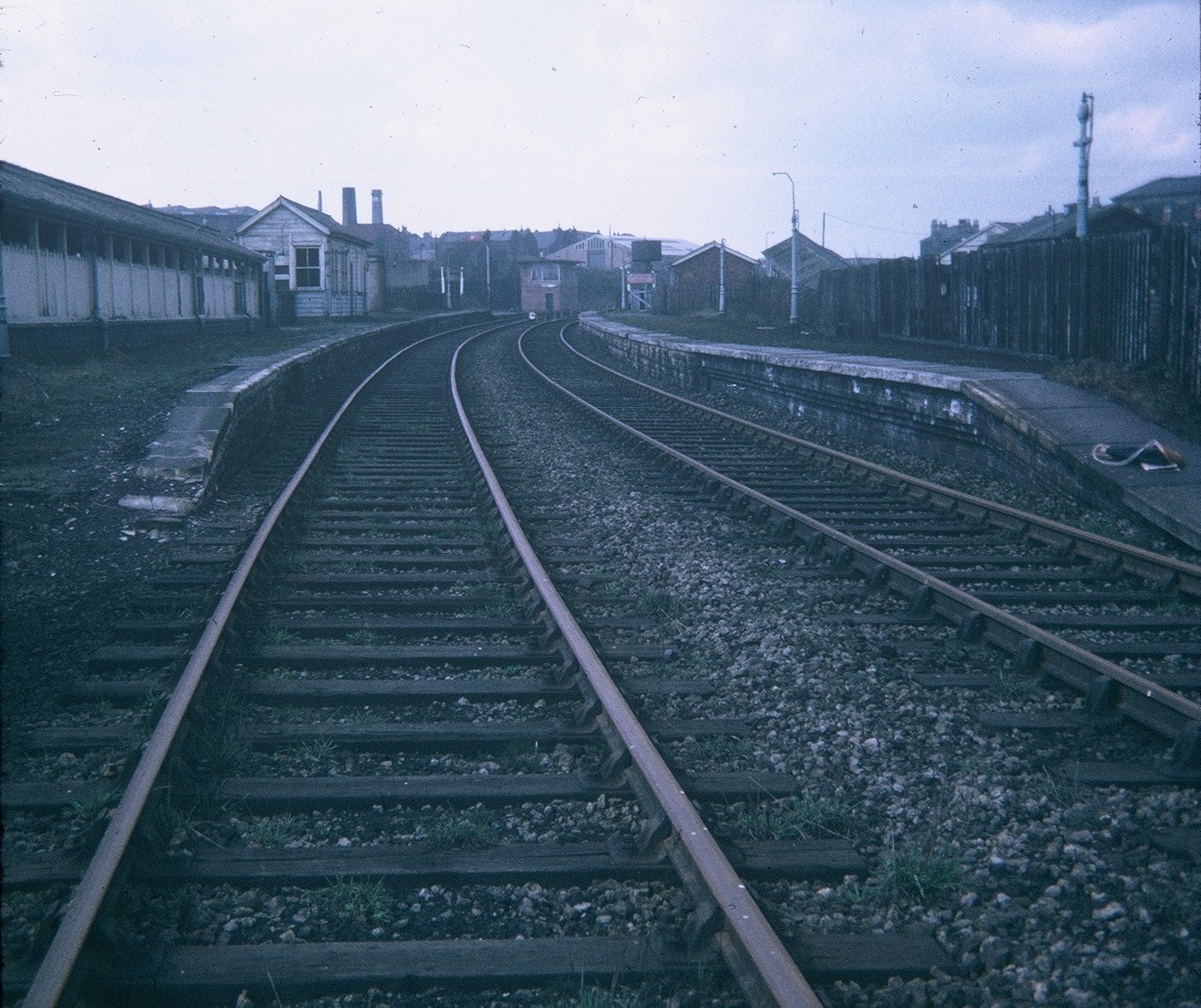
138:Morley Top Station (geograph 2263917).jpg
1024:
1016:
1008:
1000:
979:
971:
960:
952:
944:
934:
926:
918:
910:
902:
892:
862:
778:
762:
722:
706:
658:
642:
616:
600:
580:
564:
544:
528:
511:
508:
489:
482:
301:
251:
850:Transferred from geograph.co.uk using
330:View this and other nearby images on:
280:View this and other nearby images on:
882:
7:
377:and is licensed for reuse under the
791:
413:Attribution-Share Alike 2.0 Generic
401:
396:
381:Attribution-ShareAlike 2.0 license.
873:
502:
496:
387:
364:
142:
125:
71:
501:
1029:25152145B4684E8FB495B75C358BDAC7
904:Date and time of data generation
645:coordinates of the point of view
487:
443:Under the following conditions:
408:This file is licensed under the
400:
395:
389:
357:
336:
322:
314:
286:
272:
264:
92:
21:
484:
143:
14:
483:
365:This image was taken from the
26:
1:
1021:A directly photographed image
709:coordinates of depicted place
31:
660:53°44'27.812"N, 1°36'4.939"W
509:Items portrayed in this file
313:
263:
973:Date and time of digitizing
1046:
1002:Supported Flashpix version
865:Morley Top railway station
724:53°44'28.14"N, 1°36'6.01"W
457:same or compatible license
981:Meaning of each component
946:File change date and time
888:FUJI PHOTO FILM CO., LTD.
792:
239:David Hillas /
220:David Hillas /
16:
486:
423:
99:This is a file from the
849:
211:required by the license
189:
179:
168:
161:
158:
135:
103:. Information from its
949:21:48, 2 February 2011
371:this photograph's page
342:53.741150; -1.601670
292:53.741059; -1.601372
106:description page there
41:Size of this preview:
920:Horizontal resolution
1013:Digital still camera
976:09:01, 19 April 2010
828:18:52, 11 April 2021
65:1,463 × 1,228 pixels
61:1,220 × 1,024 pixels
954:Y and C positioning
928:Vertical resolution
884:Camera manufacturer
438:– to adapt the work
47:Other resolutions:
241:Morley Top Station
222:Morley Top Station
149:Morley Top Station
1033:
1032:
853:
700:
636:
567:copyright license
495:
386:
385:
369:collection. See
347:
346:
297:
296:
246:
245:
214:
198:
195:Reusing this file
121:
120:
101:Wikimedia Commons
1037:
881:
840:
746:
745:
740:
682:
681:
676:
531:copyright status
479:
476:
473:
470:
467:
459:as the original.
421:
410:Creative Commons
404:
403:
399:
398:
393:
392:
379:Creative Commons
367:Geograph project
361:
354:
343:
340:
326:
325:
319:
318:
317:
311:
310:
299:
293:
290:
276:
275:
269:
268:
267:
261:
260:
249:
208:
192:
164:
147:
139:
133:
117:
96:
95:
89:
83:
81:
68:
57:915 × 768 pixels
53:572 × 480 pixels
49:286 × 240 pixels
43:714 × 599 pixels
1045:
1044:
1040:
1039:
1038:
1036:
1035:
1034:
1026:Unique image ID
869:
861:
854:
846:
838:
794:
793:
790:
789:
788:
787:
786:
785:
784:
783:
781:
771:
770:
769:
767:
756:
755:
754:
753:
752:
751:
750:
749:
748:
747:
743:
741:
738:
729:
728:
727:
725:
715:
714:
713:
711:
692:
691:
690:
689:
688:
687:
686:
685:
684:
683:
679:
677:
674:
665:
664:
663:
661:
651:
650:
649:
647:
628:
627:
626:
625:
624:
623:
622:
621:
619:
609:
608:
607:
605:
594:
593:
592:
591:
590:
589:
588:
587:
585:
573:
572:
571:
569:
558:
557:
556:
555:
554:
553:
552:
551:
549:
537:
536:
535:
533:
522:
521:
520:
519:
518:
516:
500:
499:
498:
481:
480:
477:
474:
471:
468:
465:
464:
422:
419:
416:
405:
382:
352:
341:
315:
306:
305:
302:Object location
291:
265:
256:
255:
252:Camera location
247:
236:
229:
217:
174:geograph.org.uk
154:
137:
130:
123:
122:
111:
110:
109:is shown below.
85:
79:
77:
70:
69:
46:
12:
11:
5:
1043:
1041:
1031:
1030:
1027:
1023:
1022:
1019:
1015:
1014:
1011:
1007:
1006:
1003:
999:
998:
997:
996:
995:does not exist
993:
990:
987:
982:
978:
977:
974:
970:
969:
966:
959:
958:
955:
951:
950:
947:
943:
942:
937:
933:
932:
929:
925:
924:
921:
917:
916:
913:
909:
908:
905:
901:
900:
895:
891:
890:
885:
872:
868:
867:
859:
858:
857:
852:
851:
848:
844:
841:
837:1,463 × 1,228
835:
830:
825:
821:
820:
817:
814:
811:
808:
805:
798:
797:
782:
779:
777:
776:
775:
774:
773:
772:
768:
763:
761:
760:
759:
758:
757:
734:
733:
732:
731:
730:
726:
723:
721:
720:
719:
718:
717:
716:
712:
707:
705:
704:
703:
702:
696:
670:
669:
668:
667:
666:
662:
659:
657:
656:
655:
654:
653:
652:
648:
643:
641:
640:
639:
638:
632:
620:
617:
615:
614:
613:
612:
611:
610:
606:
601:
599:
598:
597:
596:
595:
586:
581:
579:
578:
577:
576:
575:
574:
570:
565:
563:
562:
561:
560:
559:
550:
545:
543:
542:
541:
540:
539:
538:
534:
529:
527:
526:
525:
524:
523:
517:
512:
510:
507:
506:
505:
504:
503:
492:
491:
488:
485:
463:
462:
461:
460:
450:
441:
440:
439:
433:
426:You are free:
417:
407:
406:
388:
384:
383:
362:
351:
348:
345:
344:
334:
328:
303:
295:
294:
284:
278:
253:
244:
243:
237:
234:
231:
230:
225:
218:
215:
203:
202:
199:
187:
186:
181:
177:
176:
170:
166:
165:
160:
156:
155:
140:
131:
129:
126:
124:
119:
118:
97:
87:
86:
40:
36:
35:
34:
29:
24:
19:
13:
10:
9:
6:
4:
3:
2:
1042:
1028:
1025:
1020:
1017:
1012:
1009:
1004:
1001:
994:
991:
988:
985:
984:
983:
980:
975:
972:
967:
964:
961:
956:
953:
948:
945:
941:
938:
936:Software used
935:
930:
927:
922:
919:
914:
911:
906:
903:
899:
896:
893:
889:
886:
883:
879:
876:
870:
866:
863:
855:
847:
842:
836:
834:
831:
829:
826:
823:
822:
818:
815:
812:
809:
806:
804:
803:
801:
795:
766:
737:
710:
673:
646:
618:17 April 1969
604:
584:
568:
548:
532:
515:
469:CC BY-SA 2.0
458:
454:
451:
448:
445:
444:
442:
437:
434:
431:
428:
427:
425:
424:
418:Attribution:
414:
411:
394:
380:
376:
372:
368:
363:
360:
356:
355:
349:
339:
335:
333:
332:OpenStreetMap
329:
327:
309:
304:
300:
289:
285:
283:
282:OpenStreetMap
279:
277:
259:
254:
250:
242:
238:
233:
232:
228:
224: /
223:
219:
212:
207:
205:
204:
200:
196:
191:
188:
185:
182:
178:
175:
171:
167:
163:17 April 1969
157:
151:
150:
146:
141:
134:
127:
115:
108:
107:
102:
98:
91:
90:
84:
75:
74:Original file
66:
62:
58:
54:
50:
44:
39:
33:
30:
28:
25:
23:
20:
18:
15:
907:Unknown date
894:Camera model
877:
874:
799:
796:File history
452:
446:
435:
429:
420:David Hillas
375:David Hillas
374:
312:
262:
240:
227:CC BY-SA 2.0
221:
184:David Hillas
148:
144:
114:You can help
104:
72:
22:File history
1010:File source
912:Orientation
845:Lamberhurst
547:copyrighted
453:share alike
447:attribution
206:Attribution
136:Description
1018:Scene type
856:File usage
813:Dimensions
780:image/jpeg
765:media type
190:Permission
80:image/jpeg
27:File usage
810:Thumbnail
807:Date/Time
603:inception
350:Licensing
235:InfoField
216:InfoField
145:English:
957:Centered
871:Metadata
839:(540 KB)
490:Captions
436:to remix
430:to share
415:license.
32:Metadata
965:version
898:SP-2000
824:current
819:Comment
736:heading
695:heading
672:heading
631:heading
514:depicts
494:English
128:Summary
76:
931:72 dpi
923:72 dpi
915:Normal
744:degree
699:degree
680:degree
635:degree
320:
270:
180:Author
169:Source
172:From
963:Exif
816:User
742:292
678:292
478:true
475:true
159:Date
17:File
968:2.1
992:Cr
989:Cb
739::
675::
63:|
59:|
55:|
51:|
45:.
1005:1
986:Y
213:)
209:(
197:)
193:(
116:.
82:)
67:.
Text is available under the Creative Commons Attribution-ShareAlike License. Additional terms may apply.
.jpg)
.jpg¶ms=053.741059_N_-001.601372_E_globe:Earth_type:camera_source:geograph-osgb36(SE26392726)_heading:292.00&language=en)
.jpg¶ms=053.741150_N_-001.601670_E_globe:Earth_class:object_type:object_source:geograph-osgb36(SE26372727)_heading:292.00&language=en)
