43:
395:
328:
278:
320:
270:
342:
292:
363:
401:
406:
103:
701:"}},"text\/plain":{"en":{"":"heading"}}},"{\"value\":{\"amount\":\"+315\",\"unit\":\"http:\\\/\\\/www.wikidata.org\\\/entity\\\/Q28390\"},\"type\":\"quantity\"}":{"text\/html":{"en":{"P7787":"315
637:"}},"text\/plain":{"en":{"":"heading"}}},"{\"value\":{\"amount\":\"+315\",\"unit\":\"http:\\\/\\\/www.wikidata.org\\\/entity\\\/Q28390\"},\"type\":\"quantity\"}":{"text\/html":{"en":{"P7787":"315
633:
839:
311:
261:
453:– You must give appropriate credit, provide a link to the license, and indicate if changes were made. You may do so in any reasonable manner, but not in any way that suggests the licensor endorses you or your use.
698:
634:
69:
65:
61:
57:
53:
47:
82:
198:
114:
1056:
784:
586:
550:
335:
285:
1079:
370:
926:
This file contains additional information, probably added from the digital camera or scanner used to create or digitize it.
460:
875:
768:
739:
712:
675:
648:
534:
606:
570:
517:
357:
416:
929:
If the file has been modified from its original state, some details may not fully reflect the modified file.
1124:
459:– If you remix, transform, or build upon the material, you must distribute your contributions under the
377:
on the
Geograph website for the photographer's contact details. The copyright on this image is owned by
413:
705:"}},"text\/plain":{"en":{"P7787":"315 degree"}}}}": -->
641:"}},"text\/plain":{"en":{"P7787":"315 degree"}}}}": -->
1152:
838:
833:
73:
42:
122:
1230:
870:
214:
341:
291:
1204:
1142:
1098:
955:
382:
109:
1240:
995:
849:
230:
275:
1178:
325:
166:
975:
187:
177:
903:
1250:
965:
948:
362:
938:
374:
806:
Click on a date/time to view the file as it appeared at that time.
327:
277:
302:
252:
97:
312:
53° 30′ 38.4″ N, 2° 14′ 35″ W
262:
53° 30′ 37.4″ N, 2° 14′ 33″ W
501:
Add a one-line explanation of what this file represents
87:(3,729 × 2,218 pixels, file size: 1.95 MB, MIME type:
913:
205:
Creative
Commons Attribution Share-alike license 2.0
141:
121:
Commons is a freely licensed media file repository.
587:
Creative
Commons Attribution-ShareAlike 2.0 Generic
1057:Adobe Photoshop Lightroom Classic 9.0 (Windows)
470:https://creativecommons.org/licenses/by-sa/2.0
102:
476:Creative Commons Attribution-Share Alike 2.0
394:
8:
702:
638:
436:– to copy, distribute and transmit the work
931:
808:
497:
886:The following other wikis use this file:
1346:
1338:
1330:
1322:
1314:
1306:
1298:
1290:
1282:
1274:
1266:
1258:
1248:
1238:
1228:
1220:
1212:
1202:
1194:
1186:
1176:
1168:
1160:
1150:
1140:
1132:
1122:
1114:
1106:
1096:
1088:
1077:
1069:
1061:
1051:
1043:
1035:
1027:
1019:
1011:
1003:
992:
984:
973:
963:
953:
943:
868:
782:
766:
726:
710:
662:
646:
620:
604:
584:
568:
548:
532:
515:
512:
493:
486:
305:
255:
856:Transferred from geograph.co.uk using
334:View this and other nearby images on:
284:View this and other nearby images on:
933:
866:The following 2 pages use this file:
7:
381:and is licensed for reuse under the
797:
417:Attribution-Share Alike 2.0 Generic
405:
400:
385:Attribution-ShareAlike 2.0 license.
924:
506:
500:
391:
368:
151:
134:
80:
505:
1303:38768535C43190FFCD437C376AAD7280
986:Date and time of data generation
649:coordinates of the point of view
491:
447:Under the following conditions:
412:This file is licensed under the
404:
399:
393:
361:
340:
326:
318:
290:
276:
268:
101:
31:
21:
1292:Date metadata was last modified
488:
152:
14:
1300:Unique ID of original document
960:1/150 sec (0.0066666666666667)
904:Daftar masjid di Britania Raya
487:
369:This image was taken from the
26:
1:
1287:Samsung Galaxy S8 Rear Camera
1191:A directly photographed image
894:উত্তর ম্যানচেস্টার জামে মসজিদ
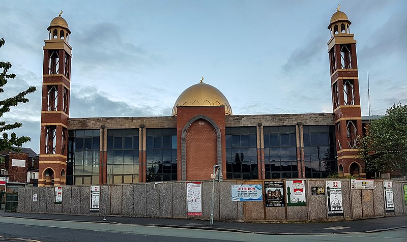
876:North Manchester Jamia Mosque
713:coordinates of depicted place
664:53°30'37.393"N, 2°14'32.744"W
147:Mosque (geograph 6458792).jpg
36:
1170:DateTimeDigitized subseconds
513:Items portrayed in this file
317:
267:
243:Peter McDermott /
224:Peter McDermott /
1162:DateTimeOriginal subseconds
1090:Date and time of digitizing
728:53°30'38.38"N, 2°14'34.91"W
1368:
1214:Focal length in 35 mm film
1024:129 meters above sea level
910:Usage on www.wikidata.org
900:Usage on id.wikipedia.org
890:Usage on bn.wikipedia.org
461:same or compatible license
1332:Sublocation of city shown
1063:File change date and time
798:
16:
490:
427:
108:This is a file from the
1316:Province or state shown
1260:GPS time (atomic clock)
1147:Center weighted average
855:
834:10:14, 19 February 2021
215:required by the license
193:
183:
172:
165:
162:
144:
112:. Information from its
1340:Code for country shown
375:this photograph's page
346:53.510660; -2.243030
296:53.510387; -2.242429
115:description page there
46:Size of this preview:
1134:Maximum land aperture
1037:Horizontal resolution
1295:20:39, 30 April 2020
1093:06:04, 30 April 2020
1066:19:39, 30 April 2020
989:06:04, 30 April 2020
74:3,729 × 2,218 pixels
70:2,560 × 1,523 pixels
1045:Vertical resolution
935:Camera manufacturer
442:– to adapt the work
52:Other resolutions:
1222:Scene capture type
1209:Auto white balance
1157:Flash did not fire
66:1,280 × 761 pixels
62:1,024 × 609 pixels
1355:
1354:
1137:1.53 APEX (f/1.7)
882:Global file usage
859:
785:Samsung Galaxy S8
704:
640:
571:copyright license
499:
390:
389:
373:collection. See
351:
350:
301:
300:
250:
249:
218:
202:
199:Reusing this file
130:
129:
110:Wikimedia Commons
32:Global file usage
1359:
1071:Exposure Program
932:
871:Barelvi movement
846:
750:
749:
744:
686:
685:
680:
535:copyright status
483:
480:
477:
474:
471:
463:as the original.
425:
414:Creative Commons
408:
407:
403:
402:
397:
396:
383:Creative Commons
371:Geograph project
365:
358:
347:
344:
330:
329:
323:
322:
321:
315:
314:
303:
297:
294:
280:
279:
273:
272:
271:
265:
264:
253:
212:
196:
168:
156:
148:
142:
126:
105:
104:
98:
92:
90:
77:
58:640 × 381 pixels
54:320 × 190 pixels
48:800 × 476 pixels
1367:
1366:
1362:
1361:
1360:
1358:
1357:
1356:
1276:GPS tag version
1116:APEX brightness
920:
880:
860:
852:
844:
800:
799:
796:
795:
794:
793:
792:
791:
790:
789:
787:
775:
774:
773:
771:
760:
759:
758:
757:
756:
755:
754:
753:
752:
751:
747:
745:
742:
733:
732:
731:
729:
719:
718:
717:
715:
696:
695:
694:
693:
692:
691:
690:
689:
688:
687:
683:
681:
678:
669:
668:
667:
665:
655:
654:
653:
651:
632:
631:
630:
629:
628:
627:
626:
625:
623:
613:
612:
611:
609:
598:
597:
596:
595:
594:
593:
592:
591:
589:
577:
576:
575:
573:
562:
561:
560:
559:
558:
557:
556:
555:
553:
541:
540:
539:
537:
526:
525:
524:
523:
522:
520:
504:
503:
502:
485:
484:
481:
478:
475:
472:
469:
468:
426:
424:Peter McDermott
423:
420:
409:
386:
379:Peter McDermott
356:
345:
319:
310:
309:
306:Object location
295:
269:
260:
259:
256:Camera location
251:
240:
233:
221:
188:Peter McDermott
178:geograph.org.uk
158:
146:
139:
132:
131:
120:
119:
118:is shown below.
94:
88:
86:
79:
78:
51:
12:
11:
5:
1365:
1363:
1353:
1352:
1349:
1345:
1344:
1341:
1337:
1336:
1333:
1329:
1328:
1327:United Kingdom
1325:
1321:
1320:
1317:
1313:
1312:
1309:
1305:
1304:
1301:
1297:
1296:
1293:
1289:
1288:
1285:
1281:
1280:
1277:
1273:
1272:
1269:
1265:
1264:
1261:
1257:
1256:
1253:
1247:
1246:
1243:
1237:
1236:
1233:
1227:
1226:
1223:
1219:
1218:
1215:
1211:
1210:
1207:
1201:
1200:
1197:
1193:
1192:
1189:
1185:
1184:
1181:
1175:
1174:
1171:
1167:
1166:
1163:
1159:
1158:
1155:
1149:
1148:
1145:
1139:
1138:
1135:
1131:
1130:
1127:
1121:
1120:
1117:
1113:
1112:
1109:
1105:
1104:
1101:
1095:
1094:
1091:
1087:
1086:
1083:
1076:
1075:
1074:Normal program
1072:
1068:
1067:
1064:
1060:
1059:
1054:
1050:
1049:
1046:
1042:
1041:
1038:
1034:
1033:
1030:
1026:
1025:
1022:
1018:
1017:
1014:
1010:
1009:
1006:
1002:
1001:
998:
991:
990:
987:
983:
982:
979:
972:
971:
968:
962:
961:
958:
952:
951:
946:
942:
941:
936:
923:
919:
918:
917:
916:
908:
907:
906:
898:
897:
896:
884:
883:
879:
878:
873:
864:
863:
858:
857:
854:
850:
847:
843:3,729 × 2,218
841:
836:
831:
827:
826:
823:
820:
817:
814:
811:
804:
803:
788:
783:
781:
780:
779:
778:
777:
776:
772:
767:
765:
764:
763:
762:
761:
738:
737:
736:
735:
734:
730:
727:
725:
724:
723:
722:
721:
720:
716:
711:
709:
708:
707:
706:
700:
674:
673:
672:
671:
670:
666:
663:
661:
660:
659:
658:
657:
656:
652:
647:
645:
644:
643:
642:
636:
624:
621:
619:
618:
617:
616:
615:
614:
610:
605:
603:
602:
601:
600:
599:
590:
585:
583:
582:
581:
580:
579:
578:
574:
569:
567:
566:
565:
564:
563:
554:
549:
547:
546:
545:
544:
543:
542:
538:
533:
531:
530:
529:
528:
527:
521:
516:
514:
511:
510:
509:
508:
507:
496:
495:
492:
489:
467:
466:
465:
464:
454:
445:
444:
443:
437:
430:You are free:
421:
411:
410:
392:
388:
387:
366:
355:
352:
349:
348:
338:
332:
307:
299:
298:
288:
282:
257:
248:
247:
241:
238:
235:
234:
229:
222:
219:
207:
206:
203:
191:
190:
185:
181:
180:
174:
170:
169:
164:
160:
159:
149:
140:
138:
135:
133:
128:
127:
106:
96:
95:
45:
41:
40:
39:
34:
29:
24:
19:
13:
10:
9:
6:
4:
3:
2:
1364:
1350:
1347:
1342:
1339:
1334:
1331:
1326:
1324:Country shown
1323:
1318:
1315:
1310:
1307:
1302:
1299:
1294:
1291:
1286:
1283:
1278:
1275:
1271:30 April 2020
1270:
1267:
1262:
1259:
1254:
1252:
1249:
1244:
1242:
1239:
1234:
1232:
1229:
1224:
1221:
1216:
1213:
1208:
1206:
1205:White balance
1203:
1199:Auto exposure
1198:
1196:Exposure mode
1195:
1190:
1187:
1182:
1180:
1177:
1172:
1169:
1164:
1161:
1156:
1154:
1151:
1146:
1144:
1143:Metering mode
1141:
1136:
1133:
1128:
1126:
1125:Exposure bias
1123:
1118:
1115:
1110:
1108:APEX aperture
1107:
1102:
1100:
1099:Shutter speed
1097:
1092:
1089:
1084:
1081:
1078:
1073:
1070:
1065:
1062:
1058:
1055:
1053:Software used
1052:
1047:
1044:
1039:
1036:
1031:
1028:
1023:
1020:
1015:
1012:
1008:53° 30′ 38″ N
1007:
1004:
999:
997:
993:
988:
985:
980:
977:
974:
969:
967:
964:
959:
957:
956:Exposure time
954:
950:
947:
944:
940:
937:
934:
930:
927:
921:
915:
912:
911:
909:
905:
902:
901:
899:
895:
892:
891:
889:
888:
887:
881:
877:
874:
872:
869:
867:
861:
853:
848:
842:
840:
837:
835:
832:
829:
828:
824:
821:
818:
815:
812:
810:
809:
807:
801:
786:
770:
769:captured with
741:
714:
677:
650:
622:30 April 2020
608:
588:
572:
552:
536:
519:
473:CC BY-SA 2.0
462:
458:
455:
452:
449:
448:
446:
441:
438:
435:
432:
431:
429:
428:
422:Attribution:
418:
415:
398:
384:
380:
376:
372:
367:
364:
360:
359:
353:
343:
339:
337:
336:OpenStreetMap
333:
331:
313:
308:
304:
293:
289:
287:
286:OpenStreetMap
283:
281:
263:
258:
254:
246:
242:
237:
236:
232:
228: /
227:
223:
216:
211:
209:
208:
204:
200:
195:
192:
189:
186:
182:
179:
175:
171:
167:30 April 2020
161:
155:
150:
143:
136:
124:
117:
116:
111:
107:
100:
99:
93:
84:
83:Original file
75:
71:
67:
63:
59:
55:
49:
44:
38:
35:
33:
30:
28:
25:
23:
20:
18:
15:
1016:2° 14′ 33″ W
996:focal length
945:Camera model
928:
925:
885:
865:
805:
802:File history
456:
450:
439:
433:
378:
316:
266:
244:
231:CC BY-SA 2.0
225:
153:
123:You can help
113:
81:
22:File history
1348:IIM version
1179:Color space
551:copyrighted
457:share alike
451:attribution
210:Attribution
145:Description
1241:Saturation
1188:Scene type
1032:Manchester
1029:City shown
862:File usage
819:Dimensions
194:Permission
89:image/jpeg
27:File usage
1284:Lens used
1251:Sharpness
1013:Longitude
976:ISO speed
845:(1.95 MB)
816:Thumbnail
813:Date/Time
607:inception
354:Licensing
239:InfoField
220:InfoField
154:English:
1335:Cheetham
1311:Geograph
1308:Keywords
1268:GPS date
1231:Contrast
1225:Standard
1111:1.531069
1103:7.228819
1021:Altitude
1005:Latitude
966:F-number
949:SM-G950F
922:Metadata
914:Q7056037
494:Captions
440:to remix
434:to share
419:license.
37:Metadata
1319:England
1279:0.0.2.2
1082:version
1048:250 dpi
1040:250 dpi
939:samsung
851:Belbury
830:current
825:Comment
740:heading
699:heading
676:heading
635:heading
518:depicts
498:English
137:Summary
85:
1255:Normal
1245:Normal
1235:Normal
1000:4.2 mm
978:rating
748:degree
703:degree
684:degree
639:degree
324:
274:
245:Mosque
226:Mosque
184:Author
173:Source
157:Mosque
1263:05:04
1217:26 mm
1153:Flash
994:Lens
970:f/1.7
176:From
1183:sRGB
1173:0091
1165:0091
1119:4.95
1085:2.31
1080:Exif
822:User
746:315
682:315
482:true
479:true
163:Date
17:File
1343:GB
981:40
743::
679::
72:|
68:|
64:|
60:|
56:|
50:.
1351:4
1129:0
217:)
213:(
201:)
197:(
125:.
91:)
76:.
Text is available under the Creative Commons Attribution-ShareAlike License. Additional terms may apply.

.jpg)
.jpg¶ms=053.510387_N_-002.242429_E_globe:Earth_type:camera_source:geograph-osgb36(SD84020155)_heading:315.00&language=en)
.jpg¶ms=053.510660_N_-002.243030_E_globe:Earth_class:object_type:object_source:geograph-osgb36(SD83980158)_heading:315.00&language=en)